Atlantic Bluefin Tuna Fishing Out of Plymouth, MA
Bluefin fishing out of Plymouth starts with a ramp, a run across Cape Cod Bay and a short list of grounds the local fleet names. This page covers operator season windows, the grounds from nearest to farthest, local methods and the captains who fish bluefin from this harbor. Harbor, ramp and conditions detail is on the Plymouth port page, and species biology is in the Atlantic bluefin tuna guide. Fish aren’t guaranteed, but this should help you decide where to look.
When Bluefin Are Off Plymouth
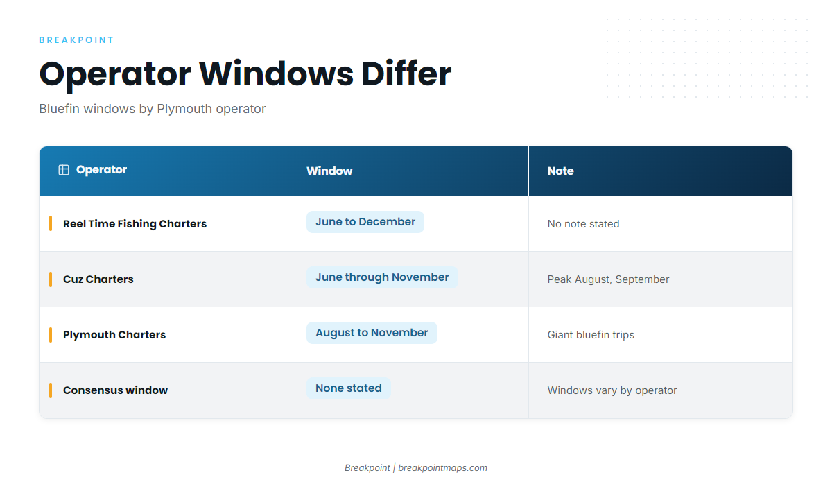
Operator windows differ, so treat the season as a range rather than a fixed date.
| Operator | Window | Note |
|---|---|---|
| Reel Time Fishing Charters | June to December | |
| Cuz Charters | June through November | Peak August and September |
| Plymouth Charters | August to November | Giant bluefin trips |
The August and September peak comes from Cuz Charters. Plymouth Charters’ August to November window applies to its giant bluefin trips.
Where Boats Run From Plymouth
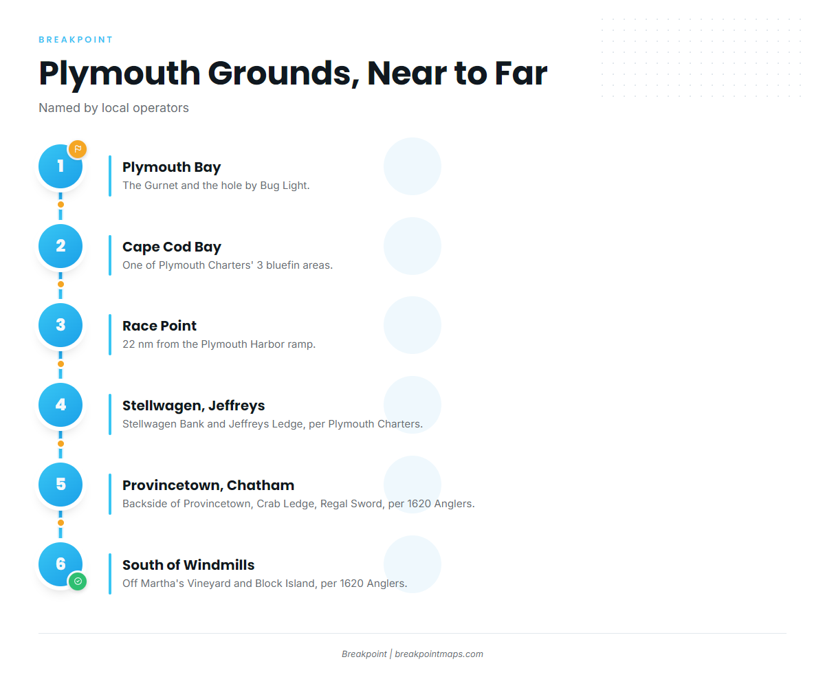
Plymouth Charters names Stellwagen Bank, Jeffreys Ledge and Cape Cod Bay. 1620 Anglers names grounds farther afield, from the backside of Provincetown to the water south of the Vineyard and Block Island.
| Ground | Named by | Note |
|---|---|---|
| Cape Cod Bay | Plymouth Charters | Bluefin area |
| Stellwagen Bank | Plymouth Charters | Bluefin area |
| Jeffreys Ledge | Plymouth Charters | Bluefin area |
| Northeast side of the backside of Provincetown | 1620 Anglers | Bluefin ground |
| Crab Ledge | 1620 Anglers | East of Chatham |
| Regal Sword | 1620 Anglers | East of Chatham |
| South of the windmills | 1620 Anglers | Off Martha’s Vineyard and Block Island |
Plymouth Bay and Cape Cod Bay
The Gurnet and the hole by Bug Light sit in Plymouth Bay. Cape Cod Bay is one of Plymouth Charters’ three bluefin areas.
Billingsgate Shoal, a Cape Cod striper hot spot named by Plymouth Charters, is a useful reference point if you’re coming to bluefin from stripers.
Race Point, Stellwagen Bank and Jeffreys Ledge
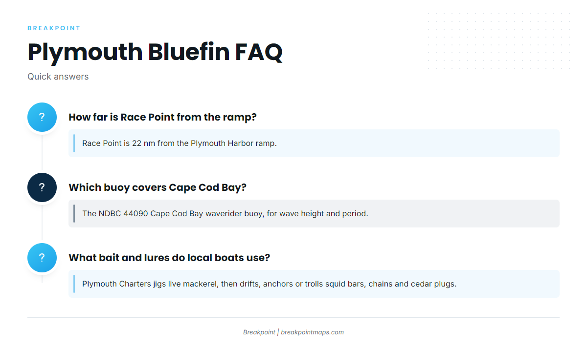
Race Point is 22 nm from the Plymouth Harbor ramp. Stellwagen Bank and Jeffreys Ledge are the other two grounds Plymouth Charters names.
Backside of Provincetown and East of Chatham
1620 Anglers names three grounds on this side of the Cape:
- The northeast side of the backside of Provincetown
- Crab Ledge, east of Chatham
- Regal Sword, east of Chatham
South of the Windmills
1620 Anglers also runs south of the windmills, off Martha’s Vineyard and Block Island. The Northeast bluefin guide (see also the Atlantic Northeast fishing guide) covers the wider range these runs belong to.
Reading the Bay Before the Run
The NDBC 44090 Cape Cod Bay waverider buoy reports wave height and period. Check it before you leave the dock, along with the NWS Cape Cod Bay forecast. Breakpoint chart layers are not for navigation.
How the Local Fleet Fishes Bluefin
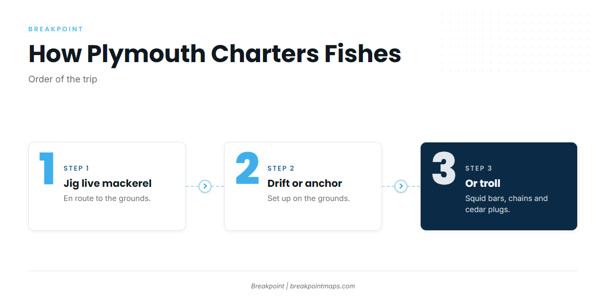
This section reflects how Plymouth Charters describes its tuna trips.
Live Mackerel on the Way Out
Plymouth Charters jigs live mackerel en route to the grounds.
Drift, Anchor or Troll
Once on the grounds, Plymouth Charters works the water one of three ways:
- Drift
- Anchor
- Troll squid bars, chains and cedar plugs
Who Fishes for Bluefin Out of Plymouth
These operators list Atlantic bluefin tuna from this harbor. The tuna fishing guides hub covers the wider picture.
- Plymouth Charters tuna trips
- Reel Time Fishing Charters: Captain Roland Lizotte III
- Cuz Charters bluefin trips: Captain Ed Kislauskis
- 1620 Anglers bluefin charters: Capt. Rick, Everglades 27 ft center console
- Black Rose Fishing Charters: Rich Antonino, boat Black Rose
FAQ
When is bluefin season out of Plymouth?
Operator windows differ. Reel Time Fishing Charters lists June to December. Cuz Charters says June through November, peaking August and September. Plymouth Charters lists giant bluefin trips August to November.
How far is Race Point from the Plymouth ramp?
Race Point is 22 nm from the Plymouth Harbor ramp.
Where do Plymouth boats fish for bluefin?
Plymouth Charters names Stellwagen Bank, Jeffreys Ledge and Cape Cod Bay. 1620 Anglers adds the northeast side of the backside of Provincetown, Crab Ledge and Regal Sword east of Chatham, and south of the windmills off Martha’s Vineyard and Block Island.
What bait and lures do local boats use?
Plymouth Charters jigs live mackerel en route. It then drifts, anchors or trolls squid bars, chains and cedar plugs.
Which buoy covers Cape Cod Bay?
The NDBC 44090 Cape Cod Bay waverider buoy reports wave height and period.