
Running out of Shark River Inlet
Blue marlin fishing out of Belmar starts at Shark River Inlet. Fin-ominal says its boats sail out of the inlet, and this page works from that departure point. From there, Belmar boats reach a short list of named reefs, wrecks and a deep trough called the Mud Hole. The sections below give the depth and position of each piece of structure.
Nearby reference points
Two shore references anchor the distances below:
- The Sea Girt Reef is measured from Sea Girt.
- The Shark River Reef is measured from Manasquan.
Neither distance runs from Belmar, so adjust for that when you build a route.
Grounds and structure off Belmar
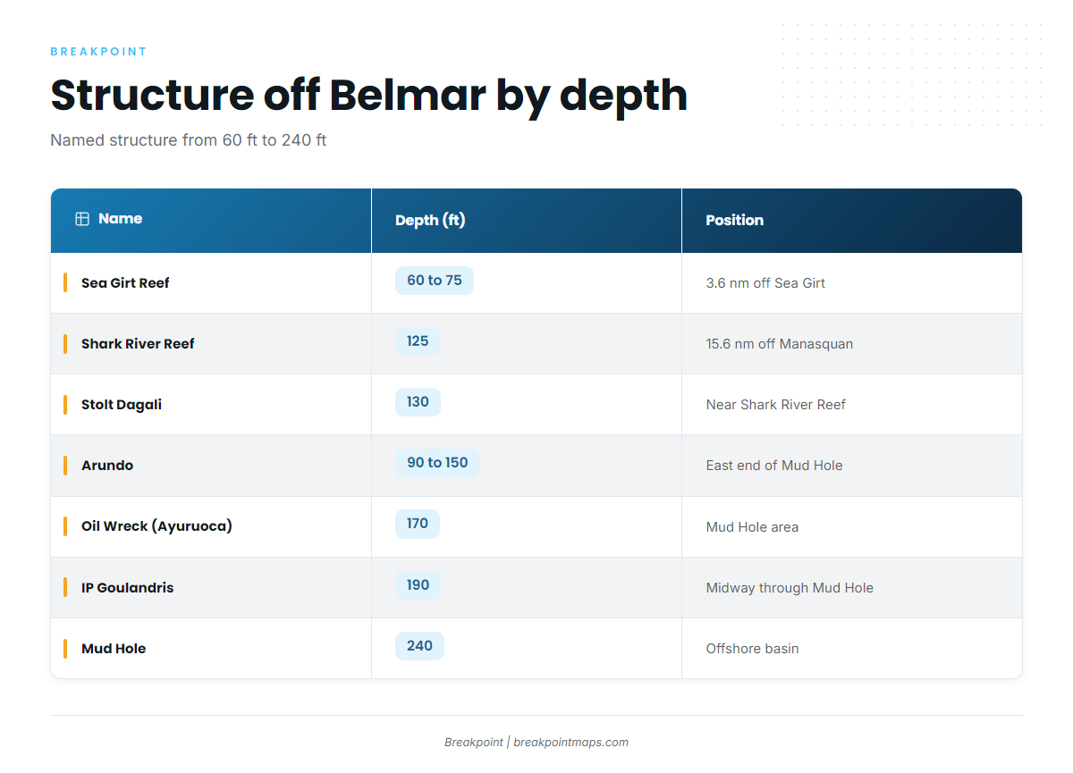
The named structure off this port runs from 60 ft to 240 ft:
| Name | Depth (ft) | Position |
|---|---|---|
| Sea Girt Reef | 60 to 75 | 3.6 nm off Sea Girt, atop the Klondike |
| Klondike | Underwater ridge under the Sea Girt Reef | |
| Shark River Reef | 125 | 15.6 nm off Manasquan |
| Stolt Dagali | 130 | Near the Shark River Reef, close to the Mud Hole edge |
| Arundo | 90 to 150 | Eastern end of the Mud Hole |
| Oil Wreck (Ayuruoca) | 170 | In the Mud Hole area |
| IP Goulandris | 190 | Midway through the Mud Hole |
| Mud Hole | 240 |
Mark each as a waypoint and read the depths against the Chart Contours layer. Chart layers are not for navigation.
Sea Girt Reef and the Klondike
The Sea Girt Reef lies in 60 to 75 ft, 3.6 nautical miles off Sea Girt, atop the Klondike, an underwater ridge. It is the nearest named reference in this list.
Shark River Reef and the Stolt Dagali
The Shark River Reef is in 125 ft, 15.6 nautical miles off Manasquan. The Stolt Dagali is a 130 ft wreck near the reef, close to the Mud Hole edge.
The Mud Hole and its wrecks
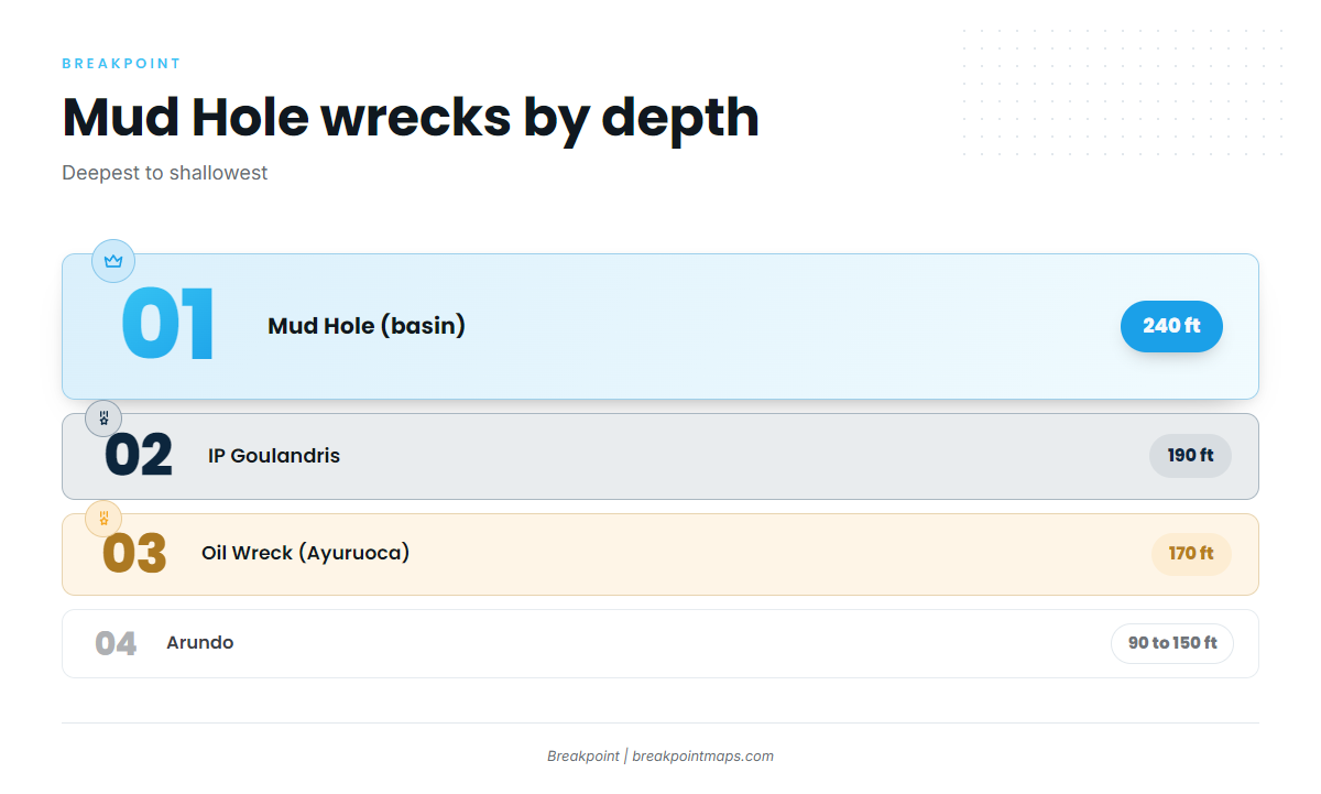
The Mud Hole is 240 ft deep. Three wrecks are named in and around it:
- Arundo: lies in 90 to 150 ft at the eastern end of the Mud Hole.
- Oil Wreck (Ayuruoca): 170 ft, in the Mud Hole area.
- IP Goulandris: 190 ft, midway through the Mud Hole.
When and how blue marlin are fished from this port
Seasonality, water temperature and trolling spreads for blue marlin aren’t specific to one port, so they are covered in the species and regional guides. Our blue marlin fishing guide covers timing, temperature and spreads. The Atlantic Northeast blue marlin guide (see also the Atlantic Northeast offshore fishing guide) explains how fish move through the region and how far boats run in the Northeast. For gear and method, see billfish tackle and technique. This page covers only the structure off Belmar.
Who fishes for blue marlin out of Belmar
Fin-ominal Charters, run by Capt. Jared, lists blue marlin out of Belmar. The operation has two boats, a 55 ft Custom Carman and a 101 ft Custom Sport Yacht. Fin-ominal says its boats sail out of Shark River Inlet; its own description is on the Fin-ominal’s Belmar offshore charters page.
FAQ about blue marlin fishing out of Belmar
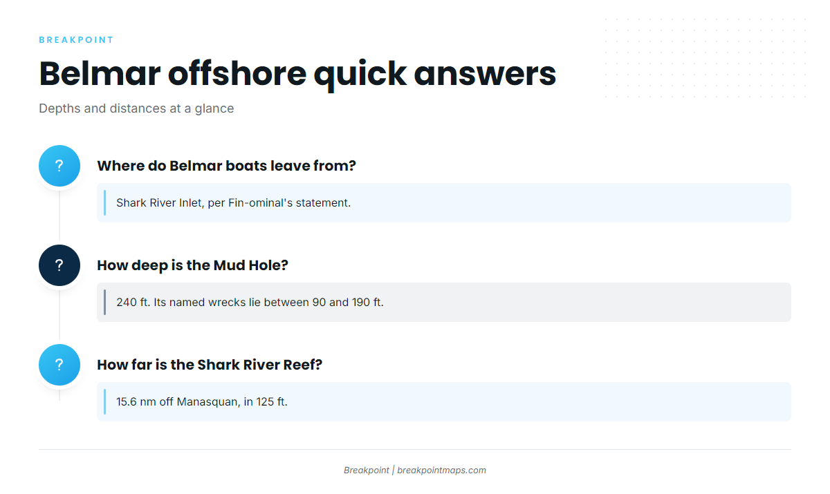
Where do Belmar boats leave from?
Shark River Inlet. Fin-ominal says its boats sail out of Shark River Inlet.
How deep is the Mud Hole?
240 ft. Its named wrecks lie between 90 and 190 ft.
How far is the Shark River Reef?
15.6 nautical miles off Manasquan, in 125 ft.
Which wrecks lie in the Mud Hole?
Three are named:
- The Arundo, in 90 to 150 ft at the eastern end.
- The Oil Wreck, also called the Ayuruoca, at 170 ft.
- The IP Goulandris, at 190 ft, midway through.
Who runs blue marlin charters from Belmar?
Fin-ominal Charters, run by Capt. Jared, with a 55 ft Custom Carman and a 101 ft Custom Sport Yacht.