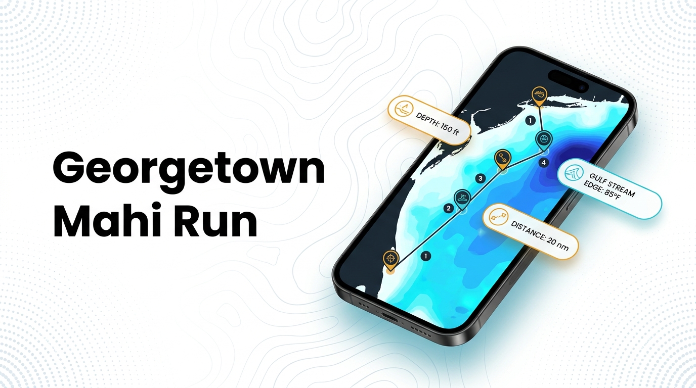
Mahi-mahi fishing out of Georgetown means a run of 50 to 70 miles to the Gulf Stream, or 30 to 40 miles when weed lines set up closer in. This page covers the season window, run distances, reef depths for your plotter and the method the local operator uses. It helps you decide where to look and does not promise fish. For the species itself, start with the mahi-mahi guide.
When mahi are off Georgetown
The window is summer, and the operator’s numbers set the months.
Peak months
Captain Eric of Winyah Adventures puts the peak at May through September, with June and July prime. If you have limited dates, aim for those two months. The same warm stretch brings other offshore gamefish onto the grounds.
| Window | Months | Operator’s description |
|---|---|---|
| Peak | May through September | Peak |
| Prime | June and July | Best of the peak |
| Off | October to April | Effectively over |
The off months
The operator describes October to April as effectively over. Plan other trips for those months.
Where boats run for mahi-mahi fishing out of Georgetown
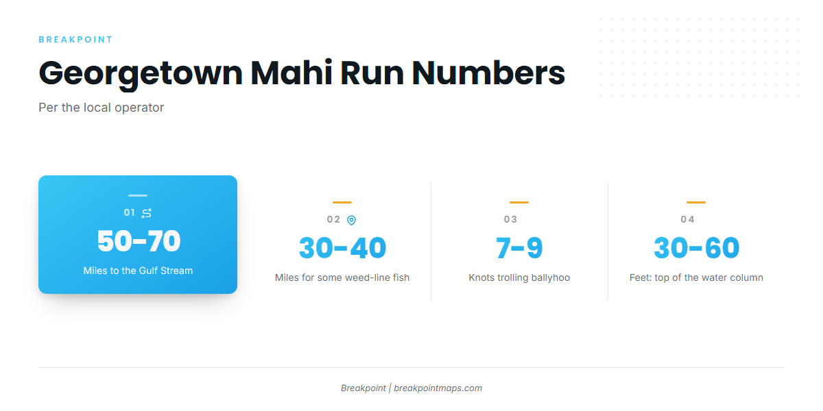
The Gulf Stream off Georgetown typically runs 50 to 70 miles offshore, and some weed-line fish sit in 30 to 40 miles of water. Boats work weed lines (sargassum) and temperature breaks along the way. For the wider Gulf Stream picture, see mahi along the Atlantic Southeast (see also the wider Atlantic Southeast guide).
Weed lines in 30 to 40 miles of water
This is the shorter run, and the fish are not guaranteed. Treat it as a place to look on the way out rather than a destination to count on.
The Gulf Stream at 50 to 70 miles
Boats run to the Gulf Stream’s weed lines and temperature breaks. At that distance the trip takes a full day, so plan your fuel and your return around it.
Temperature breaks
OBS SST shows where a break sits. Cloud cover can block a satellite pass, so a clear map the night before may not be available on the morning of the trip.
Checking conditions at NIWS1
The nearest NOAA buoy is NOAA NDBC station NIWS1 at Oyster Landing, North Inlet-Winyah Bay Reserve, at 33.349 N, 79.189 W. It is an estuary station inside North Inlet and reads conditions there, not the Gulf Stream 50 to 70 miles out. For offshore water, read the official NWS marine forecast and base your decision on wind, wave height and period.
- NIWS1: estuary conditions at the inlet
- NWS marine forecast: offshore wind, seas and period
- Chart layers: reference only, not for navigation
Named reefs and structure off Georgetown
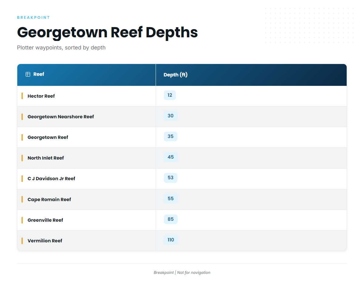
These named reefs carry charted depths and work as references and waypoints on the run out. Mahi are surface fish, so use this as a plotter list rather than a list of places the fish hold. The state keeps its own list of SC DNR artificial reef locations.
| Reef | Depth (ft) |
|---|---|
| Hector Reef | 12 |
| Georgetown Nearshore Reef | 30 |
| Georgetown Reef | 35 |
| North Inlet Reef | 45 |
| C J Davidson Jr Reef | 53 (147 degrees, 6.5 nm from channel buoy 2WB, one buoy marked) |
| Cape Romain Reef | 55 |
| Greenville Reef | 85 |
| Vermilion Reef | 110 |
Chart layers are not for navigation. Use official charts to navigate.
How mahi are fished out of Georgetown
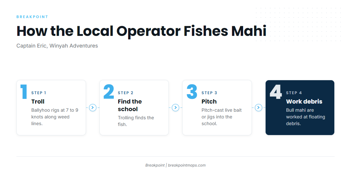
Captain Eric of Winyah Adventures describes a sequence that runs from finding fish to working them: troll first, then pitch, and work debris for the larger fish.
Trolling ballyhoo along weed lines
The operator trolls ballyhoo rigs at 7 to 9 knots along weed lines. Trolling covers water and shows where the school is.
Pitching to the school
Once a school shows, the operator pitch-casts live bait or jigs into it, which keeps the school working after the troll finds it.
Bulls at floating debris
Bull mahi are worked at floating debris. The operator treats debris as a separate stop from the weed line.
The top 30 to 60 feet
The operator says mahi sit in the top 30 to 60 feet of water, which is why the spread stays near the surface.
Who fishes for mahi out of Georgetown
Winyah Adventures in Georgetown lists mahi-mahi. The captain is Captain Eric, USCG-licensed. If you want to learn the grounds from a local before running your own boat, this is the operator who lists mahi from this port.
FAQ: mahi-mahi fishing out of Georgetown
What are the best months for mahi off Georgetown?
The peak runs May through September, with June and July prime, per the local operator. October to April is effectively over.
How far is the Gulf Stream from Georgetown?
It is typically 50 to 70 miles offshore, according to the operator.
Can you find mahi closer than the Gulf Stream?
The operator reports some weed-line fish in 30 to 40 miles of water, but they are not reliable.
What trolling speed is used locally?
The operator trolls ballyhoo rigs at 7 to 9 knots along weed lines. Mahi sit in the top 30 to 60 feet.
Which buoy should I check before running?
Check NOAA NDBC station NIWS1 at Oyster Landing, North Inlet-Winyah Bay Reserve. It reads the estuary, not offshore water, so read the official NWS marine forecast for the offshore numbers.