
About Hatteras Village
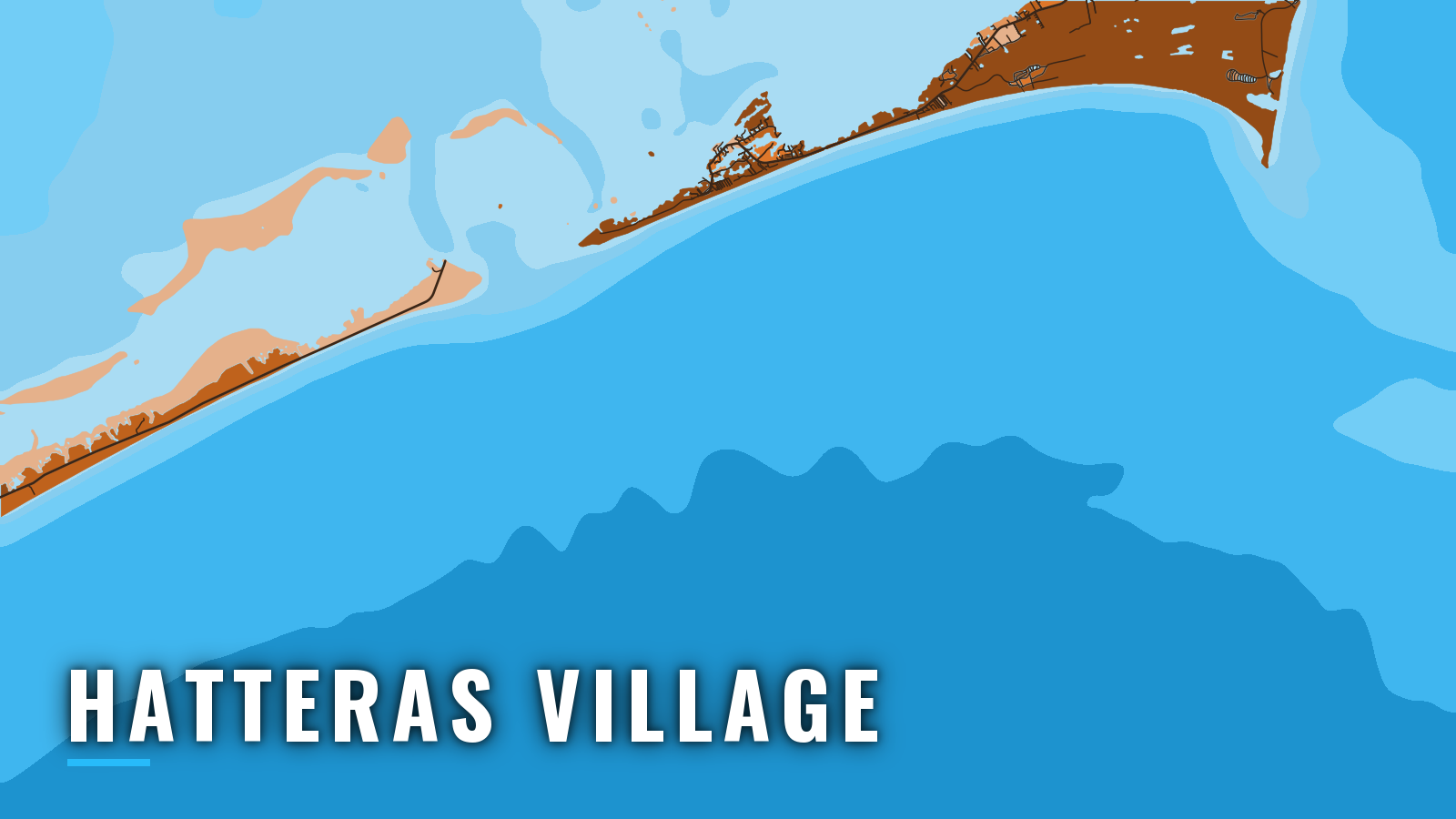
Hatteras Village sits on Hatteras Island, 3 miles northeast of Hatteras Inlet. The harbor basin reaches the Atlantic through the dredged Hatteras Inlet Channel and reaches Pamlico Sound through Rollinson Channel. Offshore fishing runs year-round because the Gulf Stream passes close to Cape Hatteras. Bluefin tuna lead the winter, then yellowfin tuna, mahi-mahi, wahoo, marlin and sailfish take over through the warm months. This page covers the port layout, inlet behavior and the seasonal menu, so you can plan the run before you trailer or leave the dock. Size, bag and season rules from NCDMF, along with the federal HMS permit required for tuna and billfish, are on our North Carolina fishing regulations page.
Access and navigation
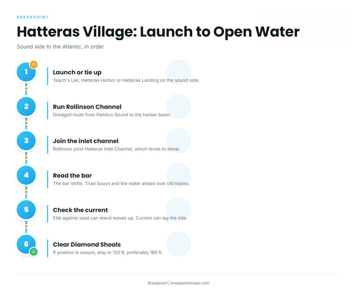
You launch or tie up on the sound side of the village and run the channel out to the inlet. The run to the bar is short, and the bar is the part that needs attention.
Ramps and marinas
- Teach’s Lair Marina – launch ramp, fuel listed.
- Hatteras Harbor Marina – fuel listed, dockage.
- Hatteras Landing Marina – the marina describes a 9-foot basin.
How Hatteras Inlet behaves
The bar at Hatteras Inlet shifts continually. A lighted whistle buoy marks the approach, but according to NOAA Coast Pilot 4, the buoys over the bar are not charted because they are moved often. The dredged channel to the harbor tends to shoal quickly between dredgings. Old tracks on your plotter can lead you onto new sand, so the buoys and the water in front of you are a better guide than last trip’s line.
Current through the inlet channel runs about 2 knots and is influenced by wind. Current change can lag the tide change, so a tide table alone may mislead you. An ebb running out against incoming seas can stand waves up on the bar. Prevailing winds run north to northeast in the cooler season and southwest in summer.
The Hatteras Connector replaced the former South Ferry Channel. The USCG NAVCEN Port Status lists the inlet open with frequent shoaling and shifting bottoms, and shoaling remains in several areas. Check Port Status before each trip.
The inside route
Rollinson Channel is the dredged approach from Pamlico Sound to the harbor basin, and it joins Hatteras Inlet Channel. Its lights can be hard to tell from lights ashore, and the Coast Pilot says strangers should not attempt passage at night. Pamlico Sound holds fishtraps, stakes and pound nets, and some may be submerged.
The other way out
Oregon Inlet is the other ocean exit, at the north end of the Hatteras Island chain.
Diamond Shoals
Diamond Shoals extend about 9 miles southeast from Cape Hatteras, with spots as shallow as 3 feet. The hydrography there is not charted because it keeps changing, and currents set across the shoals with great velocity in strong winds. When your position is uncertain, stay in 120 feet of water, preferably 180 feet. Diamond Shoals Lighted Buoy 12 is the guide for clearing the shoals.
On arrival
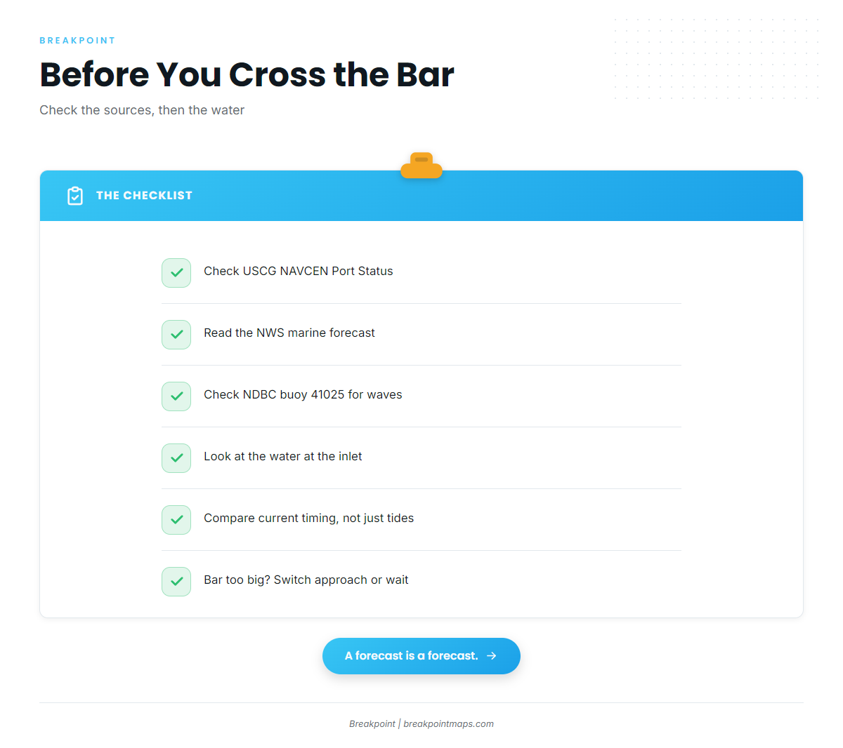
Look at the water at the inlet before you commit. Check the NWS Newport/Morehead City marine forecast and NDBC buoy 41025 at Diamond Shoals for wind, wave height and period. If the bar looks bigger than you want, switch approaches or wait for the current to turn.
Fishing conditions
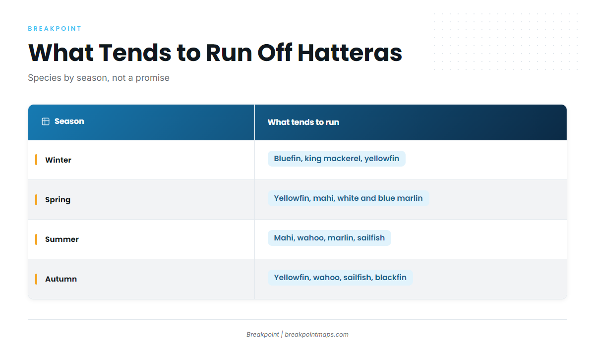
Hatteras sits on the Gulf Stream side of the Cape, south of the 35°15.3′ N management line at Cape Hatteras. The Atlantic Southeast fishing guide covers the wider region. What runs here depends on the season and on where the warm water sits.
The named grounds:
- AR-230 artificial reef – off Hatteras Inlet, 70 ft.
- Rock Pile – rock.
- 280 Rocks – rock.
- 230 Rocks – rock.
Diamond Shoals is both a hazard and an edge. The USS Monitor National Marine Sanctuary, about 1 mile across, lies south of the shoals.
Pull up OBS SST and Chart Contours before you choose a direction off the bar. Chart layers are not for navigation.
Winter
Bluefin tuna, king mackerel and yellowfin tuna are the winter list. Bluefin tends to follow the cool-season north and northeast wind pattern and the water north of the Cape, which the Atlantic Northeast fishing guide covers.
Spring
Yellowfin tuna arrive and become the main draw; the yellowfin tuna fishing guide covers them. Dolphin (mahi-mahi) show up too, and the mahi-mahi fishing guide has the detail. White marlin begin to appear, with the white marlin fishing guide as a reference, and blue marlin follow. King mackerel, red drum, bluefish and false albacore round out the list.
Summer
Mahi, wahoo, blue marlin, white marlin and sailfish lead the summer run, with yellowfin tuna still in the mix. The wahoo fishing guide and the blue marlin fishing guide cover the two headline species. For regional patterns, see blue marlin patterns south of the Cape. Spanish mackerel, amberjack and barracuda fill out the list. Summer’s prevailing wind runs southwest, per the Coast Pilot.
Autumn
Yellowfin tuna, mahi, wahoo and king mackerel carry the autumn list, with bluefin tuna and blackfin tuna in the mix. Sailfish are covered in the sailfish fishing guide. White marlin, red drum and false albacore round out the season.