
About Depoe Bay
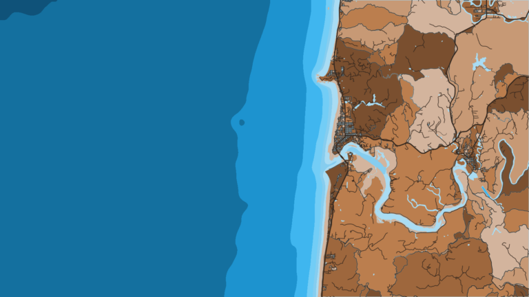
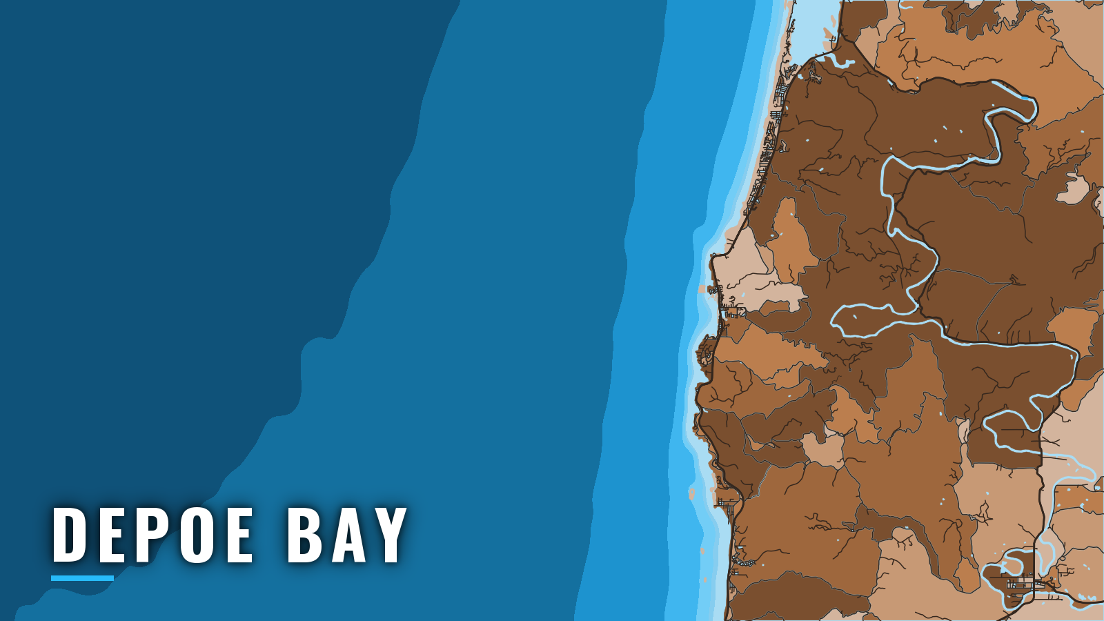
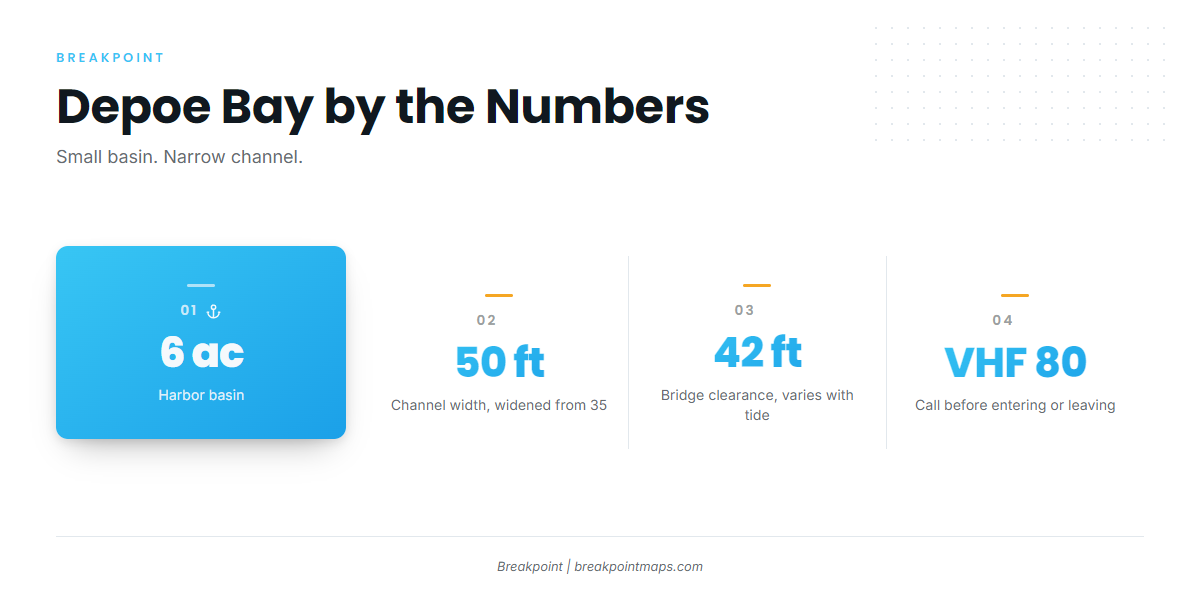
Depoe Bay sits on US 101 on the central Oregon coast. A basin of about 6 acres opens to the Pacific through a rock-walled channel about 50 feet wide, which runs under the US 101 bridge. The port calls itself the world’s smallest navigable harbor. For a private boat, open water is a few minutes from the dock, and the entrance is the first thing to plan around.
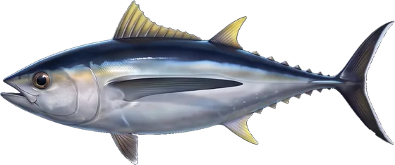
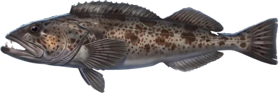
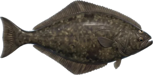
The nearshore reefs make Depoe Bay a year-round base for black rockfish and lingcod. Pacific halibut, Chinook and coho salmon, and albacore run farther out in their seasons, part of the wider Pacific Northwest offshore fishing picture. The channel shapes every trip, so read the entrance before anything else.
Access and navigation at Depoe Bay
Launch and moorage
The public ramp is the City of Depoe Bay harbor ramp at the end of Shell Avenue, reached from US 101 via Schoolhouse Street. The Oregon State Marine Board access listing carries current ramp details. Truck and trailer parking near the ramp can be tight on busy days, so arrive early.
The Port of Depoe Bay handles harbor moorage, and fuel is listed there. Arrange berthing through the city harbor office at cityofdepoebay.org/harbor. A bar advisory sign stands at the ramp; see Reading conditions below.
The entrance
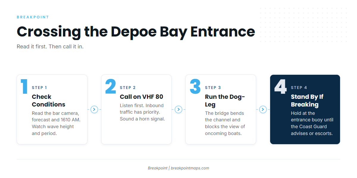
Crossing the Depoe Bay Bar, the joint Coast Guard, NOAA and Oregon State Marine Board guide, should be read before your first run. The basics:
- The channel cuts through basalt and has been widened from 35 to 50 feet.
- It passes under a fixed bridge with about 42 feet of vertical clearance, which varies with the tide.
- Controlling depths run 6 to 8 feet, per NOAA chart and Coast Pilot.
- Vessels over 50 feet should check with the harbormaster and the Coast Guard before coming in.
A dog-leg under the bridge blocks the view of oncoming boats. Call on VHF channel 80 and sound a horn signal before entering or leaving. Listen on 80 before you go, since inbound traffic has priority.
Reefs sit close on both sides of the channel. Seas can break over North Reef from the northwest and southwest at the same time, and Flat Rock, the reef to the south, breaks almost all the time. In adverse conditions, breakers from North Reef can cross the channel and run into the entrance. Do not fish between the entrance and lighted Bell Buoy 2. When breakers are crossing the channel, stand by at the entrance buoy until the Coast Guard advises you or escorts you in.
Little estuary water drains through the channel, so the entrance responds more to swell height, swell period and wind than to tide. A change in wind or swell direction can turn the channel quickly.
Reading conditions
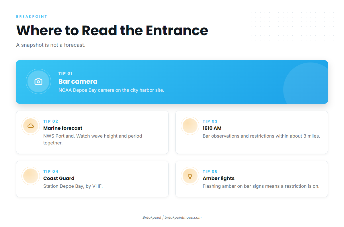
The Coast Guard can restrict recreational vessels from crossing. Flashing amber lights on the bar advisory signs, including the one at the ramp, mean a restriction is in effect.
Sources for current conditions:
- The NOAA Depoe Bay bar camera, posted on the City of Depoe Bay harbor site.
- The NWS Portland marine forecast.
- The 1610 AM continuous broadcast, received within about 3 miles of the station, covering bar observations, restrictions and local weather.
- Coast Guard Station Depoe Bay, by VHF.
A camera frame is a snapshot and a forecast is a forecast. Neither shows what the next set will do, so watch wave height and swell period together.
Alternative approach
Newport is the next port south. The Yaquina Bay entrance at Newport is entered through jetties and a maintained channel rather than a rock-walled cut. It is the option for the return when the Depoe Bay entrance looks bigger than you want, or for the departure if you would rather start from there.
Before you commit
On arrival, look at the water from the bridge and check the official forecast. If the entrance looks bigger than you want, use the Newport approach or stay in.
Fishing conditions off Depoe Bay
The named grounds include Siletz Reef and the Cape Foulweather Complex MCA, where statewide ODFW rules apply with no special restrictions. Reefs close to the harbor around the Bell Buoy fill out the nearshore options.
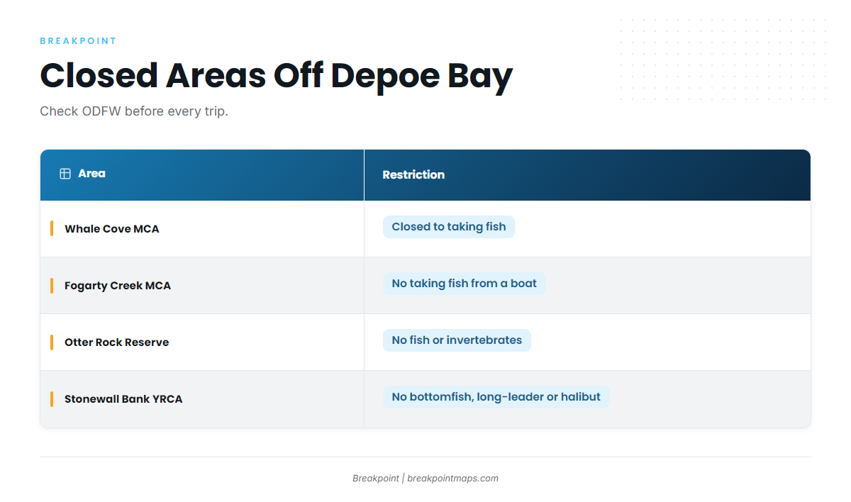
Several areas on this stretch of coast are closed or restricted. Check the ODFW marine area designations for the boundaries:
- Whale Cove MCA: closed to taking fish.
- Fogarty Creek MCA: closed to taking fish from a boat.
- Otter Rock Marine Reserve: closed to taking fish or invertebrates.
- Stonewall Bank Yelloweye Rockfish Conservation Area, about 15 miles west of Newport: closed to bottomfish, long-leader and Pacific halibut fishing. A vessel with halibut aboard may not fish there.
Two depth lines run through the rules. Use a descending device on any rockfish released seaward of the 30-fathom line. The 40-fathom line separates the nearshore halibut fishery from the long-leader fishery. Every boat fishing bottomfish or halibut needs a working descending device aboard. ODFW publishes waypoints for both lines. Check the ODFW marine zone regulations before every trip.
| Season | Main targets | Where |
|---|---|---|
| Winter | black rockfish, lingcod | nearshore reefs |
| Spring | lingcod, Chinook salmon, Pacific halibut | reefs, then offshore |
| Summer | coho and Chinook salmon, Pacific halibut, albacore | offshore |
| Autumn | rockfish, lingcod, albacore, Chinook salmon, Dungeness crab | reefs and offshore |
Winter
Black rockfish and lingcod hold on the nearshore reefs. Lingcod run 22 inches minimum and 3 per day, per ODFW. Winter swell can limit the days the entrance works, so run through the conditions list above before every departure. Bag limits can be cut in-season when black rockfish catch nears its cap, so check the ODFW marine zone page before fishing.
Spring
Lingcod stay on the reefs while Chinook salmon and Pacific halibut open up the offshore side. Depoe Bay and Pacific City both land halibut in the Central Oregon Coast subarea. That subarea has spring and summer all-depth seasons and a nearshore season inside the 40-fathom line, each running until its quota is caught. The Pacific halibut guide covers the fish itself. Every angler holds a Combined Angling Tag.
The Pacific Fishery Management Council sets ocean salmon seasons each year. Use no more than 2 single-point barbless hooks. Check the ODFW marine zone page before fishing.
Summer
Coho and Chinook salmon, Pacific halibut and albacore all draw boats offshore. The albacore window tends to open in late summer and depends on warm water pushing inshore. Check OBS SST and Chlorophyll for the temperature break before committing to the run. Chart layers are not for navigation.
Tuna and most offshore pelagics may be aboard with halibut seaward of the 40-fathom line. The ODFW combination fishing guide lays out which fisheries can share a trip. An Ocean Endorsement is required to keep tuna. Check the ODFW marine zone page before fishing.
Autumn
Rockfish and lingcod stay on the reefs, Chinook salmon linger, and the late offshore run brings albacore tuna tactics back into play. For deep water, sablefish can be kept with all-depth halibut or with either bottomfish fishery. Ocean crabbing for Dungeness pairs easily with a bottomfish trip, so check the ODFW marine zone page for crab rules before you set gear. Autumn swell can build, so the same entrance routine applies on every run.