Bigeye tuna fishing out of Chatham means the offshore canyons, reached by an overnight trip. This page covers the run, the named marks between Chatham Inlet and the canyons, and who fishes for bigeye from this port. For the inlet, ramps, marinas and local conditions, use the Chatham port guide.
Where Chatham boats run for bigeye
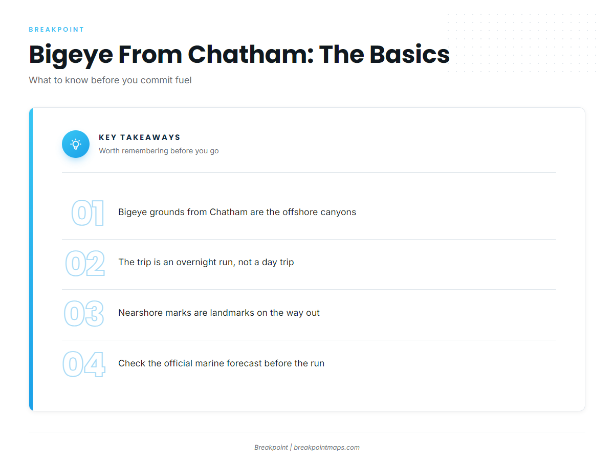
Chatham boats go to the offshore canyons for bigeye, and the trip is an overnight run, unlike a day trip to the grounds east of the inlet.
The marks below are points you pass and plot on the way out. They are reference points, not bigeye spots. For the individual canyons and the wider Northeast picture, read the regional guide (see also the wider Atlantic Northeast guide).
Grounds and marks between Chatham and the canyons
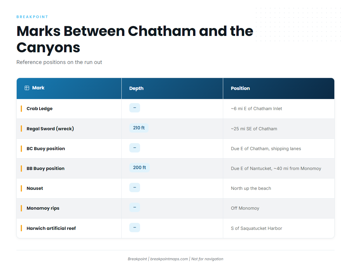
These named grounds and reference positions near Chatham are landmarks on the run, not bigeye marks.
| Mark | Depth | Position from port |
|---|---|---|
| Crab Ledge | – | About 6 miles east of Chatham Inlet |
| Regal Sword (wreck) | 210 ft | About 25 miles southeast of Chatham |
| BC Buoy position (buoy removed) | – | Basically due east of Chatham, in the shipping lanes |
| BB Buoy position (buoy removed) | 200 ft | Due east of Nantucket, about 40 miles from Monomoy |
| Nauset (marsh and inlet) | – | North up the beach from Chatham |
| Monomoy rips | – | Off Monomoy |
| Harwich artificial reef | – | South of Saquatucket Harbor, Nantucket Sound |
Chart layers are not for navigation.
Crab Ledge
Crab Ledge is about 6 miles east of Chatham Inlet.
Regal Sword wreck
The Regal Sword lies in 210 ft, about 25 miles southeast of Chatham, per The Fisherman.
BC Buoy position
The buoy has been removed. The position is basically due east of Chatham, in the shipping lanes, and now exists only as a waypoint in your plotter.
BB Buoy position
The buoy has been removed. It sat in 200 ft, due east of Nantucket, about 40 miles from Monomoy. Like BC, it is now a plotter waypoint.
Nauset
Nauset is a marsh and inlet tuna ground, north up the beach from Chatham.
Monomoy rips
The Monomoy rips are a named ground off Monomoy.
Harwich artificial reef
The Harwich artificial reef sits south of Saquatucket Harbor in Harwich, in Nantucket Sound.
Timing and tactics for bigeye from Chatham
Bigeye trips from Chatham are canyon overnighters. Season windows, depth behavior and tackle are covered in the bigeye species guide.
Before committing to the run, check the official marine forecast for wind, wave height and period.
Who fishes for bigeye out of Chatham
One local charter lists bigeye tuna.
Fish Chatham Charters
The Fish Chatham Charters website lists bigeye tuna. Captain John runs the 38 ft Northern Bay ‘Shearwater’, docked at Stage Harbor.
FAQ about bigeye tuna fishing out of Chatham
Where do Chatham boats go for bigeye tuna?
Boats go to the offshore canyons on an overnight trip.
How far is Crab Ledge from Chatham?
Crab Ledge is about 6 miles east of Chatham Inlet.
Where were the BB and BC buoys?
BC was basically due east of Chatham, in the shipping lanes. BB was in 200 ft, due east of Nantucket, about 40 miles from Monomoy. Both buoys have been removed, and both positions are used as reference points.
Who runs bigeye trips out of Chatham?
Fish Chatham Charters lists bigeye tuna. Captain John runs the 38 ft ‘Shearwater’ from Stage Harbor.
Where can I find more tuna fishing information?
The wider tuna picture is in our tuna fishing guides.