
About Chatham
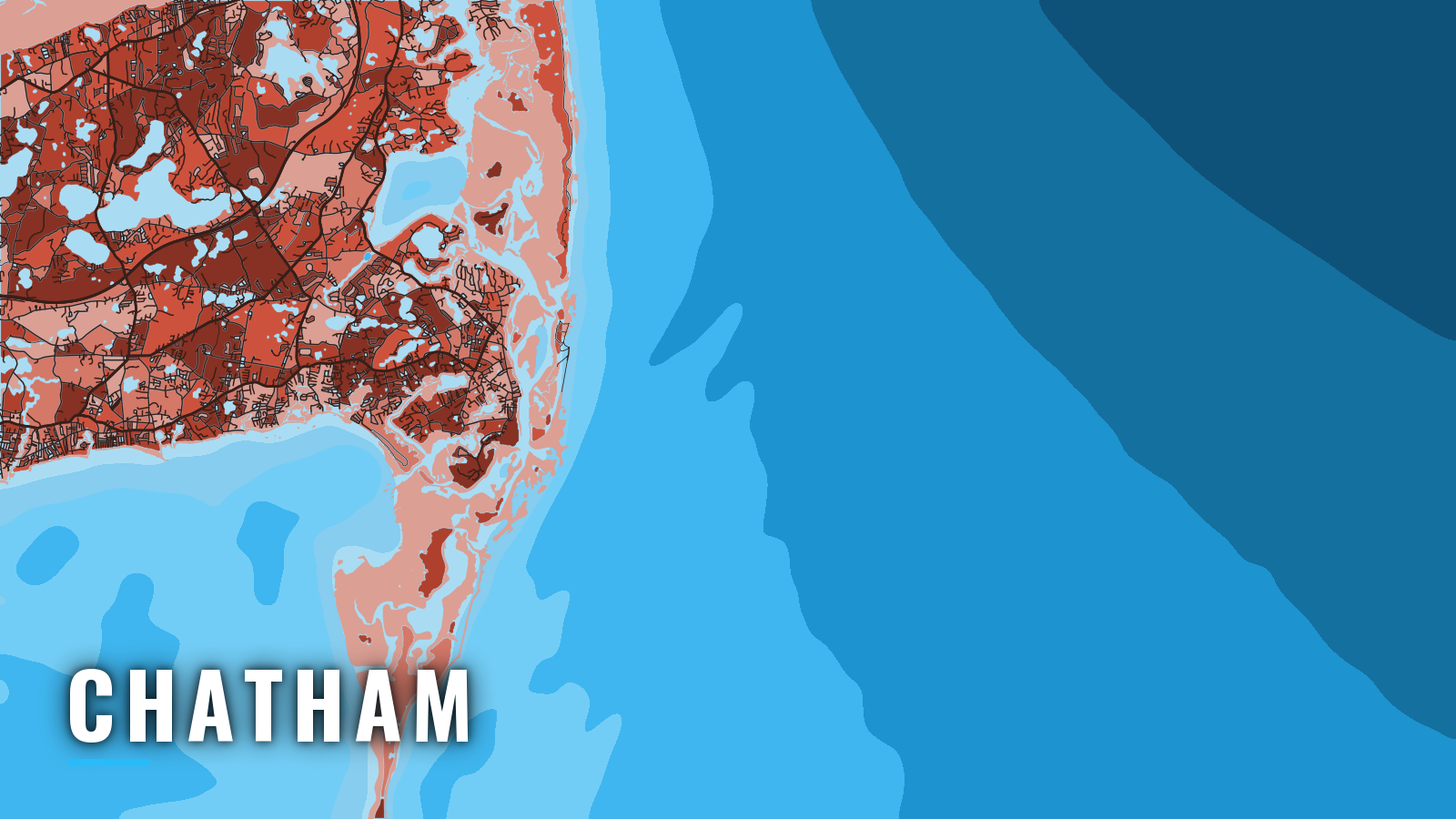
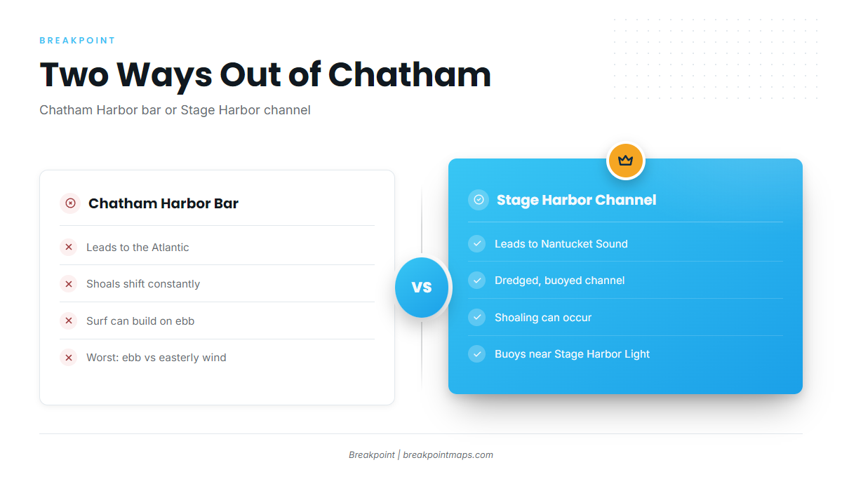
Chatham sits at the elbow of Cape Cod and has two ways out. The Chatham Harbor bar leads east to the Atlantic through Pleasant Bay and Chatham Harbor. The Stage Harbor channel and Chatham Roads lead to Nantucket Sound and the Monomoy shoals. It is a Massachusetts port with coast on both sides of the Cape. Hyannis lies west along the Hyannis Nantucket Sound shore, and Barnstable sits on the Cape Cod Bay side.
Offshore fishing out of Chatham runs from spring through autumn. The target list is striped bass, bluefish, bluefin tuna, false albacore, bonito, black sea bass, tautog and fluke. The Atlantic Northeast fishing guide covers regional species and seasons.
The planning sequence is to pick a ramp, learn how the bar and Stage Harbor behave, know where to check conditions, then match the grounds to the season.
Access and navigation
Launch and fuel options:
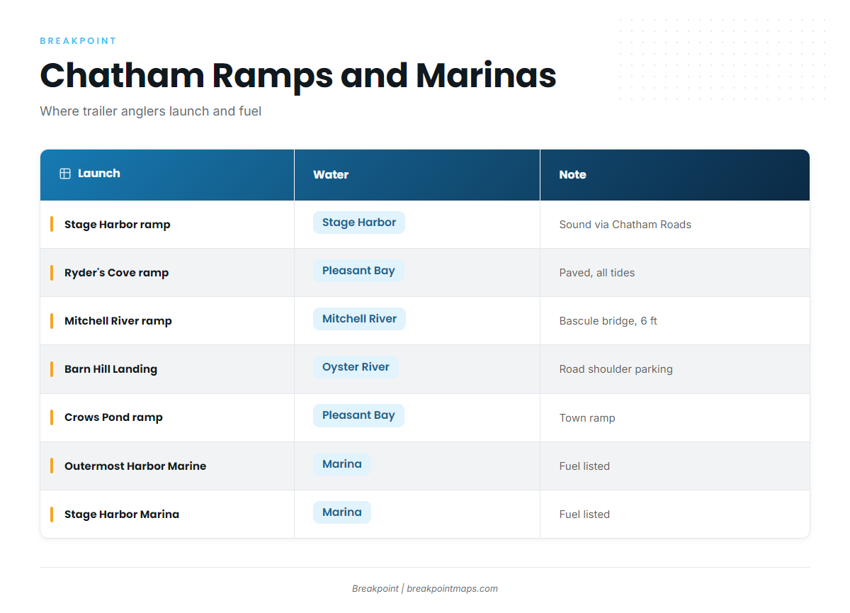
- Stage Harbor (Old Mill Boat Yard) ramp – town ramp into Stage Harbor, with Nantucket Sound via Chatham Roads
- Ryder’s Cove ramp – paved town ramp on Pleasant Bay
- Mitchell River ramp (Bridge Street) – town ramp below a bascule bridge with 6 ft vertical clearance
- Barn Hill Landing ramp (Oyster River) – town ramp, parking on the Barn Hill Road shoulder
- Crows Pond ramp – town ramp on the Pleasant Bay side
- Outermost Harbor Marine – marina, fuel listed
- Stage Harbor Marina – marina, fuel listed
- Chatham Municipal Fish Pier (Aunt Lydia’s Cove) – commercial off-loading pier, not a launch
A Waterways User Permit is required to use the town ramps, and non-residents may launch from Ryder’s Cove or Barn Hill. The rules are in Chatham’s boater access rules. The Cape and Islands Harbormasters ramp list notes that Ryder’s Cove is paved and usable at all tides, and that Barn Hill parking is on the road shoulder. From Ryder’s Cove, the run to the cuts and the Atlantic is 2 to 3 miles of narrow, tide-swept channel.
The Chatham Harbor bar
Sand moves here, and the bar may not look the same from one trip to the next. Chatham Harbor is entered east of Chatham Light, where the shoals shift constantly and the currents are described as extremely strong. Surf can build quickly on the outer bar during an ebb, and conditions are usually worst when an outgoing tide runs against an easterly wind.
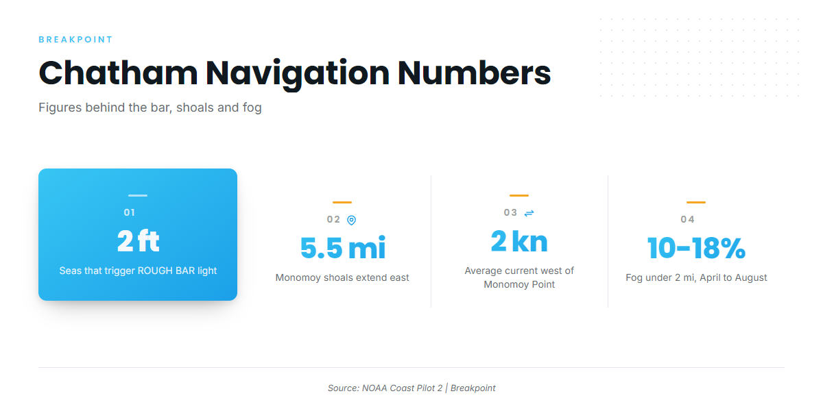
A guide light and dayboard marked ROUGH BAR near Chatham Light activates when seas exceed 2 ft. A light that is not flashing does not mean seas are favorable. The bars move faster than surveys and chart updates, which is why the U.S. Coast Pilot 2, Chapter 4 describes a moving target. Boats launched in Stage Harbor still reach the Atlantic by crossing the new inlet or Chatham Bar.
Stage Harbor and Chatham Roads
Stage Harbor also sits among shifting sandbars and can shoal. A dredged, buoyed channel leads in from Chatham Roads. The entrance buoys are usually picked up about 800 yards southwest of Stage Harbor Light. A course of 063° with Stage Harbor and Chatham Lights in range can lead toward the approach buoy, but treat it as a starting point rather than a fixed route.
Shoals, rips and fog
Monomoy Shoals extend about 5.5 mi east and 9.5 mi southeast of Monomoy Point, and they shift in location and depth. Tidal currents average about 2 kn at strength just west of Monomoy Point. About 2.7 mi south of Chatham Light there is a large shoal area with no marked channel.
Pollock Rip Channel and Butler Hole run between Bearse Shoal and Pollock Rip, then east of Handkerchief Shoal, into Nantucket Sound. They can carry large-vessel traffic, which matters in fog. Fog is most frequent from April through August, when visibility drops below 2 mi 10 to 18% of the time, and May through July has the most. Fog distorts sound, so the direction of bells and horns can be hard to judge.
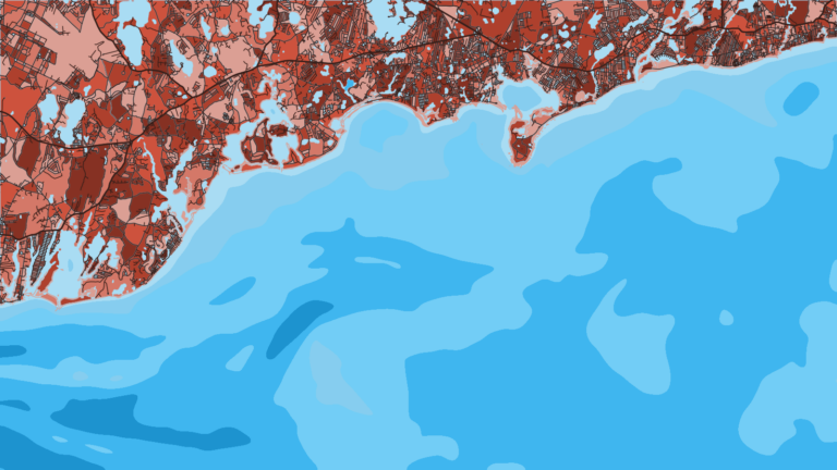
Breakpoint chart layers are not for navigation. Use NOAA chart 13248 and the Coast Pilot.
On arrival, look at the water, the South Inlet spotter buoy on the NERACOOS Mariners Dashboard, and the NWS marine forecast. Check wave height and period, and switch approaches if conditions look bigger than you want.
Fishing conditions
The named grounds are:
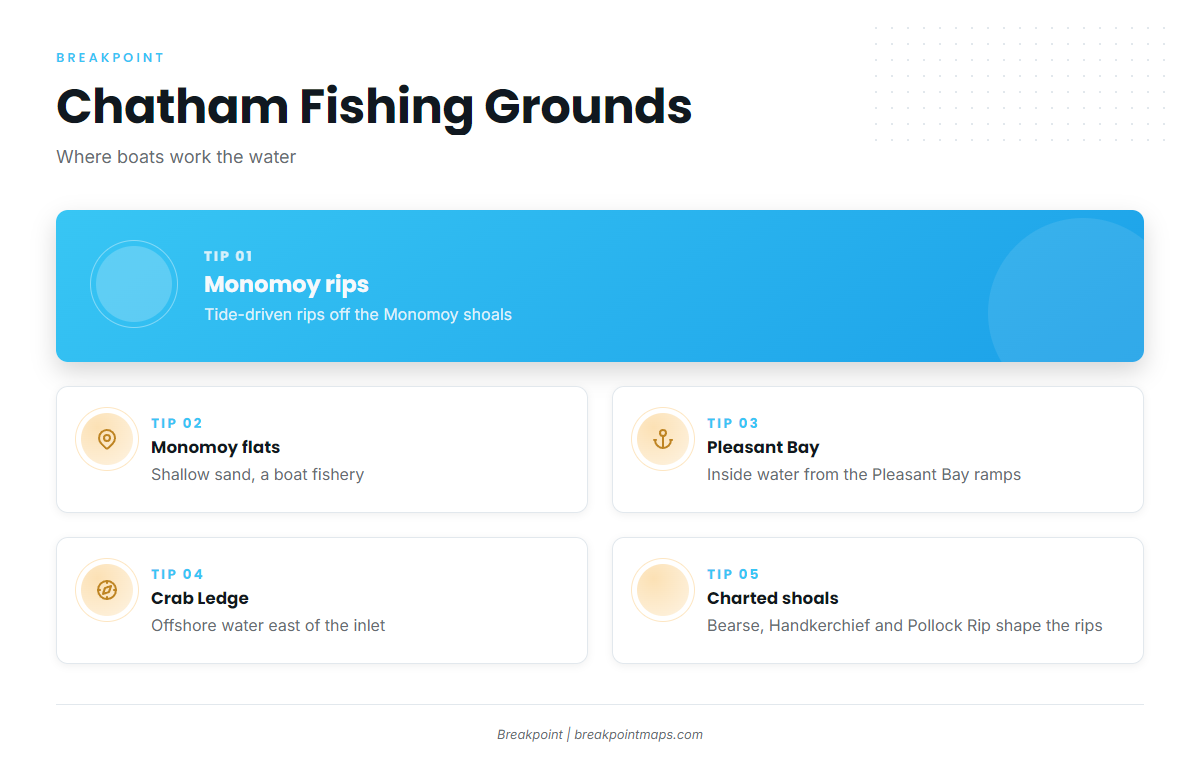
- Monomoy rips: tide-driven rips off the Monomoy shoals
- Monomoy flats: shallow sand
- Pleasant Bay: inside water reached from the Pleasant Bay ramps
- Crab Ledge: offshore ground east of the inlet
Bearse Shoal, Handkerchief Shoal and Pollock Rip shape the current and the rips, and the rips are fished from boats.
Winter
Options are thin and center on offshore groundfish. Cod seasons and conservation closures vary by area, so check the Massachusetts Division of Marine Fisheries before fishing. Cold water and short weather windows limit most trips.
Spring
Tautog and black sea bass come first. Striped bass tend to arrive in the rips and Pleasant Bay in late spring. Size, bag and season rules for each species are in the Massachusetts recreational saltwater regulations from MassDMF, so check them before you fish. Black sea bass has a defined season, which MassDMF can confirm. Fog peaks from May through July.
Summer
The summer list is striped bass, bluefish, bluefin tuna and black sea bass, and fluke work the Nantucket Sound side. Bass work the Monomoy rips, and the regional guide has details on striped bass in the Northeast. Bluefin gather at Crab Ledge and the offshore water east of the inlet, covered on the Northeast bluefin tuna page. NOAA’s Highly Migratory Species office manages bluefin, and the rules follow quotas, so check before each trip. OBS SST can show temperature edges east of the inlet.
Autumn
False albacore, bonito, Spanish mackerel, tuna, striped bass and bluefish make up the autumn list. Bass and bluefish tend to feed hard as the water cools. Check MassDMF for the rules on false albacore and bonito. For warm-water tunas farther offshore in the region, see the yellowfin tuna guide and the Northeast yellowfin page. Check water temperature edges and the marine forecast before any run.