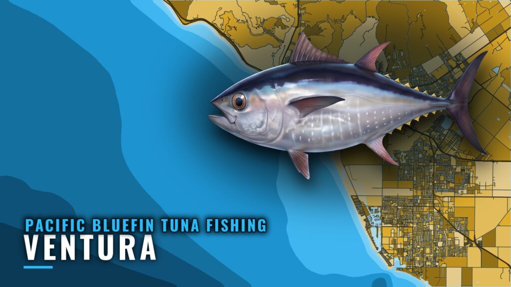
Pacific bluefin tuna fishing out of Ventura runs late summer into early fall, against the Channel Islands and their underwater banks. This page covers when the fish show, where boats point, which named structure to scout, and which buoy to read before the run. It is written for skippers running their own boats.
When Pacific bluefin are around Ventura
Bluefin are around Ventura in late summer and early fall, according to Visit Ventura’s fishing overview. Boats leave from Ventura Harbor, and the Ventura port page covers the harbor itself. The fish sit against the Channel Islands and their underwater banks, so the grounds list below doubles as your scouting list for the window.
Late summer and early fall
This is the window to point the boat at island structure. Migratory predators stack against the islands and the banks that extend from them, and that is where the fuel is best spent. For the species picture beyond this port, see the Pacific bluefin tuna guide.
Where boats run from Ventura
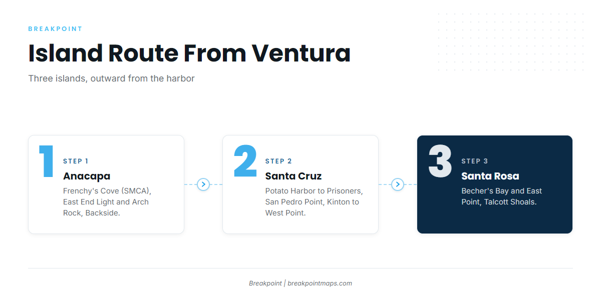
Boats out of Ventura run to the Channel Islands and fish against the islands and their underwater banks. The list below moves outward from the harbor: Anacapa, then Santa Cruz, then Santa Rosa. Three closures shape the route and where you set up: Frenchy’s Cove (SMCA), the Scorpion closure and the Gull Island closure. The Regulations section below covers them.
Anacapa Island
Anacapa is the first island on the list from Ventura.
- North side of West Anacapa, Frenchy’s Cove to west end (SMCA). This stretch is named with the SMCA, so know the boundary before you set up.
- East End Light and Arch Rock. East end of Anacapa.
- Backside (south side). South side of Anacapa.
Santa Cruz Island
Santa Cruz is the next island out, with grounds running east to west.
- Potato Harbor to Chinese Harbor to Prisoners.
- San Pedro Point, Yellowbanks to Gull Island closure. East end of Santa Cruz, past the Scorpion closure. Both closures sit along this route, so plan your line around them.
- Kinton Point, Fraser Point and West Point. West tip of Santa Cruz, next to Santa Rosa.
Santa Rosa Island
Santa Rosa is the farthest island on the list.
- Becher’s Bay and East Point. Northeast side of Santa Rosa.
- Talcott Shoals. North side of Santa Rosa. This is shallow rock fishing.
For Channel Islands bluefin beyond these grounds, see the Pacific Southwest regional guide (see also the Pacific Southwest region guide).
This list is a planning reference and is not meant for navigation. Run off your charts.
How bluefin are fished and who fishes them from Ventura
From Ventura, bluefin are fished by Ventura Sportfishing’s Endeavor, run by owner and captain Tucker McCombs. For rigs and approaches, see our tuna fishing guides.
The local fleet
The landing is Ventura Sportfishing, also listed as Ventura Harbor Sportfishing. Its bluefin boat is the Endeavor. Find the operation at Ventura Sportfishing’s landing site.
Reading fleet counts
Endeavor counts come from overnight and multi-day trips. Those trips cover more water and more hours than a private-boat day run, so a count won’t forecast your day. Treat the Endeavor’s posted trip counts as a sign that fish are within the islands’ range, and use them to choose which island to scout first.
Reading conditions at Anacapa Passage
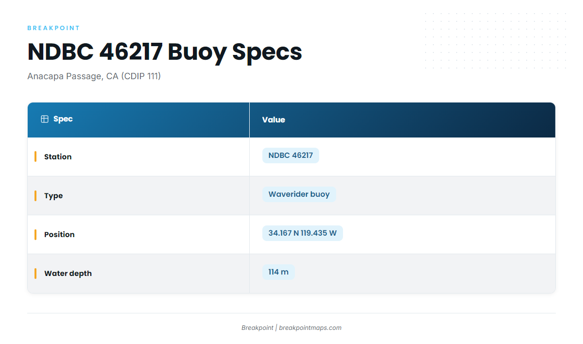
Check NDBC 46217, Anacapa Passage, before the run. It sits in the water you cross to reach Anacapa.
NDBC 46217 / CDIP 111
- Station: NDBC 46217, Anacapa Passage, CA (CDIP 111)
- Type: Waverider buoy
- Position: 34.167 N 119.435 W
- Water depth: 114 m
Read wave height and period as numbers and set them against your own boat’s limits. Pull them from the NDBC 46217 station page.
Read the NWS East Santa Barbara Channel forecast alongside the buoy. The forecast gives you what is expected, and the buoy shows what the water is doing at the station.
FAQ: Pacific bluefin tuna fishing out of Ventura
When is bluefin season out of Ventura?
Late summer and early fall, per Visit Ventura.
Where do boats run for bluefin from Ventura?
To the Channel Islands, fishing against the islands and their underwater banks.
Which island grounds are named near Ventura?
Anacapa has the north side of West Anacapa (Frenchy’s Cove to west end, SMCA), East End Light and Arch Rock, and the backside. Santa Cruz has Potato Harbor to Chinese Harbor to Prisoners, San Pedro Point (Yellowbanks to Gull Island closure), and Kinton Point, Fraser Point and West Point. Santa Rosa has Becher’s Bay and East Point, and Talcott Shoals.
Who runs bluefin trips out of Ventura?
Ventura Sportfishing’s Endeavor, with owner and captain Tucker McCombs. Counts come from overnight and multi-day trips.
Which buoy should I check before the run?
NDBC 46217, Anacapa Passage (CDIP 111). Read wave height and period alongside the official marine forecast.