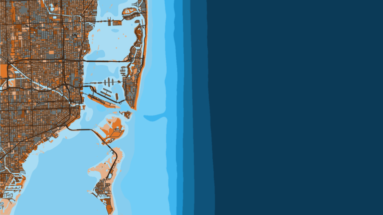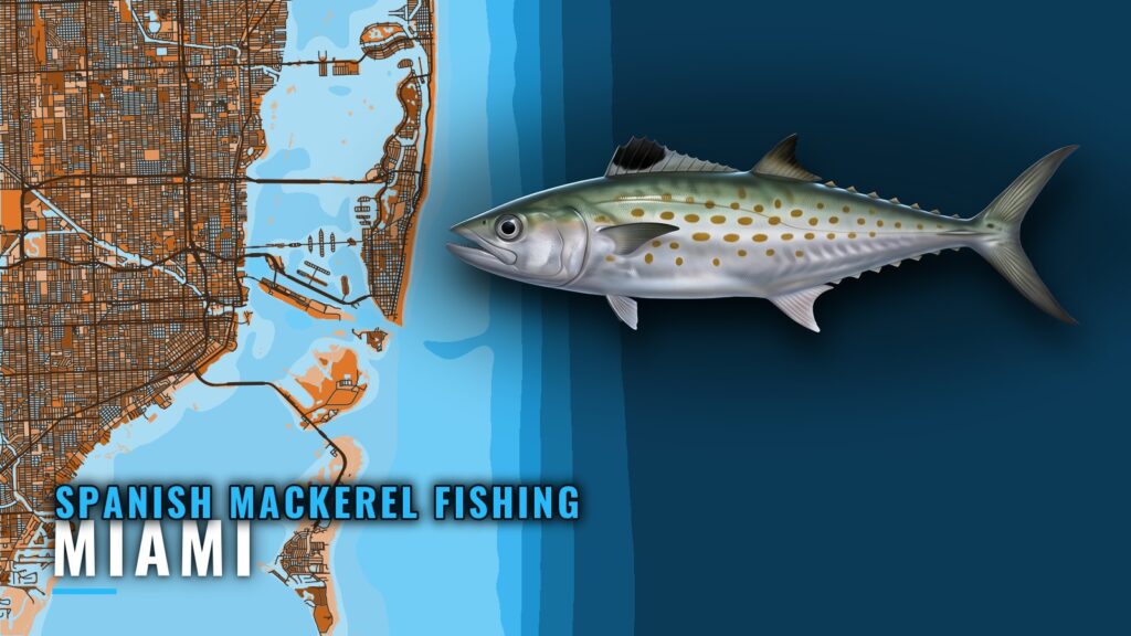
Spanish mackerel fishing out of Miami is a close-to-shore, near-inlet fishery worked off the Haulover Inlet area. This page covers where boats run, the named grounds with their depths and distances, how the fish are worked, who targets them, and where the rules live.
When Spanish mackerel are around Miami
Spanish mackerel are on the species list for the Haulover Inlet area and on The Reward Fleet’s target list for Miami.
Run timing follows the coastal migration rather than the port. The Spanish mackerel species guide covers the fish and its movements, and southeast Atlantic run timing (see also the wider Atlantic Southeast guide) covers timing along the coast.
Where boats run from Miami
Boats work the Haulover Inlet area and stay close to shore. For the wider port picture, see fishing out of Miami.
| Item | Detail |
|---|---|
| Main area | Haulover Inlet area |
| Range | Close to shore, nearshore and near-inlet |
| Scale reference | The Edge, about 3 miles from the coastline off Miami Beach |
Haulover Inlet area
Spanish mackerel are on the Haulover Inlet species list, and most of the local effort centers here.
Close to shore
The fishery stays close to shore. For scale, The Edge sits about 3 miles from the coastline, just off Miami Beach. It is covered in the next section.
Grounds and structure near Miami
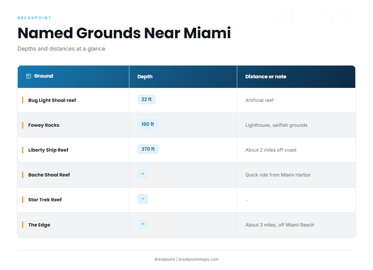
The table lists the named grounds and structure near Miami, with whatever depth and distance figures exist for each. Depths are in feet.
| Ground | Depth | Distance or note |
|---|---|---|
| Bug Light Shoal artificial reef | 22 ft | |
| Fowey Rocks | 160 ft | Lighthouse and rocks; sailfish grounds |
| O.L. Bodenhamer Wreck / Liberty Ship Reef | 370 ft | About 2 miles off the coast |
| Bache Shoal Reef | Quick boat ride from Miami Harbor | |
| Star Trek Reef | ||
| The Edge | About 3 miles from the coastline, just off Miami Beach |
You can mark this structure with the Chart Contours layer in the app. Chart layers are not for navigation.
Bug Light Shoal artificial reef
Bug Light Shoal is an artificial reef in 22 ft, the shallowest depth-listed structure here.
Fowey Rocks
Fowey Rocks is a lighthouse and rocks in 160 ft, known as sailfish grounds.
O.L. Bodenhamer Wreck / Liberty Ship Reef
The O.L. Bodenhamer Wreck, also called Liberty Ship Reef, sits in 370 ft, about 2 miles off the coast.
Bache Shoal Reef
Bache Shoal Reef is a quick boat ride from Miami Harbor.
Star Trek Reef
Star Trek Reef is named structure near Miami.
The Edge
The Edge lies about 3 miles from the coastline, just off Miami Beach.
How Spanish mackerel are fished out of Miami
The local approach is inshore and near-inlet fishing, tied to the Haulover Inlet area and the close-to-shore range described above. Runs are short and the water is nearshore. For a broader treatment of how these fish are worked, see nearshore and inshore pelagic methods.
Who fishes for Spanish mackerel from Miami
The Reward Fleet is a charter that lists Spanish mackerel among its targets. It departs from Bayside Marketplace in Miami.
FAQ: Spanish mackerel fishing out of Miami
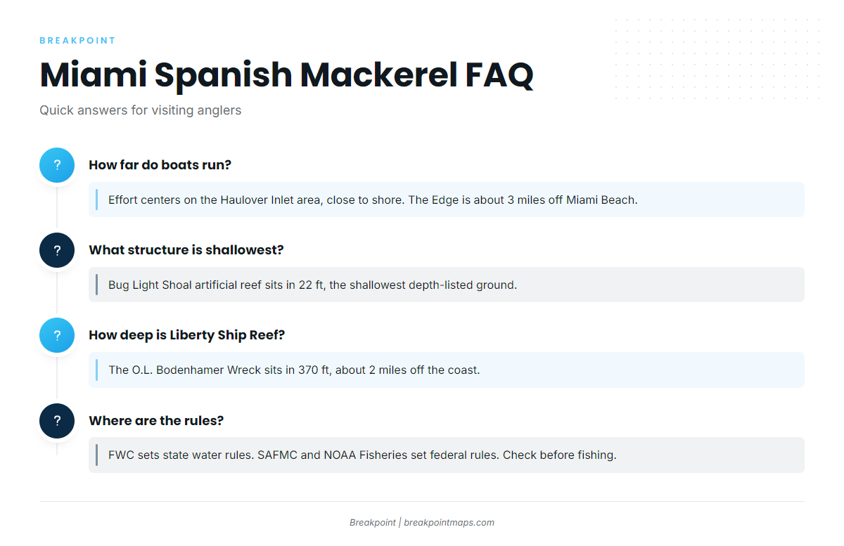
How far do boats run for Spanish mackerel out of Miami?
Fishing centers on the Haulover Inlet area, close to shore. For scale, The Edge lies about 3 miles from the coastline off Miami Beach.
What structure near Miami is shallowest?
Bug Light Shoal artificial reef, in 22 ft, is the shallowest of the depth-listed grounds near Miami.
How deep is the Liberty Ship Reef?
The O.L. Bodenhamer Wreck, also called Liberty Ship Reef, sits in 370 ft, about 2 miles off the coast.
Does a Miami charter target Spanish mackerel?
The Reward Fleet lists Spanish mackerel among its targets. It departs from Bayside Marketplace in Miami.
Where are the rules for Spanish mackerel off Miami?
FWC sets the rules in Florida state waters. The South Atlantic Fishery Management Council and NOAA Fisheries set them in federal waters. Check the agency before fishing.