When striped bass are here
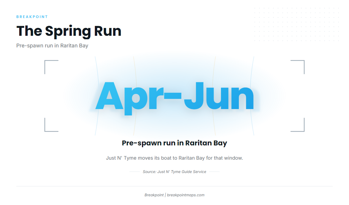
The pre-spawn run in Raritan Bay, April to June, is the main season. Just N’ Tyme moves its boat there for that window. For general biology and coastwide timing, see the striped bass species page.
- Window: April to June
- Where the run sets up: Raritan Bay
Where boats run
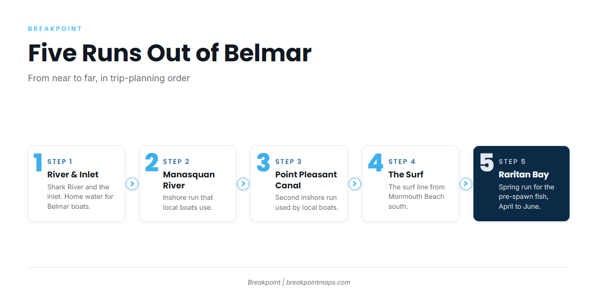
Belmar boats work five runs, from nearest to farthest: Shark River and the inlet, the Manasquan River, the Point Pleasant Canal, the surf line and Raritan Bay. This briefing covers striped bass fishing out of Belmar: the named runs and structure, depths in feet, distances in nautical miles, the local method and the charters that list the species. The names and numbers are meant for building your chart for the day.
Shark River and the inlet
Shark River and the inlet are home water for Belmar boats. Just N’ Tyme docks in Shark River.
Manasquan River and Point Pleasant Canal
These are the inshore runs local boats use, and both are within reach of a Belmar start.
The surf from Monmouth Beach south
This is the beachfront run, and it stays within the same stretch of coast as the inlet.
Raritan Bay in spring
In spring the fleet goes to Raritan Bay for the pre-spawn fish, April to June. For the regional and coastwide picture, see the coastwide migration (see also the Atlantic Northeast offshore fishing guide).
Grounds and structure off Belmar
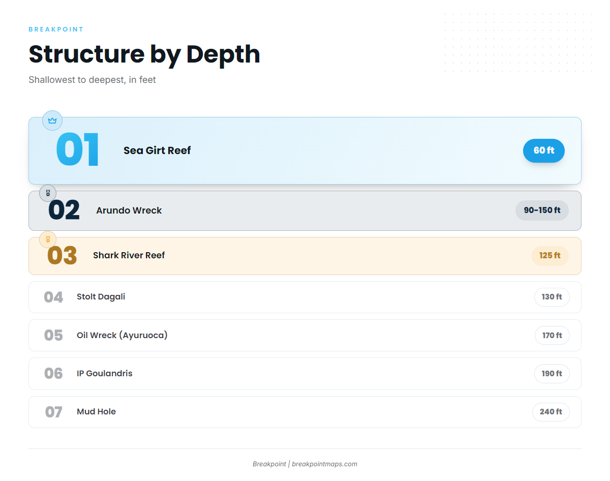
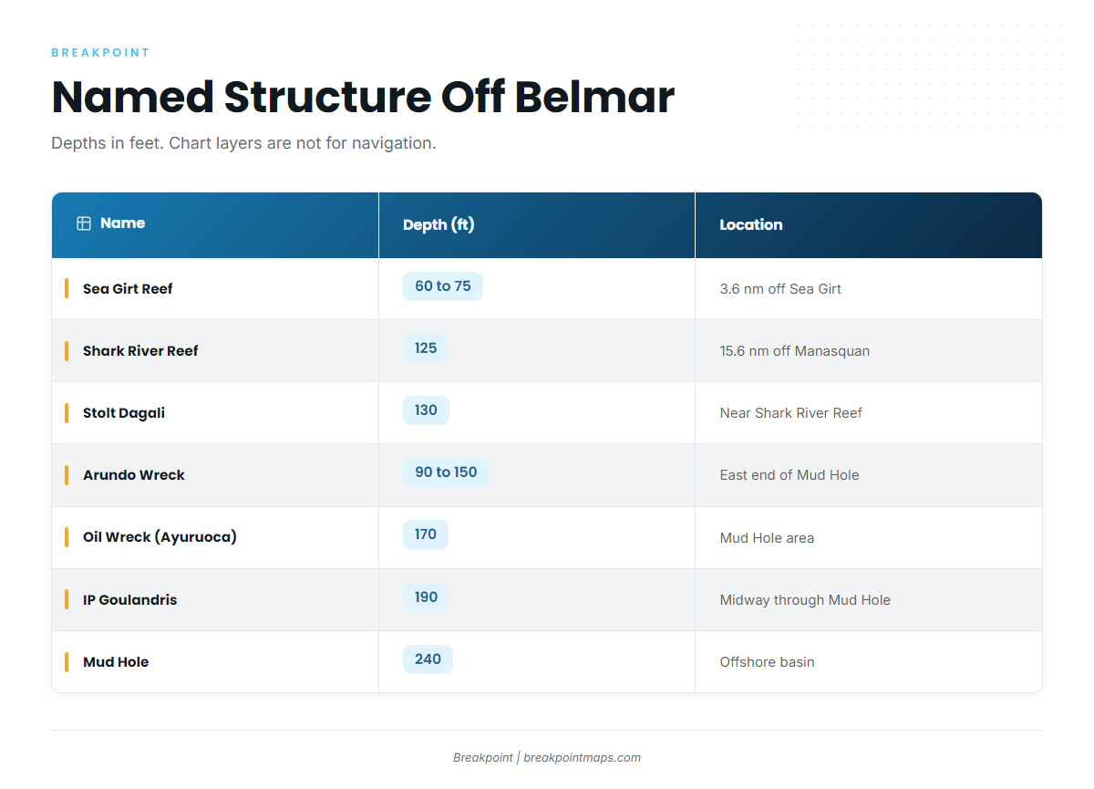
The table lists the named reefs, ridge and wrecks local boats run, in the form you would enter them on a chart. Chart layers are not for navigation.
| Name | Depth (ft) | Location |
|---|---|---|
| Sea Girt Reef | 60 to 75 | 3.6 nm off Sea Girt |
| Klondike | Under the Sea Girt Reef | Underwater ridge the Sea Girt Reef sits atop |
| Shark River Reef | 125 | 15.6 nm off Manasquan |
| Stolt Dagali | 130 | Near the Shark River Reef, close to the Mud Hole edge |
| Mud Hole | 240 | |
| Arundo Wreck | 90 to 150 | Eastern end of the Mud Hole |
| Oil Wreck (Ayuruoca) | 170 | In the Mud Hole area |
| IP Goulandris | 190 | Midway through the Mud Hole |
Sea Girt Reef and the Klondike
Sea Girt Reef lies in 60 ft, 3.6 nm off Sea Girt, with a depth range of 60 to 75 ft. It sits atop the Klondike, an underwater ridge.
Shark River Reef and the Stolt Dagali
Shark River Reef lies in 125 ft, 15.6 nm off Manasquan. The Stolt Dagali is a wreck in 130 ft, near the reef and close to the Mud Hole edge.
The Mud Hole wrecks
The Mud Hole is 240 ft deep. Three wrecks sit in and around it:
- The Arundo lies in 90 to 150 ft at the eastern end.
- The Oil Wreck (Ayuruoca) lies in 170 ft in the Mud Hole area.
- The IP Goulandris lies in 190 ft, midway through the Hole.
How it is fished: live lining bunker
Local boats fish striped bass by live lining bunker. The coastal gamefish hub covers the other species.
Who fishes for striped bass out of Belmar
These local charters list striped bass:
- Golden Eagle: a vessel named Golden Eagle at Belmar Marina.
- Parker Pete’s Fishing Charters: Captain Pete Sykes and USCG licensed captains.
- Just N’ Tyme Guide Service: Capt. Justin Swanson runs a 35 foot Sea Hunter center console docked in Shark River. The boat moves to Raritan Bay from April to June.
- Shark Inlet Charters: a local charter that lists striped bass.
- XTC Sportfishing: Captain Scott Kulaszewski.
FAQ about striped bass fishing out of Belmar
When is the spring striped bass run out of Belmar?
It is the pre-spawn run in Raritan Bay, April to June. Just N’ Tyme moves its boat there for that window.
Where do Belmar boats go for striped bass in spring?
They run to Raritan Bay. The inshore runs are Shark River and the inlet, the Manasquan River, the Point Pleasant Canal and the surf from Monmouth Beach south.
How deep is the Sea Girt Reef?
The reef lies in 60 ft, with a range of 60 to 75 ft, 3.6 nm off Sea Girt. It sits atop the Klondike ridge.
How far out is the Shark River Reef?
It is 15.6 nm off Manasquan, in 125 ft. The Stolt Dagali lies nearby in 130 ft, close to the Mud Hole edge.
What method do local boats use for striped bass?
Live lining bunker is the method used locally.