Black sea bass fishing out of Montauk runs from close-in bottom like The Haps to the Block Island area and, south of the Windmills, offshore ground such as West Atlantis and The Tails. These grounds sit at very different ranges, so the first decision is how far the day lets you run. The wider picture is in the black sea bass fishing in the Atlantic Northeast and the Atlantic Northeast region guide.
This guide covers which ground fits the day’s range, which numbers to read, which reports to watch, and where the rules live. General biology and habits are in the black sea bass species guide.
When black sea bass are around Montauk
Two local markers set the timing: the late-summer reports from Star Island Yacht Club and the date of the Montauk Grand Slam Charity Fishing Tournament. The full season pattern is in the species guide.
Late summer in the reports
Star Island Yacht Club lists sea bass in its late-summer reports. The reports don’t name grounds, so they can’t be tied to any one spot.
Tournament timing
The Montauk Grand Slam Charity Fishing Tournament is usually held in July. It is a fixed point on the calendar that some boats plan around.
Where Montauk boats run
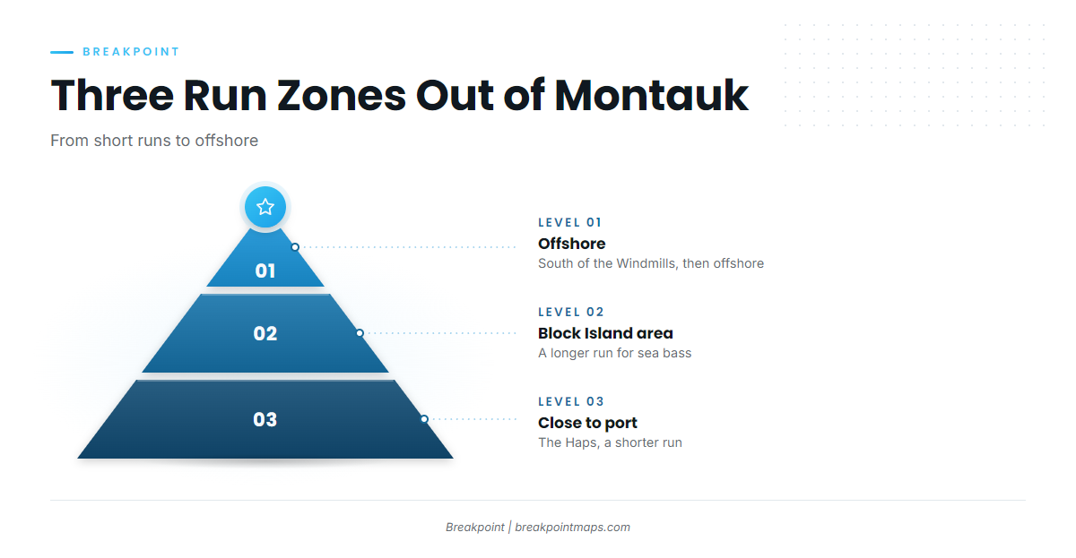
Sea bass out of Montauk are fished across three zones. The Montauk port guide covers the harbor and port detail, and the grounds table in the next section follows the same zones.
- Close to port: short runs to nearby bottom
- The Block Island area: the middle-range run
- South of the Windmills and offshore: the longest runs
Before any long run, check the nearest NOAA buoy, NDBC 44017 (Montauk Point). It is the source of numbers for the offshore zone, and the details are below.
Close to port
The Haps sits close to Montauk, though no distance is published for it. It suits a shorter run.
The Block Island area
Montauk boats run to the Block Island area for sea bass. It is the middle-range option between the close-in bottom and the offshore ground.
South of the Windmills and offshore
Boats run south of the Windmills and then offshore. West Atlantis and The Tails belong to this zone. Before committing to this run, read 44017’s wind, wave height and dominant period as numbers, alongside the NWS marine forecast.
Grounds and structure near Montauk
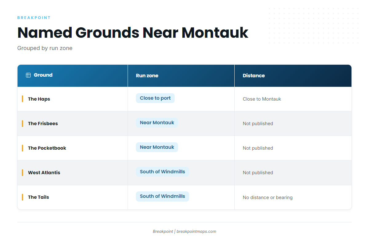
These are named grounds near Montauk, grouped by run zone.
| Ground | Run zone | Published distance |
|---|---|---|
| The Haps | Close to port | Close to Montauk |
| The Frisbees | Named ground near Montauk | |
| The Pocketbook | Named ground near Montauk | |
| West Atlantis | South of the Windmills and offshore | |
| The Tails | South of the Windmills and offshore | No distance or bearing published |
For the general picture of fishing bottom structure, see the reef and bottom fish guides. Check the structure on Chart Contours before the run. Chart layers are not for navigation.
The Haps
The Haps sits close to Montauk. No distance is stated. It is the short-run option.
The Frisbees
The Frisbees is a named ground near Montauk.
The Pocketbook
The Pocketbook is a named ground near Montauk.
West Atlantis
West Atlantis sits in the zone south of the Windmills and offshore.
The Tails
The Tails sits in the offshore zone. No distance or bearing is published for it.
How it is fished and who fishes it from Montauk
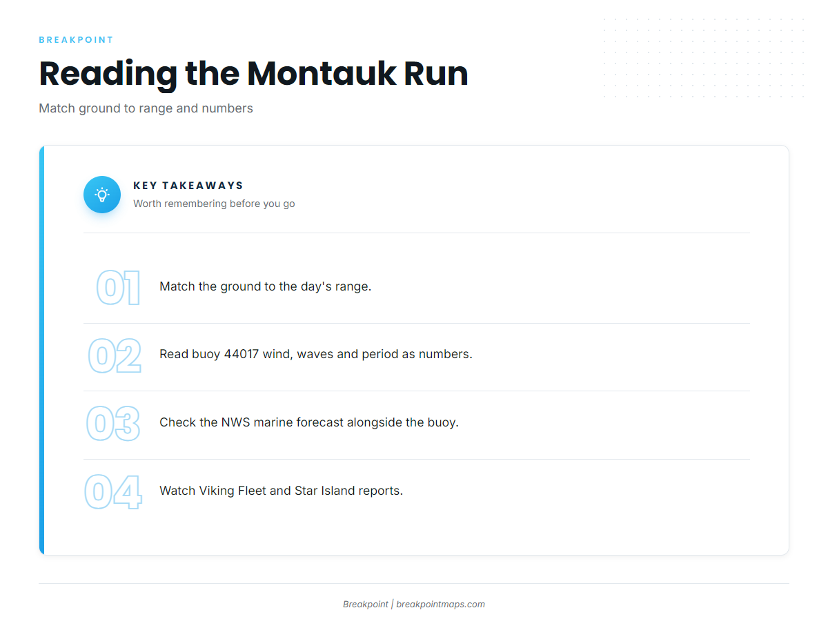
The local approach is to match the ground to the day’s range and numbers, then watch what the fleet reports. Tackle questions are covered in the species guide and the reef and bottom fish guides.
Reading buoy 44017
NDBC station 44017 (Montauk Point) sits at 40.693 N, 72.049 W. Read wind, wave height and dominant period as numbers, alongside the NWS marine forecast. The forecast covers the wider area, while the buoy reports a single point.
Viking Fleet
The Viking Fleet fishing trips page lists black sea bass. The boats are:
- Viking Fivestar
- Viking Starship (Capt. Dave)
- Viking Starlite (Captain JR)
Star Island Yacht Club
Star Island Yacht Club reports list sea bass in late summer without naming grounds.
Montauk Grand Slam Charity Fishing Tournament
The Montauk Grand Slam Charity Fishing Tournament is usually held in July. It is the local tournament for Montauk black sea bass.
FAQ: black sea bass fishing out of Montauk
Where do boats run for black sea bass out of Montauk?
Boats run close in to grounds like The Haps, to the Block Island area, and south of the Windmills and then offshore to grounds such as West Atlantis and The Tails.
Is The Haps close to Montauk?
Yes. The Haps sits close to Montauk, and no distance is published for it.
Which buoy should I check before running out?
NDBC 44017 (Montauk Point), at 40.693 N, 72.049 W. Read its wind, wave height and dominant period alongside the NWS forecast.
Who reports sea bass out of Montauk?
The Viking Fleet, which includes Viking Fivestar, Viking Starship and Viking Starlite, lists black sea bass. Star Island Yacht Club lists sea bass in its late-summer reports.
When is the Montauk Grand Slam Charity Fishing Tournament?
It is usually held in July.
Where are the sea bass rules?
New York DEC sets the state rules, and the New York regulations page links them. Check before fishing.