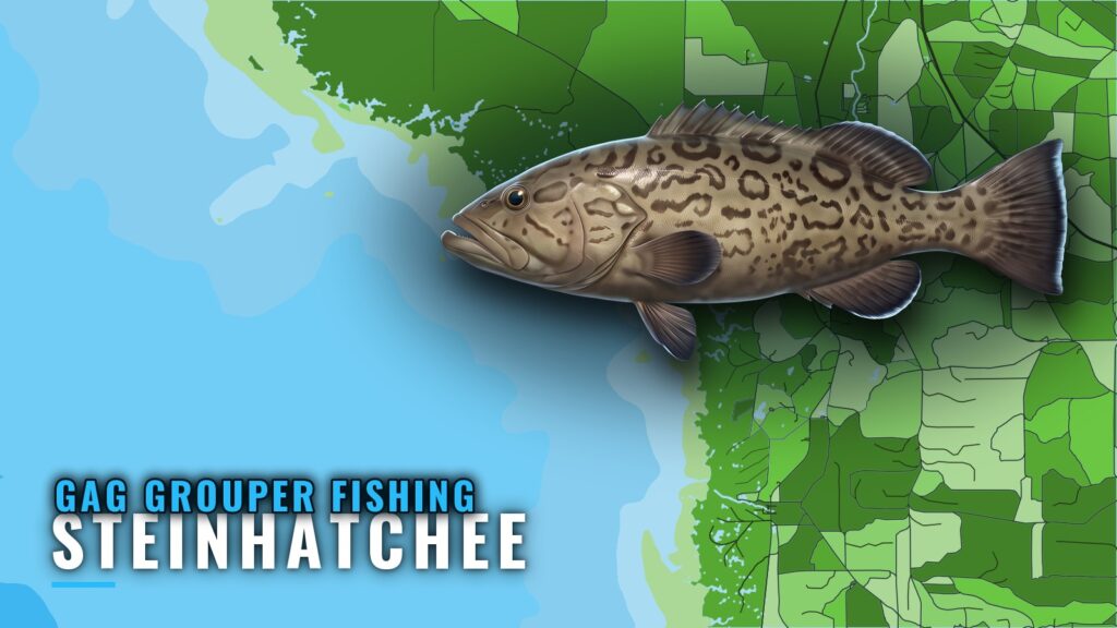
Gag grouper fishing out of Steinhatchee centers on winter, January to March, with offshore grouper also picking up October to December. Every run starts at the Steinhatchee River mouth and ends in one of three bands: 25 miles, 30+ miles or 100+ miles. This page covers those run bands, named ledges with coordinates, nearshore permitted reefs and the two methods used for gag grouper here. The wider picture is in the Gulf of Mexico region guide.
Season
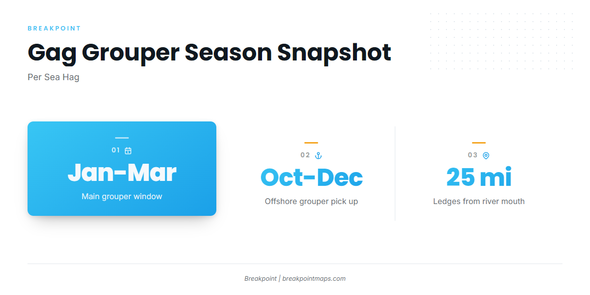
Sea Hag puts the main grouper window in winter, with a second window offshore in fall. Season dates are set by the state agency and are covered under Regulations below.
Winter: January to March
Sea Hag lists January, February and March as the primary grouper months for this port. Plan the main trip here.
Fall: October to December
Sea Hag also reports offshore grouper picking up from October to December. Because that fishing is offshore, the run bands in the next section apply.
How Far Boats Run
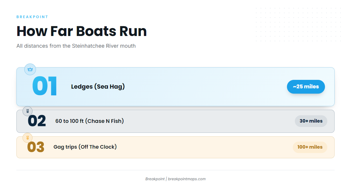
All distances are measured from the Steinhatchee River mouth. Match the range to your boat.
- About 25 miles: ledges, per Sea Hag
- 30+ miles in 60 to 100 ft: Chase N Fish
- 100+ miles: Off The Clock gag trips
The named ledges sit in the 25-mile band. Shorter runs go to the permitted reefs, covered below.
Ledges at 25 Miles
Sea Hag puts ledges roughly 25 miles out from the river mouth. Super Ledge, The Crack and Lamb Spring are the named ledge marks, and their coordinates are in the table below.
30+ Miles in 60 to 100 ft
Chase N Fish runs about 30+ miles out, in 60 to 100 ft of water.
100+ Mile Trips
Off The Clock runs gag trips 100+ miles out, aboard a 36 ft Contender with triple 350 Suzuki engines.
Grounds and Structure
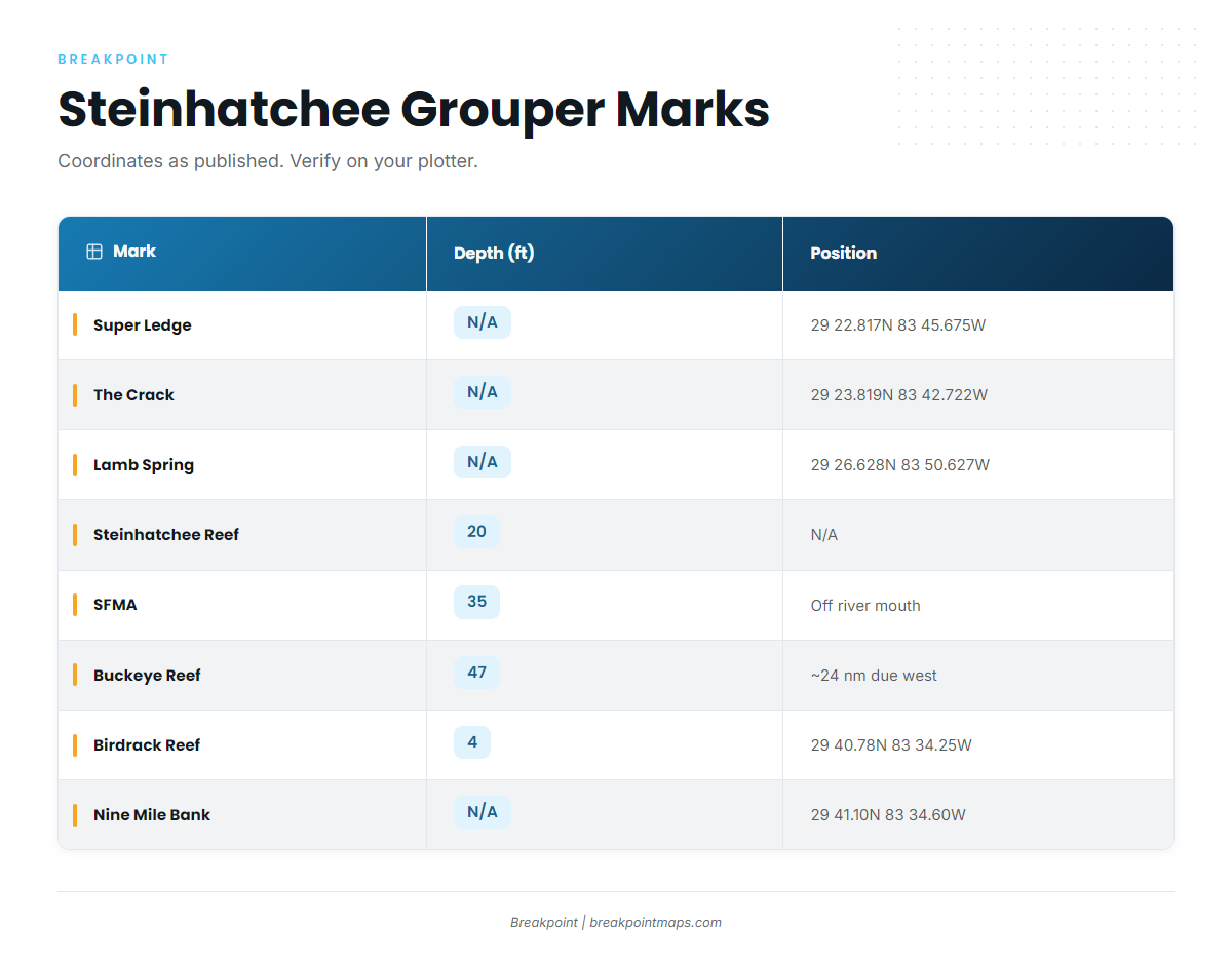
For the wider coast, see the reef fish guides for the Big Bend. The marks off this port are listed here.
| Mark | Type | Depth (ft) | Position or Location |
|---|---|---|---|
| Super Ledge | Ledge | 29 22.817N 83 45.675W | |
| The Crack | Ledge | 29 23.819N 83 42.722W | |
| Lamb Spring | Ledge | 29 26.628N 83 50.627W | |
| Steinhatchee Reef | Permitted public reef, four bottom areas plus cube field | 20 | |
| Steinhatchee Fisheries Management Area (SFMA) | Permitted artificial reef area | 35 | Centered off the mouth of the Steinhatchee River |
| Buckeye Reef | Reef | 47 | About 24 nautical miles due west of Steinhatchee |
| Birdrack Reef | Concrete culverts around bird rack platform | 4 | 29 40.78N 83 34.25W |
| Nine Mile Bank | Bank | 29 41.10N 83 34.60W |
Coordinates are given as published. Verify each mark on your plotter before you run.
In Breakpoint, the Chart Contours layer shows the bottom between these marks. Chart layers are not for navigation.
Offshore Ledges: Super Ledge, The Crack, Lamb Spring
These are the named ledge marks in the roughly 25-mile band Sea Hag describes. Positions are in the table above. The three sit within a few miles of each other, so they can be worked as a group.
Permitted Reefs: Steinhatchee Reef, SFMA, Buckeye Reef
- Steinhatchee Reef: a permitted public reef with four bottom areas plus a cube field, in 20 ft.
- Steinhatchee Fisheries Management Area (SFMA): a permitted artificial reef area in 35 ft, centered off the Steinhatchee River mouth.
- Buckeye Reef: 47 ft, about 24 nautical miles due west of Steinhatchee.
The SFMA and Steinhatchee Reef suit shorter runs.
Shallow Structure: Birdrack Reef, Nine Mile Bank
Birdrack Reef is concrete culverts around the bird rack platform, in 4 ft. Nine Mile Bank is a position mark only. Coordinates for both are in the table.
How Gag Are Fished Here
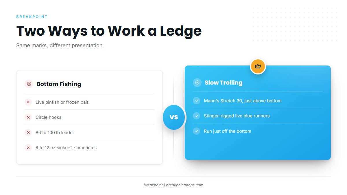
Two methods work the same ledge: bait on the bottom, or a lure or live bait trolled just above it.
Bottom Fishing
Local anglers drop bait to the bottom on heavy leaders:
- Bait: live pinfish or frozen bait
- Hooks: circle hooks
- Leader: 80 to 100 lb
- Sinkers: 8 to 12 oz, used sometimes
Slow Trolling
Troll just above bottom with a lure or a live bait:
- Lures: Mann’s Stretch 30, run just above bottom
- Live bait: stinger-rigged live blue runners
Who Fishes for Them Out of Steinhatchee
Two local charters list gag grouper. Anyone who wants to fish with a guide first can start with either.
Chase N Fish Charters
Chase N Fish Charters, run by Captain Chase Norwood, fishes about 30+ miles out in 60 to 100 ft.
Off The Clock Charters
Off The Clock Charters is run by Captain Shan Roper. The boat is a 36 ft Contender with triple 350 Suzuki engines, and the gag trips run 100+ miles out.
FAQ
When is gag grouper fishing out of Steinhatchee best?
January to March is the main window, per Sea Hag, with offshore grouper also picking up October to December. FWC sets open dates, so check the state regulations page.
How far do boats run for gag grouper from Steinhatchee?
About 25 miles to the ledges, per Sea Hag. Chase N Fish runs about 30+ miles, and Off The Clock runs 100+ miles. All distances are measured from the river mouth.
What depth do Steinhatchee boats fish for gag?
Chase N Fish fishes 60 to 100 ft at 30+ miles. The nearshore permitted reefs sit in 20 ft at Steinhatchee Reef, 35 ft at the SFMA and 47 ft at Buckeye Reef.
What bait and rigs are used?
Bottom fishing uses 80 to 100 lb leaders on circle hooks with live pinfish or frozen bait, sometimes with 8 to 12 oz sinkers. Slow trolling uses Mann’s Stretch 30 lures just above bottom, or stinger-rigged live blue runners.
Are there nearshore spots off Steinhatchee?
Birdrack Reef sits in 4 ft, Steinhatchee Reef in 20 ft and the SFMA in 35 ft off the river mouth. Nine Mile Bank is at 29 41.10N 83 34.60W.
Which charters target gag grouper out of Steinhatchee?
Two local charters list gag. Chase N Fish Charters (Captain Chase Norwood) fishes 30+ miles out in 60 to 100 ft. Off The Clock Charters (Captain Shan Roper) runs 100+ mile trips on a 36 ft Contender.