Spanish mackerel fishing out of Steinhatchee runs late spring through fall, per Rocky Creek Charters, and the shortest run is about 4 miles from the river mouth to Steinhatchee Short Reef. West of there the Big Bend structure spreads out, with a few named banks inside 5 miles and a longer run to Buckeye Reef.
This page covers when the fish are around, how far boats run, the named grounds with coordinates, the local trolling method, and who runs charters. It can’t promise fish; it is meant to help you pick a better place to start looking. For the species picture, see our Spanish mackerel guide, and for launch and port details see Steinhatchee.
When Spanish mackerel are off Steinhatchee
Rocky Creek lists Spanish mackerel here late spring through fall, and Sea Hag also reports them on the flats in fall. That is a long local window, opening as the water warms and closing as it cools. The wider Gulf (see also the Gulf of Mexico fishing guide) movement is covered separately.
- Late spring through fall: the season window, per Rocky Creek
- Fall: fish on the flats, per Sea Hag
Where boats run and how far
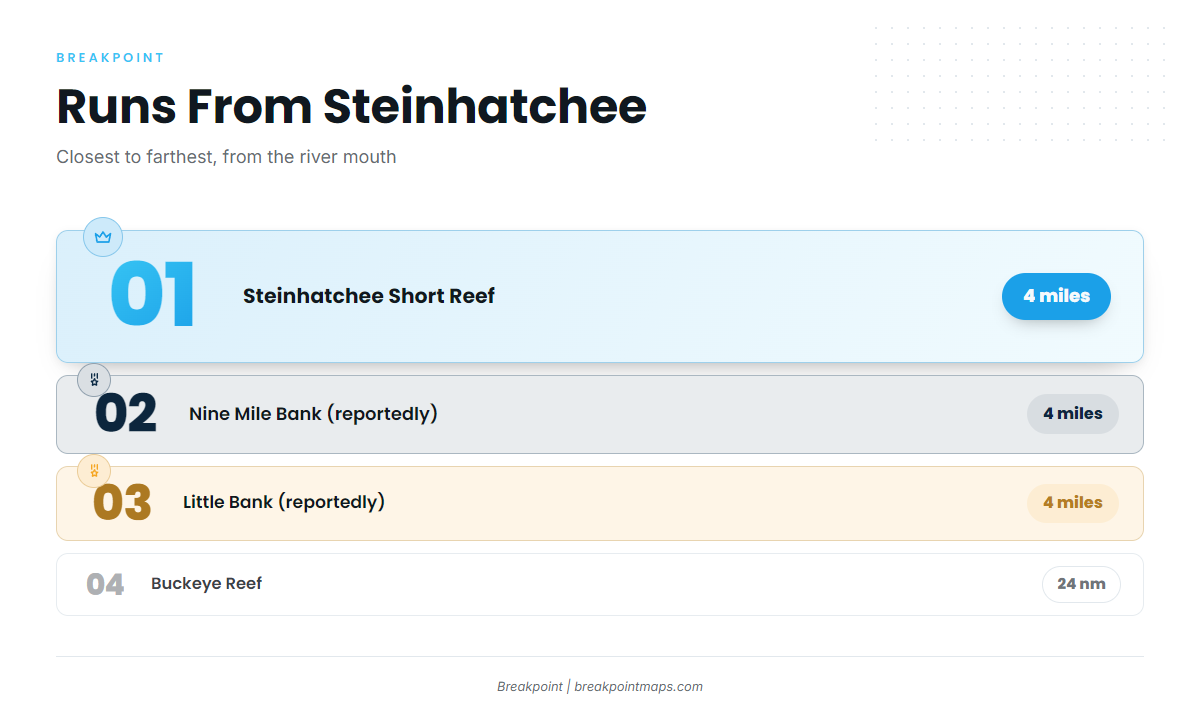
The closest run is Steinhatchee Short Reef, about 4 miles from the river mouth. Two banks sit on a similar run, and Steinhatchee Reef is where Sea Hag has reported fish working bait.
Steinhatchee Short Reef
Steinhatchee Short Reef is about 4 miles from the river mouth.
Nine Mile Bank and Little Bank
Both banks are reportedly about 4 miles out on a 230 degree heading from Marker 1. Plot them before you leave the dock:
- Nine Mile Bank: 29 41.10N 83 34.60W
- Little Bank: 29 39.95N 83 34.25W
Steinhatchee Reef
Sea Hag reports fish chasing bait on Steinhatchee Reef. Its depth is in the grounds table below.
Grounds and structure that hold fish
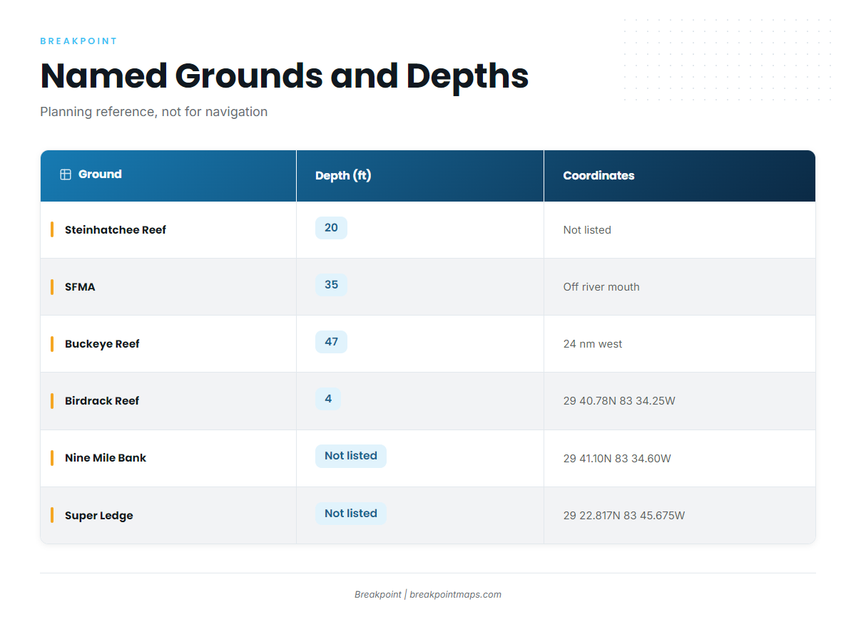
The named grounds off Steinhatchee range from 4 ft culverts to 47 ft structure, with coordinates listed where they are published.
| Name | Type or note | Depth (ft) | Coordinates or location |
|---|---|---|---|
| Steinhatchee Reef | Permitted public reef, four bottom areas plus cube field | 20 | |
| Steinhatchee Fisheries Management Area (SFMA) | Permitted artificial reef area | 35 | Centered off the mouth of the Steinhatchee River |
| Buckeye Reef | 47 | About 24 nautical miles due west of Steinhatchee | |
| Super Ledge | 29 22.817N 83 45.675W | ||
| The Crack | 29 23.819N 83 42.722W | ||
| Lamb Spring | 29 26.628N 83 50.627W | ||
| Birdrack Reef | Concrete culverts around bird rack platform | 4 | 29 40.78N 83 34.25W |
| Nine Mile Bank | 29 41.10N 83 34.60W |
These coordinates load as waypoints in Breakpoint. Coordinates and chart layers are for planning, not navigation.
SFMA
The Steinhatchee Fisheries Management Area is a permitted artificial reef area in 35 ft, centered off the river mouth.
Buckeye Reef
Buckeye Reef sits in 47 ft, about 24 nautical miles due west of Steinhatchee, the longest run on the list. Check the official NWS marine forecast for wind, wave height and period before you commit to it.
Birdrack Reef
Birdrack Reef is concrete culverts around the bird rack platform, in 4 ft, at 29 40.78N 83 34.25W.
How it’s fished locally
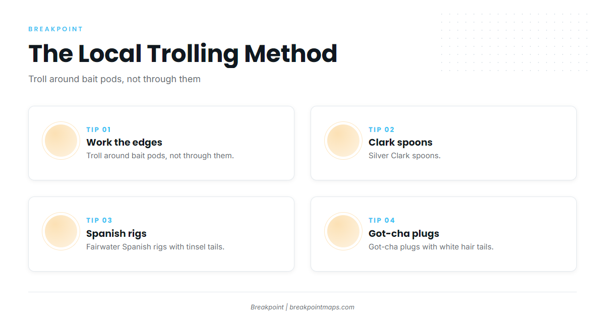
Locals troll around bait pods rather than through them. Three lures come up in the local reports:
- Silver Clark spoons
- Fairwater Spanish rigs with tinsel tails
- Got-cha plugs with white hair tails
For general technique beyond the local method, see our trolling and rigging coverage.
Who fishes them from this port
Rocky Creek Charters in Steinhatchee, run by Captain Frank Taylor Jr, lists Spanish mackerel among its targets. If you are weighing your own boat against a booked trip, it is the local operator that names the species.
FAQ: Spanish mackerel out of Steinhatchee
When is Spanish mackerel fishing out of Steinhatchee best?
Rocky Creek lists Spanish mackerel here late spring through fall, and Sea Hag also reports them on the flats in fall. Local sources describe a long season with no single peak, so plan around that window and watch for bait.
How far do boats run for Spanish mackerel from Steinhatchee?
Steinhatchee Short Reef is about 4 miles from the river mouth. Nine Mile Bank and Little Bank are reportedly about 4 miles out on a 230 degree heading from Marker 1. Buckeye Reef is the long run, about 24 nautical miles due west.
What are the coordinates for Nine Mile Bank and Little Bank?
Nine Mile Bank is 29 41.10N 83 34.60W and Little Bank is 29 39.95N 83 34.25W. Use the numbers for planning, not navigation.
What lures do local anglers troll for Spanish mackerel at Steinhatchee?
Local anglers troll silver Clark spoons, Fairwater Spanish rigs with tinsel tails, and Got-cha plugs with white hair tails, working around bait pods rather than through them.
Does any Steinhatchee charter target Spanish mackerel?
Rocky Creek Charters, run by Captain Frank Taylor Jr, lists Spanish mackerel among its targets out of Steinhatchee.
How deep is Steinhatchee Reef?
Steinhatchee Reef sits in 20 ft. It is a permitted public reef with four bottom areas plus a cube field, and Sea Hag reports fish chasing bait there.