When sailfish show up off Steinhatchee
Sailfish fishing out of Steinhatchee is occasional. Sea Hag reports an occasional sailfish offshore, which matches how the port fishes: a sailfish is a bonus, and nobody plans the day around one. The Gulf of Mexico sailfish guide (see also the Gulf of Mexico fishing guide) covers the wider regional seasonal picture. Below are the grounds boats run from Steinhatchee and the structure you’ll be working when one shows up.
Where boats run and the grounds that hold them
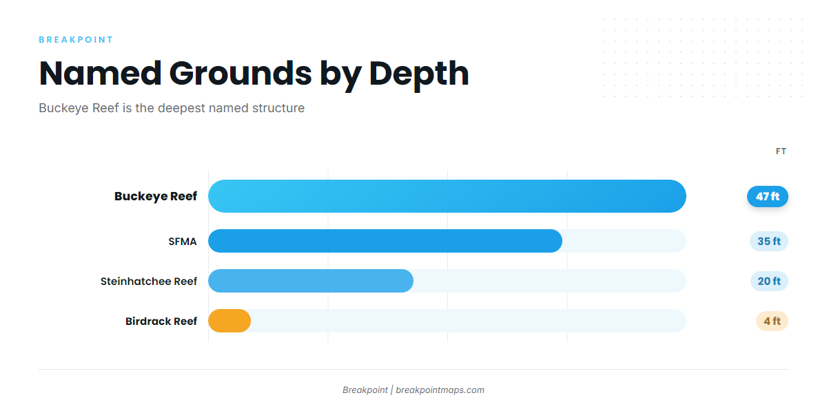
Boats run offshore from Steinhatchee, and the deepest named structure is Buckeye Reef at 47 ft. The table runs from the river mouth outward.
| Name | Type | Depth (ft) | Position/Location |
|---|---|---|---|
| Steinhatchee Fisheries Management Area (SFMA) | Permitted artificial reef area | 35 | Centered off the mouth of the Steinhatchee River |
| Steinhatchee Reef | Permitted public reef, four bottom areas plus cube field | 20 | |
| Birdrack Reef | Concrete culverts around bird rack platform | 4 | 29 40.78N 83 34.25W |
| Nine Mile Bank | Bank | 29 41.10N 83 34.60W | |
| Super Ledge | Ledge | 29 22.817N 83 45.675W | |
| The Crack | Structure | 29 23.819N 83 42.722W | |
| Lamb Spring | Spring | 29 26.628N 83 50.627W | |
| Buckeye Reef | Reef | 47 | About 24 nautical miles due west of Steinhatchee |
The Chart Contours layer shows these grounds against the bottom. Chart layers are not for navigation.
SFMA and Steinhatchee Reef
The Steinhatchee Fisheries Management Area is a permitted artificial reef area in 35 ft, centered off the mouth of the Steinhatchee River. Steinhatchee Reef is a permitted public reef in 20 ft, with four bottom areas plus a cube field.
Nearshore: Birdrack Reef and Nine Mile Bank
Birdrack Reef is concrete culverts around the bird rack platform in 4 ft, at 29 40.78N 83 34.25W. Nine Mile Bank sits at 29 41.10N 83 34.60W.
Ledges and springs
Super Ledge is at 29 22.817N 83 45.675W, The Crack at 29 23.819N 83 42.722W, and Lamb Spring at 29 26.628N 83 50.627W.
Buckeye Reef
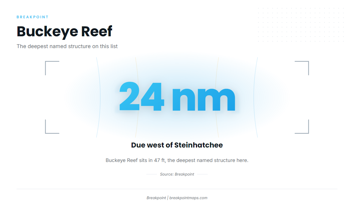
Buckeye Reef sits in 47 ft, about 24 nautical miles due west of Steinhatchee. It is the deepest named structure on this list.
How sailfish are fished out of Steinhatchee
Sailfish are incidental here. Most anglers work the structure above for other fish and keep gear ready in case a sailfish shows up.
For baits, spreads and biology, use our sailfish guide. Before the run, check the NOAA and NWS marine forecast for wind, wave height and period, and make the go or no-go call from those numbers. No NOAA buoy is named for this port here, so verify the nearest one on NOAA.
Who fishes for sailfish here
Three kinds of anglers run into a sailfish here:
- The owner-operator already running offshore structure out of Steinhatchee, for whom a sailfish is a bonus.
- The visitor planning an offshore day, who should treat a sailfish as a surprise rather than a goal.
- The angler chasing a sailfish as the goal, who should not plan a trip around this port. The billfish guides cover places built for that fishing.
FAQ: Sailfish fishing out of Steinhatchee
Can you catch sailfish out of Steinhatchee?
Yes, occasionally. This is not a port to plan a sailfish trip around, so treat one as a bonus while you fish offshore structure.
How far is Buckeye Reef from Steinhatchee?
About 24 nautical miles due west. It sits in 47 ft, the deepest named structure here.
What depth is the SFMA?
35 ft. It is a permitted artificial reef area centered off the mouth of the Steinhatchee River.
Where do you check conditions before running offshore?
The NOAA and NWS marine forecast, for wind, wave height and period. Read the numbers before you leave the dock and again before you commit to the run.
Where do the sailfish rules live?
On the Florida regulations page and the federal Atlantic billfish rules page, both linked in the Regulations section above. Check both before fishing.