When mahi are off Destin
Mahi-mahi fishing out of Destin peaks in summer. From Destin, boats clear East Pass and run south, and the season is the first filter on that run. For the Gulf-wide picture, see the Gulf of Mexico mahi guide (see also the Gulf of Mexico fishing guide). This page covers the port only.
Summer peak
Summer is the peak for mahi off Destin East Pass. The charterfishingdestin.com seasonal fish chart lists mahi in its June to August column, so that is the window to plan the busiest offshore days around.
Spring and fall
The same source says mahi are taken by trolling or sight fishing in spring, summer and fall, and not in winter. Settle the window first, then pick a run.
Where boats run out of East Pass
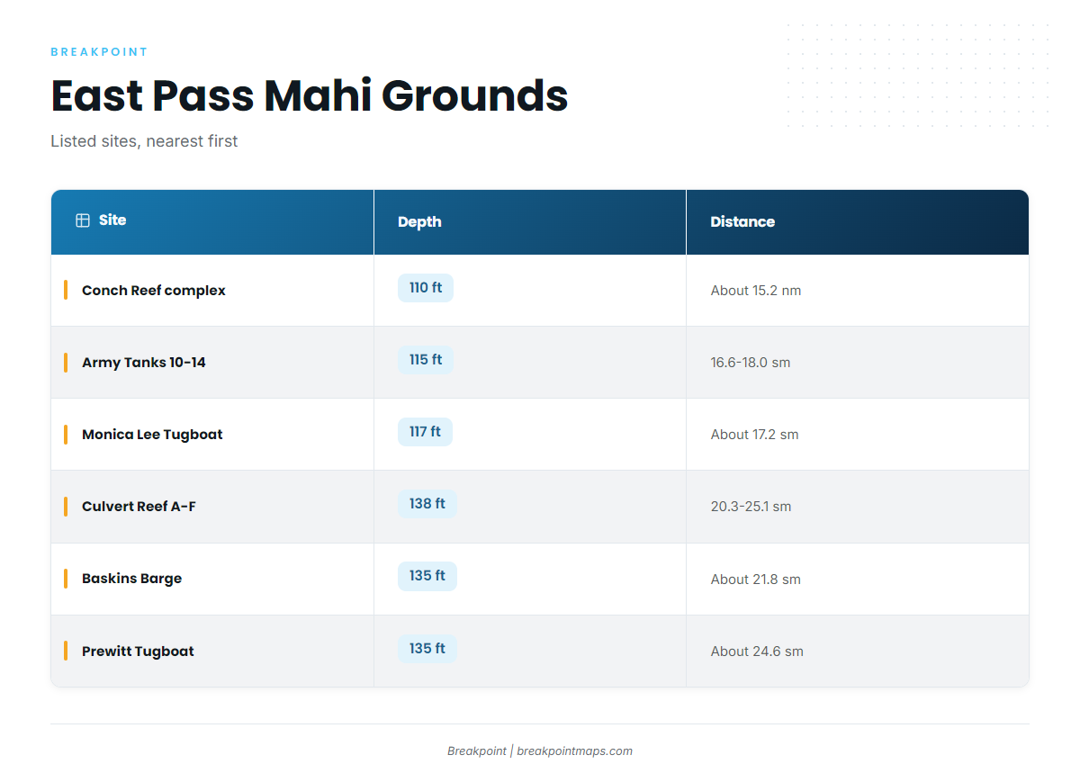
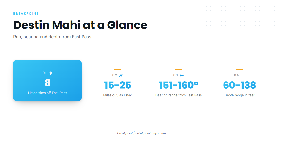
The listed grounds sit roughly 15 to 25 miles out of Destin East Pass on bearings between 151° and 160°. Run distance sets fuel and range, so settle it before plotting a line. Distances appear in the unit each source uses, statute miles (sm) or nautical miles (nm), and bearings are labeled magnetic only where the source says so. Several of these sites are Okaloosa County artificial reefs.
| Site | Depth | Distance | Bearing | Notes |
|---|---|---|---|---|
| Conch Reef complex | 110 ft | About 15.2 nm | 151° from Destin Pass | Bearing not labeled magnetic |
| Army Tanks 10-14 | 115 ft | About 16.6-18.0 sm | 154-158° magnetic | Tanks 10 through 14 |
| Monica Lee Tugboat | 117 ft | About 17.2 sm | 152° magnetic | Tugboat |
| Culvert Reef A-F | 138 ft | About 20.3-25.1 sm | 152-160° magnetic | Deepest listed site |
| Baskins Barge | 135 ft | About 21.8 sm | 156° magnetic | Barge |
| Prewitt Tugboat | 135 ft | About 24.6 sm | 152° magnetic | Tugboat |
Swipe the table sideways to see every column.
Chart layers are not for navigation. Use official charts and your own electronics. In the app, the Chart Contours layer shows these sites against bottom structure.
Most sites cluster along the 152° to 156° headings, so one run line can pass several of them.
The Boatyard
The Boatyard is the M/V Miss JoAnn, placed beside the M/V Dylan and M/V Brannon. Depth is 119 ft and relief is 40 ft.
Miss Louise (OK-100)
Miss Louise is a tugboat and Okaloosa County site OK-100. Depth is 60 ft, length is 95 ft and beam is 23 ft. It is the shallowest listed site.
How mahi are fished locally
The two local methods are trolling and sight fishing. For behavior, rigging and technique, use the mahi-mahi guide. This section covers how the methods fit the port.
Trolling
Trolling covers water, which suits a run line that passes listed structure along a shared bearing. Work the whole line instead of a single spot and let the bite show itself along the way.
Sight fishing
Sight fishing means working fish you spot instead of searching blind. Once you reach the grounds, take a slow look around. It works when fish show themselves, so be ready to switch from trolling when they do.
Who fishes for mahi out of Destin
Two local charters list mahi-mahi. If you are weighing other species too, the offshore gamefish guides cover them.
Into the Blue
Charter Boat Into the Blue, a 46 ft boat run by Captain Nino Bright, lists mahi-mahi.
Finest Kind
Finest Kind, a 53 ft G&S sportfisher run by Capt. Jason Mikel, lists mahi-mahi.
FAQ: mahi-mahi out of Destin
When is mahi season off Destin?
Summer is the peak. The charterfishingdestin.com chart lists mahi from June to August, and it lists trolling or sight fishing in spring, summer and fall, not winter. Use that window as your first filter before choosing a run.
How far do boats run for mahi out of Destin?
The listed sites run from about 15.2 nm at the Conch Reef complex to about 25.1 sm at the outer end of Culvert Reef A-F, on bearings of 151° to 160°. Each unit stays as the source gives it. Run distance sets fuel and range.
What structure is listed near Destin?
Eight sites are listed: The Boatyard, Miss Louise (OK-100), Army Tanks 10-14, Conch Reef complex, Culvert Reef A-F, Prewitt Tugboat, Monica Lee Tugboat and Baskins Barge. Depths run from 60 ft at Miss Louise to 138 ft at Culvert Reef A-F. The Boatyard has 40 ft of relief.
Which Destin charters list mahi-mahi?
Charter Boat Into the Blue, a 46 ft boat with Captain Nino Bright, and Finest Kind, a 53 ft G&S sportfisher with Capt. Jason Mikel.
Where do I check tides for East Pass?
Use NOAA tide station 8729511 (Destin, East Pass), which gives tide data for the pass. Check the official NOAA marine forecast for wind and sea state before you run, and plan from those numbers, not from this page.