When Spanish mackerel are off Haulover
The Haulover species list puts Spanish mackerel in spring and autumn, with winter and summer outside the window.
NOAA Fisheries and the South Atlantic Fishery Management Council both describe the species as preferring water above 68°F. Check surface temperature before committing to a run, since the calendar alone won’t tell you whether the fish are there.
For the migration along the whole coast, see the Atlantic Southeast picture (see also the Atlantic Southeast fishing guide).
Where boats run
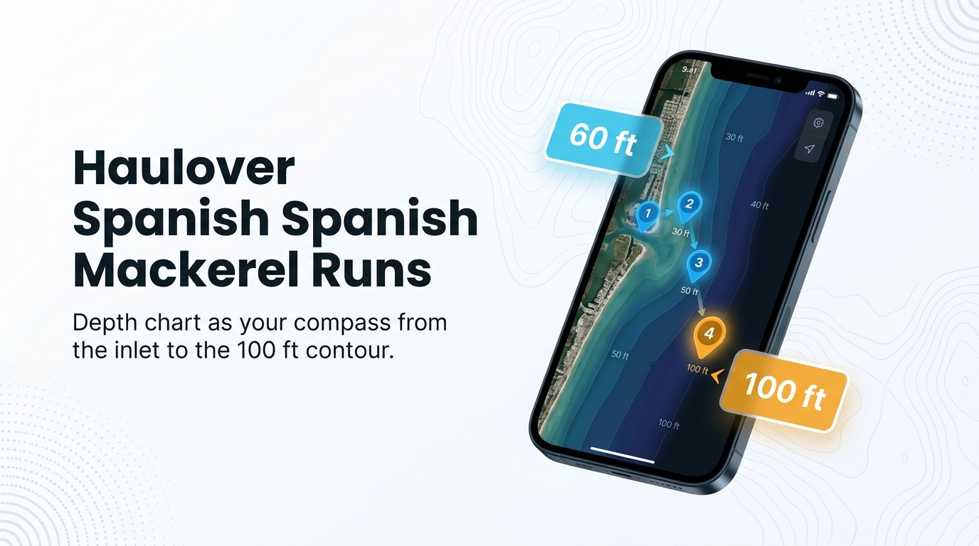
Spanish mackerel fishing out of Haulover means a 2 to 10 mile run to the reef edges and the 100 ft contour. Our Haulover port guide covers the ramps, the inlet and where to read conditions.
Run distance
Lady Mitchell lists Spanish mackerel and fishes 2 to 10 miles offshore. The 2 mile inner end is the shortest run listed.
State waters end at 3 nautical miles, so a day in that range can start in state water and finish in federal water. The Regulations section below points to the agency for each.
Getting out the inlet
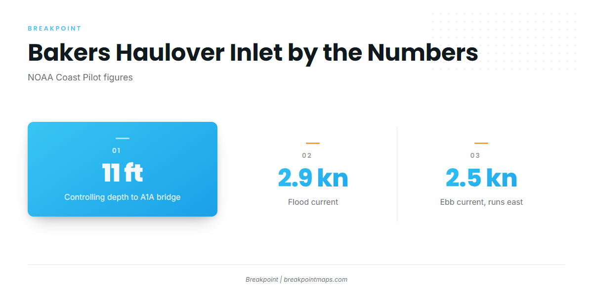
The last reported controlling depth through Bakers Haulover Inlet to the A1A bridge is 11 ft, according to the NOAA Coast Pilot chapter 10. The numbers that matter for the cut:
- Flood current: about 2.9 knots
- Ebb current: about 2.5 knots
- Channel direction: leads westward from the ocean
- Prevailing wind: easterly in nearly every month, per the Coast Pilot’s Miami offshore weather table
An outgoing current runs east, so on an easterly wind the ebb runs against the wind in the cut. Read the wind, wave height and period for zone AMZ651 in the NWS Miami marine forecast before you leave the dock.
Grounds and structure
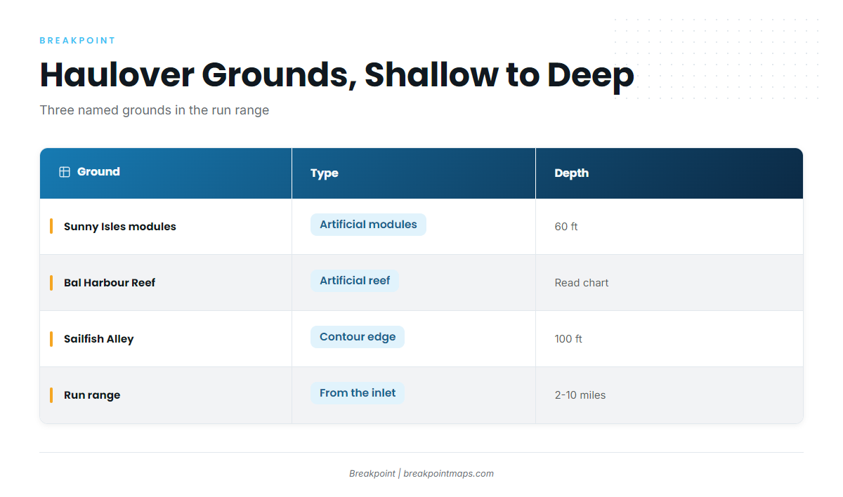
Three named grounds lie off Haulover in the depth band and run range where Spanish mackerel are fished. They are listed here from shallow to deep.
| Ground | Type | Depth |
|---|---|---|
| Sunny Isles Reef Restoration modules | Artificial modules, eastern edge of the second reef | 60 ft |
| Bal Harbour Mitigation Artificial Reef | Artificial reef | Read the chart |
| Sailfish Alley | Contour edge, locally named | 100 ft |
Chart Contours shows the 60 ft and 100 ft lines. Chart layers are not for navigation.
Sunny Isles Reef Restoration modules
The modules sit on the eastern edge of the second reef at about 60 ft.
Bal Harbour Mitigation Artificial Reef
This is a named artificial reef off Bal Harbour. No depth is listed for it here, so read the depth off the chart.
Sailfish Alley
Sailfish Alley is a locally named contour edge at 100 ft, the deepest of the three grounds.
How they’re fished here
Florida Fish and Wildlife Conservation Commission (FWC) lists trolling or casting with small shiny spoons, dusters or jigs. Their tackle notes:
- Rod and line: light spinning or bait-casting tackle with 10 to 15 lb monofilament
- Leader: 30 to 60 lb monofilament, because of the mackerel’s sharp teeth
FWC also notes anglers find them by watching for birds diving on schools of baitfish. Trolling along the 60 ft and 100 ft edges covers water, and diving birds over bait mark where to stop and cast. This is a way to search, and it doesn’t guarantee fish.
For technique and biology beyond this port, see our Spanish mackerel guide.
Who fishes for them
Lady Mitchell lists Spanish mackerel out of Haulover and fishes 2 to 10 miles offshore.
Most of this page is for anglers on their own boats, launching at the Haulover ramps covered in the port guide. The same run reaches other coastal and offshore gamefish.
FAQ: Spanish mackerel fishing out of Haulover
When are Spanish mackerel off Haulover?
Spanish mackerel fishing out of Haulover is listed for spring and autumn, with winter and summer outside the window. NOAA Fisheries notes the species prefers water above 68°F, so check surface temperature before you run.
How far do boats run?
Boats run 2 to 10 miles offshore, the range Lady Mitchell lists. The inlet’s last reported controlling depth, per the NOAA Coast Pilot, is 11 ft through to the A1A bridge.
How deep is the Sunny Isles reef edge?
The eastern edge of the second reef, where the restoration modules sit, is at about 60 ft. The Bal Harbour Mitigation Artificial Reef has no depth listed here, so read the chart.
What is Sailfish Alley?
Sailfish Alley is a locally named contour edge at 100 ft, the deepest named ground in this run.
Are the grounds in state or federal water?
Either, depending on how far you run. State water ends at 3 nautical miles, and federal rules apply beyond that. Check FWC and the South Atlantic Council before you fish.
Where is the forecast?
The NWS Miami marine forecast for zone AMZ651 covers Deerfield Beach to Ocean Reef, out to 20 NM. In the inlet, the recorded ebb is 2.5 knots and the prevailing wind is easterly. Check both against the forecast before you go.