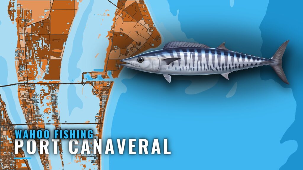
When wahoo are around Port Canaveral
Wahoo fishing out of Port Canaveral means a run offshore: the fish are past 20 miles, where the water drops to 200+ ft. This page covers the run, the named grounds and wrecks by BV code, how the fish are worked, who fishes them from this port, and which rules apply out there.
Timing shifts year to year with the water. The wahoo species guide and the Atlantic Southeast wahoo guide (see also the Atlantic Southeast offshore fishing guide) carry the seasonal picture. Before committing to the run, check the water:
- Check OBS SST for the temperature picture and where the breaks sit.
- Check NDBC Station 41009, 20 NM east of Cape Canaveral, for buoy numbers.
- Plan around the 200 ft drop-off rather than a date.
The run: how far and how deep
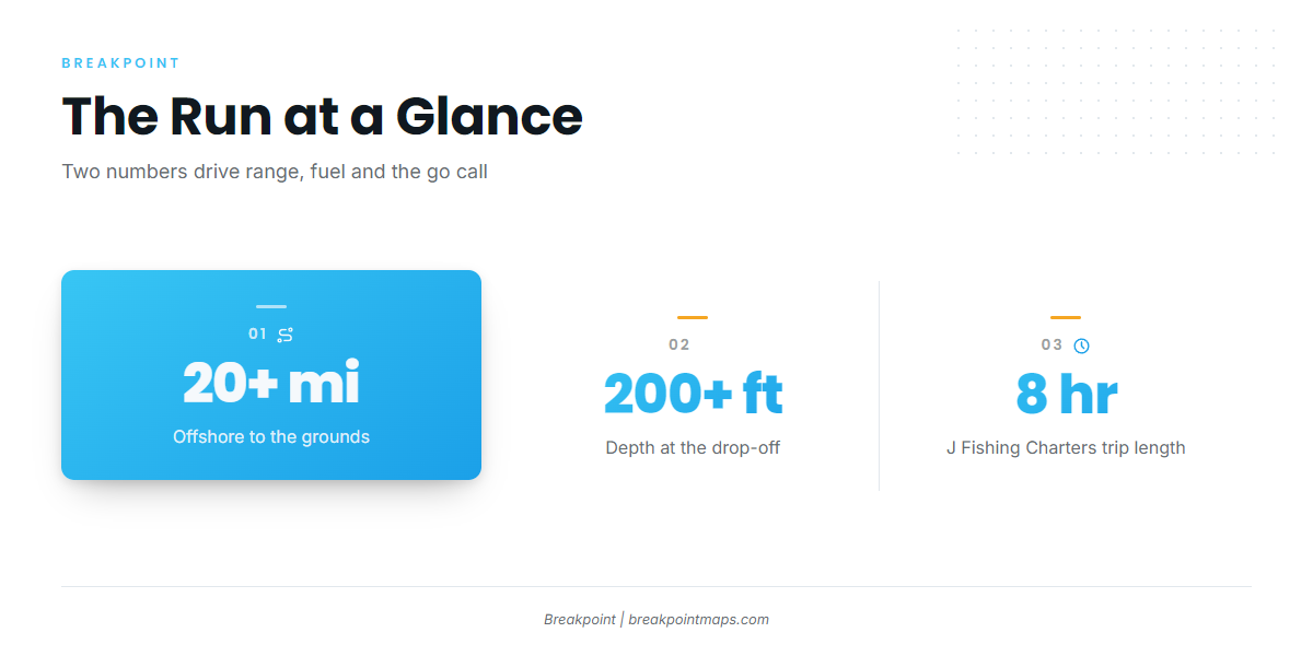
Boats run 20+ miles offshore to where the water drops to 200+ ft. J Fishing Charters runs an 8-hour trip to that water, which is about the length of day this run takes for a working charter.
- Distance: 20+ miles
- Depth: 200+ ft
Plan your range and fuel around a 20+ mile run each way. That puts the grounds well past the 3 nm state line, in federal waters. The Regulations section below covers what that means.
Check conditions before you leave the dock. NDBC Station 41009 buoy data gives wind, wave height and period 20 NM east of the cape, and the NWS marine forecast from KMLB covers the same water. We print no values here because they change by the hour.
Hetzel Shoal (BV-122) is a named landmark on the way out. Use it as a reference point, not a destination.
Grounds and structure
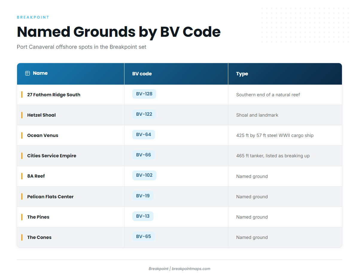
These are the named Port Canaveral offshore fishing spots in the Breakpoint waypoint set, listed as Name (BV-xx). Several carry only a name and code, so we list them that way. Wreck status changes over time, so what sits on the bottom may not match a listing. Chart layers are not for navigation.
| Name | BV code | Type or description |
|---|---|---|
| 8A Reef | BV-102 | Named ground |
| 27 Fathom Ridge South | BV-128 | Southern end of a natural reef |
| Pelican Flats Center | BV-19 | Named ground |
| The Pines | BV-13 | Named ground |
| The Cones | BV-65 | Named ground |
| Hetzel Shoal | BV-122 | Named shoal |
| Ocean Venus (Lead Wreck) | BV-64 | 425 ft by 57 ft steel WWII cargo ship |
| Cities Service Empire | BV-66 | 465 ft tanker listed as breaking up |
Reefs and ridge
27 Fathom Ridge South (BV-128) is the southern end of a natural reef. The rest of the reef set is listed by name and code:
- 8A Reef (BV-102)
- Pelican Flats Center (BV-19)
- The Pines (BV-13)
- The Cones (BV-65)
Shoal
Hetzel Shoal (BV-122) is a named shoal and a landmark on the way out. Give it room and use it as a reference on the chart.
Wrecks
Ocean Venus (Lead Wreck, BV-64) is a 425 ft by 57 ft steel WWII cargo ship. Cities Service Empire (BV-66) is a 465 ft tanker listed as breaking up, so its condition may not match the listing.
Bait gathers around structure, and wahoo hunt bait, so a wreck is worth a look. It does not guarantee fish.
How wahoo are fished here, and who fishes them
Wahoo here are worked by trolling over and around structure in 200+ ft. Run wire leader, because wahoo teeth cut through mono. Other offshore species work the same water, and our offshore gamefish guides cover them.
Who fishes them here
J Fishing Charters lists wahoo out of Port Canaveral:
- Operator: J Fishing Charters, Captain Jose Lopez
- Boat: 28-ft Bimini center console
- Trip: 8 hours, 20+ miles offshore to 200+ ft
A captain’s trip is one way to see the run before you take your own boat out.
FAQ
How far offshore is wahoo fishing out of Port Canaveral?
Boats run 20+ miles offshore to where the water drops to 200+ ft. J Fishing Charters runs an 8-hour trip to reach that water.
What depth do you fish for wahoo off Port Canaveral?
200+ ft, past the drop-off.
Which named spots are on the map?
8A Reef (BV-102), 27 Fathom Ridge South (BV-128), Pelican Flats Center (BV-19), The Pines (BV-13), The Cones (BV-65), Hetzel Shoal (BV-122), Ocean Venus (BV-64) and Cities Service Empire (BV-66).
Are there charters that target wahoo here?
Yes. J Fishing Charters, Captain Jose Lopez, lists wahoo on a 28-ft Bimini center console, on an 8-hour trip.
Do state or federal rules apply on these grounds?
Federal rules apply, because the grounds are beyond 3 nm. FWC rules apply inside 3 nm. Check the agencies before you fish.
Where do I check conditions before the run?
NDBC Station 41009, 20 NM east of Cape Canaveral, and the NWS marine forecast from KMLB. Check wind, wave height and period there before you leave.