
About Cape May
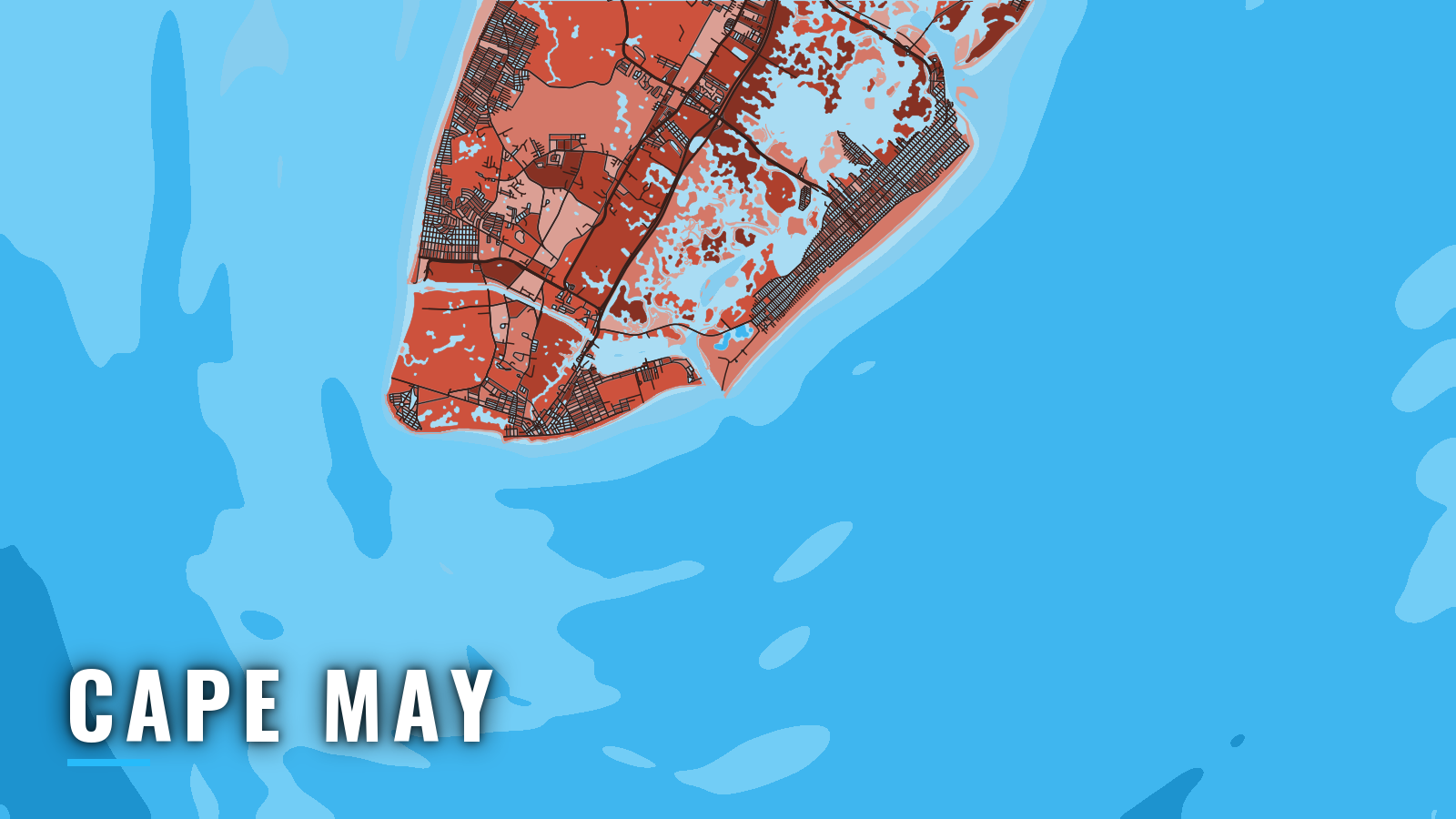
Cape May sits at the southern tip of New Jersey, where Delaware Bay meets the Atlantic. Its offshore fishing runs from the Rips and reefs near the inlet out to the Wilmington and Baltimore canyons. Like other New Jersey ports, it opens to the ocean through an inlet, in this case Cape May Inlet. Cape May Harbor is the inside water, and the Cape May Canal leads from the harbor to Delaware Bay.
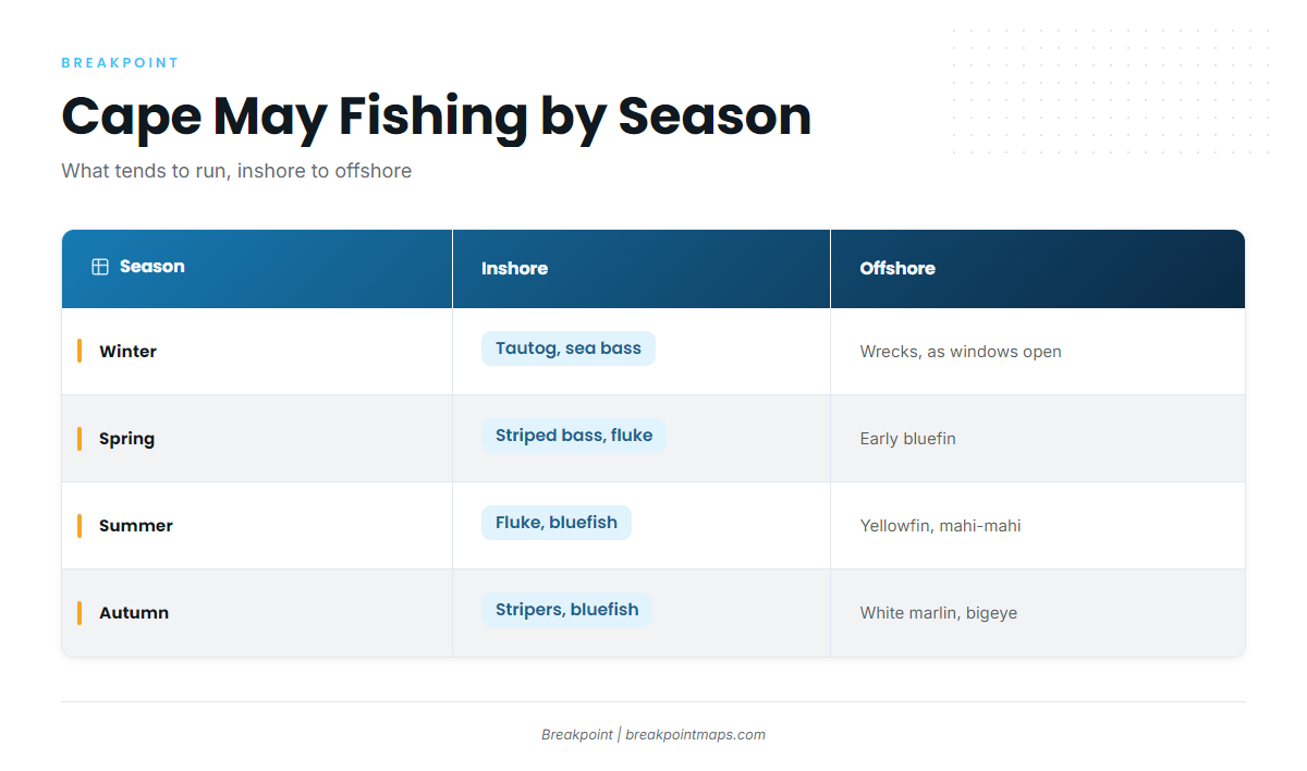
Fishing runs year-round. Tautog and sea bass hold the cool months on reefs and wrecks. Striped bass move through in spring and fall. Fluke and bluefish fill the summer inshore. Bluefin, yellowfin and bigeye tuna, mahi-mahi and white marlin work the shelf and canyons from late spring into fall.
Access and navigation
Two public-access ramps serve Cape May Harbor and the canal side:
- Spicers Creek Boat Access – concrete ramp off Wissahickon Avenue on the canal side, lighted, with a small dock and water at low tide.
- Bree-Zee-Lee Yacht Basin – concrete ramp on Cape May Harbor with water at low tide.
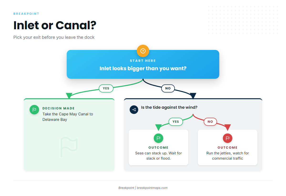
Cape May Inlet is a jettied entrance from the harbor to the Atlantic. The ebb runs out of the harbor and off the bay mouth, and when it meets a wind from the south or east, seas tend to stand up and shorten between and outside the jetties. A flood or slack tide with the same wind can look quite different, so timing the tide is part of the plan. The inlet is shared with a working commercial fleet and other boats, so the jetty run can be busy at the start and end of the day. NOAA Coast Pilot 3 and the current chart are the references for the entrance itself.
The Cape May Rips and Prissy Wicks Shoal lie west of the inlet approach, toward Cape May Point and the bay mouth. The full Delaware Bay tide moves over shoal water here, so the Rips can stack up steeply when the current runs against the wind, even when the open ocean looks modest.
The Cape May Canal links the harbor to Delaware Bay and gives you a second exit when the inlet looks bigger than you want. It is part of the New Jersey Intracoastal Waterway. You can also return through it from the bay side, or run around Cape May Point. The point route crosses the Rips, so the same tide-against-wind caution applies. Fixed bridges cross the canal, so check the chart clearances against your boat’s height before relying on this route. On days the ocean is off the table, the canal also opens bay-side water.
Check the NWS marine forecast for the coastal waters off Cape May and for Delaware Bay, the nearest NDBC buoy, and the NOAA tide and current predictions for the inlet and the canal. Read wind, wave height and period together, since a short period on a southerly can make the same height feel bigger. On arrival, look at the water and the official forecast, and if the inlet looks bigger than you want, take the canal instead.
Fishing conditions
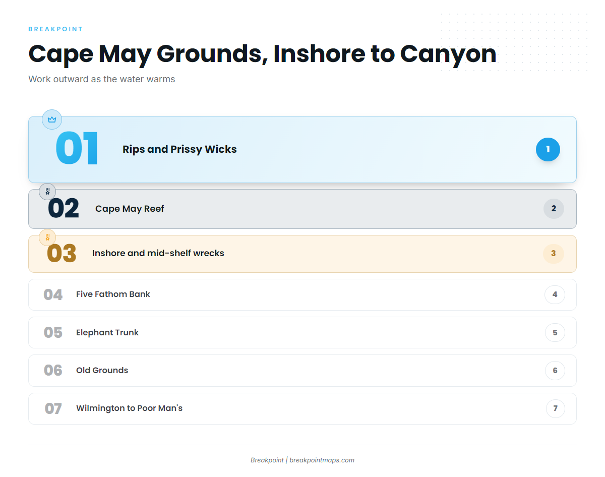
Cape May’s offshore fishing is organized by distance. Working outward, the named grounds are:
- Cape May Rips and Prissy Wicks Shoal
- Cape May Reef and the other state artificial reef sites, such as Deepwater Reef
- Inshore and mid-shelf wrecks
- Five Fathom Bank
- The Elephant Trunk
- The Old Grounds
- The Wilmington, Baltimore and Poor Man’s canyons at the shelf edge
Water tends to warm from the canyon edges inward through summer and cool from the beach outward in fall, and that pattern decides which ground is live. It follows the wider Atlantic Northeast pattern.
The NJ DEP Division of Fish and Wildlife manages state species. NOAA Fisheries HMS manages tuna and billfish, and HMS permits apply. Joining the free NJ Saltwater Recreational Registry is required. Check the rules of both agencies before fishing.
Winter
Winter is reef and wreck fishing for tautog and black sea bass, as rules allow. Tautog hold on Cape May Reef and nearby structure. Offshore wrecks can give up sea bass on the days the weather opens a window, and some boats run deep when one does. Seasons for both species open and close, so check the regulations before you go.
Spring
Spring brings striped bass back through the Rips and the bay mouth, followed by fluke and sea bass on the reefs. Stripers work the Rips and Prissy Wicks as the bay water warms. Tautog and sea bass stay on the reefs, subject to closures. Late in the season, early bluefin tuna can show on the mid-shelf lumps.
Summer
Summer puts fluke and bluefish inshore while tuna and mahi move onto the canyon edges as they warm. Fluke hold on Cape May Reef and the inshore lumps, and bluefish gather around the Rips. Farther out, yellowfin and mahi-mahi tend to show on temperature breaks and floating structure at Wilmington, Baltimore and Poor Man’s. For yellowfin in the Northeast canyons, finding the edge comes first. Bigeye can hold on the canyon walls.
The OBS SST and Chlorophyll layers in Breakpoint show where the edge sat on the last clear pass. Cloud blocks the satellite, so a gap in the data does not mean cold water. Chart layers are not for navigation. To see the data behind a canyon run, find your port in the state and port guides on breakpointmaps.com.
Autumn
Autumn tends to stack the canyons with billfish and late tuna while striped bass run the Rips on the way south. White marlin work the canyon walls from late summer into fall. Bigeye on the Northeast canyon walls and yellowfin can hang on, bluefin can return to the shelf, and an occasional wahoo turns up. Inshore, the fall striper run at the Rips is joined by bluefish as the water cools, and tautog and sea bass move back onto the reefs.