
About Two Harbors
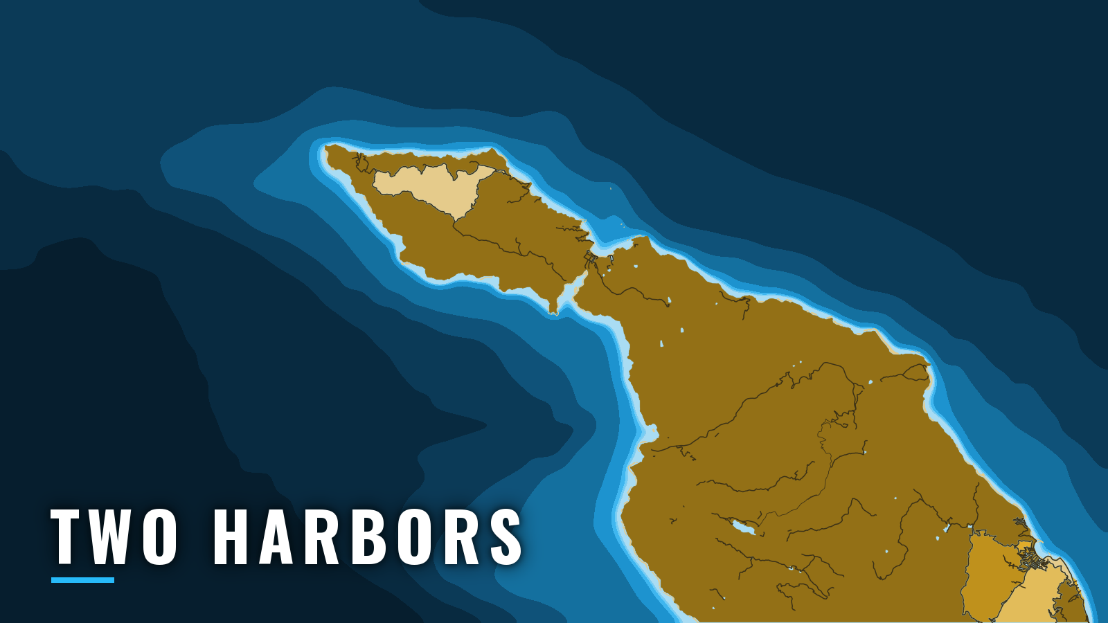
Two Harbors sits on the narrow isthmus at the West End of Santa Catalina Island, with Isthmus Cove on the north shore and Catalina Harbor (Cat Harbor) on the south. Boaters reach it across the San Pedro Channel. It is one of the California ports we map, and it is a mooring port with no public ramp.
The West End fishes year-round. The peak generally runs from spring squid and white seabass through summer and autumn yellowtail and offshore pelagics.
Yellowtail, white seabass and calico bass are the main targets, with halibut, sheephead and summer tunas also in the mix. The wider Pacific Southwest picture puts that mix in regional context. Several Catalina waters are marine protected areas with no-take or method limits, so read the CDFW marine protected area rules before you fish.
Access and navigation
There is no public trailer ramp at Two Harbors. Trailer boats launch on the mainland and cross the San Pedro Channel. Ramps are listed on our San Pedro and Long Beach and Redondo Beach pages. Avalon is the island’s other harbor and has its own page.
Overnight stays at Two Harbors run on moorings operated by the Catalina Island Company:
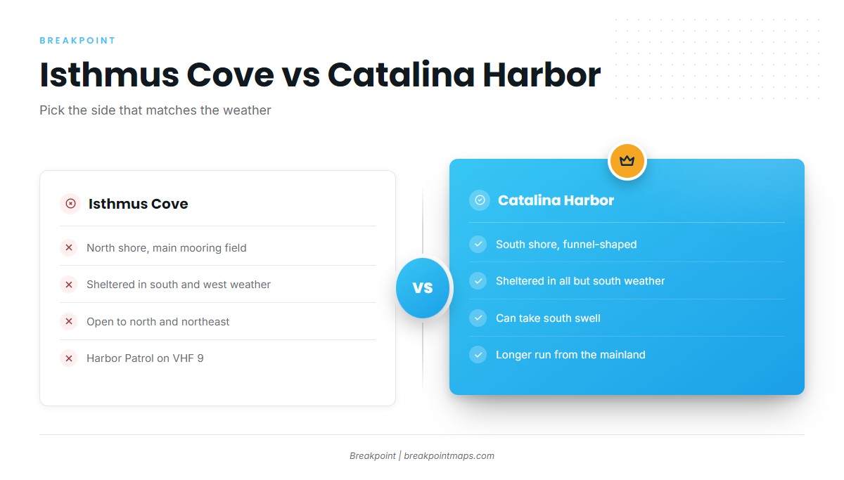
- Isthmus Cove moorings – main field off the village, shelter in south and west weather, Harbor Patrol on VHF 9.
- Catalina Harbor moorings – back side of the isthmus, shelter in all but south weather.
- Cherry Cove moorings – Lion’s Head blocks the afternoon wind.
- Fourth of July Cove moorings – small cove between the village and Cherry Cove, run by the same harbor department.
The Two Harbors harbor rules manual sets the ground rules. Moorings are first-come, first-served, and you call Harbor Patrol on VHF 9 on arrival. A 5 mph no-wake limit applies in the mooring areas and anchorages, and quiet hours run 10 pm to 7 am. Swimming, diving and fishing are not allowed by the pier, the docks or in the fairway. Anchoring is allowed 100 yards outside the mooring area. Fisherman Cove, in the east part of Isthmus Cove, is privately operated with restricted access, so don’t plan on using it.
Isthmus Cove approach
The prevailing wind in the Channel Islands is west and northwest, and it usually blows in the afternoon. Isthmus Cove is sheltered in south and west weather and exposed in north and northeast weather. The afternoon westerly can build a chop across the West End and the channel on the ride home.
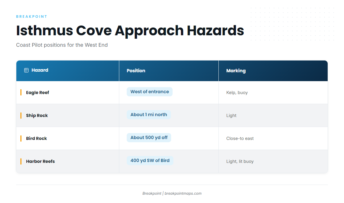
The NOAA Coast Pilot 7 chapter describes the hazards by position:
| Approach | What the Coast Pilot describes |
|---|---|
| Alongshore from the east | Clear |
| West of the entrance | Eagle Reef, covered 3 ft, marked by kelp, with a buoy about 100 yards east of it |
| From the north | Ship Rock, about 1 mile north of the cove, shows a light |
| East part of the entrance | Bird Rock, about 500 yards off the beach, can be approached close-to on its east side |
| Southwest of Bird Rock | Harbor Reefs, about 400 yards away, marked by a light and a lighted buoy |
Alternative approach: Catalina Harbor
Cat Harbor faces south and is funnel-shaped. From the mainland it means the longer run around the West End or the East End. It suits days when north or northeast weather sets into Isthmus Cove. South swell can push into the funnel, which is its only exposed quarter.
Ballast Point, a sand spit, crosses part of the entrance. The anchorage abreast Ballast Point is 24 to 30 ft (4 to 5 fathoms) over a soft bottom. The head of the harbor is shoal, with the 3-fathom curve marked by kelp, and the Coast Pilot says to give the shores a 150-yard berth. Pin Rock sits close inside the east head, with deep water around it.
Before you run
Look at the water when you arrive, then read the NWS forecast for PZZ655 and the NDBC buoy 46222 readings for wind, wave height and period. If conditions look bigger than you want on one side of the isthmus, switch approaches. Forecasts can miss, and chart layers are not for navigation. Before the run, check the OBS SST and Chart Contours layers in Breakpoint to see where the temperature breaks and structure sit.
Fishing conditions
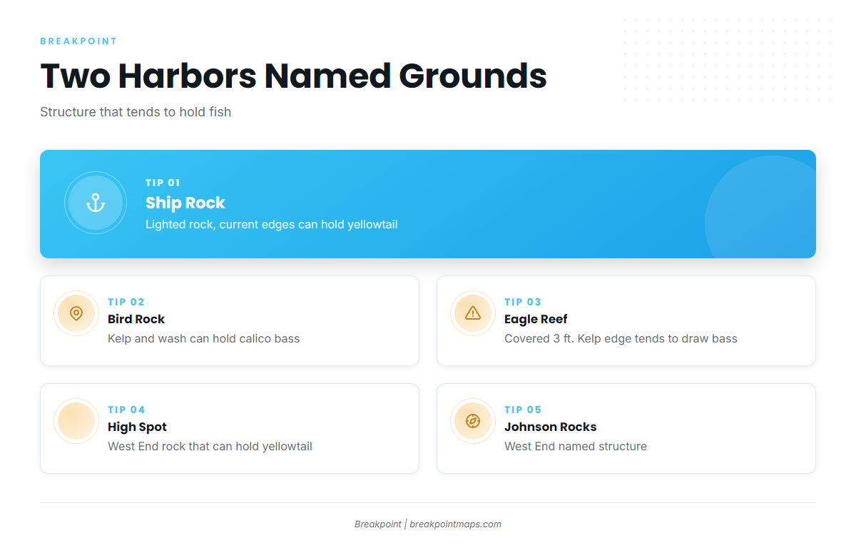
The named grounds at the West End are mostly rock, reef and kelp structure:
- Ship Rock – lighted rock about 1 mile north of Isthmus Cove. Its current edges can hold yellowtail and calico bass.
- Bird Rock – about 500 yards off the east part of the cove entrance. Its kelp and wash can hold calico bass. Mind the reef on its landside.
- Eagle Reef – west of the entrance, covered 3 ft, buoyed about 100 yards to the east. The kelp edge tends to draw bass and yellowtail, but it is first a navigation hazard.
- High Spot – West End rock structure that can hold yellowtail when the current runs.
- Johnson Rocks – West End structure along the same stretch of coast.
Farnsworth Bank lies 9.2 miles south-southeast of the West End and 1.6 miles offshore. It sits in a conservation area where take is limited by method and species, so check CDFW before you fish it.
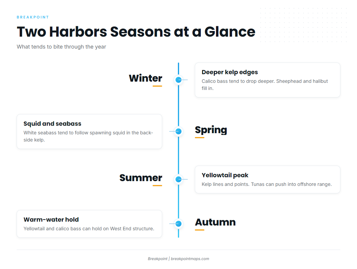
Winter
Calico bass tend to drop deeper on the kelp edges and rock piles. Sheephead, whitefish, halibut and blue perch fill in. Yellowtail and white seabass can linger at the West End, where warm water tends to hold longest.
Spring
White seabass tend to show with the spawning market squid in the back-side kelp. Halibut, yellowtail and calico bass are also around. Rockfish are an option, and CDFW sets the groundfish season and depth rules.
Summer
Yellowtail tend to peak along the kelp lines and points, with the back side and the West End often holding the most fish. Read how yellowtail move through the region to time the run. Barracuda, bonito and calico bass tend to be active. Bluefin, yellowfin and dorado can come within offshore range when warm water pushes in, and OBS SST shows where that edge sits.
Autumn
Yellowtail and calico bass can hold on the West End structure while the water stays warm. Bluefin can remain a few miles out.