
About St. Pete Beach
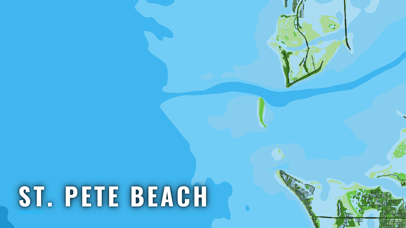
St. Pete Beach sits at the south end of Long Key, where Pass-a-Grille Channel links Boca Ciega Bay to the Gulf and Tampa Bay opens just to the south. Boats reach open water through Pass-a-Grille Channel or through Egmont and Southwest Channel at the Tampa Bay entrance. The port fishes the Gulf of America (Gulf of Mexico) off Pinellas County, Florida, year-round with seasonal peaks. Offshore anglers target gag and red grouper, mangrove snapper, king and Spanish mackerel, amberjack, cobia and hogfish. The sections below cover ramps, how the approaches behave, and the grounds by season.
Access and navigation
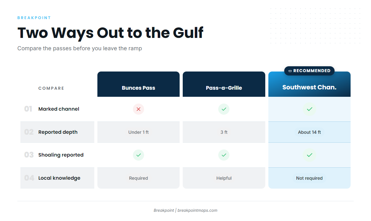
Two approaches serve this port: Pass-a-Grille Channel and the Tampa Bay entrance via Egmont and Southwest Channel. Ramps and marinas come first, followed by how each approach tends to behave.
Ramps and marinas
Public launches and fuel within reach of the passes:
- Fort De Soto boat ramp – Pinellas County park launch at the mouth of Tampa Bay, close to both Pass-a-Grille and the Egmont approaches.
- War Veterans’ Memorial Park boat ramp – Pinellas County launch at Bay Pines on Boca Ciega Bay.
- St. Petersburg Municipal Marina – city public boat launch, with fuel listed at the marina.
- Merry Pier – Pass-a-Grille dock on the channel.
Facilities can close or change after storms, so check the operator’s page before towing.
Pass-a-Grille Channel
The NOAA U.S. Coast Pilot 5 puts the flood in Pass-a-Grille Channel at about 1.2 knots to the north and the ebb at about 1.4 knots to the south. North Channel, the dredged cut over the bar, was reported with a controlling depth of 3 feet to the Intracoastal channel. South Channel was reported shoaled.
Wind against the ebb can stand the bar up, and shoals tend to move after storms. Depths are reported values, markers can shift, and dredging can change the channel. Keep clear of dredge vessels and piping.
Bunces Pass is unmarked, with less than 1 foot reported over the Gulf bar, and it is local-knowledge water. A center console is better served by the marked Southwest Channel.
The Tampa Bay alternative: Egmont and Southwest Channel
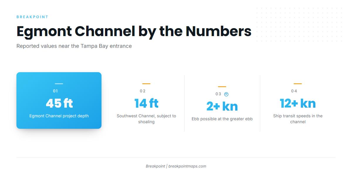
Egmont Channel runs past Egmont Key with a 45 foot project depth. Southwest Channel carries about 14 feet and is subject to shoaling. Passage Key Inlet is an unmarked, shifting channel of about 9 feet, and unexploded ordnance is reported on the Passage Key shoals. Treat the inlet as a hazard to avoid rather than a route.
The ebb here shows a large daily inequality, and 2 knots or more is possible at the greater ebb. Wind can change the current considerably. All deep-draft vessels use Egmont Channel. Pilots board between Lighted Buoys 9 and 10, day and night, and ships can transit at more than 12 knots.
The Intracoastal Waterway runs north toward Johns Pass at Madeira Beach and south across lower Tampa Bay toward Anna Maria Sound and Cortez. A Securite call on VHF 13 is requested before crossing the ship channel.
Weather by season
Cold fronts arrive from fall through spring, often with winds above 20 knots. Seas of 10 feet or more behind fronts are not uncommon. Sea fog is most common from December to early March and can last several days. Thunderstorms are most likely from May through September, and offshore storms are most frequent in the evening and early morning.
Before you commit to the pass
Look at the water and read the NWS Tampa Bay marine forecast on arrival, then check NOAA PORTS real-time observations for wind, water level and current. If the pass looks bigger than you want, switch approaches.
Advisories cover whole zones, so conditions at the pass can differ from the forecast. Chart Contours shows where the bottom steps between the 30 and 66 foot reef depths. Chart layers are not for navigation.
Fishing conditions
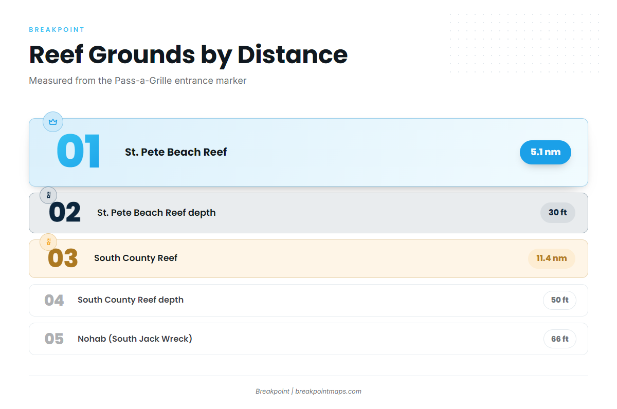
The offshore grounds from the pass are the Pinellas County artificial reefs and wrecks. The Pinellas County Artificial Reef Guide gives positions and bearings from the Pass-a-Grille entrance marker. Named grounds, nearest first:
- St. Pete Beach Reef: 5.1 nm, 30 ft.
- South County Reef: 11.4 nm, 50 ft.
- Nohab (South Jack Wreck): 66 ft.
- Egmont Key Reef and Egmont Key: at the mouth of Tampa Bay.
Grouper show up in every season, and the detail is in gag grouper fishing off Tampa Bay. Gag and red snapper seasons change, so check FWC saltwater fishing information before you fish.
Winter
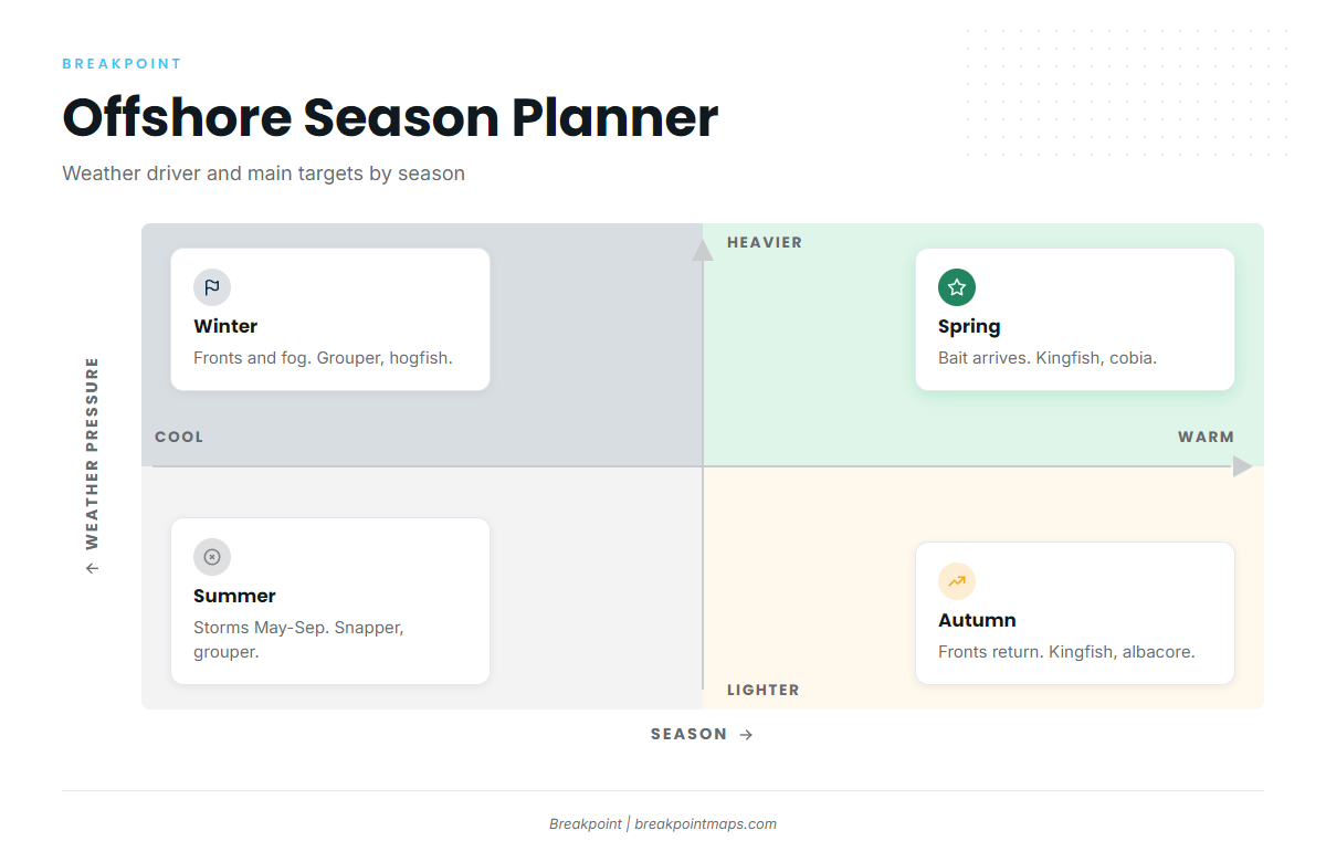
Fronts and the fog window set the calendar. Grouper and hogfish hold on the reefs, and sheepshead work the inshore structure. Plan trips between fronts.
Spring
Bait arrival drives the bite. Kingfish tend to follow the bait, and cobia and Spanish mackerel show up on the same grounds. Grouper fishing continues.
Summer
Thunderstorms from May through September shape the day, so early starts tend to fit. Mangrove snapper, red snapper and grouper are the reef targets, and red snapper rules need an FWC check. Mahi turn up in trolling spreads, but finding them usually means a longer run past the reef grounds. The Gulf of Mexico mahi guide covers range, and the mahi rigging and tactics page covers technique.
Autumn
The first fronts return, and so does the kingfish run, with grouper, Spanish mackerel and false albacore on the grounds. Blue-water pelagics sit in deep water well beyond these grounds, and reaching them depends on range. That is covered under Gulf of Mexico sailfish and sailfish tactics.