Atlantic bluefin tuna fishing out of Hilton Head Island is an occasional winter possibility, and nothing like the dependable fishery off Morehead City. This guide covers the winter window, the named SCDNR reefs with their depths, the run distances, and how bluefin are fished in the Carolinas. It does not promise fish. It should help you decide whether to look and where.
When Atlantic bluefin tuna show up off Hilton Head Island
Bluefin are a winter visitor here. Some winters put fish near the nearshore reefs; others do not. No seasonal species list for this port includes bluefin.
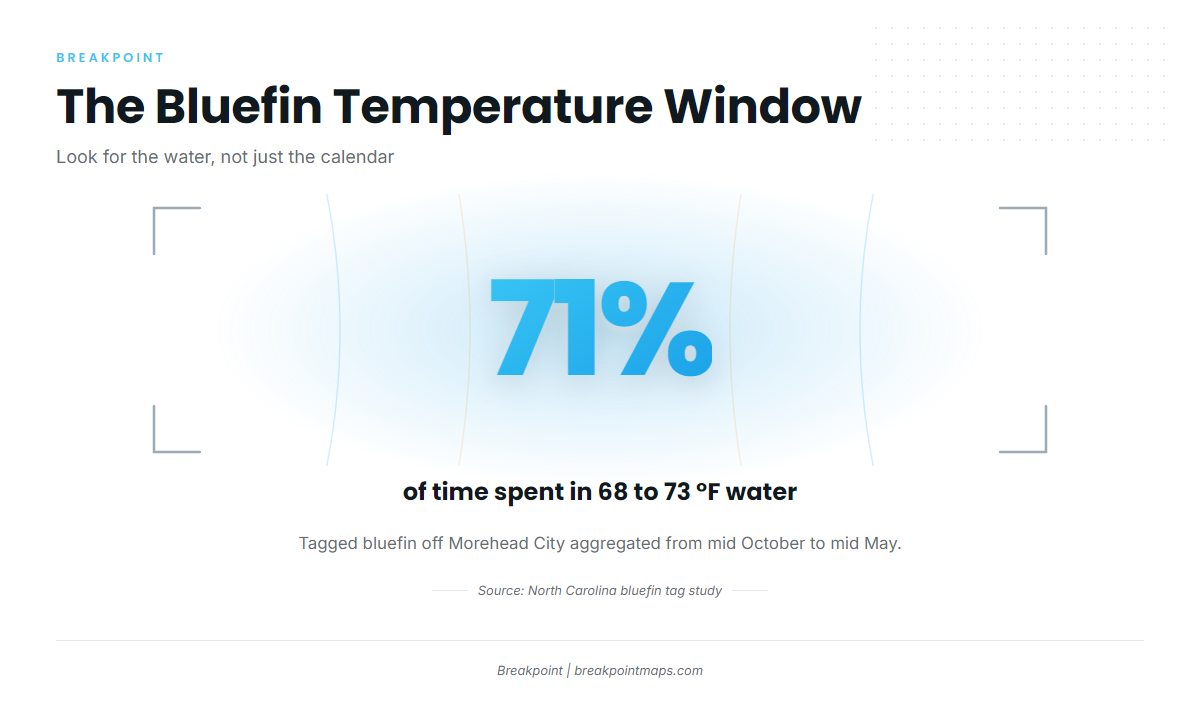
The best timing data comes from a North Carolina bluefin tag study in which fish were released offshore of Morehead City. Those fish aggregated from as early as mid October to as late as the middle of May, and spent 71% of their time in 20 to 23 °C water (68 to 73 °F).
Treat that window as the outer frame. Off Hilton Head, the reason to look is 68 to 73 °F water with bait on it, and the calendar alone is not enough. OBS SST shows where that band of water sits relative to the reefs. Chart layers are not for navigation.
The tagged aggregation in that study is off Morehead City. Hilton Head sits at the southern, less predictable end of the winter picture. For biology and habits, see our Atlantic bluefin tuna guide. For the Carolinas migration and the Morehead City comparison, read about bluefin in the Atlantic Southeast (see also the Atlantic Southeast fishing guide).
Getting out of Hilton Head Island and how far boats run
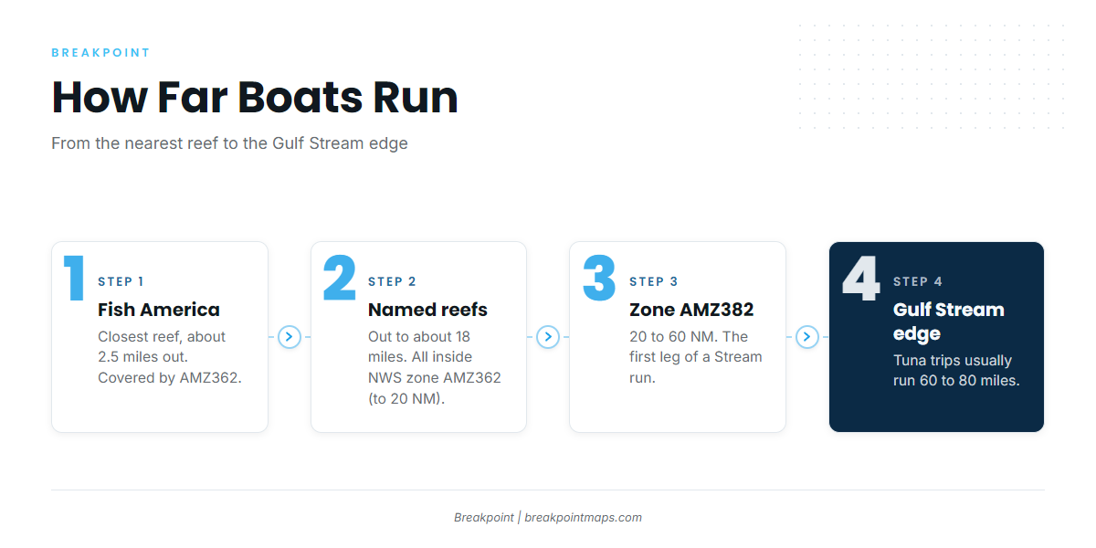
The named reefs sit about 2.5 miles (Fish America) to about 18 miles off the island. Tuna trips from this port usually run 60 to 80 miles to the Gulf Stream edge. The Hilton Head Island port page covers the inlets and ramps in more detail.
Port Royal Sound, Skull Creek and Calibogue Sound
The NOAA Coast Pilot 4 chapter describes the ways out:
- Port Royal Sound: The channel is dredged to 27 ft across the bar and marked by lights, lighted ranges and buoys. South Channel and Southeast Channel through the breakers are unmarked.
- Calibogue Sound: It runs between Hilton Head and Daufuskie Island and is obstructed by shifting shoals with several crooked channels. Boats exit through it from Harbour Town and Broad Creek.
- Skull Creek: It is the Intracoastal Waterway link on the north end, connecting to Port Royal Sound.
- Mackay Creek: It is only partly marked, has a reported controlling depth of about 8 ft and has fixed bridge spans with 25 ft of clearance.
Current, tide station 8669167 and fog
Tidal current runs about 1.5 kn on the Port Royal Sound bar and about 1.8 kn off Hilton Head. After prolonged easterlies the ebb often reaches 5 kn. Breaking shoals extend about 8 miles off the island, and tide rips on Fishing Rip can look like breakers. Read the ebb before you cross the bar, and time the run with NOAA tide station 8669167 at Port Royal Plantation.
Fog occurs mostly in winter and can show up from October to April, the same months as the bluefin window. Easterlies bring it in and westerlies clear it. It usually burns off in the forenoon.
Forecast zones
Use the NWS Charleston marine zone forecasts before you leave. AMZ362 covers Edisto Beach to Savannah out to 20 NM, which includes every named reef. AMZ382 covers 20 to 60 NM, the first leg of a Stream run. Read wind in kt and seas in ft with period, and decide from the numbers.
Ramps and the run
Public ramps and marinas on and around the island:
- Cross Island Boat Landing (Broad Creek)
- C.C. Haigh Jr. Boat Landing
- Buckingham Boat Landing
- Daufuskie Island Boat Landing
- Marshland Boat Landing (small boats only)
- Harbour Town Yacht Basin (marina)
The reef runs are 2.5 to 18 miles and the Stream run is 60 to 80 miles. These are separate trips with different fuel and weather decisions.
Grounds and structure for bluefin off Hilton Head
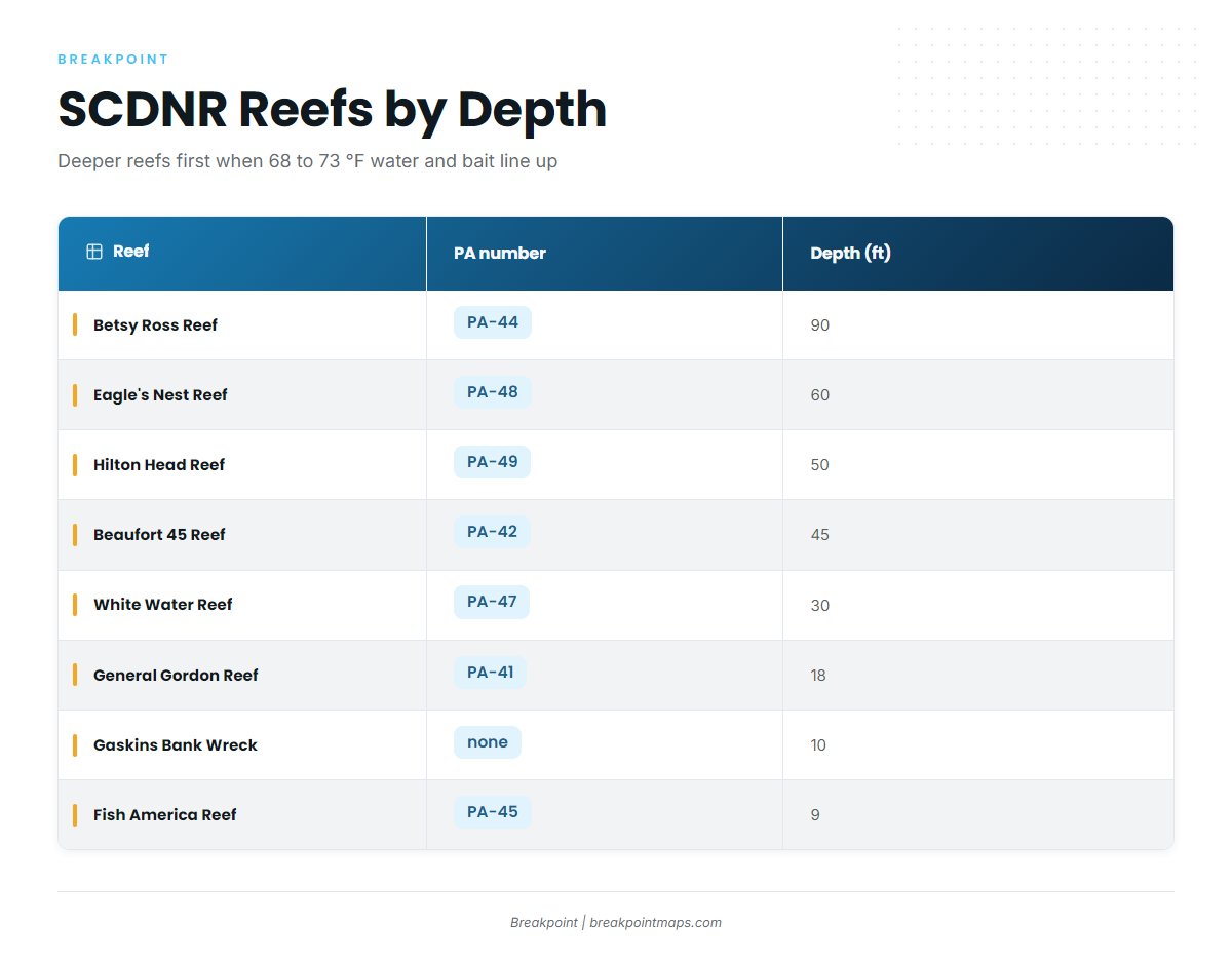
The deeper SCDNR reefs, at 45 to 90 ft, are where it makes sense to look when 68 to 73 °F water and bait line up. The shallow sites serve as bait and reference marks and are not bluefin set-ups.
| Name | PA number | Type | Depth (ft) |
|---|---|---|---|
| Betsy Ross Reef | PA-44 | wreck/reef | 90 |
| Eagle’s Nest Reef | PA-48 | reef | 60 |
| Hilton Head Reef | PA-49 | reef | 50 |
| Beaufort 45 Reef | PA-42 | reef | 45 |
| White Water Reef | PA-47 | reef | 30 |
| General Gordon Reef | PA-41 | wreck | 18 |
| Gaskins Bank Wreck | none | wreck | 10 |
| Fish America Reef | PA-45 | reef | 9 |
SCDNR gives coordinates only for Beaufort 45.
90, 60, 50 and 45 ft: Betsy Ross, Eagle’s Nest, Hilton Head Reef, Beaufort 45
These are the first stops to check in a winter when the water temperature is right. Look for bait on the sounder over and around the structure. Chart Contours helps you set up along the edges around these reefs. Chart layers are not for navigation.
30 ft: White Water Reef
White Water is a transition mark, useful mainly for the bait it holds.
18, 10 and 9 ft: General Gordon, Gaskins Bank Wreck, Fish America
Treat these as bait and reference marks rather than bluefin set-ups. Fish America is the closest reef, at about 2.5 miles.
How bluefin are fished and who fishes for them from Hilton Head
From this port, bluefin are mostly an opportunistic winter trip on private boats. The charter fleet runs mainly for blackfin, wahoo and mahi.
Trolling: spreader bars and ballyhoo
Carolinas boats troll spreader bars and ballyhoo. Ballyhoo is the standard switch when live bait is not available.
Slow-trolling live bait and chunking near bait
Boats slow-troll live menhaden, much the way they fish for king mackerel but with heavier gear. Chunking is done near bait concentrations. Find the bait first: bait over the 50 to 90 ft reefs is the signal.
Blackfin vs bluefin and who is on the water
Blackfin is the tuna most local boats find. It is a state-managed fish, not an HMS-managed one. Yellowfin mostly come from the Stream run. For more on local boats running for blackfin and yellowfin, see our tuna fishing guides.
FAQ: bluefin tuna off Hilton Head Island
Is there Atlantic bluefin tuna fishing out of Hilton Head Island?
Bluefin are an occasional winter fish here, not an established fishery. Some winters produce fish near the reefs and others do not. Charters mainly target blackfin, wahoo and mahi.
What months do bluefin show up off Hilton Head?
Winter, inside the Carolinas window of mid October to mid May. The water temperature to watch is 20 to 23 °C (68 to 73 °F).
How far out do boats run?
The reefs are about 2.5 to 18 miles out. Tuna trips usually run 60 to 80 miles to the Gulf Stream. NWS zone AMZ362 covers to 20 NM and AMZ382 covers 20 to 60 NM.
Which reef should I check first?
Start with the deeper SCDNR reefs: Betsy Ross (PA-44, 90 ft), Eagle’s Nest (PA-48, 60 ft) and Hilton Head Reef (PA-49, 50 ft). Check them when 68 to 73 °F water and bait line up.
Which permit do I need for bluefin?
NOAA requires an HMS Angling permit, even inside 3 miles, and SCDNR requires a South Carolina saltwater license. Report retained or dead-discarded bluefin within 24 hours.
How does Hilton Head compare with Morehead City?
The tagged winter aggregation in the research is off Morehead City. Hilton Head is less predictable, and fish here turn up only in some winters.