When king mackerel are around Georgetown
King mackerel move through the nearshore water off Georgetown on their spring and fall migrations, and charter operators here describe those two runs as the main windows. An older captain’s account from the port puts summer fish on the tidelines and reefs in July, but spring and fall are the seasons boats plan around. This guide is for skippers running their own boat out of Georgetown: where the fish are found off Winyah Bay, which DNR reefs hold them, how locals fish for kings, and who targets them from this port.
For the migration picture along the whole coast, see the Atlantic Southeast king mackerel guide. Biology and rigging are in the king mackerel fishing guide, and the coastal and offshore gamefish guides cover the rest of the lineup.
Where boats run
Most king fishing out of Georgetown happens in the nearshore zone, about 3 to 9 miles out, in roughly 60 feet of water.
The tidelines off Winyah Bay
A tideline off the Winyah Bay outflow, known locally as the Inshore Hole, is one of the named king spots.
Ledges and live bottom
Two other spots named in local coverage are 2CR Ledge and a mark called the Parking Lot. Boats drift live bait across ledges and live bottom here and troll the surface and the 60 to 80 foot band behind planers.
Farther reefs
Past the nearshore band, the DNR reefs form a chain out to the 100-foot line: Cape Romain Reef at 55 to 65 feet and Greenville Reef at 85 feet extend the run to 12 and 17.5 nautical miles from the bay channel. Check the NWS Charleston marine forecast for wind, wave height and period before any run past the first buoys.
Grounds and structure
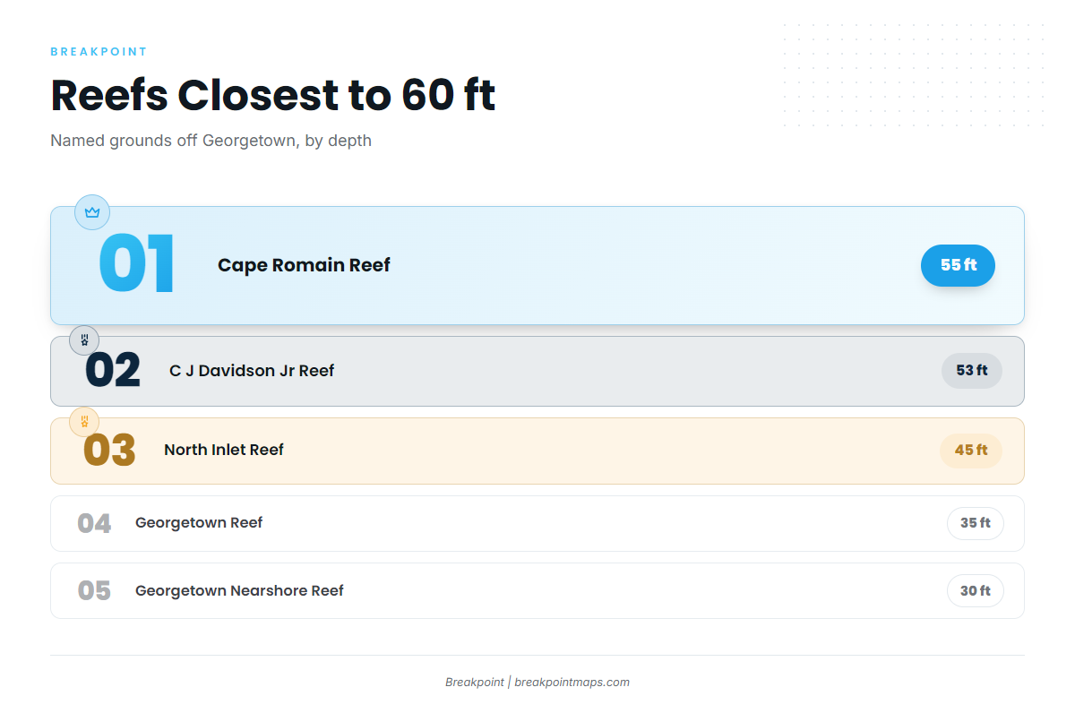
The named DNR artificial reefs off Georgetown, from shallow to deep, with their distance and bearing from the Winyah Bay jetties and channel buoy:
| Reef | Depth (ft) | Position |
|---|---|---|
| Georgetown Nearshore Reef | 30 | 065 degrees, 2.7 nm from the south jetty mound |
| Georgetown Reef | 35 to 39 | 074 degrees, 7.6 nm from the end of the jetty |
| North Inlet Reef | 45 | 020 degrees, 9.6 nm from channel buoy 2WB |
| C J Davidson Jr Reef | 53 | 147 degrees, 6.5 nm from channel buoy 2WB |
| Cape Romain Reef | 55 to 65 | 173 degrees, 12.0 nm from channel buoy 2WB |
| Greenville Reef | 85 | 149 degrees, 17.5 nm from channel buoy 2WB |
Chart data is not for navigation. Use these as a starting list and confirm positions against the DNR reef listing and your own plotter before you run.
How kings are fished here
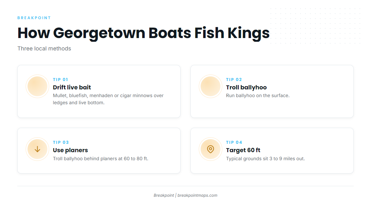
Locals use two methods, often on the same trip.
Live bait
Mullet, bluefish, menhaden or cigar minnows are drifted over ledges and live bottom. The method suits ledges and live bottom.
Trolling
Ballyhoo are trolled at the surface and behind planers at 60 to 80 feet, which covers the depth range boats here work. In July, one local captain avoided the reefs because of barracuda and amberjack that cut off baits, and stayed on the tidelines instead.
Who fishes for them
Several Georgetown charter operators list king mackerel among the fish they target:
- Winyah Adventureslists king mackerel among its targets
- Georgetown Charterslists king mackerel among its targets
- Carolina Guide Servicelists king mackerel among its targets
- Harvest Moon Fishing Charterslists king mackerel among its targets
Boats from the nearby ports fish the same migration: see the guides for king mackerel out of Murrells Inlet to the north and Edisto Beach to the south.
FAQ: king mackerel fishing out of Georgetown
When do king mackerel run off Georgetown?
Charter operators describe spring and fall nearshore runs. One local captain also fishes kings on the tidelines in July.
How far do boats run for kings out of Georgetown?
Most fishing is 3 to 9 miles out in about 60 feet of water. The farther DNR reefs are 12 to 17.5 nautical miles from the bay channel.
What bait do locals use?
Live mullet, bluefish, menhaden or cigar minnows, and ballyhoo for trolling.
Where are the size and bag rules?
On the South Carolina regulations page. Federal rules apply past state waters.