When kings are off Murrells Inlet
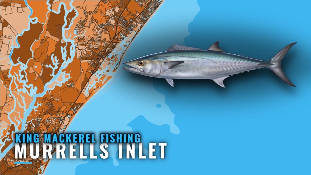
King mackerel fishing out of Murrells Inlet follows the spring and fall migrations. Marlin Quay Marina lists a kingfish tournament in September, which suggests the fall run is part of the local calendar.
This page covers named reefs with depths and buoy marks, run distances in bands, and the methods the local fleet uses. It is meant to help you decide where to look, and it makes no promise about fish.
For launch, inlet and conditions context, start with the Murrells Inlet port page. The king mackerel species page covers biology and behavior, and the Atlantic Southeast king mackerel picture (see also the Atlantic Southeast offshore fishing guide) covers the wider range.
Base each run on the official marine forecast’s wind, wave height and period.
How far boats run
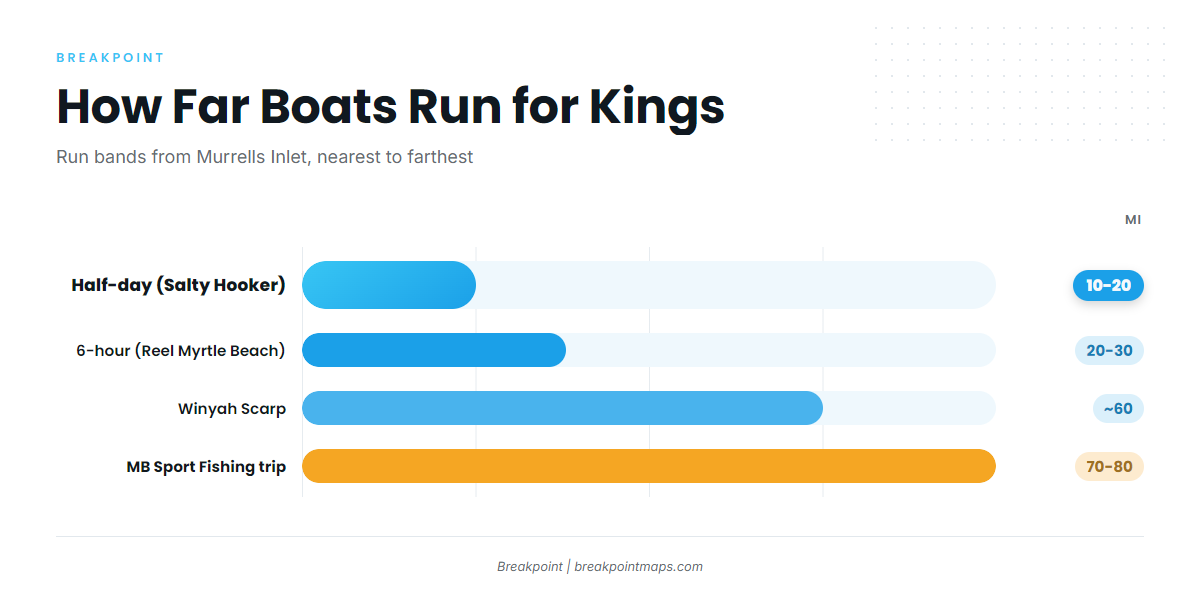
The local fleet works in bands, starting with the nearshore reefs and wrecks closest to the inlet and stretching outward.
- Nearshore reefs and wrecks. The short runs, inside the half-day range.
- 10 to 20 miles. Salty Hooker’s half-day trips run this band.
- 20 to 30 miles. Reel Myrtle Beach’s 6-hour trip runs this band for kingfish.
- About 60 miles. The Winyah Scarp, a ledge, sits about 60 miles out.
- 70 to 80 miles. Myrtle Beach Sport Fishing’s long trip runs to live bottom and wrecks. The operator calls the water it crosses on the way "prime king territory."
Kings are caught across that whole span, so pick the band that fits your fuel, your hull and your weather window.
Grounds and structure that hold kings
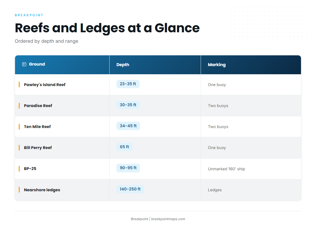
The grounds below run from the shallowest reef near the inlet out to the ledges. Blank cells mean no figure is given.
| Ground | Depth | Marking/structure | Notes |
|---|---|---|---|
| Pawley’s Island Reef | 23-35 ft | One buoy | 177°, 5.5 nm from the south jetty |
| Paradise Reef (with H.P. Springs Jr. and other add-on reefs) | 30-35 ft | Two buoys | |
| Ten Mile Reef | 34-45 ft | Two buoys | |
| Bill Perry Reef | 65 ft | One buoy | |
| BP-25 | 90-95 ft | Unmarked 160′ ship | |
| Will Goldfinch Reef | 175′ ship (YO-225) | 33 17.005 N / 078 45.372 W | |
| Nearshore ledges | 140-250 ft | Ledges | Wahoo and blackfin ledges |
| Winyah Scarp | Ledge | About 60 miles out |
You can view the reefs and ledges on Chart Contours in the Breakpoint app. Chart layers are not for navigation.
Pawley’s Island Reef
Pawley’s Island Reef sits in 23 to 35 ft with one buoy, on a bearing of 177° and 5.5 nm from the south jetty.
Paradise Reef and H.P. Springs Jr.
Paradise Reef sits in 30 to 35 ft and is marked by two buoys. The add-on reefs, including H.P. Springs Jr., are part of the site.
Ten Mile Reef
Ten Mile Reef sits in 34 to 45 ft and is marked by two buoys.
Bill Perry Reef
Bill Perry Reef sits in 65 ft with one buoy. It is the deepest buoyed reef on this list.
BP-25
BP-25 is a 160′ ship in 90 to 95 ft. It is unmarked, so you find it by number rather than by buoy.
Will Goldfinch Reef (YO-225)
Will Goldfinch Reef is a 175′ ship, YO-225, at 33 17.005 N / 078 45.372 W.
Nearshore ledges
The nearshore ledges run 140 to 250 ft and are known as the wahoo and blackfin ledges. Our wahoo and blackfin tuna guides cover those companion species.
Winyah Scarp
The Winyah Scarp is a ledge about 60 miles out, the longest run on this list.
How kings are fished here, and who runs for them
Trolling and live bait make up the local method mix, and several operators list kings among their trips.
Trolling
Trolling is a local method for kings out of this port. Salty Hooker lists kings on its half-day, 3/4-day and full-day trips, so the method is used at every range the fleet covers.
Live bait
Myrtle Beach Sport Fishing’s deep drop page calls out live bait, the other method in the local mix.
The charter fleet
These operators list king mackerel:
- The Marlin Quay Marina fleet menu lists Carolina Fly and Grand Slam.
- Crazy Sister Marina head boats include New Inlet Princess and Crazy Sister (110 ft).
- Salty Hooker Fishing Charters trips list kings on half-day, 3/4-day and full-day runs.
- The Next Lvl Sportfishing offshore page lists Hidden Agenda as a 29′ Sea Hunt. Crazy Sister lists it as a 30′ center console.
- The Myrtle Beach Sport Fishing site describes "Two Boats."
FAQ about king mackerel fishing out of Murrells Inlet
When are king mackerel off Murrells Inlet?
During the spring and fall migrations. Marlin Quay lists a kingfish tournament in September.
How far do boats run for kings?
From nearshore reefs and wrecks out to 10 to 20 miles on Salty Hooker’s half-day trips and 20 to 30 miles on Reel Myrtle Beach’s 6-hour trip. The Winyah Scarp sits about 60 miles out.
Which reef is closest to the inlet?
Pawley’s Island Reef, at 177° and 5.5 nm from the south jetty, in 23 to 35 ft.
Which grounds are marked with buoys?
Pawley’s Island Reef and Bill Perry Reef have one buoy each. Paradise Reef and Ten Mile Reef have two buoys each. BP-25 is unmarked.
What methods do locals use?
Trolling, plus live bait as called out by Myrtle Beach Sport Fishing.
Where do I find the rules?
On the state regulations page and, for federal waters offshore, the federal mackerel and cobia rules page. Check both before you fish.