Red grouper fishing out of Steinhatchee runs from 20 ft public reefs near the river mouth to ledges about 25 miles out and the Florida Middle Grounds. This guide covers season, run distance, named grounds with coordinates, local methods and charters, in that order. Ramps, the river run and port details are on the Steinhatchee port page. How far your boat runs should decide where you start looking. The wider picture is in the red grouper fishing in the Gulf of Mexico and the Gulf of Mexico fishing guide.
When red grouper are around Steinhatchee
Sea Hag’s fishing seasons page says winter brings grouper, both red and gag, closer to shore off Steinhatchee. It also notes offshore grouper in fall. Biology, depth range and bottom preferences are in the red grouper species guide.
The season sets your range:
- Winter: grouper come closer to shore, which puts small boats on the inshore water.
- Fall: offshore grouper are noted, which points longer-range boats out to the ledges.
How far boats run
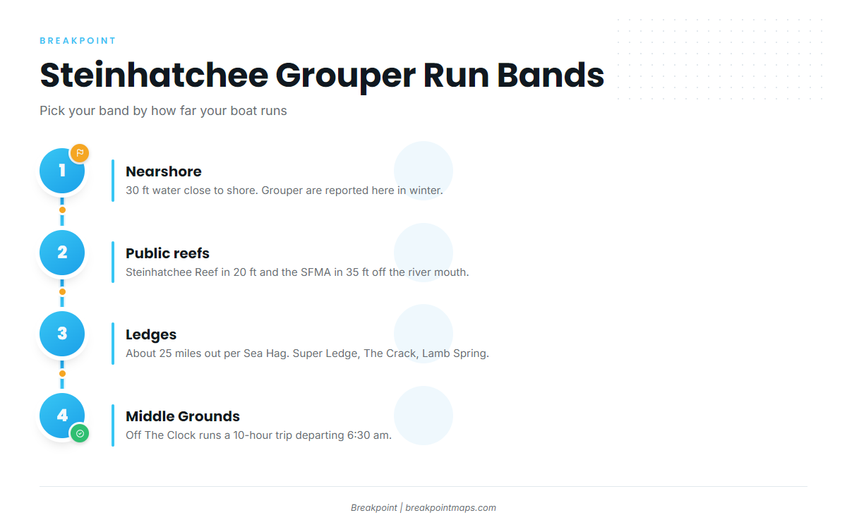
Boats out of Steinhatchee fish for grouper in three bands: 30 ft water close to shore, ledges about 25 miles out, and the Florida Middle Grounds. Before you commit to a band, check wind, wave height and period against the NOAA marine forecast for the Big Bend. The sources for this page don’t name a NOAA buoy, so look up the nearest one on NOAA.
| Band | Distance or depth | Source detail |
|---|---|---|
| Nearshore | 30 ft water | Grouper reported close to shore in winter |
| Ledges | About 25 miles out | Per Sea Hag |
| Florida Middle Grounds | Long-range run | Off The Clock’s 10-hour trip, 6:30 am departure |
Nearshore in 30 ft
Grouper are reported in 30 ft water close to shore in winter, which makes this the small-boat band. Steinhatchee Reef (20 ft) and the Steinhatchee Fisheries Management Area (35 ft) sit in the same inshore water and are covered in the next section.
Ledges about 25 miles out
Sea Hag puts the ledges about 25 miles out. Super Ledge, The Crack and Lamb Spring are the named spots in this band, with coordinates in the table below.
Florida Middle Grounds
Off The Clock runs a 10-hour Middle Grounds trip departing at 6:30 am. That trip is the long-range option from this port.
Grounds and structure off Steinhatchee
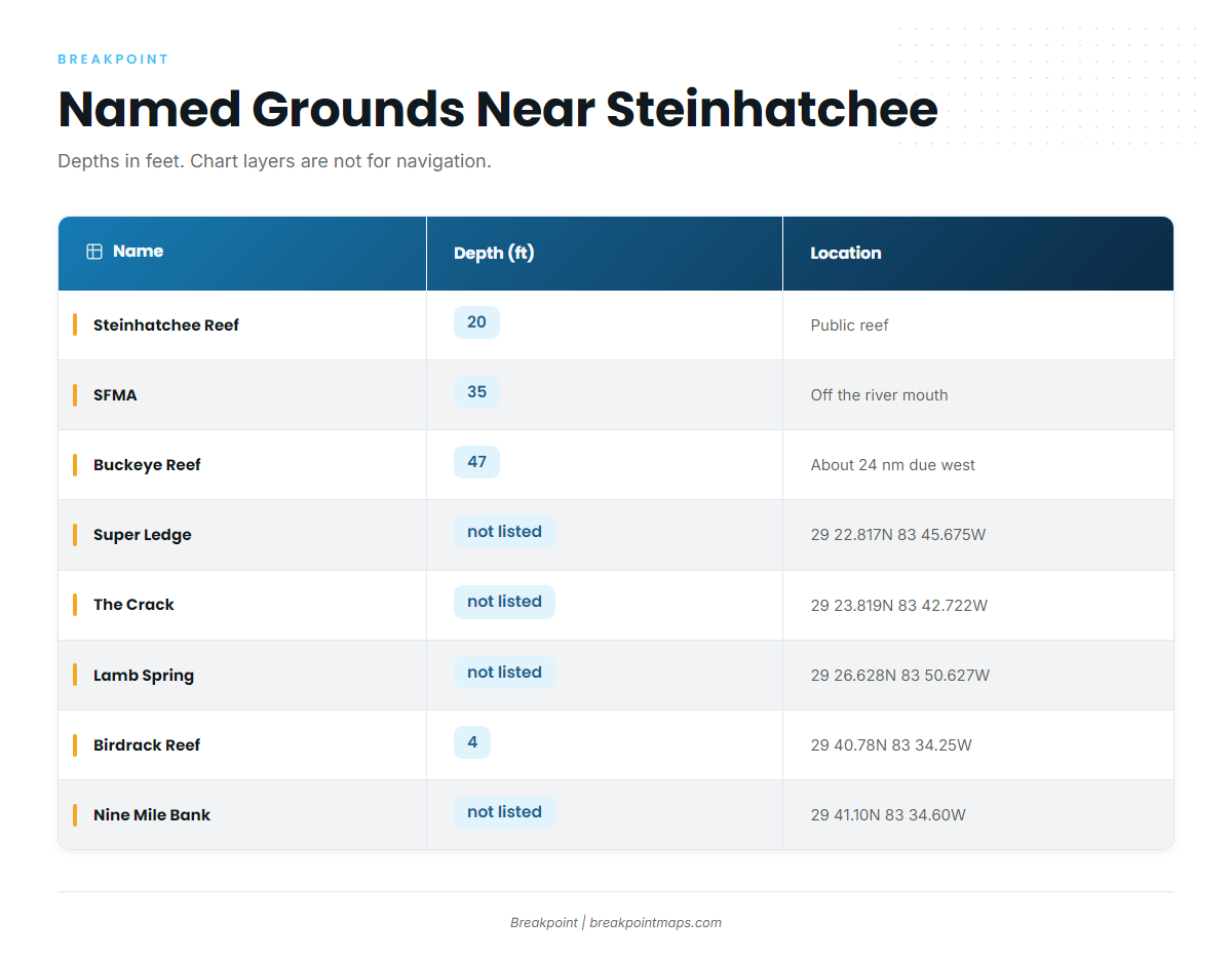
These are the named grounds near Steinhatchee, with depths in feet and coordinates to plot.
| Name | Type | Depth (ft) | Location/Coordinates |
|---|---|---|---|
| Steinhatchee Reef | Permitted public reef, four bottom areas plus cube field | 20 | |
| Steinhatchee Fisheries Management Area (SFMA) | Permitted artificial reef area | 35 | Centered off the mouth of the Steinhatchee River |
| Buckeye Reef | Reef | 47 | About 24 nautical miles due west of Steinhatchee |
| Super Ledge | Ledge | not listed | 29 22.817N 83 45.675W |
| The Crack | Named structure | not listed | 29 23.819N 83 42.722W |
| Lamb Spring | Spring | not listed | 29 26.628N 83 50.627W |
| Birdrack Reef | Concrete culverts around bird rack platform | 4 | 29 40.78N 83 34.25W |
| Nine Mile Bank | Bank | not listed | 29 41.10N 83 34.60W |
Chart layers are not for navigation.
Public reefs
- Steinhatchee Reef is a permitted public reef in 20 ft, with four bottom areas plus a cube field.
- The SFMA is a permitted artificial reef area in 35 ft, centered off the river mouth.
- Buckeye Reef sits in 47 ft, about 24 nautical miles due west.
Steinhatchee Reef and the SFMA are the close-range options.
Named ledges and springs
Super Ledge, The Crack and Lamb Spring have coordinates in the table for plotting. They fall in the band of ledges about 25 miles out.
Shallow structure
Birdrack Reef is concrete culverts around the bird rack platform in 4 ft. Nine Mile Bank sits close by, with its coordinates in the table.
How red grouper are fished here
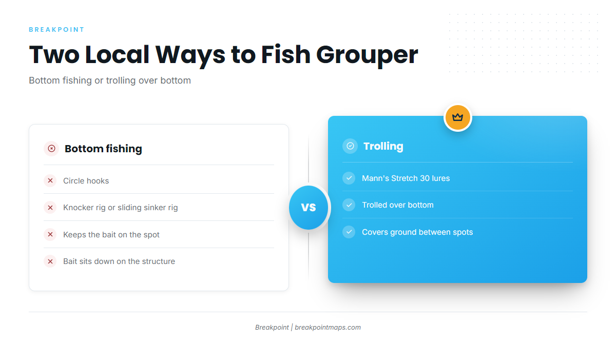
Locally, red grouper are bottom fished on circle hooks with knocker or sliding sinker rigs, or caught trolling Mann’s Stretch 30 lures over bottom.
Bottom rigs
- Circle hooks.
- Knocker rig or sliding sinker rig.
- Both rigs keep the bait on the spot, down on the structure where the fish are.
Trolling
- Mann’s Stretch 30 lures trolled over bottom.
- Troll over the structure and the bottom between marks, then work the productive stretch again.
Wider reef-fish technique is in the reef fish guides.
Who fishes for them out of Steinhatchee
Two Steinhatchee charters list red grouper: Chase N Fish Charters and Off The Clock Charters.
- Chase N Fish Charters page: Captain Chase Norwood.
- Off The Clock Charters: Captain Shan Roper runs a 36 ft Contender with triple 350 Suzuki engines. The 10-hour Middle Grounds trip departs at 6:30 am.
FAQ about red grouper fishing out of Steinhatchee
When is the best season for red grouper out of Steinhatchee?
Sea Hag says winter brings red and gag grouper closer to shore. It also notes offshore grouper in fall.
How far do boats run from Steinhatchee for red grouper?
Boats fish 30 ft water close to shore in winter, ledges about 25 miles out per Sea Hag, and the Middle Grounds on Off The Clock’s 10-hour trip.
Can a small boat find red grouper close to Steinhatchee?
Yes. Grouper are reported in 30 ft water close to shore in winter. Steinhatchee Reef sits in 20 ft and the SFMA in 35 ft off the river mouth, so red grouper fishing out of Steinhatchee is workable for boats that stay inshore.
What rig is used for red grouper here?
Circle hooks on knocker or sliding sinker rigs, which keep the bait on the spot. Trolling Mann’s Stretch 30 lures over bottom is the other local method.
Where are the coordinates for Super Ledge, The Crack and Lamb Spring?
They are in the grounds table above. Chart layers are not for navigation.
Where are the rules for red grouper out of Steinhatchee?
Check the Florida regulations page and the federal Gulf reef fish rules before fishing.