Red snapper fishing out of Destin is bottom fishing on reefs, wrecks and tanks in about 115 ft of water, roughly 15 to 25 miles off the beach on headings between 151 and 160 deg. This page covers when the fish are around, how far boats run and on what heading, the depth of each named ground, who fishes them, and where the rules live. Numbers come first, and nothing here promises fish. For the whole coast, see the Gulf of Mexico fishing guide.
Red snapper season out of Destin
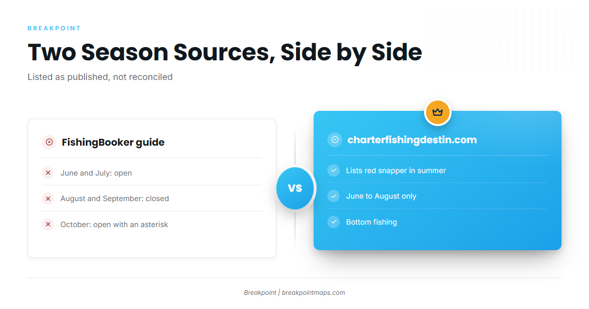
A FishingBooker Destin seasons guide marks June and July open, August and September closed, and October open with an asterisk. charterfishingdestin.com lists red snapper for summer bottom fishing, June to August, only.
The two sources disagree month for month, and the October asterisk is unresolved. See the Regulations section below before you plan around it.
Every distance and heading on this page runs from Destin Pass (East Pass). Harbor and inlet details are on the Destin port page.
Running out of Destin Pass
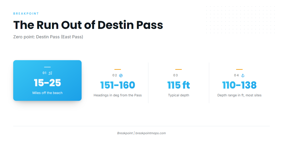
The nearest named ground is the Conch Reef complex, 110-125 ft, about 15.2 nm at 151 deg from Destin Pass. Army Tanks 10-14 is next at 115 ft, about 16.6-18.0 sm at 154-158 deg magnetic. The named grounds run roughly 15 to 25 miles out, on headings between 151 and 160 deg.
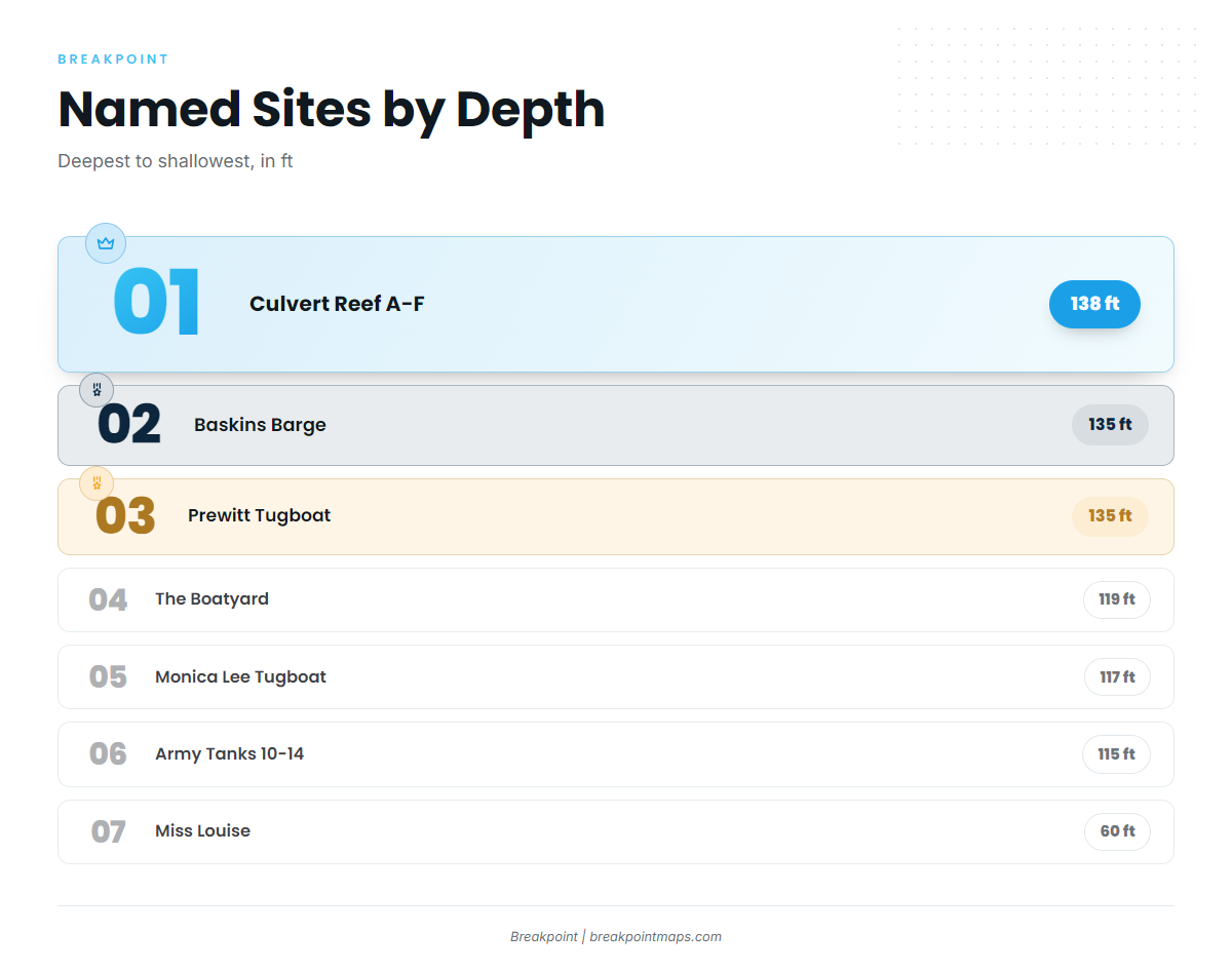
Typical depth is about 115 ft. Most named sites fall between 110 and 138 ft, with Miss Louise, at 60 ft, the outlier.
What the data gives you for the run:
- Buoy: No NDBC buoy is confirmed at Destin Pass.
- Tide station: The nearest NOAA tide station is 8729511 (Destin, East Pass).
- Forecast: Read the official marine forecast for wind, wave height and period before the run.
Chart layers are not for navigation. Use the official NOAA Coast Pilot chapter for the approach and the channel.
Grounds and structure off Destin
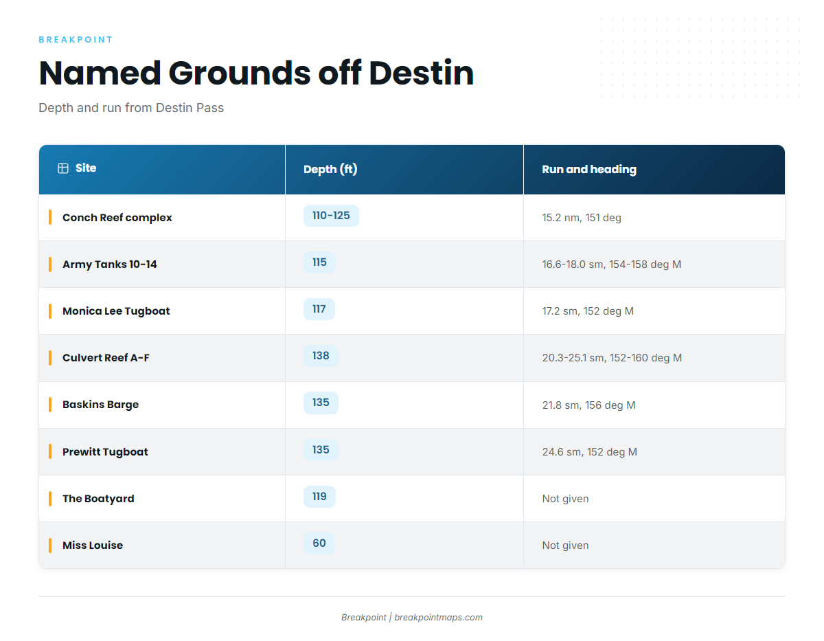
The named sites fall into three groups. Conch Reef, Army Tanks and Monica Lee are the nearer runs. Culvert Reef, Baskins Barge and Prewitt are the outer runs. The Boatyard and Miss Louise are listed without a distance. For the wider picture across the Gulf, see our reef fish guides.
| Site | Type | Depth (ft) | Distance/heading | Notes |
|---|---|---|---|---|
| Conch Reef complex | Reef | 110-125 | About 15.2 nm at 151 deg from Destin Pass | |
| Army Tanks 10-14 | Tanks | 115 | About 16.6-18.0 sm at 154-158 deg magnetic | |
| Monica Lee Tugboat | Tugboat wreck | 117 | About 17.2 sm at 152 deg magnetic | |
| Culvert Reef A-F | Reef | 138 | About 20.3-25.1 sm at 152-160 deg magnetic | Spans the Baskins and Prewitt distances |
| Baskins Barge | Barge | 135 | About 21.8 sm at 156 deg magnetic | |
| Prewitt Tugboat | Tugboat wreck | 135 | About 24.6 sm at 152 deg magnetic | |
| The Boatyard | Wrecks | 119 | Not given | M/V Miss JoAnn, placed beside M/V Dylan and M/V Brannon; 40 ft relief |
| Miss Louise | Tugboat | 60 | Not given | Okaloosa County site OK-100; length 95 ft, beam 23 ft |
Swipe the table sideways to see every column.
Conch Reef complex
110-125 ft, about 15.2 nm at 151 deg from Destin Pass. It is the shortest given run.
Army Tanks 10-14
115 ft, about 16.6-18.0 sm at 154-158 deg magnetic. This is the typical depth for the port.
Monica Lee Tugboat
Tugboat wreck at 117 ft, about 17.2 sm at 152 deg magnetic. It shares a heading with Prewitt but sits closer in.
Culvert Reef A-F
138 ft, the deepest named site, about 20.3-25.1 sm at 152-160 deg magnetic. Its range brackets Baskins and Prewitt.
Baskins Barge
135 ft, about 21.8 sm at 156 deg magnetic.
Prewitt Tugboat
135 ft, about 24.6 sm at 152 deg magnetic. It is the farthest given run.
The Boatyard
M/V Miss JoAnn, placed beside M/V Dylan and M/V Brannon, in 119 ft with 40 ft of relief.
Miss Louise
Tugboat at Okaloosa County site OK-100, in 60 ft, with a length of 95 ft and a beam of 23 ft. It is the shallow outlier among the named grounds.
How it’s fished and who fishes it
Locals bottom fish reefs, wrecks and tanks at about 115 ft, and a handful of Destin charters list red snapper.
How it’s fished
Locals bottom fish reefs, wrecks and tanks, at about 115 ft. Species behavior and biology are covered in our guide to red snapper in the Gulf.
Who fishes them
These Destin charters list red snapper:
- Catching Memories Charters (the captain’s name is inconsistent on the listing: Brian, Cole, Matt)
- Done Deal (Destin Inshore Fishing Co.), 52 ft
- Capt. Christian Duplantis
Confirm the target species and the grounds with the charter when you book.
FAQ: red snapper fishing out of Destin
When is red snapper season out of Destin?
A FishingBooker guide marks June and July open, August and September closed, and October with an asterisk. charterfishingdestin.com lists June to August. Check the state and federal regulations pages before you fish.
How far offshore do boats run for red snapper from Destin?
About 15.2 nm to Conch Reef, out to about 24.6 sm to the Prewitt Tugboat. Headings run 151 to 160 deg from Destin Pass.
How deep are the snapper reefs off Destin?
About 115 ft is typical, and most named sites run 110 to 138 ft. Miss Louise sits at 60 ft.
What is the Boatyard?
M/V Miss JoAnn, placed beside M/V Dylan and M/V Brannon, in 119 ft with 40 ft of relief.
Who runs red snapper charters in Destin?
Catching Memories Charters, Done Deal (52 ft, Destin Inshore Fishing Co.) and Capt. Christian Duplantis all list red snapper.
Is there a buoy at Destin Pass?
No NDBC buoy is confirmed at Destin Pass. The NOAA tide station is 8729511 (Destin, East Pass). Use the official marine forecast for wind, wave height and period.