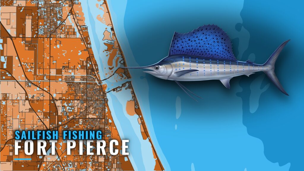
When sailfish are off Fort Pierce
Sailfish are off Fort Pierce all year, and the best fishing runs through winter and spring. This page is for anglers running their own boat. It covers the season windows, two depth bands, named structure with its SL IDs, and the local boats that fish it. For inlet and port context, see Fort Pierce.
Year-round presence
Sailfish are caught off Fort Pierce in every month, and Colossal Catch lists them as an all-year target out of the port. For general species behavior, read our sailfish fishing guide.
Best months
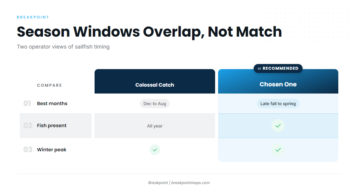
Colossal Catch puts the best months at December through August. Chosen One reports good numbers from late fall through spring. The two windows overlap but do not match.
Winter and spring peak
Peak action off Fort Pierce runs through winter and spring, so a short trip has its best odds inside that window.
| Window | Source |
|---|---|
| All year | Colossal Catch |
| December through August (best) | Colossal Catch |
| Late fall through spring (good numbers) | Chosen One |
| Winter and spring (peak action) | Operator reports |
Where boats run from Fort Pierce Inlet
Boats leave through Fort Pierce Inlet and work blue water offshore. For Sailfish Alley along the wider coast, see the wider Atlantic Southeast picture (see also the wider Atlantic Southeast guide).
Blue water and current edges
Chosen One runs past the breakers to blue water and works the fish along Gulf Stream current edges. Before you run to the edge, check the NWS Coastal Waters Forecast for current conditions.
Two depth bands
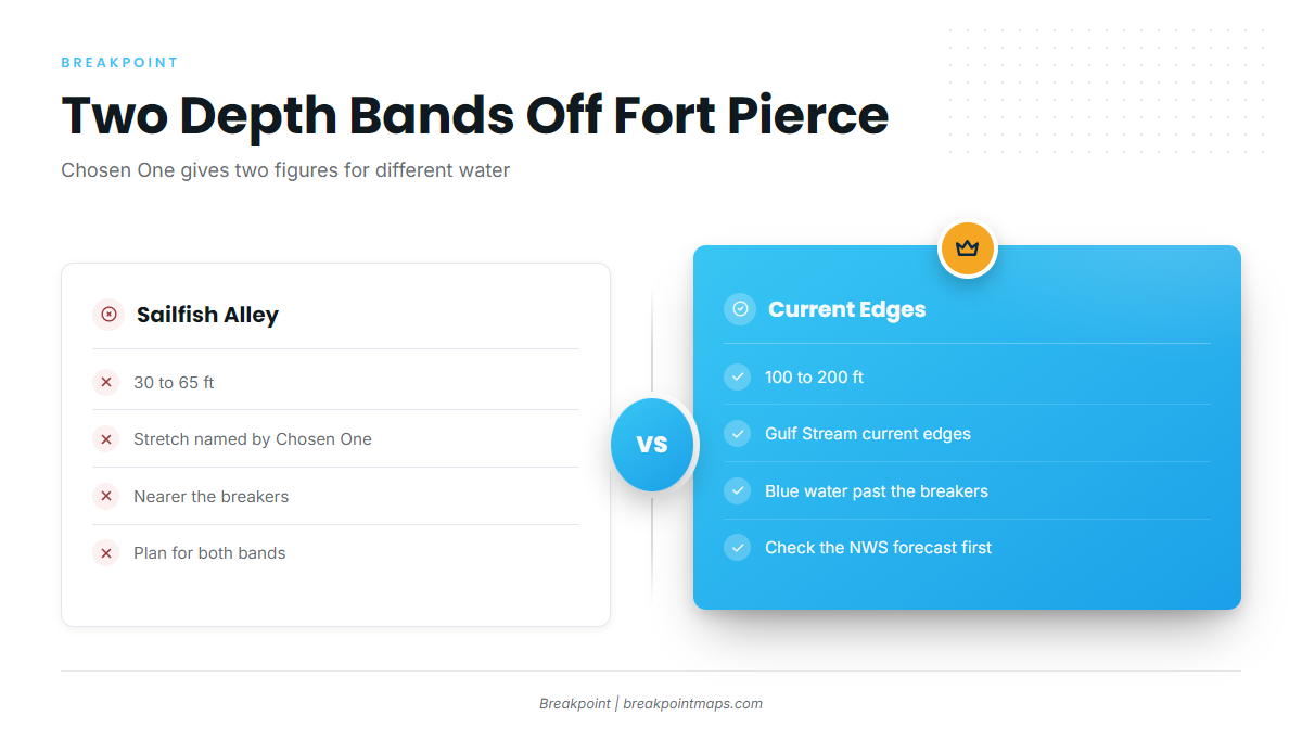
Chosen One gives 30 to 65 ft for a stretch it calls Sailfish Alley and 100 to 200 ft along the current edges. These are different water, so plan for both bands.
| Band | Depth | Described as |
|---|---|---|
| Inshore | 30 to 65 ft | Sailfish Alley |
| Offshore | 100 to 200 ft | Current edges |
Grounds and structure near Fort Pierce
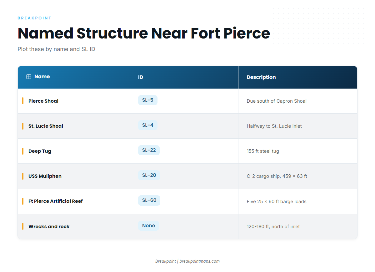
Named structure near the port includes shoals to the south, reefs and wrecks to the north, and the St. Lucie County SL-series sites. Plot each one yourself, since chart layers are not for navigation.
| Name | ID | Description | Position relative to inlet |
|---|---|---|---|
| Capron Shoal | n/a | Shoal | East-southeast of Fort Pierce Inlet |
| Pierce Shoal | SL-5 | Shoal | Due south of Capron Shoal |
| St. Lucie Shoal | SL-4 | Shoal | About halfway between Fort Pierce and St. Lucie inlets |
| Unnamed artificial reef | n/a | About 1 mile long | Just north of Fort Pierce Inlet |
| Wrecks and rock areas | n/a | Artificial wrecks and rock, 120 to 180 ft | North of Fort Pierce Inlet |
| Ft Pierce Artificial, Deep Tug | SL-22 | 155 ft steel tug | n/a |
| USS Muliphen | SL-20 | C-2 attack cargo ship, 459 x 63 ft | n/a |
| Ft Pierce Artificial Reef | SL-60 | Five 25 x 60 ft barge loads | n/a |
Shoals south of the inlet
Capron Shoal lies east-southeast of Fort Pierce Inlet. Pierce Shoal (SL-5) sits due south of Capron Shoal, and St. Lucie Shoal (SL-4) sits about halfway between Fort Pierce and St. Lucie inlets. All three lie offshore of the port, as described in NOAA Coast Pilot 4.
Reefs and wrecks north of the inlet
An unnamed artificial reef about 1 mile long sits just north of Fort Pierce Inlet. Artificial wrecks and rock areas lie farther north in 120 to 180 ft of water, a range that overlaps the 100 to 200 ft current-edge band.
St. Lucie County artificial reefs
- Deep Tug (SL-22): a 155 ft steel tug.
- USS Muliphen (SL-20): a C-2 attack cargo ship, 459 x 63 ft.
- Ft Pierce Artificial Reef (SL-60): five 25 x 60 ft barge loads.
Who fishes for sailfish out of Fort Pierce
Four operators list sailfish out of Fort Pierce. Each is named below with its captain.
Reel Sporty Charters
Captain Ricky Spikes runs Reel Sporty Charters.
Hot Reels Offshore Adventures
Captain Philipe Chibas runs Hot Reels Offshore Adventures from a 31-foot Bluewater center console built in Fort Pierce.
Colossal Catch Charter Fishing
Capt. Jonathon runs Colossal Catch Charter Fishing. The boat carries up to 6 guests, and Colossal Catch is the source of the December through August window.
Chosen One Fishing Charters
Captain Remus Griffin runs Chosen One Fishing Charters. Chosen One is the source of the two depth bands and the late fall through spring window.
If you are comparing ports or other billfish, see our billfish guides.
FAQ: sailfish fishing out of Fort Pierce
When is the best time for sailfish out of Fort Pierce?
Fish are present all year. Colossal Catch lists December through August as best, Chosen One reports good numbers late fall through spring, and peak action runs through winter and spring.
How deep do boats fish for sailfish off Fort Pierce?
Chosen One gives two bands: 30 to 65 ft for Sailfish Alley and 100 to 200 ft along current edges. These are different water, so plan for both.
What is Sailfish Alley off Fort Pierce?
Chosen One describes Sailfish Alley as a stretch at 30 to 65 ft. The same operator gives 100 to 200 ft along the current edges as a separate band.
What structure is near Fort Pierce Inlet?
Capron Shoal, Pierce Shoal (SL-5), St. Lucie Shoal (SL-4), USS Muliphen (SL-20), Deep Tug (SL-22) and Ft Pierce Artificial Reef (SL-60) are named. Artificial wrecks and rock sit north of the inlet in 120 to 180 ft.
Which Fort Pierce charters target sailfish?
Four charters list the species: Reel Sporty Charters (Captain Ricky Spikes), Hot Reels Offshore Adventures (Captain Philipe Chibas), Colossal Catch Charter Fishing (Capt. Jonathon) and Chosen One Fishing Charters (Captain Remus Griffin).