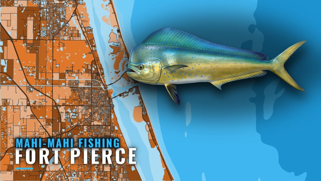
Mahi-mahi fishing out of Fort Pierce runs spring through fall, with a July to November peak, according to Chosen One Fishing Charters. Boats work offshore in 30 to 200 ft and look for floating debris and weed lines. This is one of the offshore gamefish runs out of Fort Pierce Inlet, and the named structure below gives you places to start looking.
Mahi-Mahi Season Out of Fort Pierce
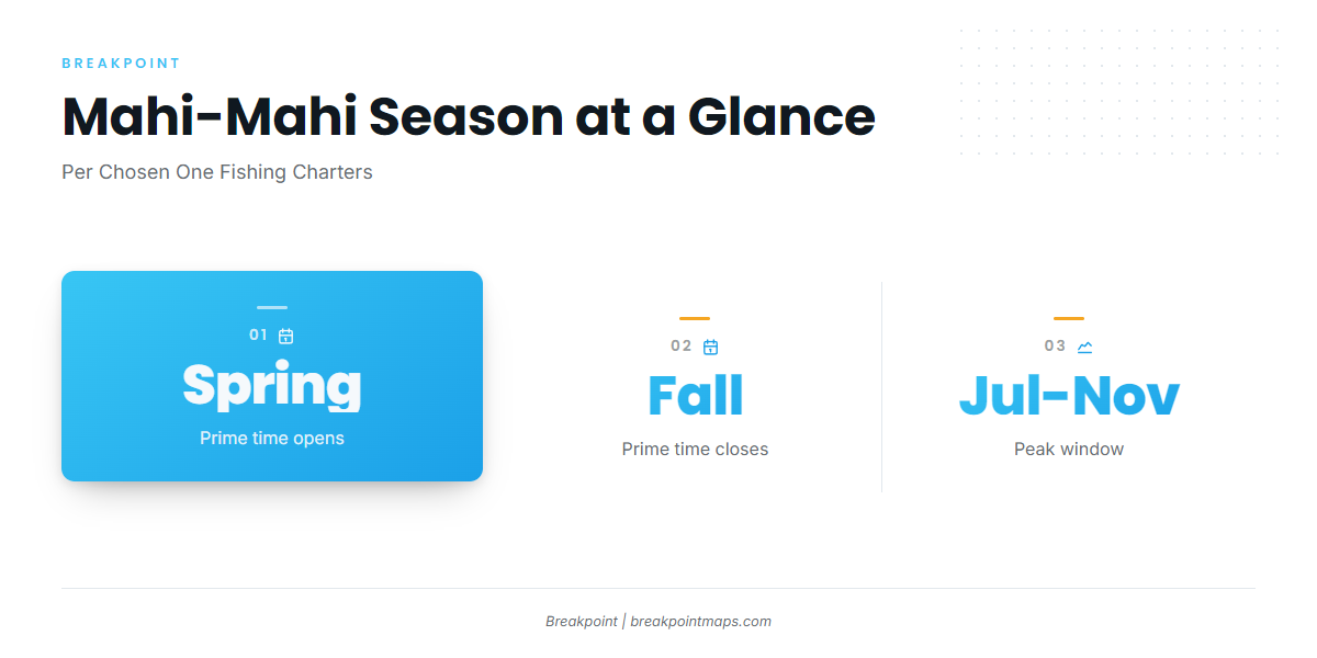
Chosen One Fishing Charters puts prime time at spring through fall, with the peak from July to November. For timing beyond the Treasure Coast, see the regional picture (see also the Atlantic Southeast region guide) for the Atlantic Southeast.
| Window | Timing | Source |
|---|---|---|
| Prime time | Spring through fall | Chosen One Fishing Charters |
| Peak | July to November | Chosen One Fishing Charters |
| Tournament | Usually May | Fishing Frenzy Dolphin Tournament |
Prime Months
Spring through fall is the window to plan a run from the inlet, per Chosen One.
Peak Months
The peak runs July to November, per Chosen One. If your dates are flexible, this is the stretch to pick.
Where Boats Run for Mahi-Mahi
Boats from Fort Pierce run offshore into 30 to 200 ft and look for floating debris and weed lines. That band is the port’s working zone.
Depth Band
The 30 to 200 ft band is wide, so the practical question is where inside it to start. The Chart Contours layer shows where the band sits off the inlet. Chart layers are not for navigation, and the band shows where to look rather than where the fish are on a given day.
Floating Cover
The named grounds are fixed, while weed lines and debris move. Use the structure as a starting point, with the floating cover as the target.
Grounds and Structure off Fort Pierce
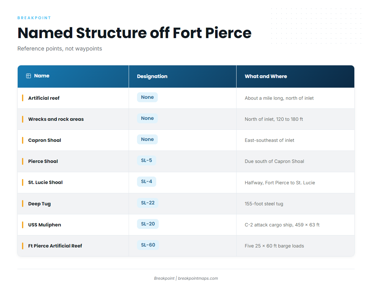
These are the named grounds and structure near the inlet, in and around the 30 to 200 ft zone.
| Name | Designation | What and Where |
|---|---|---|
| Artificial reef (no name given) | None | About a mile long, just north of Fort Pierce Inlet |
| Artificial wrecks and rock areas | None | North of Fort Pierce Inlet, in 120 to 180 ft |
| Capron Shoal | None | East-southeast of Fort Pierce Inlet |
| Pierce Shoal | SL-5 | Due south of Capron Shoal |
| St. Lucie Shoal | SL-4 | About halfway between Fort Pierce and St. Lucie inlets |
| Ft Pierce Artificial, Deep Tug | SL-22 | 155-foot steel tug |
| USS Muliphen | SL-20 | C-2 attack cargo ship, 459 x 63 ft |
| Ft Pierce Artificial Reef | SL-60 | Five 25 x 60 ft barge loads |
The bearings are relative descriptions, not waypoints. Pull positions from the official reef and chart sources in the app. Chart layers are not for navigation.
North of the Inlet
The artificial reef just north of Fort Pierce Inlet is about a mile long, and no name is given for it. Farther out, the artificial wrecks and rock areas sit in 120 to 180 ft, inside the 30 to 200 ft zone.
Shoals
Capron Shoal lies east-southeast of the inlet. Pierce Shoal (SL-5) lies due south of Capron Shoal. St. Lucie Shoal (SL-4) sits about halfway between Fort Pierce and St. Lucie inlets.
Artificial Reefs and Wrecks
- Deep Tug (SL-22): a 155-foot steel tug.
- USS Muliphen (SL-20): a C-2 attack cargo ship, 459 x 63 ft.
- Ft Pierce Artificial Reef (SL-60): five 25 x 60 ft barge loads.
How Mahi-Mahi Are Fished Here
Locally, mahi-mahi are worked around floating debris and weed lines, per Chosen One. For rigging and trolling basics, use the species guide.
Weed Lines
Boats look for weed lines inside the 30 to 200 ft band. They move, so the named structure serves only as a reference point.
Floating Debris
Debris is the other cover worked locally. Boats have to find it, and the structure above gives them a place to start looking.
Who Fishes Mahi-Mahi out of Fort Pierce
These Fort Pierce charters list mahi-mahi.
Charters
- Smokin’ Fish Fishing Charters: boat named Smokin Fish.
- Reel Sporty Charters: Captain Ricky Spikes.
- Hot Reels Offshore Adventures: Captain Philipe Chibas, with a 31-foot Bluewater center console built in Fort Pierce.
- Colossal Catch Charter Fishing: Capt. Jonathon, up to 6 guests.
- Chosen One Fishing Charters: Captain Remus Griffin.
Fishing Frenzy Dolphin Tournament
The Fishing Frenzy Dolphin Tournament is the local mahi-mahi tournament out of Fort Pierce, usually held in May.
FAQ: Mahi-Mahi Fishing out of Fort Pierce
When is mahi-mahi season in Fort Pierce?
Spring through fall is prime time, per Chosen One Fishing Charters.
When is the peak for mahi-mahi off Fort Pierce?
The peak runs July to November, per Chosen One Fishing Charters.
What depth do boats fish for mahi-mahi out of Fort Pierce?
Boats run offshore in 30 to 200 ft, near floating debris and weed lines.
What named structure is near Fort Pierce Inlet?
Capron Shoal, Pierce Shoal (SL-5), St. Lucie Shoal (SL-4), the artificial reef and the wrecks and rock areas north of the inlet, Deep Tug (SL-22), USS Muliphen (SL-20) and Ft Pierce Artificial Reef (SL-60). Treat them as reference points in and around the offshore zone.
Is there a local mahi-mahi tournament?
The Fishing Frenzy Dolphin Tournament, usually held in May.