When vermilion snapper are around Corpus Christi
Vermilion snapper turn up in the offshore mix out of Corpus Christi, but no defined local season is documented for them here. For behavior and the general seasonal picture, see vermilion snapper biology and seasonal patterns. The wider picture is in the vermilion snapper fishing in the Gulf of Mexico and the Gulf of Mexico region guide.
How far boats run from Corpus Christi
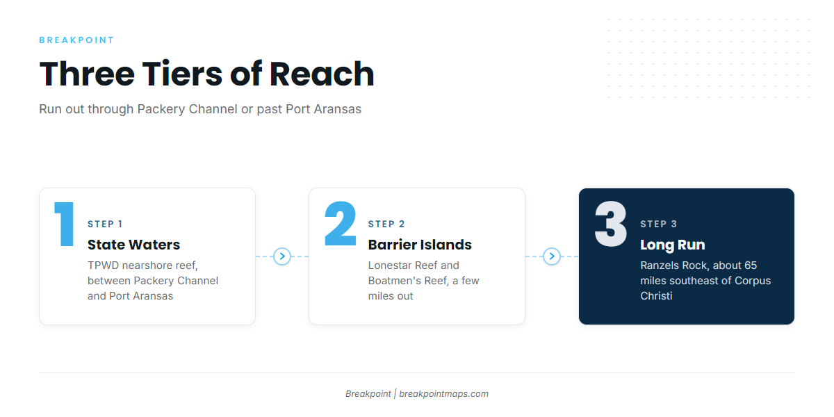
Packery Channel and Port Aransas are the two entrances to the Gulf. The Corpus Christi passes and Gulf access page covers both. From there, the grounds fall into three tiers:
- State-water nearshore reef: The TPWD nearshore reef, between Packery Channel and Port Aransas.
- A few miles out from the barrier islands: Lonestar Reef and Boatmen’s Reef, off Mustang Island and the Port Aransas side.
- Long run: Ranzels Rock, about 65 miles southeast of Corpus Christi. The Ant Hills area oil rigs and 29 Fathom Bank are also part of the offshore structure, though no distance is given for either.
In short, the split is state waters versus the long run to Ranzels Rock.
Grounds and structure that hold reef fish
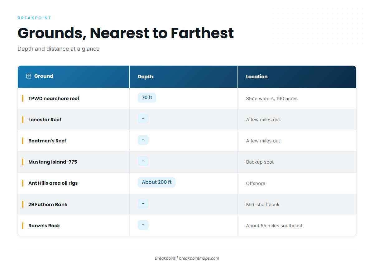
The grounds below run from the pass outward, nearest to farthest. Chart layers in Breakpoint, including Chart Contours, are not for navigation. The official reference is NOAA Coast Pilot chapter 11.
| Ground | Depth | Location or distance |
|---|---|---|
| TPWD nearshore reef (Corpus Christi Reef Site) | 70 ft | State waters between Packery Channel and Port Aransas, 160 acres |
| Lonestar Reef | A few miles out from the barrier islands | |
| Boatmen’s Reef | A few miles out from the barrier islands | |
| Mustang Island-775 | Backup spot, no distance given | |
| Ant Hills area oil rigs | About 200 ft | No distance given |
| 29 Fathom Bank | Mid-shelf bank, no distance given | |
| Ranzels Rock | About 65 miles southeast of Corpus Christi |
TPWD nearshore reef
The reef covers 160 acres in 70 ft of water, in state waters between Packery Channel and Port Aransas. The Corpus Christi Reef Site is this same reef. You can confirm its position on the TPWD Interactive Reef Locator.
Lonestar Reef
Lonestar Reef sits a few miles out from the barrier islands.
Boatmen’s Reef
Boatmen’s Reef is in the same band as Lonestar Reef, a few miles out from the barrier islands.
Mustang Island-775
Mustang Island-775 is a backup spot.
Ant Hills area oil rigs
The Ant Hills area oil rigs are fished in about 200 feet of water.
29 Fathom Bank
29 Fathom Bank is a mid-shelf bank.
Ranzels Rock
Ranzels Rock lies about 65 miles southeast of Corpus Christi, the longest run on the list.
How vermilion are fished here and who fishes them
Vermilion snapper are among the offshore species taken out of this port, along with other reef fish. Local effort for them is part of the general reef fishing from Corpus Christi rather than a standalone fishery. For technique, see bottom fishing for reef fish.
FAQ
Where is the nearshore reef off Corpus Christi?
The TPWD nearshore reef, also called the Corpus Christi Reef Site, sits in state waters between Packery Channel and Port Aransas. It covers 160 acres.
How deep is the TPWD nearshore reef?
70 ft.
How far is Ranzels Rock from Corpus Christi?
About 65 miles southeast of Corpus Christi.
How deep are the Ant Hills area oil rigs?
They are fished in about 200 feet of water.
What is Mustang Island-775?
A backup spot off the Corpus Christi coast.
Is there a NOAA buoy for Corpus Christi?
No NOAA buoy station is tied to the port. Check the NWS Corpus Christi marine forecast before running.
When is vermilion snapper season out of Corpus Christi?
Vermilion snapper are part of the port’s offshore species mix. No defined local season is documented.