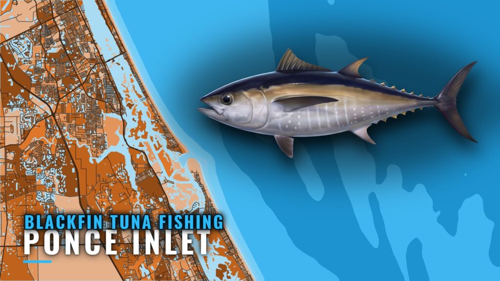
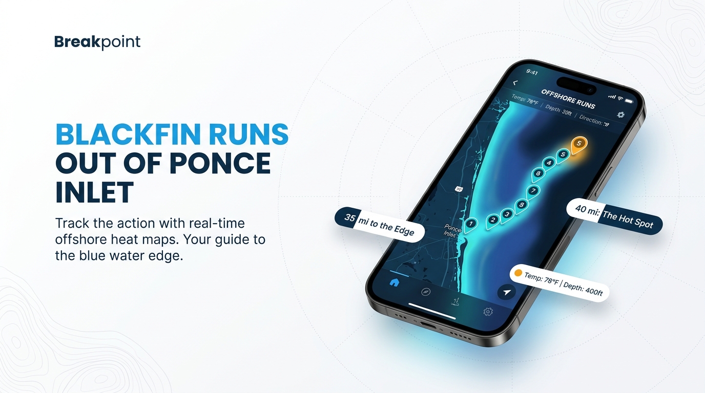
Blackfin tuna fishing out of Ponce Inlet is a fall and winter trolling fishery on the blue water edge. FishingBooker puts Gulf Stream water roughly 40 miles offshore, with the Party Grounds about 35 miles out and the Rolldown about 40 to 55 miles out. Boats from New Smyrna Beach and the rest of Volusia County use the same Ponce Inlet to reach them. For the biology of blackfin tuna, start with our species guide. This guide lays out the run in order of distance, the named grounds with their depths, and who fishes them.
When blackfin tuna are off Ponce Inlet
The season here is fall and winter. That describes a season, not a calendar, so plan trips around conditions and water rather than dates. A fall or winter day does not guarantee a bite.
Before committing to a 35 to 55 mile run, check the official marine forecast for wind speed, wave height and wave period, then decide against your own boat and your own limits.
- Season: fall and winter
- Check before you go: wind speed, wave height, wave period
- Where to look: the blue water edge, roughly 40 miles offshore
For how this port fits the wider coast, see the Atlantic Southeast blackfin picture (see also the Atlantic Southeast fishing guide).
The run offshore
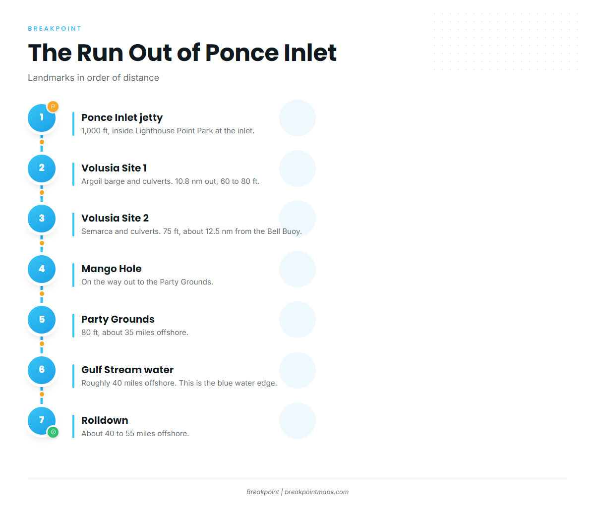
The run goes outward in this order: the jetty, Volusia Artificial Reef Sites 1 and 2 at 10.8 nm and about 12.5 nm, the Mango Hole, Cracker Ridge, the Party Grounds at about 35 miles, Gulf Stream water at about 40 miles, and the Rolldown at about 40 to 55 miles.
Inlet and nearshore reefs
The Ponce Inlet jetty is 1,000 ft long and sits inside Lighthouse Point Park at the inlet. It is the first landmark on the way out.
Volusia Artificial Reef Site 1 holds the Argoil barge and culverts, 10.8 nm from the inlet in 60 to 80 ft. Volusia Artificial Reef Site 2 holds the Semarca and culverts in 75 ft, about 12.5 nm from the Bell Buoy at 067 degrees. Use the printed bearing as a reference only and navigate from your own charts. Both sites are structure you pass on the way out.
To the Party Grounds
Per FishingBooker, the Mango Hole is on the way out to the Party Grounds. Cracker Ridge sits a few miles west of the Party Grounds, near Volusia Site 2.
FishingBooker’s Ponce Inlet fishing guide puts the Party Grounds about 35 miles offshore in 80 ft. It also names East Ridge as a trolling ground alongside the Party Grounds.
Gulf Stream water and the Rolldown
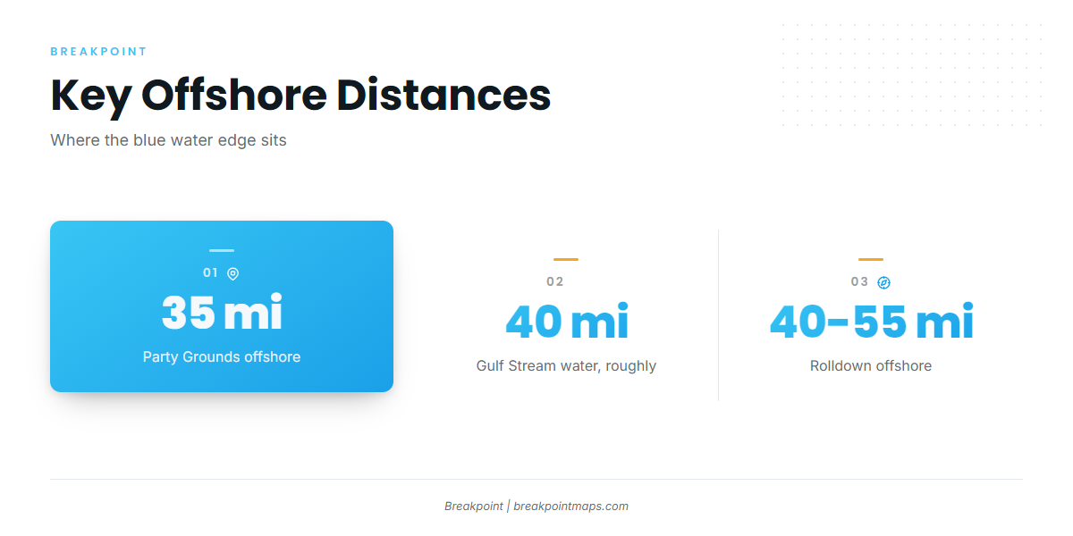
The blue water edge is the target zone. Per FishingBooker, Gulf Stream water sits roughly 40 miles offshore, and the Rolldown lies about 40 to 55 miles offshore.
The farthest named ground is about 55 miles out, so plan fuel for the round trip. Plot the named grounds as waypoints before you leave, since chart layers are not for navigation.
| Leg | Distance | Unit as sourced |
|---|---|---|
| Volusia Artificial Reef Site 1 | 10.8 | nm from the inlet |
| Volusia Artificial Reef Site 2 | About 12.5 | nm from the Bell Buoy at 067 degrees |
| Party Grounds | About 35 | miles offshore |
| Gulf Stream water | Roughly 40 | miles offshore |
| Rolldown | About 40 to 55 | miles offshore |
Grounds and structure
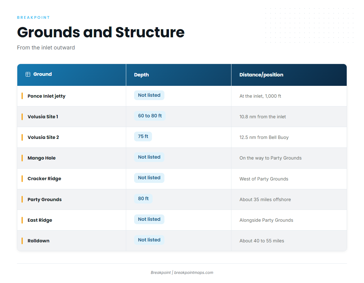
The table runs from the inlet outward, with each ground detailed below it.
| Ground | Depth | Distance/position |
|---|---|---|
| Ponce Inlet jetty (Lighthouse Point Park) | Not listed | At the inlet, 1,000 ft long |
| Volusia Artificial Reef Site 1 (Argoil barge, culverts) | 60 to 80 ft | 10.8 nm from the inlet |
| Volusia Artificial Reef Site 2 (Semarca, culverts) | 75 ft | About 12.5 nm from the Bell Buoy at 067 degrees |
| Mango Hole | Not listed | On the way out to the Party Grounds |
| Cracker Ridge | Not listed | A few miles west of the Party Grounds, near Site 2 |
| Party Grounds | 80 ft | About 35 miles offshore |
| East Ridge | Not listed | Trolling ground alongside the Party Grounds |
| Rolldown | Not listed | About 40 to 55 miles offshore |
Party Grounds
80 ft, about 35 miles offshore per FishingBooker.
East Ridge
Named as a trolling ground alongside the Party Grounds.
Cracker Ridge
A few miles west of the Party Grounds, near Volusia Site 2.
Mango Hole
On the way out to the Party Grounds, per FishingBooker.
Rolldown
About 40 to 55 miles offshore.
Volusia Artificial Reef Site 1
Argoil barge and culverts, 10.8 nm from the inlet, 60 to 80 ft.
Volusia Artificial Reef Site 2
Semarca and culverts, 75 ft, about 12.5 nm from the Bell Buoy at 067 degrees.
Ponce Inlet jetty
1,000 ft, inside Lighthouse Point Park at the inlet.
How blackfin are fished here
The local method is trolling spreads on the blue water edge, where Gulf Stream water sits roughly 40 miles out. That distance is why the run order matters.
East Ridge is the one ground explicitly named for trolling, alongside the Party Grounds. For spread layout, lures and rigging, see our tuna fishing guides.
Who fishes for them out of Ponce Inlet
Private boats run the same grounds from the inlet.
For anyone who wants to learn the water with a captain first, Rare Breed Charters lists blackfin tuna on its offshore trips. The boat is a 31 ft Cape Horn that takes up to 6 passengers, and the trip page names Captain Daniel.
FAQ: blackfin tuna out of Ponce Inlet
How far do you run for blackfin tuna fishing out of Ponce Inlet?
Per FishingBooker, Gulf Stream water sits roughly 40 miles offshore. The Party Grounds are about 35 miles out and the Rolldown about 40 to 55 miles out.
When are blackfin around?
Fall and winter.
Where are the Party Grounds?
About 35 miles offshore in 80 ft, per FishingBooker. The Mango Hole is on the way out, and Cracker Ridge sits a few miles west.
How are blackfin fished here?
With trolling spreads on the blue water edge.
Is there a charter that targets blackfin?
Rare Breed Charters lists blackfin tuna. It runs a 31 ft Cape Horn for up to 6 passengers.
Where are the rules?
Check the Florida regulations page before fishing. Federal Atlantic tuna rules have their own page.