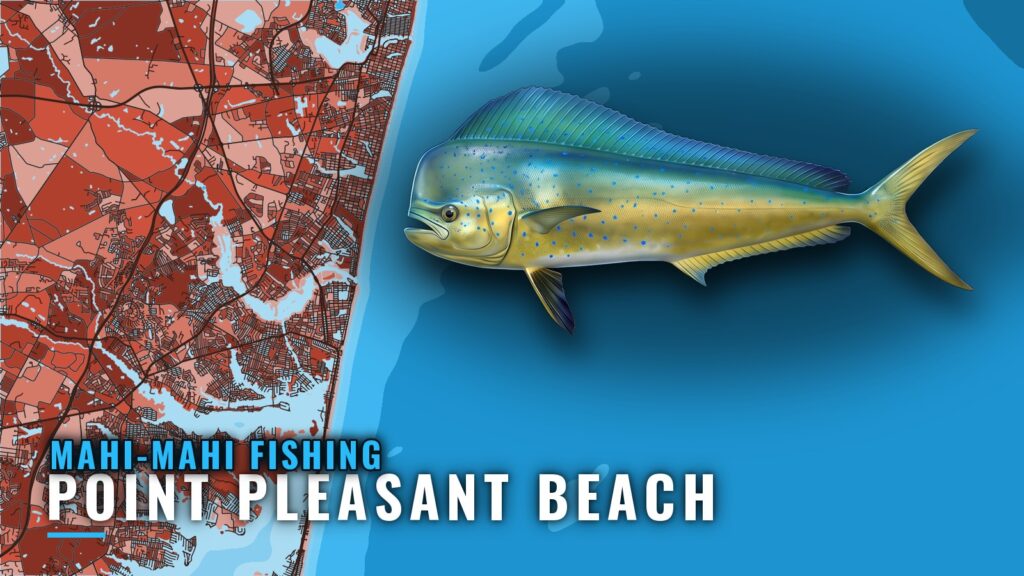
Mahi-mahi fishing out of Point Pleasant Beach is a late-summer pursuit: pots nearshore, trolling offshore. Every run starts at Manasquan Inlet, the only way out to every ground on this page. This guide works outward from the inlet, with depths and a waypoint you can load before you leave the dock. For the port itself, see the Point Pleasant Beach port page.
When mahi-mahi are around Point Pleasant Beach
Mahi-mahi off this port are a late-summer fish. For how the season builds across the Northeast (see also the Atlantic Northeast region guide), use the regional page. For mahi-mahi biology and migration, use the species page.
Timing shifts from year to year, so treat late summer as the window to start looking. No one can promise fish on a given day, but knowing the window helps you decide where to look first.
Where boats run from Manasquan Inlet
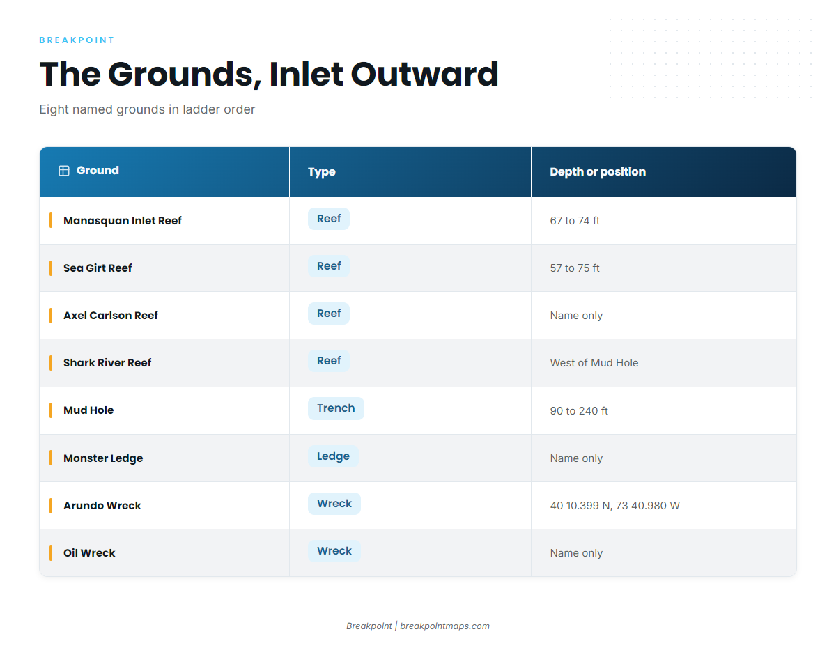
The grounds below are listed in order from the inlet outward: nearshore reefs first, then the Mud Hole, then the ledge and wrecks farther out.
Nearshore reefs
The first three grounds are reefs. Manasquan Inlet Reef sits in 67 to 74 ft, Sea Girt Reef covers 57 to 75 ft, and Axel Carlson Reef is the third.
Pot fishing happens on these nearshore grounds. Mahi-mahi don’t hold on the reef itself, so you are working the water around it.
Shark River Reef and the Mud Hole
Shark River Reef sits on the west side of the Mud Hole. The Mud Hole itself runs from 90 to 240 ft, from the flats to the deepest point.
This is the transition from nearshore water to the trolling grounds. Anglers who work the trench treat Mud Hole mahi as a separate fishery from the pots inshore.
Monster Ledge and the wrecks
Monster Ledge and the Oil Wreck sit farther out along the same run. The Arundo Wreck is at 40 10.399 N, 73 40.980 W, and the position loads as a waypoint in Breakpoint. These are the offshore grounds where trolling happens.
| Ground | Type | Depth or position |
|---|---|---|
| Manasquan Inlet Reef | Reef | 67 to 74 ft |
| Sea Girt Reef | Reef | 57 to 75 ft |
| Axel Carlson Reef | Reef | |
| Shark River Reef | Reef | West side of the Mud Hole |
| Mud Hole | Trench | 90 to 240 ft (flats to deepest point) |
| Monster Ledge | Ledge | |
| Arundo Wreck | Wreck | 40 10.399 N, 73 40.980 W |
| Oil Wreck | Wreck |
Chart layers are not for navigation. Cross-check every position on an official chart.
How mahi-mahi are fished here
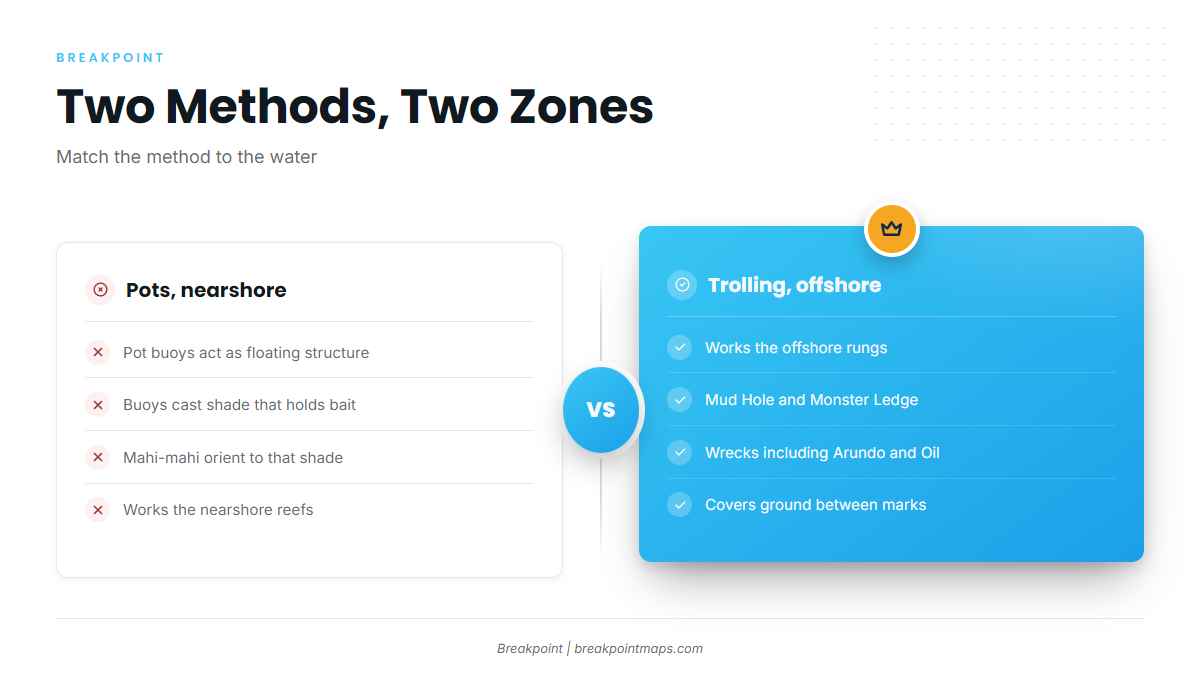
Two methods cover the water between the inlet and the offshore grounds.
Pots nearshore
Pot buoys act as floating structure. They throw shade, shade holds bait, and mahi-mahi orient to both. Locally, that means working the pots near the nearshore reefs above.
Trolling offshore
Trolling is how boats work the offshore grounds: the Mud Hole, Monster Ledge and the wrecks. A run that mixes mahi-mahi with other targets also overlaps with other offshore gamefish on the same run.
Who fishes mahi-mahi out of Point Pleasant Beach
Three local charters list mahi-mahi:
- Jenn-A Fishing Charters, Captain Adrian McElroy
- SeaOwl Fishing Charters
- Blue Chip Sportfishing
FAQ about mahi-mahi fishing out of Point Pleasant Beach
When is mahi-mahi season out of Point Pleasant Beach?
Late summer. Timing shifts from year to year, so use it as the window to start looking rather than a guarantee.
How far offshore do I need to go for mahi?
It depends on the method. Pots work the nearshore water off the inlet reefs. Trolling takes you out to the Mud Hole, Monster Ledge and the wrecks.
Which reef is closest to Manasquan Inlet?
Manasquan Inlet Reef, at 67 to 74 ft, is the first ground outward from the inlet and the nearest named reef in this list.
What are the Arundo Wreck coordinates?
40 10.399 N, 73 40.980 W. Chart layers are not for navigation, so cross-check the position on an official chart.
Can I book a charter for mahi out of Point Pleasant Beach?
Yes. Jenn-A Fishing Charters, SeaOwl Fishing Charters and Blue Chip Sportfishing all list mahi-mahi.
Where do I check conditions before running out?
Use the official NWS marine forecast. Read wind in knots, wave height in feet and period in seconds, and decide from the numbers.