When striped bass are here
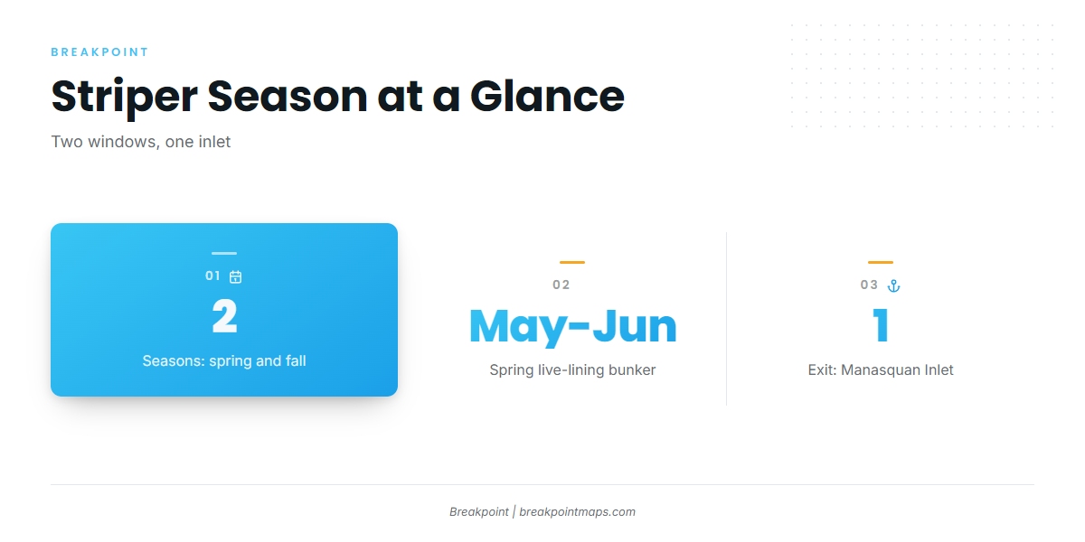
Striped bass fishing out of Point Pleasant Beach runs in two windows: spring, in May and June, and fall. Every boat reaches the grounds through Manasquan Inlet. For the biology and the coastwide migration, see the striped bass fishing guide, and the Atlantic Northeast picture (see also the Atlantic Northeast region guide) places this port in the wider run.
| Window | Months | What defines it |
|---|---|---|
| Spring | May and June | Live-lining bunker |
| Fall | Second window | Stripers again work the grounds off the inlet |
Spring: May and June bunker
In May and June, stripers here are fished by live-lining bunker, the bait the spring fishery is built on. The MRMTC Spring Striped Bass Tournament, usually held in May, falls in the same window.
Fall
Fall is the second window. It is a separate run from spring and is fished off the same inlet.
Running out of Manasquan Inlet
Point Pleasant Beach boats reach every ground in this article through Manasquan Inlet. Before the inlet run, read the official marine forecast for wind, wave height and period, and make your go or no-go call from the numbers. The grounds below run outward from the inlet.
- Wind: check speed and direction for both departure and return
- Wave height: read the forecast figure for the coastal waters
- Period: read it alongside wave height rather than on its own
Grounds and structure
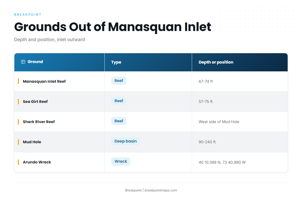
Grounds are described here by depth and position. The table lists those with published numbers.
| Ground | Type | Depth or position |
|---|---|---|
| Manasquan Inlet Reef | Reef | 67-74 ft |
| Sea Girt Reef | Reef | 57-75 ft |
| Shark River Reef | Reef | West side of the Mud Hole |
| Mud Hole | Deep basin | 90-240 ft, flats to deepest point |
| Arundo Wreck | Wreck | 40 10.399 N, 73 40.980 W |
Inlet-area reefs: Manasquan Inlet, Sea Girt, Axel Carlson
Manasquan Inlet Reef sits in 67-74 ft, and Sea Girt Reef runs 57-75 ft. Axel Carlson Reef is the third reef in the inlet area.
Mud Hole and Shark River Reef
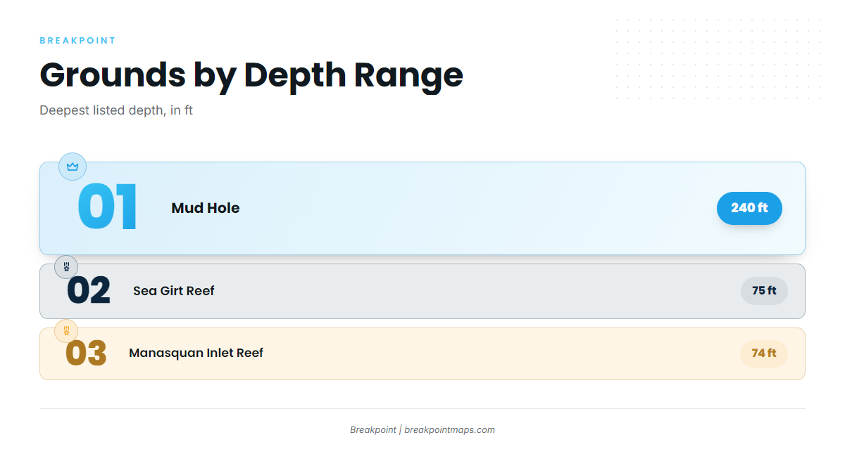
The Mud Hole runs 90-240 ft, from the flats to the deepest point. Shark River Reef sits on its west side. The deeper water also holds other species, covered in the coastal and offshore gamefish guides.
Monster Ledge and the wrecks: Arundo, Oil Wreck
Monster Ledge is named bottom structure that local boats fish. The Arundo Wreck is at 40 10.399 N, 73 40.980 W, and the Oil Wreck is the other named wreck.
You can plot the Arundo position and the reef depths above against the Chart Contours layer in Breakpoint. Chart layers are not for navigation, so use official charts and your plotter for the run.
How striped bass are fished here
Live-lining bunker is the local method, tied to the May and June window.
Live-lining bunker
Fish Monger lists live-lining bunker as how spring fish are worked out of this port. The Fish Monger Charters fishing trips page has the operator’s own description.
Who fishes for them out of this port
The local striped bass fleet consists of charters and a spring tournament.
Charters
These charters list striped bass:
- Fish Monger Charters: Capt. Jerry. Fish Monger II and III are named on the site.
- Little Mule Sport Fishing Charters: the boat is Little Mule. Cort Dalik is named in the site’s contact block.
- Parker Pete’s Fishing Charters: Captain Pete Sykes, with USCG-licensed captains and crew per the site.
- Jenn-A Fishing Charters: Captain Adrian McElroy, with crew per the site.
- SeaOwl Fishing Charters: listed for striped bass.
- Blue Chip Sportfishing: listed for striped bass.
MRMTC Spring Striped Bass Tournament
The MRMTC Spring Striped Bass Tournament is usually held in May, inside the spring bunker window.
FAQ: striped bass out of Point Pleasant Beach
When is striped bass fishing out of Point Pleasant Beach best?
Spring and fall. In spring, May and June is the live-lining bunker window. Fall is the second run. All trips go out through Manasquan Inlet.
What depth is Manasquan Inlet Reef?
Manasquan Inlet Reef sits in 67-74 ft. Sea Girt Reef, the next reef over, runs 57-75 ft.
Where is Shark River Reef?
Shark River Reef is on the west side of the Mud Hole, which runs 90-240 ft from the flats to the deepest point.
What are the Arundo Wreck coordinates?
The Arundo Wreck is at 40 10.399 N, 73 40.980 W. Chart layers are not for navigation, so verify the position against your official charts.
When is the MRMTC Spring Striped Bass Tournament?
It is usually held in May. Local charters that list striped bass include Fish Monger, Jenn-A and Parker Pete’s.