The Port and How Boats Run From Ocean Isle Beach
This guide covers vermilion snapper fishing out of Ocean Isle Beach, North Carolina, for anglers running their own boats. Locals call them beeliners. Boats leave through three Brunswick County inlets: Shallotte Inlet, Lockwood Folly Inlet and Little River Inlet, which sits at the North Carolina and South Carolina line. Each site below is referenced to one of them. Ramps, inlets and the rest of the port picture are on the Ocean Isle Beach port page. For the wider coast, see the vermilion snapper fishing in the Atlantic Southeast and the Atlantic Southeast offshore fishing guide.
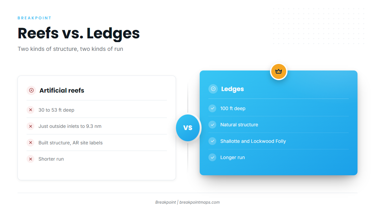
The artificial reefs run from just outside the inlets to about 9.3 nm, at depths of 30 to 53 ft. The ledges sit at 100 ft. That leaves two basic runs:
- A short run to a 30 to 38 ft reef just outside an inlet
- A longer run to the 100 ft ledges off Shallotte Inlet or Lockwood Folly Inlet
When the Vermilion Are Around
Timing, spawning and biology are covered in the vermilion snapper guide. No months are listed here, because the agency sets the open and closed harvest periods. The Regulations section below points to it.
Grounds and Structure off Ocean Isle Beach
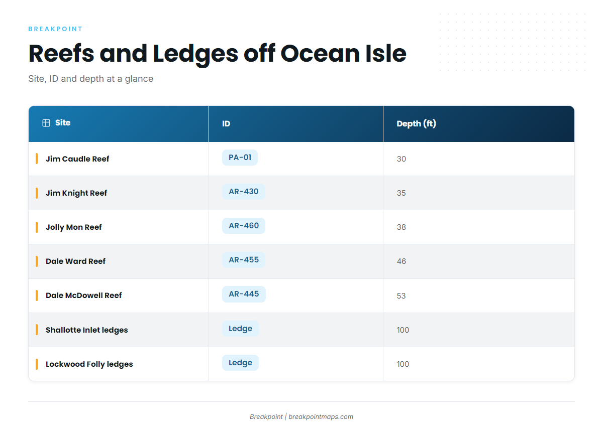
The AR numbers are site labels in the North Carolina artificial reef program. The NC Division of Marine Fisheries reef guide lists the IDs and positions. Jim Caudle Reef carries a PA designation instead.
The sites fall into two types: artificial reefs at 30 to 53 ft and natural ledges at 100 ft. For the wider reef fish picture, see the reef fish guides.
| Site | ID | Depth (ft) | Reference point |
|---|---|---|---|
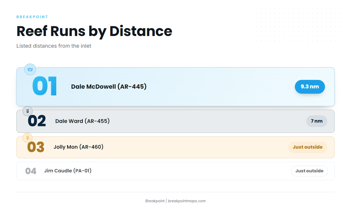
| Jolly Mon Reef | AR-460 | 38 | Just outside Shallotte Inlet |
| Dale Ward Reef | AR-455 | 46 | About 7 nm from Shallotte Inlet |
| Dale McDowell Reef | AR-445 | 53 | About 9.3 nm from Lockwood Folly Inlet |
| Jim Knight Reef | AR-430 | 35 | |
| Brunswick County Fishing Club Reef | AR-440 | ||
| Jim Caudle Reef | PA-01 | 30 | Just outside Little River Inlet |
| Shallotte Inlet ledges | 100 | ||
| Lockwood Folly Inlet ledges | 100 |
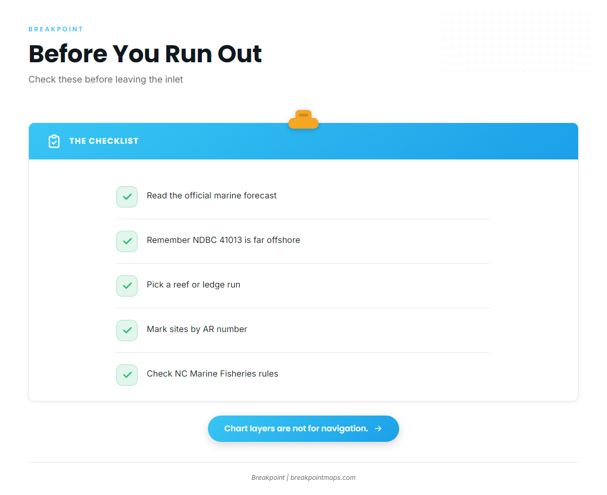
You can mark the AR sites and ledges against the Chart Contours layer. Chart layers are not for navigation.
Shallotte Inlet: Jolly Mon (AR-460), Dale Ward (AR-455) and the Ledges
This inlet offers the full range of runs, from a reef just outside the inlet to the 100 ft ledges.
- Jolly Mon Reef (AR-460): 38 ft, just outside Shallotte Inlet. One vendor list calls it Fisherman’s Reef, so match the two names by AR number.
- Dale Ward Reef (AR-455): 46 ft, about 7 nm from Shallotte Inlet.
- Shallotte Inlet ledges: 100 ft.
Lockwood Folly Inlet: Dale McDowell (AR-445) and the Ledges
- Dale McDowell Reef (AR-445): 53 ft, about 9.3 nm from Lockwood Folly Inlet. It is the farthest reef run listed.
- Lockwood Folly Inlet ledges: 100 ft.
Little River Inlet: Jim Caudle Reef (PA-01)
Jim Caudle Reef sits at 30 ft, just outside Little River Inlet at the state line, making it the shallowest site listed. The PA-01 label is a different designation from the AR sites.
Other Brunswick County Reefs: Jim Knight (AR-430) and Brunswick County Fishing Club (AR-440)
- Jim Knight Reef (AR-430): 35 ft.
- Brunswick County Fishing Club Reef (AR-440).
How Vermilion Are Fished Here, and Who Fishes Them
Locals bottom fish on structure with live or dead baits, on both the artificial reefs and the 100 ft ledges. Most of the fleet is anglers running their own boats out of Shallotte Inlet, Lockwood Folly Inlet and Little River Inlet.
The nearest NOAA buoy, NDBC 41013 Frying Pan Shoals (33.44 N, 77.76 W), is far offshore. Its wind and wave readings describe that water, not Shallotte Inlet, Little River Inlet or the nearshore reefs. Read the NWS Wilmington marine forecast before the run.
FAQ: Vermilion Snapper off Ocean Isle Beach
Which reef is closest to Shallotte Inlet?
Jolly Mon Reef (AR-460), 38 ft, just outside the inlet. Dale Ward (AR-455) is next, at 46 ft and about 7 nm.
How deep are the ledges for vermilion snapper fishing out of Ocean Isle Beach?
The Shallotte Inlet and Lockwood Folly Inlet ledges sit at 100 ft, deeper than the 30 to 53 ft artificial reefs.
What method do local anglers use?
Bottom fishing on structure with live or dead baits, from their own boats.
Are Fisherman’s Reef and Jolly Mon Reef the same site?
Yes. Jolly Mon Reef (AR-460) appears as Fisherman’s Reef in one vendor list. Match by AR number.
Does NDBC 41013 show nearshore conditions?
No. Frying Pan Shoals (33.44 N, 77.76 W) is far offshore. Check the official marine forecast for the inlets and nearshore reefs.
Where are the rules?
On the North Carolina regulations page. Check it before fishing.