Blackfin tuna fishing out of Ocean Isle Beach runs year-round along the Gulf Stream break, with boats fishing the 30-fathom break and going past 60 miles to the Stream edge. This page covers the run from Ocean Isle Beach, the structure on the way out, how local boats troll, and who fishes for blackfin. Biology and the wider picture are in our blackfin tuna guide.
When blackfin are off Ocean Isle Beach and how far boats run
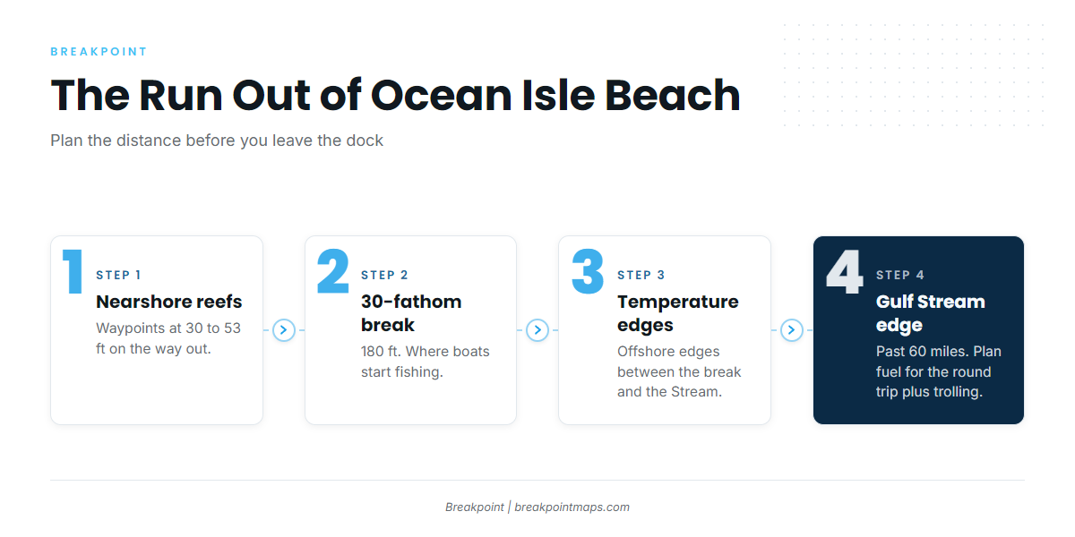
Blackfin are a year-round target here, along the Gulf Stream break. How the Stream sets up along the Southeast coast (see also the Atlantic Southeast fishing guide) from Florida to Cape Hatteras applies to this port too, though from here the Stream edge is a long way out. The run is the main planning problem, so the distances come first.
Year-round on the break
The season is year-round along the Gulf Stream break, and we print no monthly peaks. The water matters more than the calendar, so the useful question is where the offshore temperature edges sit on the day you go.
The 30-fathom break
Boats start fishing at the 30-fathom break, which is 180 ft. The nearshore reefs, at 30 to 53 ft, are waypoints on the way out.
The Chart Contours layer draws the 30-fathom line. Chart layers are not for navigation.
Past 60 miles to the Gulf Stream edge
Ocean Isle Fishing Center’s 12-hour trolling run goes past 60 miles offshore to the Gulf Stream edge. Treat that as a planning number, since range, fuel and the return run all follow from it. Plan fuel for the round trip plus the hours you spend trolling, and size the trip to the boat you run.
Between the break and the Stream, boats look along offshore temperature edges, which is where the run turns into fishing.
Reading conditions: NDBC 41013
The nearest NOAA buoy is NDBC 41013 Frying Pan Shoals, at 33.44 N, 77.76 W. It sits far offshore and does not report conditions at the inlet or in the nearshore water. Read wind, wave height and period as numbers, then check the official NWS marine forecast before the run.
Grounds and structure from Shallotte Inlet offshore
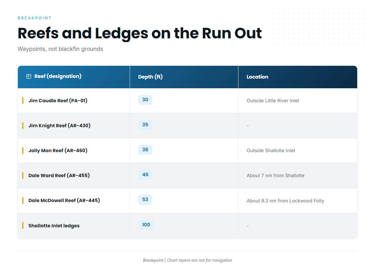
These reefs and ledges are waypoints on the run out, not blackfin grounds. Chart layers are not for navigation.
| Reef (designation) | Depth (ft) | Location or distance |
|---|---|---|
| Jim Caudle Reef (PA-01) | 30 | Just outside Little River Inlet |
| Jim Knight Reef (AR-430) | 35 | – |
| Jolly Mon Reef (AR-460) | 38 | Just outside Shallotte Inlet |
| Dale Ward Reef (AR-455) | 46 | About 7 nm from Shallotte Inlet |
| Dale McDowell Reef (AR-445) | 53 | About 9.3 nm from Lockwood Folly Inlet |
| Brunswick County Fishing Club Reef (AR-440) | – | – |
| Shallotte Inlet ledges | 100 | – |
| Lockwood Folly Inlet ledges | 100 | – |
Jolly Mon Reef appears as "Fisherman’s Reef" in one vendor list, so check both names when you build waypoints.
Inlet ledges at 100 ft
The Shallotte Inlet and Lockwood Folly Inlet ledges sit at 100 ft, deeper than every artificial reef in the table. Use them as route reference points between the nearshore reefs and the 30-fathom break at 180 ft.
How blackfin are fished from Ocean Isle Beach
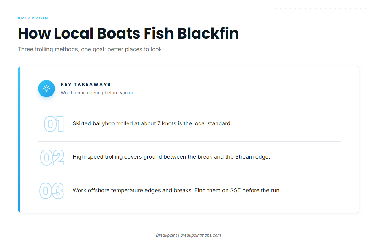
Local boats troll. The three methods are:
- Skirted ballyhoo at about 7 knots
- High-speed trolling to cover ground
- Working temperature breaks to decide where to start
Skirted ballyhoo at about 7 knots
This is the standard local troll, run at about 7 knots.
High-speed trolling
High-speed trolling covers water on a long run, when the fish could be anywhere between the break and the Stream edge. For other species and tactics, see the other tuna species and tactics pages.
Working temperature breaks
Boats work offshore temperature edges and breaks. Find them on the OBS SST layer before you run, then pick where to start trolling. The layer helps you decide where to look, but it does not guarantee fish.
Who fishes blackfin out of Ocean Isle Beach
Two local operators list blackfin tuna.
| Operator | Boats | Notable trip |
|---|---|---|
| Ocean Isle Fishing Center (Capt. Brant’s Fishing Adventures, Inc.) | 33-ft World Cat / Carolina Cat; 22-ft Get Busy; 22-ft Tiberias | 12-hour trolling run past 60 miles to the Gulf Stream edge |
| Rigged & Ready Charters | 33-ft Onslow Bay (twin 350 Mercury); 35-ft Contender (triple 300 Verado) | – |
The operator’s own page is at Ocean Isle Fishing Center charters. If you want to see the run before taking your own boat, a trip with a local crew shows you the distance and the water firsthand.
FAQ: blackfin tuna out of Ocean Isle Beach
Is there a season for blackfin tuna fishing out of Ocean Isle Beach?
Blackfin tuna fishing out of Ocean Isle Beach is year-round along the Gulf Stream break. The location of the offshore temperature edges matters more than the calendar.
How far is the run to the blackfin?
Boats run to the 30-fathom break (180 ft) and offshore temperature edges. Ocean Isle Fishing Center’s 12-hour trolling run goes past 60 miles offshore to the Gulf Stream edge.
Where do boats start fishing?
Boats start at the 30-fathom break. The artificial reefs and the 100-ft inlet ledges are waypoints on the way out, not blackfin grounds.
What speed do local boats troll?
Skirted ballyhoo is trolled at about 7 knots. Boats also use high-speed trolling to cover ground on the long run.
Which buoy covers this water?
NDBC 41013 Frying Pan Shoals, at 33.44 N, 77.76 W. It is far offshore and does not report conditions at the inlet, so check the official marine forecast before you go.
Who runs blackfin charters here?
Ocean Isle Fishing Center and Rigged & Ready Charters both list blackfin tuna.