When wahoo are around Venice
Venice sits on the Gulf coast of Sarasota County. The general wahoo picture, including when the fish show and how they are caught, is in our wahoo fishing guide. For the Gulf-wide picture, see wahoo in the Gulf (see also the Gulf of Mexico offshore fishing guide).
Wahoo fishing out of Venice is an offshore pelagic run made after bottom fishing the reefs. Boats leave Venice Inlet, work the artificial reefs first, then push into open water in the Gulf of America (Gulf of Mexico). This page covers the run pattern, the positioned reefs, the station to read for conditions, and where the rules change. It shows where to look and makes no promise about fish.
How far boats run from Venice Inlet
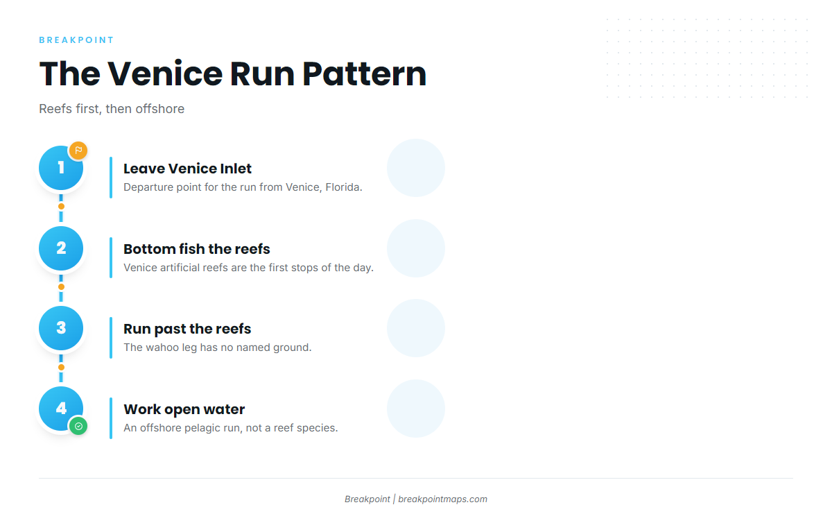
Venice Inlet is the departure point. The Venice port guide covers the inlet, ramps and marinas.
Reefs first, then offshore
Boats bottom fish the Venice artificial reefs first, then make the offshore pelagic run. The wahoo leg has no named ground; it is open water past the reefs.
Wahoo here are an offshore add-on rather than a reef species. The farthest positioned reef on this page, M-9, is 15.5 nm from the New Pass Gulf marker.
Who runs for wahoo here
Own-boat anglers run this pattern, such as Sarasota County reef fishermen who bottom fish the reefs and extend the day offshore. Other species share the reef-then-offshore day, and the offshore gamefish guides cover them.
Reefs and structure near Venice
These sites are the bottom-fishing stops before the run, not wahoo grounds. They are listed below from nearshore to farthest out.
Positioned sites
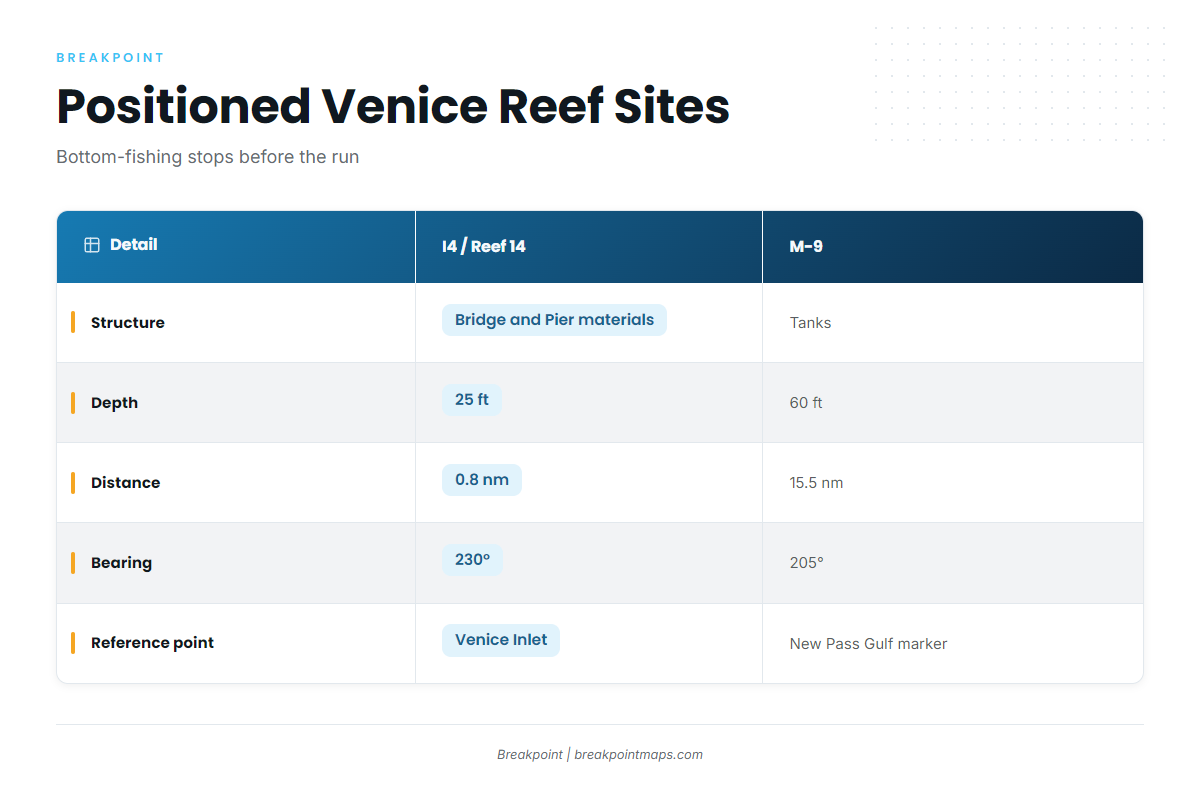
| Site | Structure | Depth | Distance | Bearing | Reference point |
|---|---|---|---|---|---|
| Venice Reef Site I4 / Reef 14 | Venice Bridge and Pier materials | 25 ft | 0.8 nm | 230° | Venice Inlet |
| M-9 | Tanks | 60 ft | 15.5 nm | 205° | New Pass Gulf marker |
Swipe the table sideways to see every column.
M-9’s bearing is referenced to the New Pass Gulf marker, not Venice Inlet, so re-plot it from the inlet before a run from Venice.
Venice reef sites
- Venice Reef Sites 1 and 2: old bridge materials and concrete rubble
- Venice Reef V-1 to V-5: limestone boulders
M-series reefs
- M-10: upside-down barge and sailboat hulls
- M-11: reef balls
- M-13: concrete culverts, sites 1 to 5
- M-15a and M-15b: culverts and rubble
These reefs can be viewed on the Chart Contours layer. Chart layers are not for navigation.
Reading conditions at VENF1
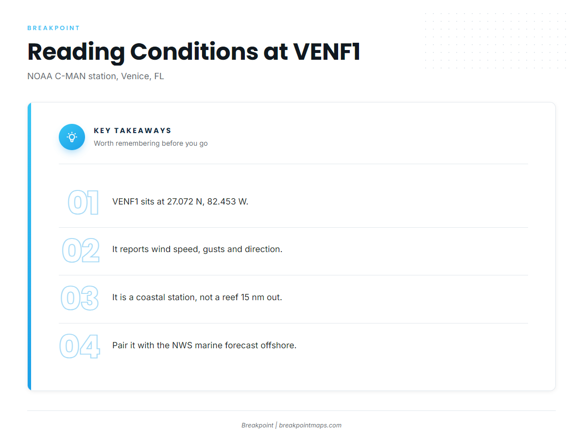
NOAA C-MAN station VENF1 (Venice, FL) sits at 27.072 N, 82.453 W and reports wind speed, gusts and direction.
- Station type: coastal. Its readings describe the coast, not a reef 15 nm out.
- Offshore picture: read the official NWS marine forecast for the area.
FAQ: wahoo fishing out of Venice
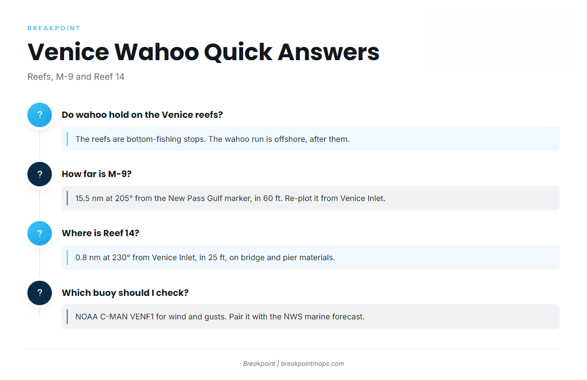
Do wahoo hold on the Venice reefs?
The reefs are bottom-fishing stops. Wahoo fishing out of Venice is an offshore pelagic run made after them, and no wahoo ground is named.
How far is M-9?
M-9 is 15.5 nm at 205° from the New Pass Gulf marker, in 60 ft, on tanks. Re-plot it from Venice Inlet before you run.
Where is Reef 14?
Venice Reef Site I4 / Reef 14 is 0.8 nm at 230° from Venice Inlet, in 25 ft. It is built from Venice Bridge and Pier materials.
Which buoy should I check?
Check NOAA C-MAN VENF1 at 27.072 N, 82.453 W for wind speed, gusts and direction. It is coastal, so pair it with the NWS marine forecast.
When is wahoo season?
Season timing is in the wahoo species guide and the Gulf guide linked in the first section. This page gives no months.