
About Mission Bay
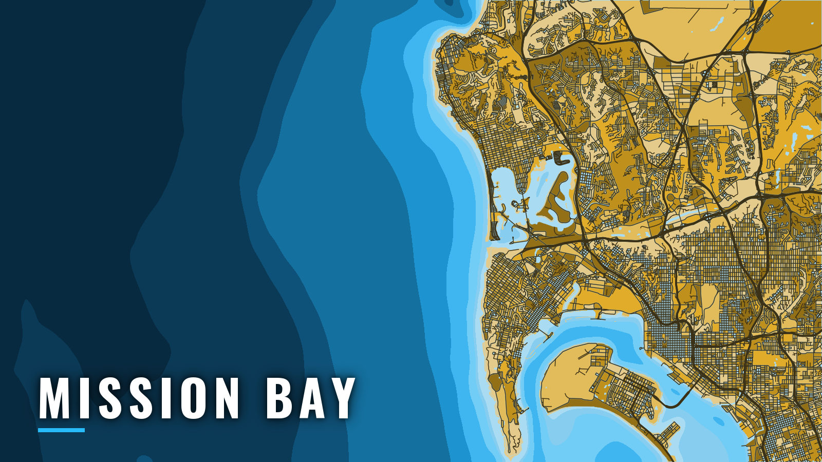
Mission Bay is a city-run small-craft harbor on the California coast. It has its own jettied entrance 5.5 miles north of Point Loma and is separate from San Diego Bay. It sits on the open coast between Point Loma and Oceanside Harbor.
Offshore access runs through the entrance channel into the Pacific, in the Gulf of Santa Catalina. Public ramps and a fuel dock serve private boats inside the bay.
The fishing season runs year-round. Groundfish and kelp species tend to run in the cool months, and pelagics tend to run in summer and autumn. Anglers here target yellowtail, bluefin tuna, yellowfin tuna, dorado, barracuda, bass and rockfish, the same mix covered in our Pacific Southwest fishing guide.
Access and navigation
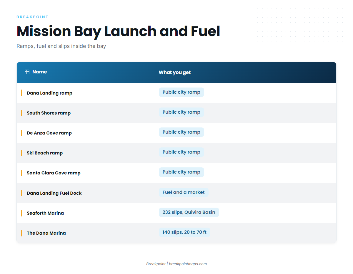
Private boats launch and fuel inside Mission Bay and reach the ocean through one channel.
Ramps, fuel and marinas
- Dana Landing ramp – public city ramp next to the fuel dock.
- South Shores ramp – public city ramp.
- De Anza Cove ramp – public city ramp.
- Ski Beach ramp – public city ramp.
- Santa Clara Cove ramp – public city ramp, also listed as San Juan Cove.
- Dana Landing Market and Fuel Dock – fuel and a market, next to the Dana Landing ramp.
- Seaforth Marina – 232 slips in Quivira Basin, minutes from the entrance channel.
- The Dana Marina – 140 slips for boats 20 to 70 ft.
Inside the bay
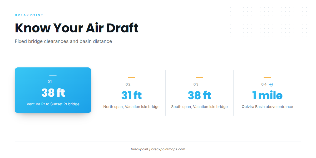
Quivira Basin is entered about 1 mile above the entrance. Two fixed highway bridges cross the bay, with clearances below.
| Bridge | Clearance |
|---|---|
| Ventura Point to Sunset Point, above the entrance | 38 ft |
| Vacation Isle to Crown Point and Dana Landing, north span | 31 ft |
| Vacation Isle to Crown Point and Dana Landing, south span | 38 ft |
If your tower or outriggers sit near those numbers, confirm your air draft before you leave the slip or ramp.
The entrance
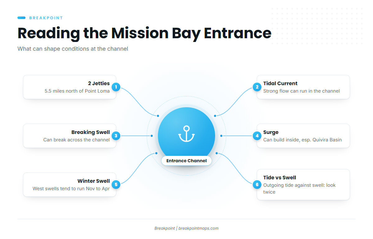
The entrance runs between 2 jetties, 5.5 miles north of Point Loma. According to the NOAA U.S. Coast Pilot 7, the bay holds a large volume of water that funnels in and out of one narrow channel with each tide change. During large tidal flow, a strong current can run in the channel.
Large swells from virtually any direction, in any season, can break across the entrance channel. With a big sea outside, heavy surge might develop inside the bay, especially in Quivira Basin, which slip holders should keep in mind.
Seas along the Gulf of Santa Catalina tend to get choppy from November through April, when distant storms send west swells. Swells of 6 ft or more occur about 2 to 5% of the time, and winter swells occasionally exceed 9 ft.
Be most cautious when an outgoing tide runs against incoming swell. The channel carries both forces through one narrow gap, so conditions there can build faster than the open water outside suggests.
The alternative approach and the forecast check
If the entrance looks bigger than you want, you can run out the San Diego Bay entrance and around Point Loma instead.
Look at the water when you arrive and check the official forecast. The NWS San Diego Coastal Waters Forecast covers San Mateo Point to the Mexican border. NDBC buoy 46232, Point Loma South, reports wave height and period, and City of San Diego Lifeguard Services is another source for conditions. A forecast is only a forecast, and a buoy reads a single point, so if the water looks bigger than you want, switch approaches.
Fishing conditions
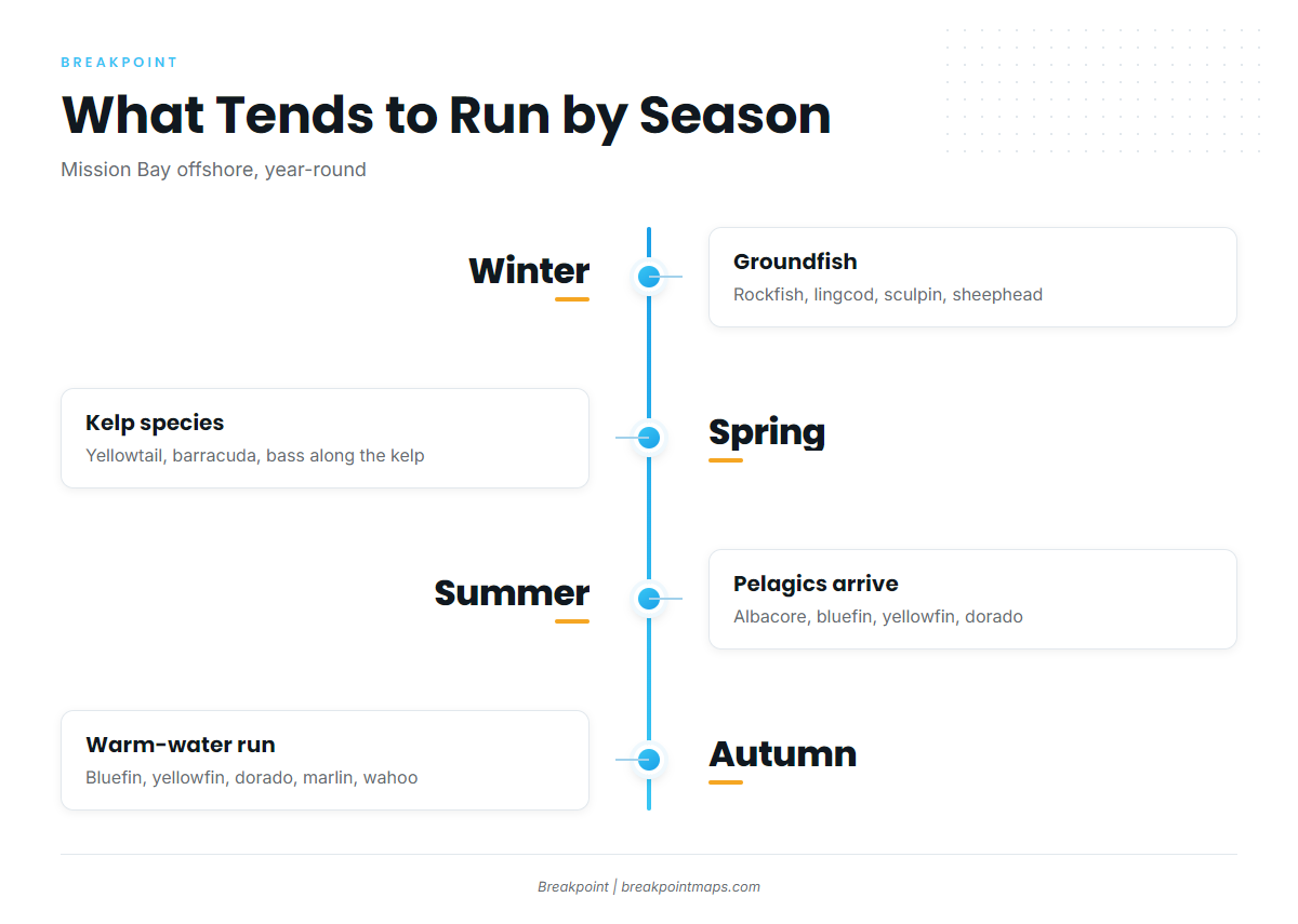
Offshore out of Mission Bay, the grounds and the species change with the seasons and with water temperature.
Named grounds
- Point Loma kelp beds
- La Jolla kelp beds
- La Jolla Canyon
- 9 Mile Bank
- 425 Bank
- Yukon shipwreck, outside Mission Beach
- NEL Tower, off Mission Beach
The La Jolla and Point Loma kelp beds hold yellowtail along with barracuda and bass. The Coronado Islands lie in Mexican waters, and fishing there requires separate Mexican permits.
Warm-water species follow temperature breaks, so where they sit shifts with the water from year to year.
Winter
Rockfish, lingcod, sculpin and sheephead tend to run in winter. Rockfish rules in the Southern Management Area change by season and depth, so check the CDFW groundfish regulations summary before fishing. Plan around the November to April west swell window described in the entrance section.
Spring
Yellowtail, barracuda and bass tend to run along the kelp in spring.
Summer
Yellowtail, barracuda and bass stay in the mix. Albacore, bluefin tuna, yellowfin tuna, bigeye tuna, skipjack tuna and dorado tend to join them.
OBS SST and Chlorophyll in Breakpoint show where the temperature edges sat on the last clear pass. Cloud can block a pass, and chart layers are not for navigation.
Autumn
Bluefin tuna, yellowfin tuna, dorado, yellowtail, striped marlin and wahoo tend to run in autumn. The regional bluefin tuna pattern holds from late summer into the fall.