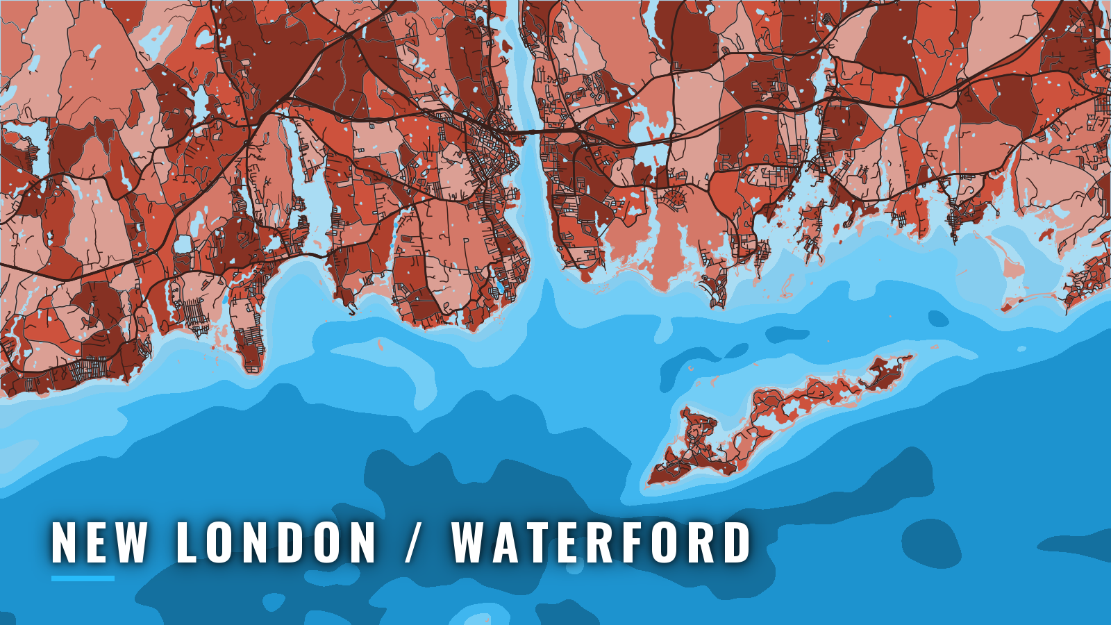

About New London / Waterford
This guide covers the Thames River port near the east end of Long Island Sound in Connecticut, with Fishers Island Sound and Block Island Sound to the east. Boats fish eastern Long Island Sound, The Race, Fishers Island, Block Island Sound and the Montauk area. The eastern Long Island Sound and the wider Northeast guide covers that water more broadly.
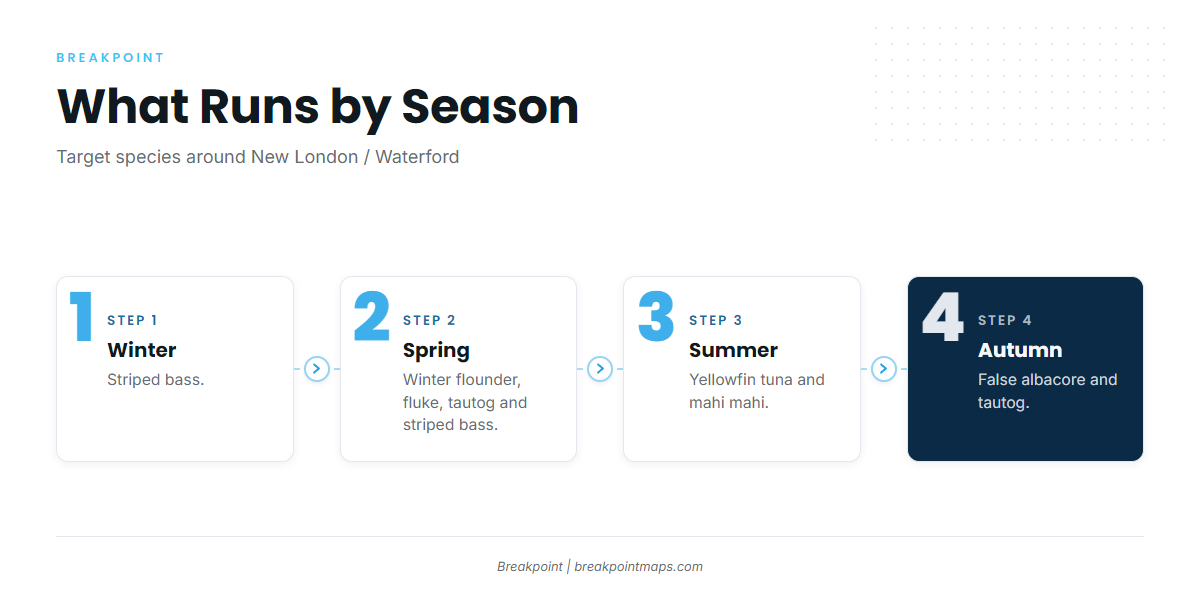
Striped bass are the winter target. Winter flounder, fluke, tautog and striped bass run in spring, yellowfin tuna and mahi mahi in summer, and false albacore and tautog in autumn. The sections below cover where to launch, how the entrance and approaches behave, where to read conditions, and what runs by season.
Access and navigation
Two public access points serve the port:
- Thames River Boat LaunchConnecticut DEEP public ramp on the Thames in New London.
- Burr’s MarinaNew London Harbor marina on the Thames, fuel listed.
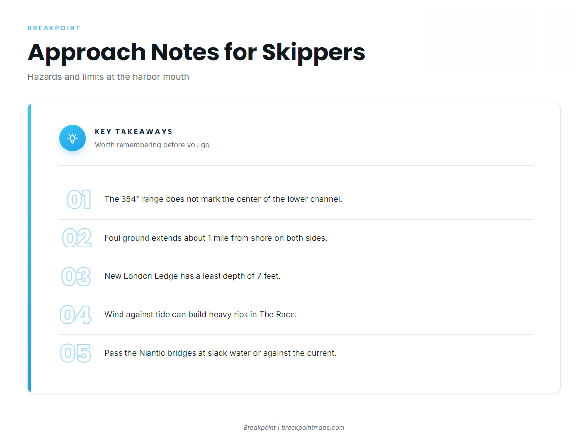
The main entrance channel runs from deep water in the Sound into the harbor. It is marked by lighted and unlighted buoys and a 354° lighted range, though the range does not mark the center of the lower end of the channel. Foul ground extends about 1 mile from shore on both sides of the approach. It includes New London Ledge, with a least depth of 7 feet, and the area off Goshen Point. New London Ledge Light is the landmark to look for. Every navigation figure on this page traces to NOAA Coast Pilot 2, Chapter 8.
Submarine operating areas lie in the harbor approaches, and submarine security zones are established in the harbor. A restricted area sits off the Naval Submarine Base, about 2.5 miles above New London. Commercial traffic carries petroleum products, chemicals and seafood, and car-passenger ferries run to Block Island, Fishers Island and Orient Point.
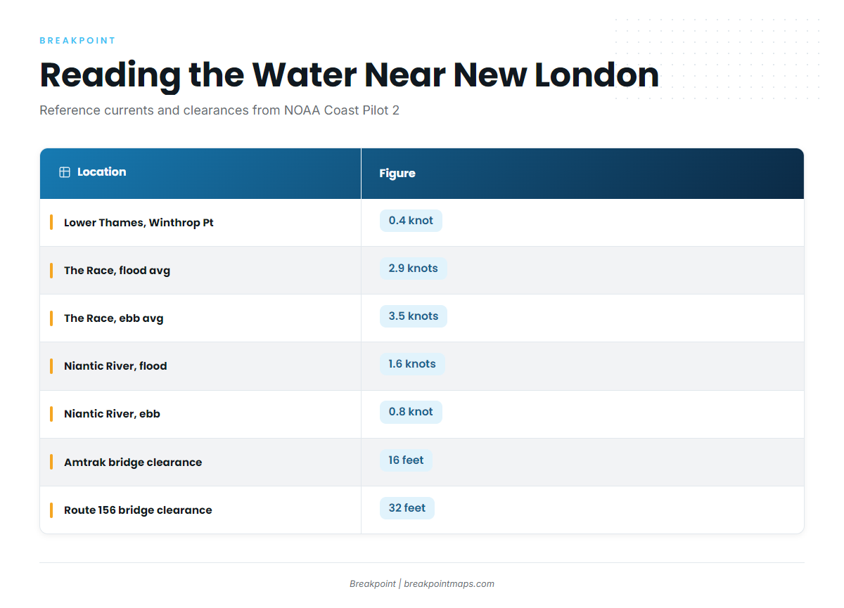
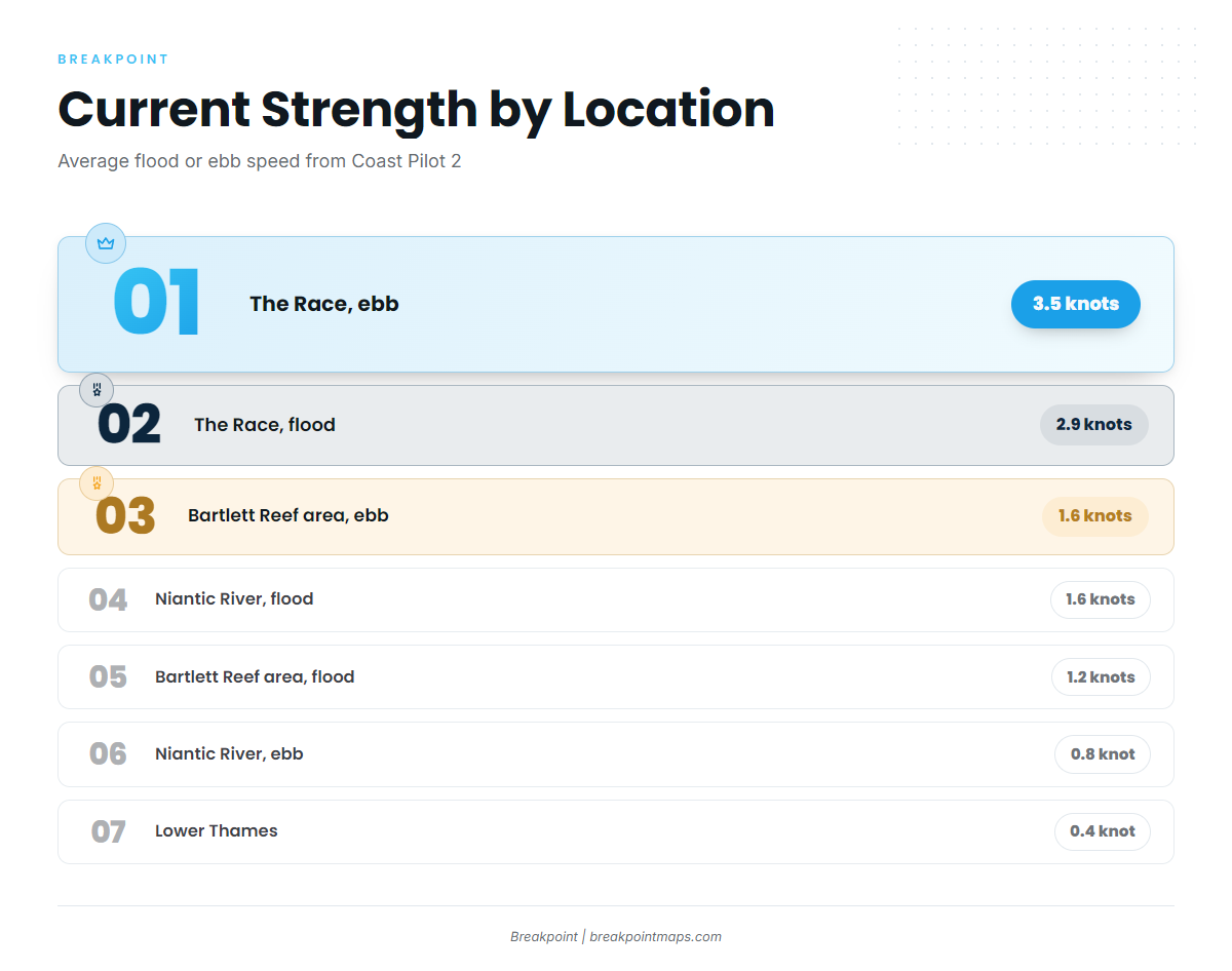
Currents in the lower Thames follow the channel and are usually weak, about 0.4 knot at Winthrop Point. During freshets, or with a north wind and a high river, the Thames can set considerably south even on the flood. Along the north shore the current turns 30 to 90 minutes earlier than in mid-Sound. About 1.5 miles east-southeast of Bartlett Reef, the flood runs 1.2 knots setting 285° and the ebb runs 1.6 knots setting 062°.
The Race is much stronger water. According to Coast Pilot 2, Chapter 7, the flood averages 2.9 knots and the ebb 3.5 knots. Strong rips run except for about half an hour at slack water, and they tend to be heaviest with wind against tide.
Pine Island Channel is the alternative approach east. It lies northeast of New London Ledge Light and leads toward Fishers Island Sound. The bottom is rocky and very broken, with a least depth of 9 feet, but the channel gives a different route east than the open Sound.
On the Waterford side, the Niantic River is entered through a dredged channel from Niantic Bay. A narrow passage beyond it is crossed by two bascule bridges:
- Amtrak, with 16 feet of clearance
- Route 156, with 32 feet of clearance
Currents through the bridges run 1.6 knots on the flood and 0.8 knot on the ebb, and much greater velocities are reported in storms and freshets. Coast Pilot cautions strangers to pass the bridges at slack water or against the current. A 6 mph speed limit is enforced on the river.
NDBC station LDLC3 observations report conditions at New London Ledge Light, at the harbor mouth, not at the Race. The NWS marine forecast linked from the station page is a forecast, and conditions on the water might differ from it. Check the water and the NOAA marine forecast on arrival, and if conditions look bigger than you want, switch approaches or stay inside.
Fishing conditions
The named grounds sit along one line of travel. The Race lies at the east end of Long Island Sound. Fishers Island and Watch Hill Reefs lie toward Fishers Island Sound. Nebraska Shoals, Endeavor Shoals and the Block Island windmills lie east in Block Island Sound, and Montauk sits farther out.
Connecticut DEEP sets size, bag and season limits, and the Commissioner adjusts them by declaration. DEEP limits apply to any fish you possess on Connecticut waters, wherever it was caught. Check the Connecticut DEEP species regulations and the DEEP Commissioner declarations before you fish. Black sea bass is among the species DEEP regulates in these waters, and the black sea bass guide covers the fish itself.
Winter
Striped bass is the winter target. Species detail is in the striped bass guide.
Spring
Winter flounder, fluke, tautog and striped bass run in spring. Tautog rules are season-specific, so confirm the open periods with DEEP before you go.
Summer
Yellowfin tuna and mahi mahi are the summer targets. The yellowfin tuna guide covers the species, and yellowfin in the Northeast covers the region. Tuna trips run beyond the Sound, toward Block Island Sound and Montauk. Federal HMS permits apply to tunas.
Autumn
False albacore and tautog are the autumn targets. For the wider tuna picture beyond the Sound, see bluefin tuna, bluefin in the Northeast, bigeye tuna and bigeye in the Northeast.
Before you choose between the Sound grounds and the run east, check the OBS SST and Chart Contours layers in Breakpoint. Chart layers are not for navigation.