
About Portsmouth
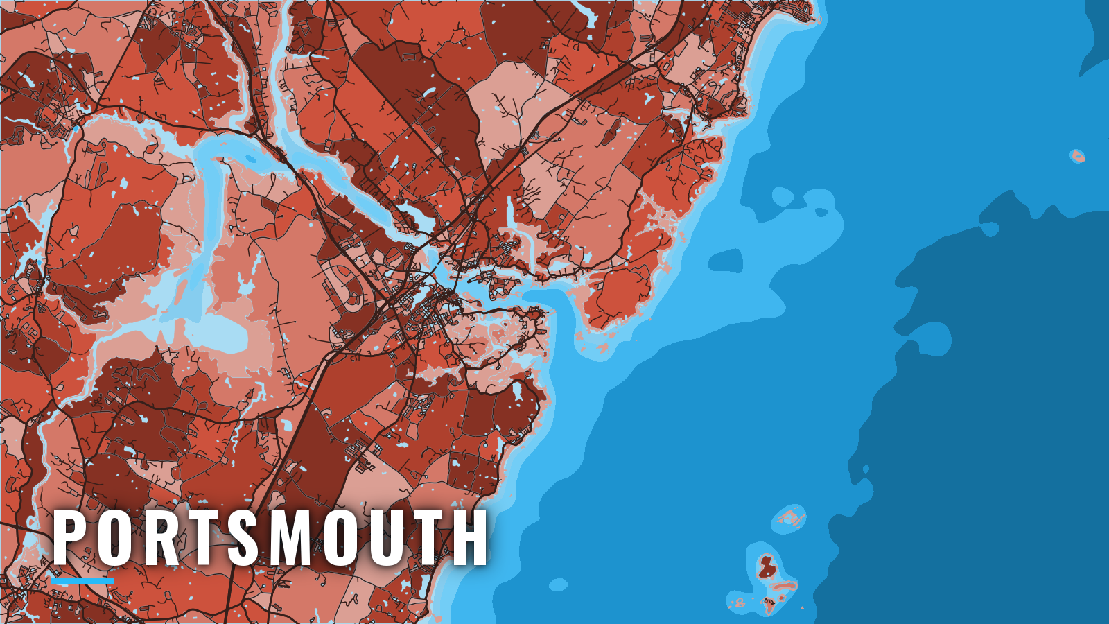
Offshore fishing out of Portsmouth, NH starts in Portsmouth Harbor, the lower reach of the Piscataqua River. The harbor is shared by Portsmouth, New Castle and Newington in New Hampshire and by Kittery, Maine, on the north bank, and it opens to the Atlantic at Bigelow Bight.
Anglers fish the river, the nearshore coast and the Isles of Shoals, about 5 to 6 miles offshore. Jeffreys Ledge sits farther out, and beyond the ledge is the Gulf of Maine proper.
The core season runs from spring to autumn. Targets include striper, bluefish, bluefin tuna, blue shark, Atlantic mackerel, haddock, cod, pollock and cusk. Striped bass fill the river and the nearshore water, while groundfish and tuna sit farther out.
Anyone 16 or older fishing from a private boat needs a New Hampshire saltwater fishing license. The rules for New Hampshire waters cover sizes, bags and seasons, and you should check them before fishing.
Access and navigation
Launch ramps and marinas sit on both the river and the Little Harbor side. The current governs launching, docking and the entrance, so read it after you pick a ramp.
Ramps and marinas
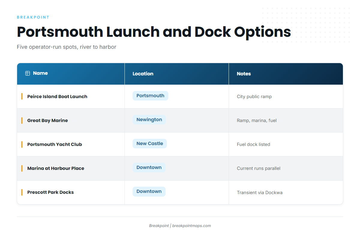
- Peirce Island Boat Launch – City of Portsmouth public boat ramp on the river side of downtown.
- Great Bay Marine – launch ramp and marina in Newington, with fuel listed.
- Portsmouth Yacht Club – New Castle, with a fuel dock listed.
- Marina at Harbour Place – downtown Portsmouth dockage, where the current runs parallel to the docks.
- Prescott Park Docks – city docks downtown, with overnight transient dockage reserved through Dockwa.
Current and entrance behavior
Tidal currents in the harbor and the river can be strong. The cove northwest of Fort Point can run counter to the harbor current for a period after slack water. Farther upriver, ebb currents average over 4 knots off Nobles Island and Dover Point. Plan your launch, your docking and your run out around the tide.
The entrance often behaves differently from the river behind it, and wind against the ebb can stand the channel up. The channel leads in on a lighted range bearing 352°45′ from Kittery Point. Oil tankers drawing up to 35 feet arrive frequently except in summer, and large vessels take a pilot and tug from the outer anchorage. Restricted areas and a security barrier surround parts of Seavey Island on the Kittery side. Arrange bridge openings on VHF 13. The U.S. Coast Pilot 1, Chapter 9 has the full description.
Hazards
Gunboat Shoal is rocky and covered 20 feet. It sits on the west side of the entrance, about 2.2 miles south of Whaleback Light. Rocks and ledges, some drying up to 5 feet, extend about 1.5 miles east of the light and up to 0.6 mile offshore.
Alternative approach: Little Harbor
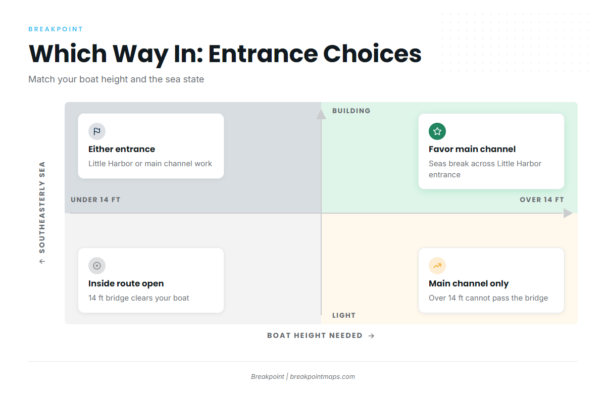
Little Harbor lies about 0.8 mile west of Whaleback Light and is entered between two breakwaters. In bad southeasterly weather the sea can break across the entrance.
A partly dredged thoroughfare under a fixed bridge with 14 feet of clearance links Little Harbor to Portsmouth Harbor. A boat that needs more than 14 feet cannot use the inside route, so Little Harbor is not an alternative for that boat from inside the river.
South of the entrance, the coast runs past Rye Harbor toward Hampton Harbor.
Reading conditions
Go by wind, wave height and period rather than a general description of the sea. The NWS marine forecast ANZ154 covers Cape Elizabeth to the Merrimack River out 25 NM. NDBC buoy 44098 on Jeffreys Ledge reports observed conditions, but it reads one point on the ledge, not the entrance.
When you arrive, look at the water and check the ANZ154 forecast. If the entrance looks bigger than you want, you can switch between the main entrance and Little Harbor, keeping the 14-foot bridge and the southeasterly caveat in mind.
Fishing conditions
Before you commit to the run, check buoy 44098 on Jeffreys Ledge along with the OBS SST and Chart Contours layers in the app. Chart layers are not for navigation.
Grounds
- Jeffreys Ledge – the farther offshore ground.
- Isles of Shoals – about 5 to 6 miles out.
Ledges surround most of the Isles of Shoals. Anderson Ledge uncovers 4 feet, is buoyed, and lies about 1 mile east-southeast of Isles of Shoals Light. A naval target area is centered on Shag Rock off the east side of Duck Island. Debris from jet-assist take-off racks is reported on the bottom within 6.7 miles seaward of the light, which matters if you drop gear to the bottom.
State waters run to 3 miles. Beyond that, federal rules apply, and where both apply the vessel follows the more restrictive rule.
Winter
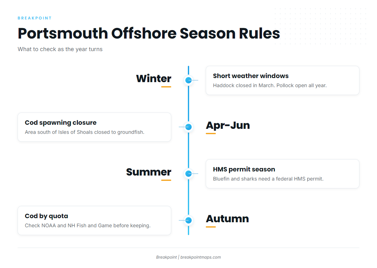
Weather windows are shorter, so watch ANZ154 and buoy 44098 closely. Haddock is open except in March, and pollock is open all year. The NOAA groundfish page, linked under Autumn, has the sizes and bags.
Spring
Striped bass arrive in the river and around the Shoals. For more on the fish, see striped bass in the Northeast. Atlantic mackerel run through, and haddock, pollock and cusk are also available.
The area south of the Isles of Shoals is the Gulf of Maine Cod Spawning Protection Area, closed to fishing and to taking groundfish in April, May and June. Narrow light-tackle exceptions apply. If you transit with groundfish, bait and hooks come off the rods and the fish are gutted. Read the Cod Spawning Protection Area rules and check the boundaries before you drop a line.
Summer
Bluefin tuna show over Jeffreys Ledge. For more, see bluefin in the Northeast. Blue shark, bluefish, stripers and groundfish are also in the mix.
Bluefin and sharks require a federal HMS permit. Striped bass are closed in federal waters beyond 3 miles, per NOAA, so stripers are a state-waters fish.
Autumn
Bluefin, stripers, bluefish, blue shark, haddock, pollock and cusk are all in the mix. Cod is season- and quota-driven, so check NOAA recreational groundfish rules and NH Fish and Game before you keep a fish.