
About Cedar Key
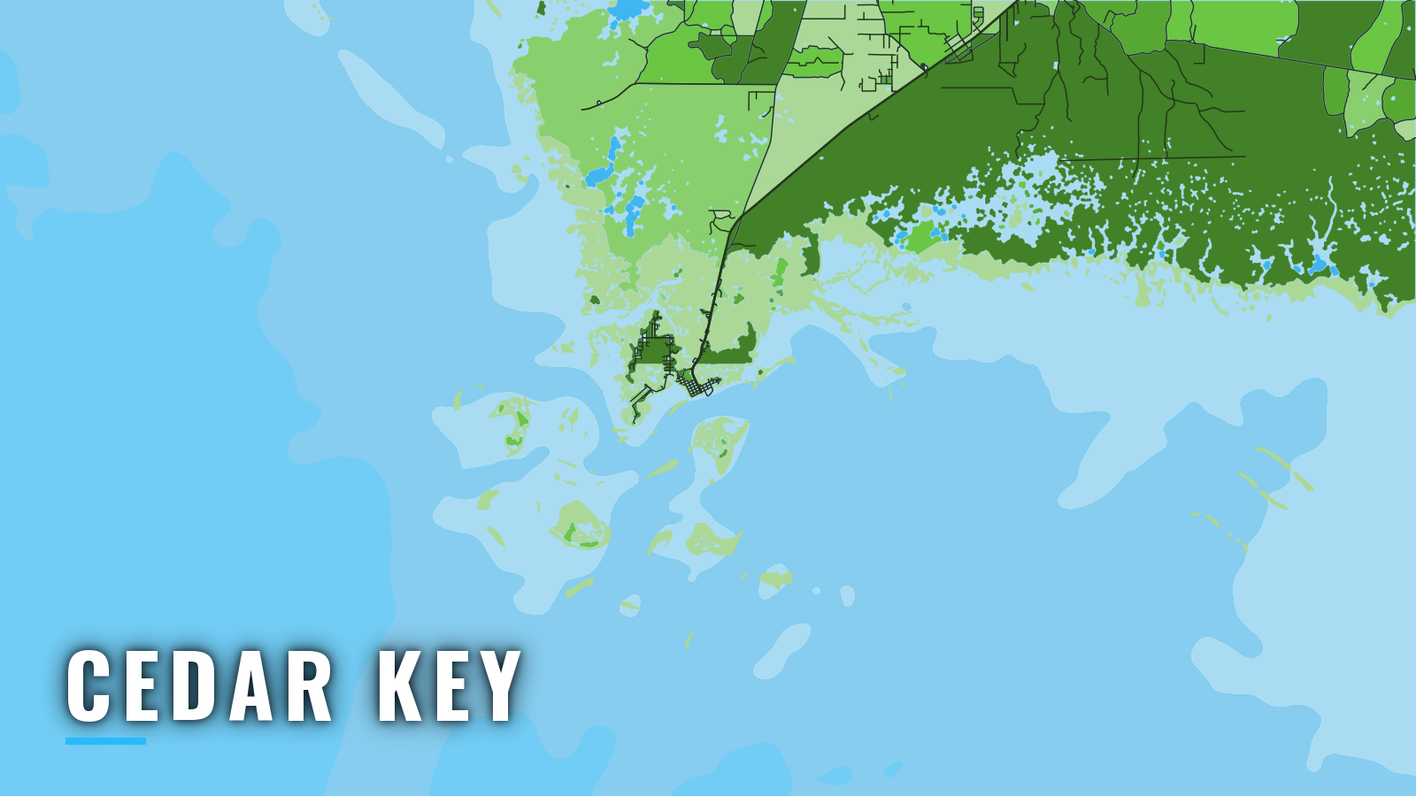
Cedar Key is an island town on Way Key in the Cedar Keys, on the Big Bend coast of the Gulf of America (Gulf of Mexico). It sits between Steinhatchee to the northwest and Crystal River to the southeast. On Florida’s Nature Coast, the main season runs spring through autumn, and summer usually offers the widest range of species. Offshore, anglers target gag grouper, red grouper, Spanish and king mackerel, and cobia. Inshore, the targets are redfish, spotted seatrout and sheepshead. This page covers how to launch, how to get through the shallow approaches, and what the grounds offer by season.
Access and navigation
Cedar Key has one county ramp and a marina with fuel.
- Cedar Key No. 4 Bridge Boat RampLevy County public ramp. The bridge and the tide can limit boats with T-tops or towers, so check the tide stage before you commit.
- Cedar Key Marina IImarina with fuel listed.
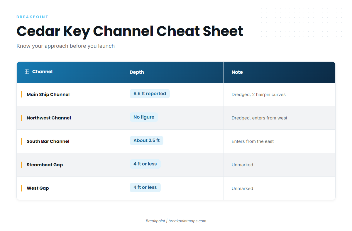
The Main Ship Channel is dredged but crooked and winding, with 2 hairpin curves and a reported 6.5 ft centerline controlling depth, according to U.S. Coast Pilot 5 Chapter 5. Water off the centerline tends to be shallower, and the figure can change as the channel shoals. The Northwest Channel is the second dredged entrance, leading in from the west between North Bank and South Bank.
| Channel | Depth | Note |
|---|---|---|
| Main Ship Channel | 6.5 ft controlling depth (reported, centerline) | Dredged, 2 hairpin curves |
| Northwest Channel | No figure | Dredged, enters from the west |
| South Bar Channel | About 2.5 ft | From the east |
| Steamboat Gap and West Gap | 4 ft or less | Unmarked |
Steamboat Gap and West Gap are unmarked, so treat them as local-knowledge water. Seahorse Reef is a shoal that extends 11 miles southwest from Seahorse Key, and a light marks its outer end. A submerged wreck with 7 ft over it lies about 3.5 miles east-southeast of that light.
Outside the entrance, the current sets east on the flood and west on the ebb. Inside, currents follow the channels and are strong near the city dock. Wind against the ebb can stand up a short chop in the entrance.
Winter fog tends to arrive on south winds and clear on north winds. Sea fog is most common from December to early March and can last several days. On this stretch of coast, cold fronts reach the water from fall through spring, and thunderstorms are most likely from May through September.
Read the NWS Tampa Bay coastal waters forecast for the Tarpon Springs to Suwannee River zones, and check NDBC station CKYF1 (8727520) at Cedar Key. The forecast covers a broad area, while the station reads a single spot, so compare both against what the water looks like when you arrive. If the approach you planned looks bigger than you want, switch to the Northwest Channel or the Main Ship Channel.
Fishing conditions
Seahorse Reef is the main offshore ground, with hard bottom and ledges that anglers target for grouper and mackerel. Kingfish Hole is the nearshore ground. Deadman’s Key and Snake Key are inshore options.
Fishing from your own boat takes a Florida saltwater license and, for gag and red grouper, the State Reef Fish Angler designation. Season and bag rules are on our Florida page, so check them before you fish.
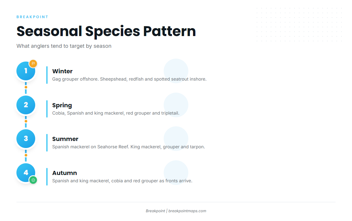
Winter
Gag grouper is usually the offshore target, and the gag grouper guide covers the detail. Inshore, anglers target sheepshead, redfish and spotted seatrout. Fog on south winds can hold for days, so read the forecast before you leave the dock.
Spring
Cobia, Spanish and king mackerel, and tripletail show up as the water warms. Red grouper is an offshore option, covered in the red grouper guide. Cedar Key tends to fish well for mackerel and cobia in this window.
Summer
Spanish mackerel work Seahorse Reef. King mackerel, gag grouper, red grouper and tarpon round out the list. Thunderstorms are most likely from May through September, so watch the sky and the forecast together.
Autumn
Spanish and king mackerel, cobia and red grouper are the offshore targets. Cold fronts begin reaching the coast, so check the forecast for wind shifts before you run.
Chart Contours and OBS SST in Breakpoint help you read the hard bottom and water temperature between Seahorse Reef and deeper ledges. Chart layers are not for navigation.