
About Sebastian Inlet
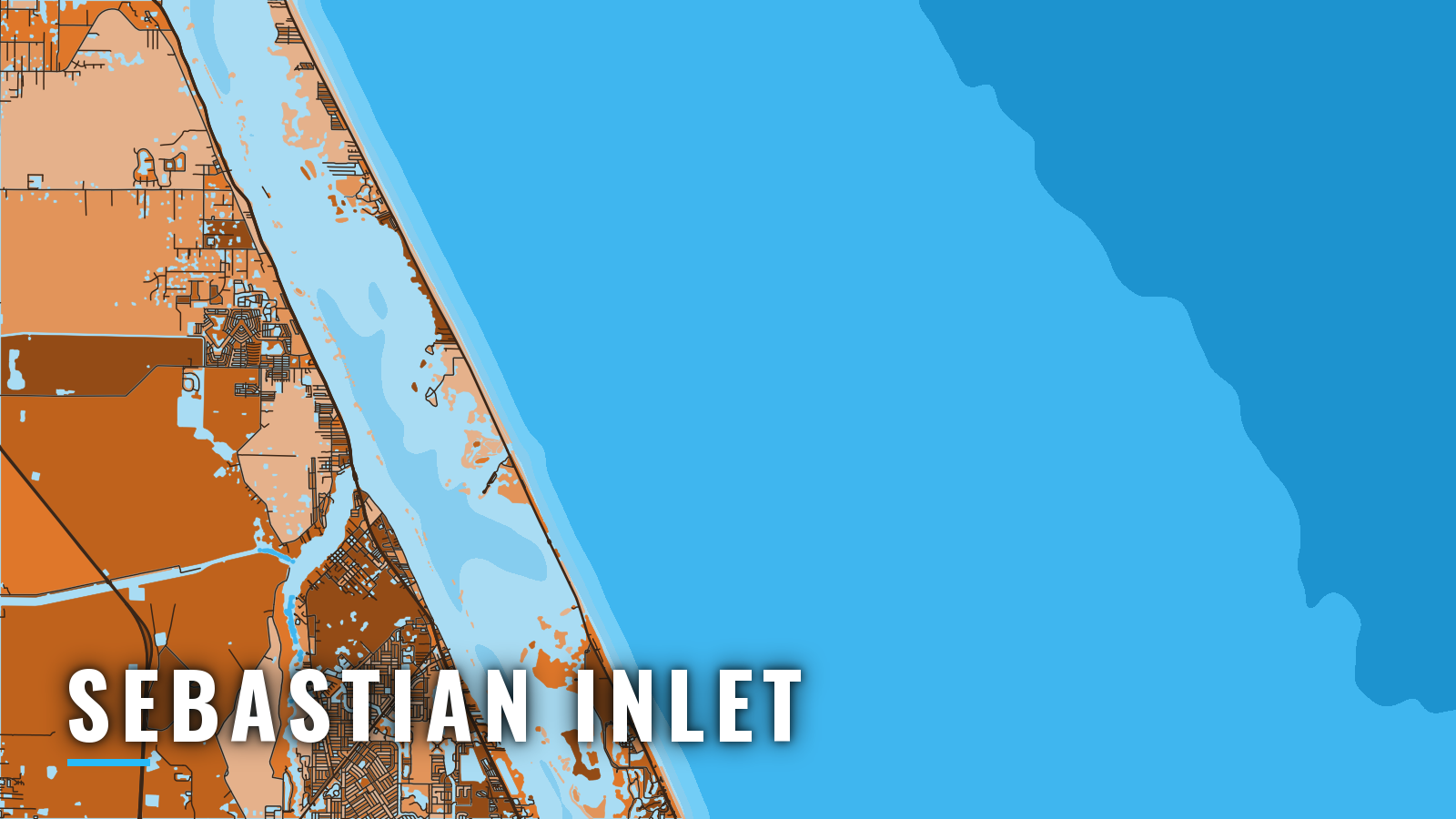
Sebastian Inlet is a jetty-protected dredged cut linking the Indian River Lagoon and the ICW to the Atlantic. It is the only break in about 62 miles of Florida’s Atlantic coast between Cape Canaveral and Fort Pierce Inlet. Offshore pelagics run spring through autumn, and sailfish and wahoo carry the winter.
The target list is king mackerel, mahi-mahi, sailfish, wahoo, cobia over nearshore reef and structure, gag grouper, red snapper and snook. Check the Florida Fish and Wildlife Conservation Commission (FWC) recreational saltwater rules, including reef fish permit requirements, before you fish.
Access and navigation at Sebastian Inlet
Public launches and slips at the inlet:
- Sebastian Inlet State Park boat ramp – four ramps on the south side, inside the inlet.
- Bayside Marina – the park’s marina, also inside the inlet.
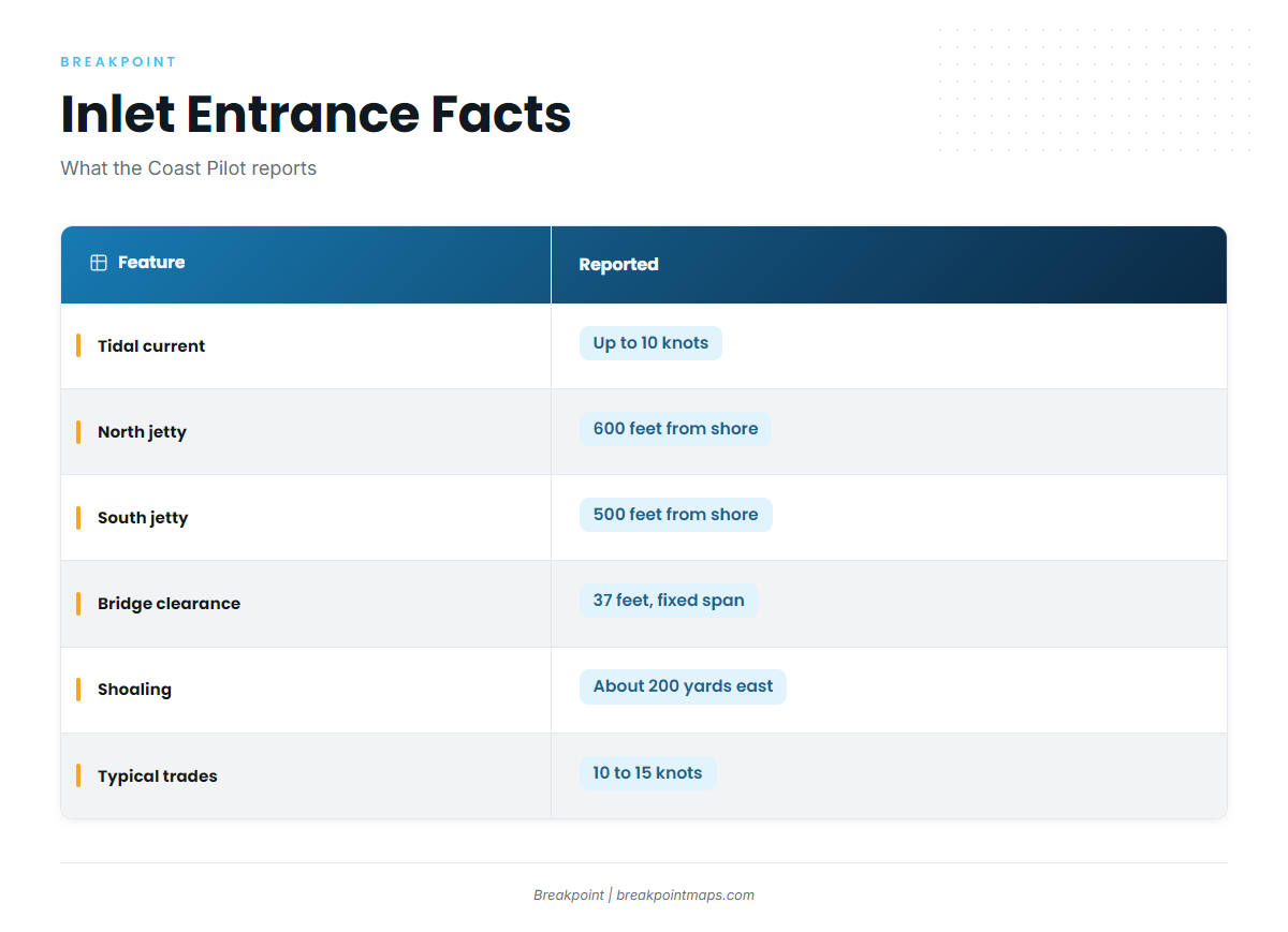
The entrance demands attention. NOAA Coast Pilot 4 guidance reports tidal currents that can reach 10 knots, with turbulence between the bridge and the ends of the jetties. The jetties reach 600 feet (north) and 500 feet (south) from shore. Except in flat calm, seas tend to break and run confused off the mouth and inside as far as the bridge, and they can worsen on an ebb or with rising wind or sea. Easterly trades of 10 to 15 knots are common along this coast through much of the year, so an ebb running into one deserves a hard look.
A boat that leaves on a flood or slack tide can find the return on an ebb impossible, so plan the return before you plan the departure. Winter conditions are generally reported worse than summer, though summer squalls and ebb tides can change things fast.
Shoaling is reported just north of the south jetty and for about 200 yards east of it, and south of the small spoil island between the bridge and the ICW. The shoals build and shift, depths in the cut vary, and the bottom is rocky in spots. The chart can lag the bottom.
From seaward the cut is hard to pick out at any distance. The A1A bridge across it and the bare sand spoil bank on the north side identify it. The bridge is a fixed span with 37 feet of clearance, which is a hard limit for tall boats. Fort Pierce Inlet is the next inlet south.
On arrival, look at the water first. Then check the Sebastian Inlet District bar cam for the North Jetty, wind and tide, the NWS Melbourne AMZ555 forecast and the NDBC buoy 41009 readings. A forecast is only a forecast, and if the inlet looks bigger than you want, switch approaches.
Fishing conditions off Sebastian Inlet
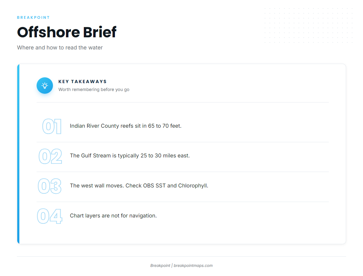
The Indian River County reef program maintains offshore artificial reefs in 65 to 70 feet of water. Florida State Parks places the Gulf Stream about 25 to 30 miles east of Sebastian Inlet, though that distance is typical rather than fixed. For the bigger picture of bait, current and seasons along this coast, see the Southeast Atlantic pattern.
The west wall of the Stream moves. The NWS Coastal Waters Forecast carries its position by inlet, and you can also read it in the OBS SST and Chlorophyll layers in Breakpoint. Chart layers are not for navigation.
Winter
Sailfish and wahoo carry winter offshore. Gag grouper and black sea bass work the bottom. Redfish, spotted seatrout, black drum, sheepshead, snook and Spanish mackerel fill the inshore side, and the same winter conditions that make the entrance harder apply to the trip out.
Spring
King mackerel and mahi-mahi build. Cobia can show on nearshore structure. Gag grouper, snook and sailfish remain.
Summer
King mackerel and mahi-mahi on this coast lead the offshore list. Red snapper is on the list too, so check FWC for any season before you keep one. Snook stay in the mix. Summer squalls can shift the inlet fast.
Autumn
Sailfish return along this coast. King mackerel, mahi-mahi, gag grouper, tuna and snook fill out the list.