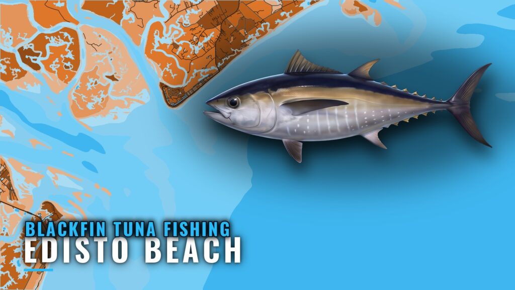
Blackfin tuna fishing out of Edisto Beach centers on the Edisto Banks, a ledge that drops from 150 ft on top to 800 ft on the drop and runs north-south for about 20 miles. Boats run offshore to it and beyond it.
This page covers where boats run, the structure between the inlet and the ledge (with reef IDs and buoy positions), and the two local approaches: trolling for fish that are up, and jigging marked fish that are deep. For inlets and ramps, see the Edisto Beach port page.
When blackfin are around Edisto Beach
Blackfin tuna are found offshore, at and beyond the ledge. Local reports describe the tuna as deeper on some days and advise jigging them with a depth finder. Depth on the day decides the method, covered below.
For biology and seasonality, read the blackfin tuna fishing guide. For how the fishery looks along the whole coast, see blackfin tuna across the Atlantic Southeast (see also the Atlantic Southeast offshore fishing guide).
How far and where boats run from Edisto Beach
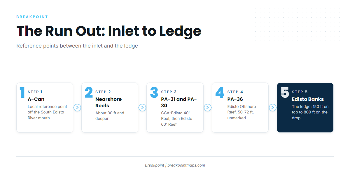
Boats run offshore to the ledge and beyond it. The route out passes a short list of reference points and structure:
- The A-Can off the South Edisto River mouth is the local reference point on the way out.
- The nearshore reefs come next, at about 30 ft and deeper.
- CCA-Edisto 40′ Reef (PA-31) and Edisto 60′ Reef (PA-30) follow.
- Edisto Offshore Reef (PA-36) sits farther out.
- The Edisto Banks mark the ledge.
These are structure between the inlet and the ledge. Blackfin are not tied to the reefs.
Reading conditions on NDBC 41004
The official buoy is NDBC Station 41004 EDISTO; its page is the NDBC Station 41004 buoy page. It sits 41 NM southeast of Charleston, SC, at 32.502N, 79.099W, in 35 m of water. That puts it offshore of Charleston rather than on the Edisto Banks, so its readings describe a nearby piece of ocean, not the ledge itself.
Check wind, wave height and dominant period as numbers on the buoy page, and read them alongside the NWS Charleston marine forecast.
Grounds and structure off Edisto Beach
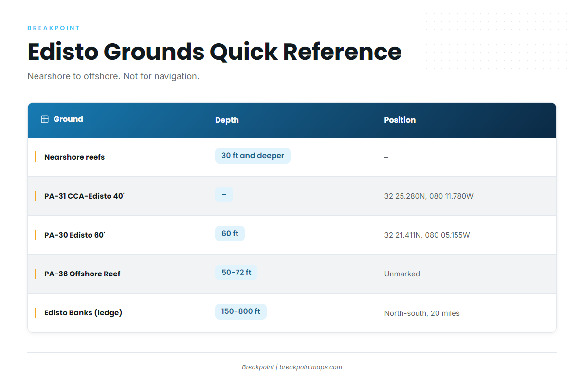
The reef designations below are South Carolina artificial-reef sites, plus the ledge and a local reference point. The SCDNR Edisto 60′ Reef sheet documents PA-30 and its buoy position.
| Ground | ID | Depth | Buoy / position |
|---|---|---|---|
| Nearshore reefs (general) | – | about 30 ft and deeper | – |
| A-Can off the South Edisto River mouth | – | – | – |
| CCA-Edisto 40′ Reef | PA-31 | – | Reef buoy 32 25.280N, 080 11.780W |
| Edisto 60′ Reef | PA-30 | 60 ft | Reef buoy 32 21.411N, 080 05.155W |
| Edisto Offshore Reef | PA-36 | 50-72 ft | Unmarked. 23.5 miles from Stono Inlet |
| Edisto Banks (the ledge) | – | 150 ft on top to 800 ft on the drop | Runs north-south for about 20 miles |
These positions and the chart layers are not for navigation. Use official charts. In the app, Chart Contours show the 150 to 800 ft drop, which is also not for navigation.
Nearshore reefs
The nearshore reefs sit at about 30 ft and deeper. They are the first structure off the beach.
The A-Can off the South Edisto River mouth
The A-Can is the reference point for the run out. Use it as a marker, not a fishing spot.
CCA-Edisto 40′ Reef (PA-31)
The reef buoy sits at 32 25.280N, 080 11.780W.
Edisto 60′ Reef (PA-30)
PA-30 sits in 60 ft. The reef buoy is at 32 21.411N, 080 05.155W.
Edisto Offshore Reef (PA-36)
PA-36 sits in 50-72 ft. It is unmarked, and its position is given only as 23.5 miles from Stono Inlet.
Edisto Banks (the ledge)
The ledge drops from 150 ft on top to 800 ft on the drop. It is steep and runs north-south for about 20 miles. Blackfin fishing happens at and beyond it.
How blackfin are fished from this port
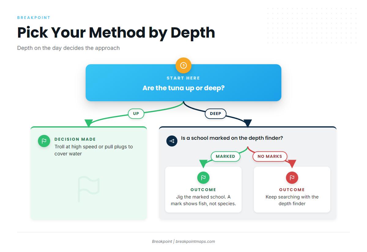
Fish that are up get high-speed trolling and plugs. Fish that are deep get the depth finder and the jig. For spreads and rigging detail, see the tuna fishing tactics library.
High-speed trolling and pulling plugs
High-speed trolling covers water at and beyond the ledge when fish are up, and it is the first approach most boats use to find where the fish are working. Pulling plugs is the second trolling approach for fish that are up. It runs alongside high-speed trolling and suits the same water.
Jigging marked schools
Local reports describe tuna as deeper on some days, with the advice to jig them with a depth finder. The sequence is simple:
- Find the school on the depth finder.
- Jig the marked school.
A mark shows fish, not species.
Who fishes for blackfin out of Edisto Beach
Owner-operators run their own boats to the ledge. The trip is theirs to plan, from the first mark on the depth finder to the run back in.
FAQ: blackfin tuna out of Edisto Beach
Where is the Edisto Banks?
The Edisto Banks is the ledge offshore of Edisto Beach. It runs north-south for about 20 miles and is the focus of blackfin tuna fishing out of Edisto Beach, with fish found at and beyond it.
What depth is the ledge?
The ledge drops from 150 ft on top to 800 ft on the drop. Blackfin are found at and beyond it, so the depth you fish depends on where the school sits that day.
What do you do when blackfin are deep?
Find the school on the depth finder and jig the marked school. A mark shows fish, not species. When fish are up, troll at high speed or pull plugs instead.
Which buoy do you check before running out?
Check NDBC 41004 EDISTO, 41 NM southeast of Charleston, at 32.502N, 79.099W, in 35 m of water. It is not on the ledge. Read wind, wave height and period as numbers alongside the NWS marine forecast.
Is PA-36 marked?
No. Edisto Offshore Reef (PA-36) is unmarked. It sits in 50-72 ft and is given as 23.5 miles from Stono Inlet. Positions are not for navigation.