
About Edisto Beach
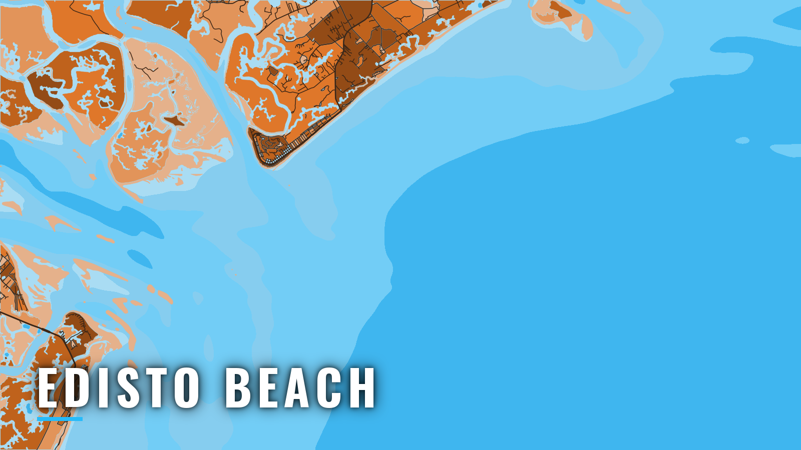
Edisto Beach is a small barrier-island port at the southern end of Edisto Island. Boats reach the ocean over the South Edisto River bar or through the North Edisto River entrance. The water opens to the Atlantic via the South Edisto River, Big Bay Creek and St. Helena Sound, with the North Edisto River entrance to the northeast. That entrance lies about 20 miles southwest of the Charleston Harbor entrance and about 10 miles southwest of Stono Inlet, the Folly Beach approach.
Offshore pelagic fishing from Edisto Beach runs mainly from late spring through early fall, while bottom fish hold on the reefs and live bottom year-round. Anglers target king and Spanish mackerel, cobia, red drum, black sea bass and snapper-grouper, mahi, wahoo, tuna, sailfish and blue marlin. The Atlantic Southeast pattern of Gulf Stream, shelf and live bottom shapes the grounds. SCDNR sets size, bag and season limits and the saltwater license, so check the South Carolina rules before you fish.
Access and navigation
Edisto Beach has one public state park launch and one full-service marina, and both reach the water through Big Bay Creek.
- Edisto Beach State Park boat launchpublic launch at Live Oak Landing off Palmetto Road, small fee.
- The Marina at Edisto Beachfuel, public ramp, nightly and weekly dockage on Big Bay Creek.
Big Bay Creek is unmarked. It empties into the east side of the South Edisto River just above Bay Point. According to U.S. Coast Pilot 4, Chapter 7, small craft have been reported aground at night while steering by Edisto Beach street and house lights. The mean tide range on the bar is about 6 feet, so creek depth on the return can differ from the morning launch.
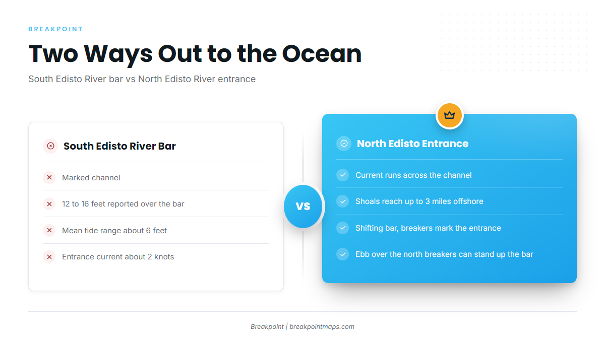
The South Edisto River ocean entrance is a marked channel with 12 to 16 feet reported over the bar, and entrance current can run about 2 knots. Farther out, shoals extend about 6 miles seaward of the St. Helena Sound entrance. A 1973 survey found depths 1 to 14 feet shallower than charted, and the bar tends to shift, so the chart may not show current conditions. A partially submerged wreck was reported near 32°26.0’N, 80°16.0’W, about 2 miles northeast of South Edisto River Approach Lighted Buoy A.
The North Edisto River entrance is the alternative. Current tends to run across the channel, with the flood setting about west and the ebb setting east, both with considerable velocity. Shoals can extend as much as 3 miles offshore and form a shifting bar, and breakers mark the entrance. The ebb setting across the north breakers can stand the bar up, especially against an onshore wind.
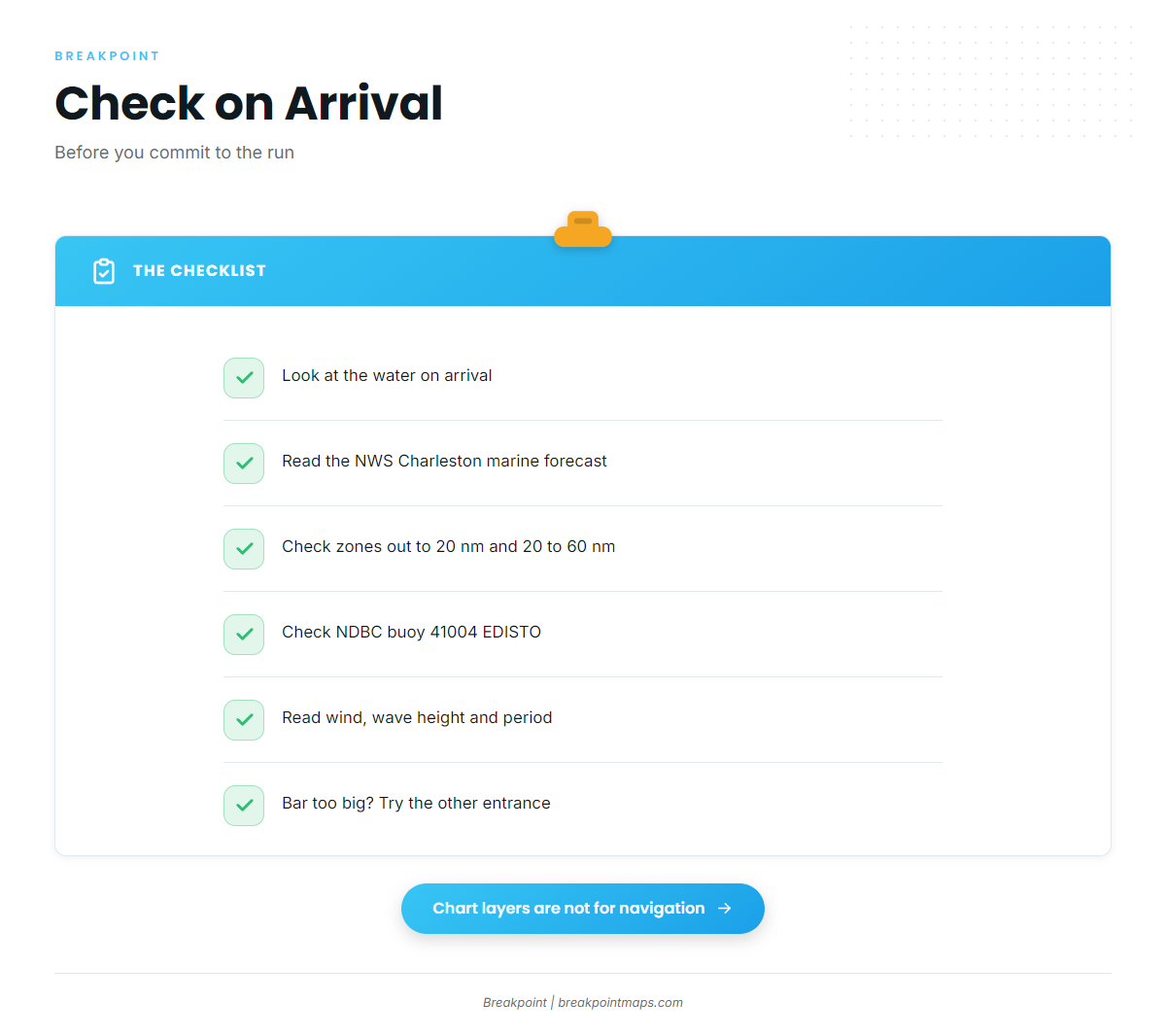
Look at the water when you arrive, and read the NWS Charleston marine forecast, which covers zones out to 20 nm and from 20 to 60 nm. Check NDBC buoy 41004 EDISTO, 41 nm southeast of Charleston, for wind, wave height and period. If the South Edisto bar looks bigger than you want, run the North Edisto entrance, or the reverse.
Fishing conditions
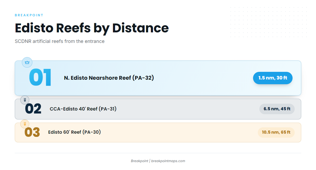
Edisto Beach grounds step out from SCDNR artificial reefs near the entrance to live bottom, the shelf edge and the Gulf Stream. The reefs, per SCDNR artificial reef data, run in order of distance:
- N. Edisto Nearshore Reef (PA-32) – 1.5 nm from the entrance, 30 ft.
- CCA-Edisto 40′ Reef (PA-31) – 6.5 nm, 45 ft.
- Edisto 60′ Reef (PA-30) – 10.5 nm, 65 ft.
- Edisto Offshore Reef (PA-36) – farther out.
Beyond the reefs, live bottom and ledges hold black sea bass, triggerfish, porgies, snapper and grouper on hard bottom. The shelf edge and the Gulf Stream lie beyond the 20 nm forecast zone. Check OBS SST and Chlorophyll for where the edge sits before committing to the long run, and Chart Contours for the ledge lines. Chart layers are not for navigation.
Snapper-grouper, cobia and black sea bass rules change by season and quota, so check SCDNR limits on the South Carolina regulations page before you keep fish.
Winter
The coldest water of the year pushes migratory pelagics south and offshore. Bottom fishing on the reefs and live bottom continues, with black sea bass and snapper-grouper the main targets, though seasonal closures can apply. Wahoo can be caught year-round in the Gulf Stream off South Carolina. Closer in, red drum hold in the inlets and creeks.
Spring
As water warms, migratory king mackerel and cobia tend to move onto the nearshore reefs, PA-32 and PA-31 among them, and along the sound edges. Mahi start showing along the Gulf Stream edge. Cobia rules can differ by zone, so confirm the zone you are fishing with SCDNR.
Summer
Offshore pelagics peak in summer. Mahi, tuna and wahoo hold on the Gulf Stream edge, and king and Spanish mackerel work the nearshore reefs. Sailfish show on the edge in warm water off the Southeast. Blue marlin push the deeper edge across the Southeast through the warmest months. Billfish, including white marlin, work the Gulf Stream edge in the Atlantic Southeast in the warm months. Sharks and tarpon work the inlets and nearshore water. Watch OBS SST for where the edge sits before the long run.
Autumn
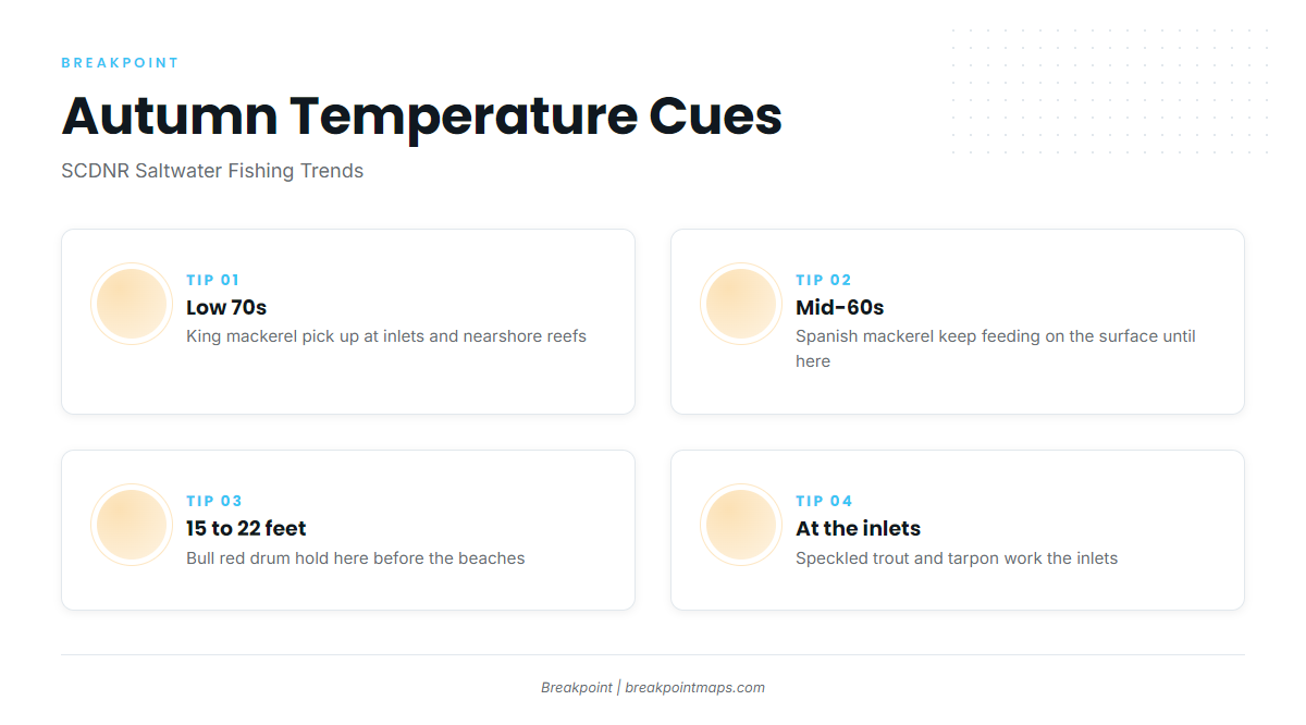
SCDNR’s Saltwater Fishing Trends describes the autumn pattern. King mackerel activity picks up at inlets and nearshore reefs as water drops into the low 70s. Spanish mackerel keep feeding on the surface until water falls into the mid-60s. Bull red drum hold in about 15 to 22 feet before they come to the beaches. Speckled trout and tarpon work the inlets. Water temperature indicates which of these is on.