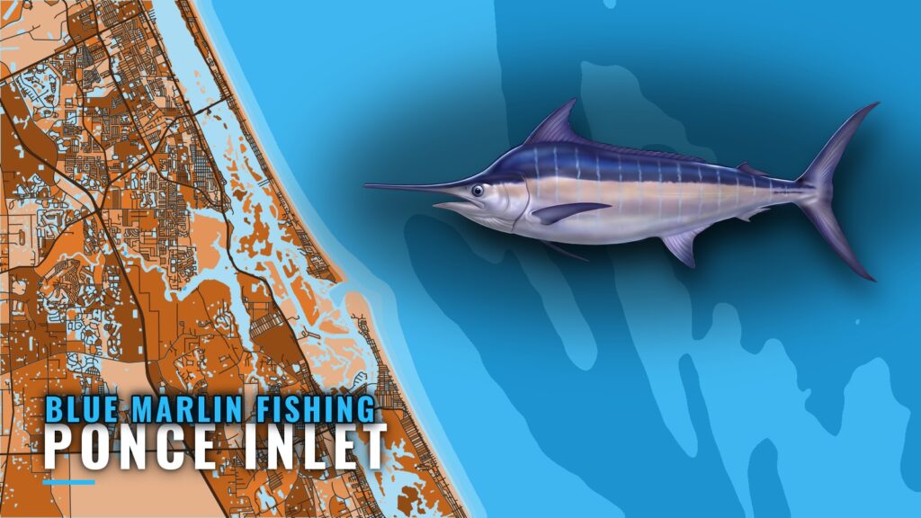
Blue marlin fishing out of Ponce Inlet means a run to the edge of the Gulf Stream, from spring into late summer. The named grounds below are listed in the order you reach them, with distances and the structure you pass on the way. For the species itself, see the blue marlin species guide.
When Blue Marlin Are Off Ponce Inlet
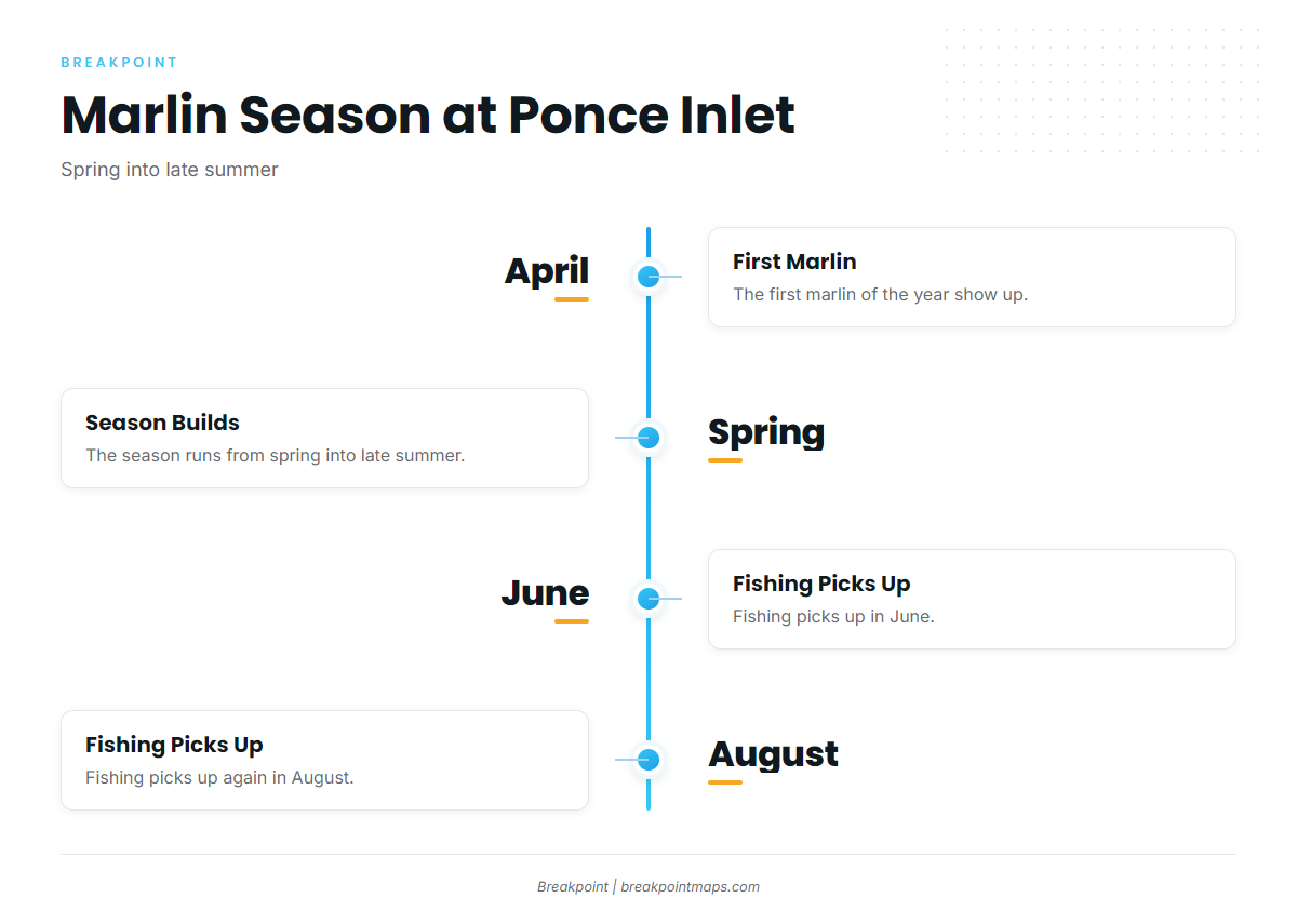
FishAnywhere’s Ponce Inlet calendar puts the season from spring into late summer, and it sets the order of the year.
- Spring: the first marlin show up.
- June: the fishing picks up.
- August: the fishing picks up again.
April Start
The calendar puts the first marlin of the year in April, which is the opening window.
June and August
June and August are the months when the fishing picks up, so the longer runs are best planned around them.
How Far Boats Run
Boats run to the edge of the Gulf Stream, where the Ponce Inlet realty page says blue marlin are found. The wider Gulf Stream picture is covered in the regional Gulf Stream guide (see also the Atlantic Southeast offshore fishing guide).
Two named grounds mark the run outward:
- Party Grounds: about 35 miles offshore, per FishingBooker’s Ponce Inlet notes. Mango Hole sits on the way out.
- Rolldown: about 40 to 55 miles offshore.
Both work as distance markers. The full list of grounds follows.
Grounds and Structure Off Ponce Inlet
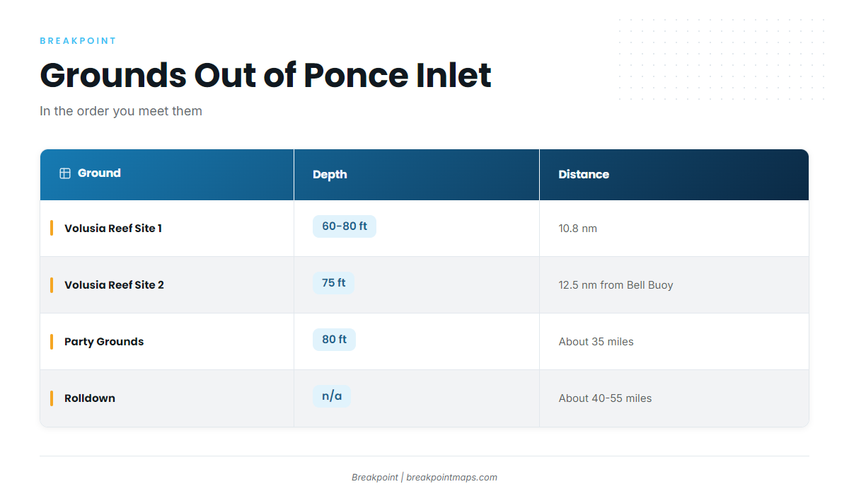
The named grounds run from the jetty out to the Rolldown, listed in the order you meet them.
| Name | Type/Notes | Depth | Distance |
|---|---|---|---|
| Ponce Inlet jetty (Lighthouse Point Park) | 1,000 ft jetty inside Lighthouse Point Park at the inlet | ||
| Volusia Artificial Reef Site 1 | Argoil barge and culverts | 60 to 80 ft | 10.8 nm from the inlet |
| Volusia Artificial Reef Site 2 | Semarca and culverts | 75 ft | About 12.5 nm from the Bell Buoy at 067 degrees |
| Mango Hole | On the way out to the Party Grounds | ||
| Cracker Ridge | A few miles west of the Party Grounds, near Volusia Site 2 | ||
| Party Grounds | Trolling ground | 80 ft | About 35 miles offshore |
| East Ridge | Trolling ground named alongside the Party Grounds | ||
| Rolldown | About 40 to 55 miles offshore |
Ponce Inlet Jetty
A 1,000 ft jetty sits inside Lighthouse Point Park at the inlet, and it serves as the starting landmark.
Volusia Reef Sites 1 and 2
Site 1 is the Argoil barge and culverts, 10.8 nm from the inlet, in 60 to 80 ft. Site 2 is the Semarca and culverts, in 75 ft, about 12.5 nm from the Bell Buoy at 067 degrees. The Volusia County reef site summary lists both. They are the nearshore sites most local anglers already know.
Mango Hole
Mango Hole sits on the way out to the Party Grounds, per FishingBooker.
Cracker Ridge
Cracker Ridge sits a few miles west of the Party Grounds, near Volusia Site 2.
Party Grounds and East Ridge
The Party Grounds are in 80 ft, about 35 miles offshore, per FishingBooker. East Ridge is named as a trolling ground alongside them.
Rolldown
The Rolldown sits about 40 to 55 miles offshore.
How It’s Fished and Who Fishes It
Captains typically troll for marlin and sailfish, per FishAnywhere. Out of Ponce Inlet, that means running baits and lures at the Gulf Stream edge. Our billfish trolling guides cover the method in more depth.
Charter captains set the local pattern, and owner-operators running their own boats make the same run to the edge.
FAQ: Blue Marlin Fishing Out of Ponce Inlet
When do blue marlin show up off Ponce Inlet?
The first marlin arrive in April, and the fishing picks up in June and August. The season runs from spring into late summer.
How far offshore are blue marlin from Ponce Inlet?
They are found at the Gulf Stream edge. For reference, the Party Grounds sit about 35 miles out and the Rolldown about 40 to 55 miles out.
Where are the Party Grounds?
About 35 miles offshore, in 80 ft. Mango Hole is on the way out, and Cracker Ridge sits a few miles west.
What is the Rolldown?
A named ground about 40 to 55 miles offshore of Ponce Inlet.
How do local captains fish for marlin?
They typically troll for marlin and sailfish.