Cobia fishing out of Venice, Florida starts at the inlet. The closest named reef sits 0.8 nm off it, on the Gulf of Mexico side of Venice Inlet. Inlet, ramp and marina detail is in our Venice port guide.
This guide covers this port only: how far local boats run, where each named structure sits (with depth, bearing and reference point), and which numbers to check before you clear the inlet.
Cobia season and timing off Venice
Biology, seasonality and general technique are in our cobia fishing guide. The Gulf-wide movement picture is in our Gulf of Mexico cobia guide (see also the Gulf of Mexico fishing guide). Water temperature off Venice can be read on the Breakpoint layers, including OBS SST.
How far boats run out of Venice Inlet
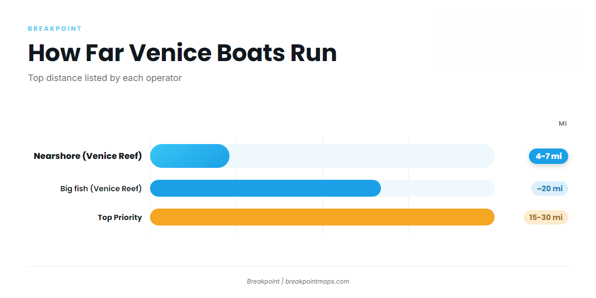
Local boats run in three tiers. Distances are in miles, as each operator lists them.
| Tier | Distance | Operator |
|---|---|---|
| Nearshore | 4 to 7 miles off the beach | Venice Reef Charters |
| Big fish trip | About 20 miles out | Venice Reef Charters |
| Offshore | About 15 to 30 miles out | Top Priority |
Nearshore, 4 to 7 miles
Venice Reef Charters runs nearshore trips 4 to 7 miles off the beach. This is the shortest run, and it suits a trailer boat or a short day.
About 20 miles, big fish trips
Venice Reef Charters lists a big fish trip about 20 miles out.
About 15 to 30 miles
Top Priority runs about 15 to 30 miles out, the longest runs any local boat lists.
Reefs and structure off Venice
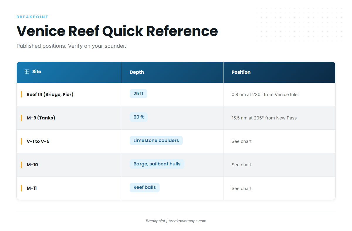
These are named artificial reefs off Venice and the Sarasota County coast. Reef 14 and M-9 are the only two with a published depth and position here.
| Site | Material | Depth | Position |
|---|---|---|---|
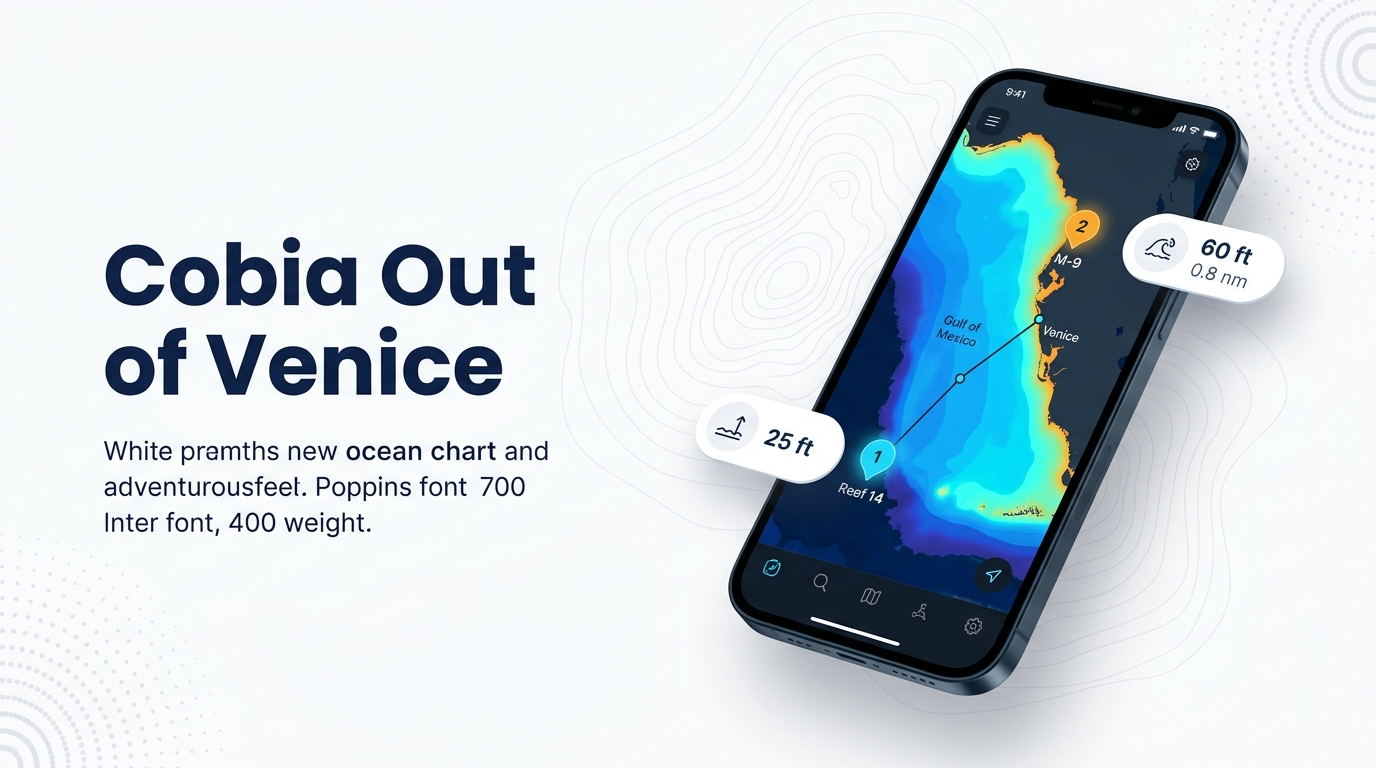
| Reef I4 / Reef 14 | Venice Bridge and Pier | 25 ft | 0.8 nm at 230° from Venice Inlet |
| M-9 | Tanks | 60 ft | 15.5 nm at 205° from the New Pass Gulf marker |
M-9’s bearing is measured from the New Pass Gulf marker rather than Venice Inlet, so plot it from New Pass. Published reef positions are a starting point; verify them on your sounder before you fish.
Reef I4 / Reef 14 (Venice Bridge and Pier)
25 ft, 0.8 nm at 230° from Venice Inlet. It is the closest named structure to the inlet.
Venice Reef Sites 1 and 2
Old bridge materials and concrete rubble.
Venice Reef V-1 to V-5
Limestone boulders.
M-9
Tanks, 60 ft, 15.5 nm at 205° from the New Pass Gulf marker.
M-10
An upside-down barge and sailboat hulls.
M-11
Reef balls.
M-13 (sites 1 to 5)
Concrete culverts across sites 1 to 5.
M-15a and M-15b
Culverts and rubble.
Planning a cobia run from Venice
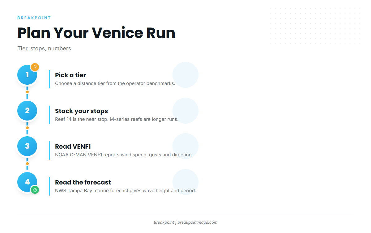
Turning the map into a plan takes three steps:
- Pick a tier. Choose a distance tier from the operator benchmarks above.
- Stack your stops. Reef 14 is the near stop, and the M-series reefs are the stops for longer runs. Match the structure to the tier you picked.
- Read the numbers. Check wind, gusts and direction before you run.
For wind speed, gusts and direction, use NOAA C-MAN station VENF1 (Venice, FL), at 27.072 N, 82.453 W. For wave height and period, use the NWS Tampa Bay marine forecast.
Chart layers, including Chart Contours, are not for navigation. Structure-fishing technique is in our coastal and offshore gamefish guides.
Who fishes cobia out of Venice
Three operators list cobia, and a fourth mentions it. The distances these captains run give you a benchmark for where to look in a private boat.
Liquid Lifestyle Charters
Liquid Lifestyle Charters lists cobia. Captain Eric White is named on the site.
Venice Reef Charters
Venice Reef Charters lists cobia. Captain Phil Bloom is named on the site. The operation runs nearshore trips 4 to 7 miles off the beach and a big fish trip about 20 miles out.
Top Priority Fishing Charters
Top Priority Fishing Charters lists cobia. It runs a 34 ft Yellowfin center console with Capt. David, about 15 to 30 miles out.
The Miss Venice Deep Sea Fishing
The Miss Venice Deep Sea Fishing mentions cobia in its site text, where Captain Joe is named.
FAQ about cobia fishing out of Venice
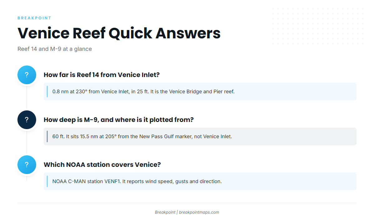
How far is Reef 14 from Venice Inlet?
0.8 nm at 230° from Venice Inlet, in 25 ft. It is the Venice Bridge and Pier reef.
How deep is M-9, and where does its position come from?
60 ft. It sits 15.5 nm at 205° from the New Pass Gulf marker, not from Venice Inlet.
Which NOAA station covers Venice?
NOAA C-MAN station VENF1 (Venice, FL), at 27.072 N, 82.453 W. It reports wind speed, gusts and direction. The NWS Tampa Bay marine forecast gives wave height and period.
How far do charters run for cobia fishing out of Venice?
Venice Reef Charters runs 4 to 7 miles nearshore and about 20 miles on big fish trips. Top Priority runs about 15 to 30 miles.
Where are the cobia rules for Venice?
FWC sets the state rules. Federal rules apply in federal waters. Check both before you fish.