Where boats run for gags out of Crystal River
Gag grouper fishing out of Crystal River runs from ledges and rock piles near shore to grounds 50 miles out. The Crystal River port page has channel, ramp and conditions detail, and the gag grouper species guide covers biology, seasonal movement and general tackle. This page sorts the runs by distance so you can decide where to look. The same fishery along the rest of the coast is in the Gulf of Mexico offshore fishing guide.
Nearshore ledges and rock piles
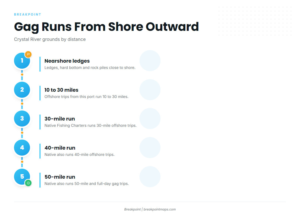
Tall Tales and High Octane both run shallow-water gag trips on ledges, hard bottom and rock piles near shore. A skiff or bay boat can work this water. The 26 ft and 30 ft reefs in the next section sit in the same zone.
10 to 30 miles offshore
Offshore trips from this port run 10 to 30 miles.
The 30-, 40- and 50-mile runs
Native Fishing Charters runs 30-, 40- and 50-mile offshore trips, plus a full-day offshore gag trip. The Middle Grounds also appear on local trip menus. Runs this far can leave state waters, which affects the rules covered at the end of this page.
| Run | Distance | Where it appears |
|---|---|---|
| Nearshore | Ledges, hard bottom, rock piles | Tall Tales, High Octane |
| Offshore | 10 to 30 miles | Local charter menus |
| Long offshore | 30, 40 and 50 miles | Native Fishing Charters |
Reading conditions at CDRF1
The nearest NOAA buoy is NDBC C-MAN station CDRF1 at Cedar Key, 29.136 N 83.029 W. Read wind, wave height and period there, then check the official NWS marine zone forecast before you leave the dock. The buoy reports conditions at its own position, which may differ from your fishing spot.
Grounds and structure off Crystal River
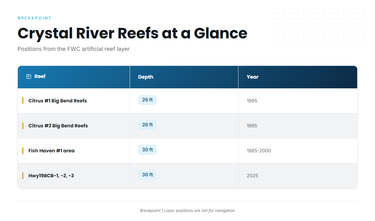
Reef positions below come from the FWC artificial reef layer and are not for navigation. For the wider Big Bend picture, see our reef fish guides for the Gulf coast.
| Reef | Depth | Structure | Year | Position (FWC layer) |
|---|---|---|---|---|
| Citrus #1 Big Bend Reefs | 26 ft | 24 pre-fabricated cubes | 1995 | 28.9166 N, 82.8715 W |
| Citrus #2 Big Bend Reefs | 26 ft | 96 pre-fabricated cubes | 1995 | 28.9130 N, 82.8828 W |
| Fish Haven #1 area (Citrus County group) | 30 ft | artificial reef group | 1985–2000 | 28.786–28.791 N, 83.054–83.061 W |
| Hwy19BCB-1, -2, -3 | 30 ft | bridge-material concrete, 615–698 tons | 2025 | not listed in the FWC layer coordinates here |
Swipe the table sideways to see every column.
Citrus #1 and #2 Big Bend Reefs
Both sit in 26 ft and date to 1995. Citrus #1 holds 24 pre-fabricated cubes at 28.9166 N, 82.8715 W. Citrus #2 holds 96 cubes at 28.9130 N, 82.8828 W.
Fish Haven #1 area
Fish Haven is a group of Citrus County fish haven reefs. The Fish Haven #1 area sits in 30 ft, with deployments from 1985 to 2000. The FWC layer box spans 28.786 to 28.791 N and 83.054 to 83.061 W.
Hwy19 bridge-material reefs
Hwy19BCB-1, -2 and -3 went down in 2025. Each holds 615 to 698 tons of concrete and sits in 30 ft. The FWC layer coordinates do not list positions for this new structure, so none are given here.
Middle Grounds
The Middle Grounds are a Gulf bank that appears by name on local trip menus. Plan that run from your own chart work.
How gags are fished here
The local method is bottom fishing on structure and ledges, including hard bottom and rock piles. General tackle is covered in the species guide.
Bottom fishing on structure and ledges
Fishing targets bottom relief. Ledges, rock piles and reef edges hold the fish, and the local trips are built around them.
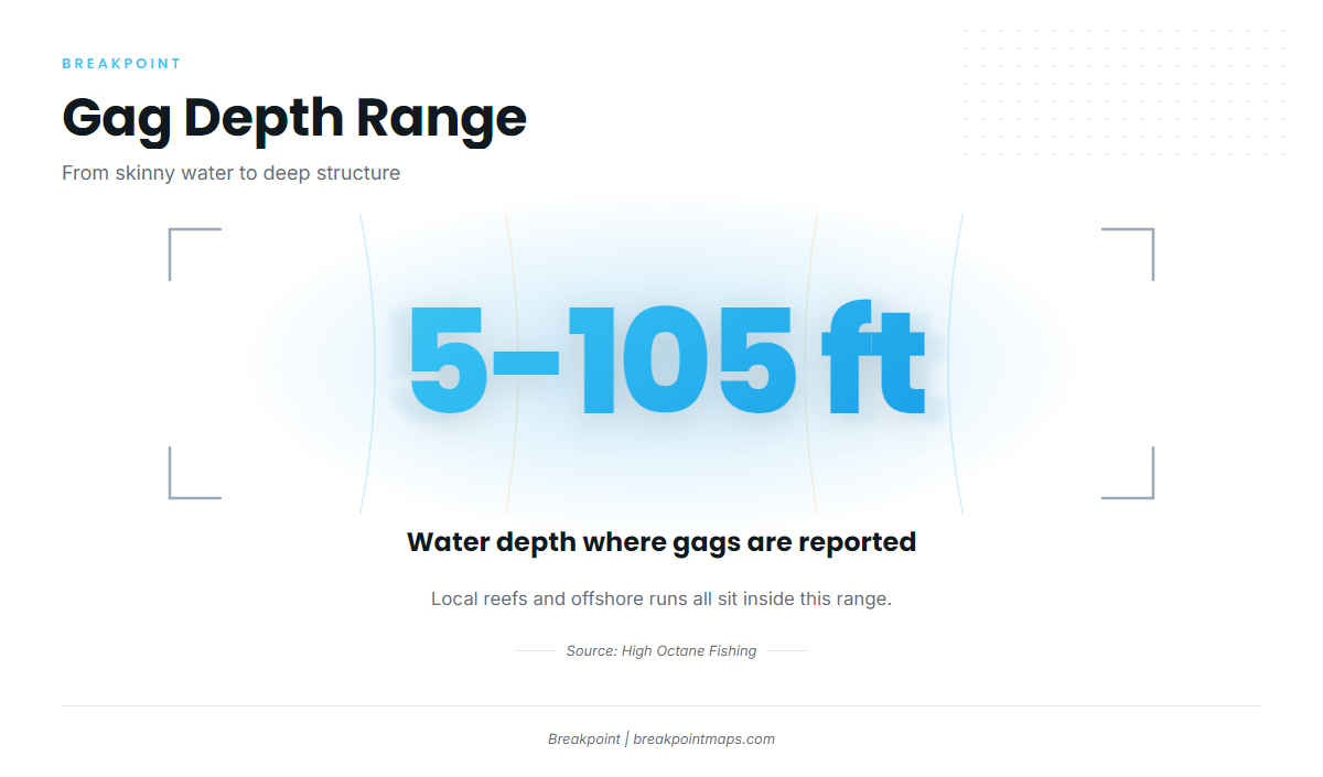
5 feet to 105 feet
High Octane Fishing reports gags from 5 feet of water out to 105 feet. The 26 ft and 30 ft reefs sit inside that range, and so do the longer runs. For seasonal movement, use the species guide. For season status, use the regulations pointer below.
Who fishes gags out of Crystal River
Four operators list gag grouper fishing out of Crystal River, and their trip menus show how the port is fished. This describes the local pattern across Crystal River grouper charters and is not a recommendation.
Native Fishing Charters
Capt. Bobby Horn and first mate Alyssa run 30-, 40- and 50-mile offshore trips and a full-day offshore gag trip. The Native Fishing Charters listing carries their trips.
High Octane Fishing
High Octane runs shallow-water gag trips on ledges, hard bottom and rock piles. It is the source of the 5 to 105 ft range above.
Lickety Split Charters
Capt. Sam Samhaoui lists gag grouper. See the Lickety Split Charters listing.
Tall Tales Charters
Capt. Marrio Castello runs the "Sundance," a Carolina Skiff with a 150 HP Mercury, for 2 anglers. The Tall Tales private grouper hunt covers shallow-water gag trips on ledges, hard bottom and rock piles.
FAQ on gag grouper fishing out of Crystal River
How far do boats run for gags out of Crystal River?
Offshore trips run 10 to 30 miles. Native Fishing Charters also runs 30-, 40- and 50-mile trips.
How shallow do gags come off Crystal River?
High Octane reports gags from 5 feet of water out to 105 feet, with shallow trips on ledges, hard bottom and rock piles near shore.
What reefs are near Crystal River?
Citrus #1 and #2 Big Bend Reefs sit at 26 ft, the Fish Haven #1 area at 30 ft, and the Hwy19BCB bridge-material reefs at 30 ft, deployed in 2025. Citrus #1 sits at 28.9166 N, 82.8715 W in the FWC layer.
Which buoy should I watch?
Watch NDBC C-MAN station CDRF1 at Cedar Key, 29.136 N 83.029 W, for wind, wave height and period. Then check the official forecast.
Where are the current gag rules?
Check the FWC state rules and the NOAA Fisheries federal rules before you fish. Longer runs can cross into federal waters.