Where boats run for triggerfish out of Steinhatchee
Gray triggerfish trips from Steinhatchee are offshore runs that leave from the mouth of the Steinhatchee River. Boats head out of Steinhatchee to reef and hard bottom, and each stop on the list sits farther from the river mouth than the last. The wider picture is in the gray triggerfish fishing in the Gulf of Mexico and the Gulf of Mexico fishing guide.
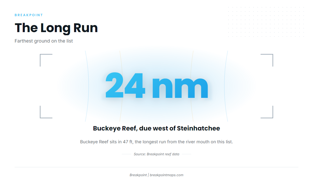
The nearest named ground is the Steinhatchee Fisheries Management Area (SFMA), a permitted artificial reef area in 35 ft of water, centered off the river mouth. The longest run on this list is Buckeye Reef, in 47 ft, about 24 nautical miles due west of Steinhatchee.
- Run style: offshore trips, not nearshore river fishing
- Short run: SFMA, centered off the river mouth in 35 ft
- Long run: Buckeye Reef, about 24 nautical miles due west
The grounds below are listed from the river mouth outward. Species timing and behavior are covered in the species guide linked further down.
Grounds and structure that hold them
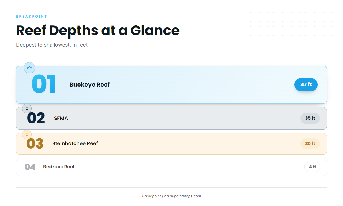
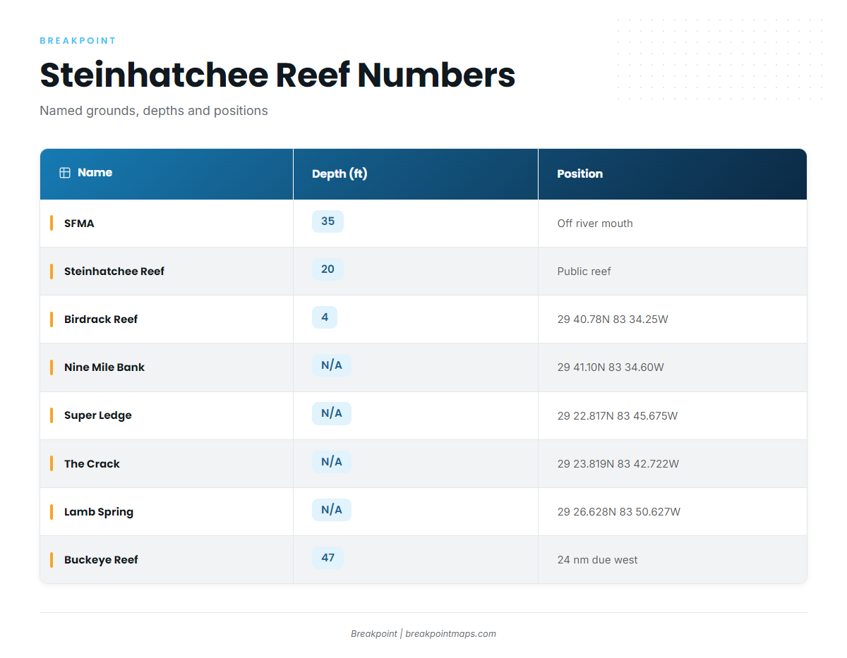
These are the named reefs and bottom features within running distance, with depth and coordinates where they exist.
| Name | Depth (ft) | Coordinates | Structure |
|---|---|---|---|
| Steinhatchee Fisheries Management Area (SFMA) | 35 | Centered off the mouth of the Steinhatchee River | Permitted artificial reef area |
| Steinhatchee Reef | 20 | Permitted public reef, four bottom areas plus cube field | |
| Birdrack Reef | 4 | 29 40.78N 83 34.25W | Concrete culverts around bird rack platform |
| Nine Mile Bank | 29 41.10N 83 34.60W | ||
| Super Ledge | 29 22.817N 83 45.675W | ||
| The Crack | 29 23.819N 83 42.722W | ||
| Lamb Spring | 29 26.628N 83 50.627W | ||
| Buckeye Reef | 47 | About 24 nautical miles due west of Steinhatchee |
Coordinates are for planning. Chart layers are not for navigation.
Steinhatchee Fisheries Management Area (SFMA)
The SFMA is a permitted artificial reef area in 35 ft, centered off the mouth of the Steinhatchee River. It is the shortest run on the list.
Steinhatchee Reef
Steinhatchee Reef is a permitted public reef in 20 ft. It has four bottom areas plus a cube field.
Birdrack Reef
Birdrack Reef is a set of concrete culverts around the bird rack platform, in 4 ft, at 29 40.78N 83 34.25W.
Nine Mile Bank
Nine Mile Bank is at 29 41.10N 83 34.60W.
Super Ledge, The Crack and Lamb Spring
These are the named ledge, crack and spring features on the list:
- Super Ledge: 29 22.817N 83 45.675W
- The Crack: 29 23.819N 83 42.722W
- Lamb Spring: 29 26.628N 83 50.627W
Buckeye Reef
Buckeye Reef is in 47 ft, about 24 nautical miles due west of Steinhatchee. It is the longest run on this list.
How triggerfish are fished from this port
Triggerfish here are a bottom-fishing target on offshore trips. Boats work them over the named reefs and hard bottom listed above, so the plan comes down to picking a ground, fishing it, and moving to the next.
Rigging, bait and species behavior are covered in our gray triggerfish guide. This page covers the port only.
Who fishes for them
Anglers with their own boats choose a route from the river mouth, check it against the day’s forecast, and fish the structure they can reach and return from.
On the charter side, FinSeaker Fishing Charters lists triggerfish as an offshore target, along with amberjack, cobia, grouper and snapper. Those species have their own reef fish guides.
FAQ: gray triggerfish fishing out of Steinhatchee
How far is Buckeye Reef from Steinhatchee?
About 24 nautical miles due west of Steinhatchee, in 47 ft.
How deep is the SFMA?
The Steinhatchee Fisheries Management Area is a permitted artificial reef area in 35 ft, centered off the mouth of the Steinhatchee River.
What is at Steinhatchee Reef?
It is a permitted public reef in 20 ft, with four bottom areas plus a cube field.
Do charters run for triggerfish out of Steinhatchee?
FinSeaker Fishing Charters lists triggerfish as an offshore target.
Where do I find the rules for gray triggerfish fishing out of Steinhatchee?
FWC sets state rules. Limits and seasons are on our Florida regulations page, and Gulf reef fish rules differ between state and federal waters.
What should I check before running offshore?
Read the National Weather Service marine forecast and the nearest NOAA station. Look at wind speed, wave height and wave period, and make the call from those numbers.