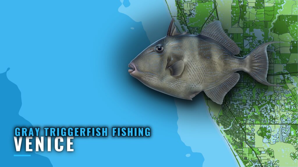
When gray triggerfish are around Venice
Gray triggerfish fishing out of Venice is structure fishing on artificial reefs, from a site under 1 nm off the inlet to the M-series reefs 15 nm out. The Venice port guide covers the inlet, the ramps and where to read conditions. This page covers the fish and the ground. For the wider coast, see the gray triggerfish fishing in the Gulf of Mexico and the Gulf of Mexico offshore fishing guide.
Seasonal patterns for Gulf reef fish are the same along the whole coast, so the regional reef fish guides carry them. What is specific to Venice is the sea you have to cross to reach the structure.
Check NOAA C-MAN station VENF1 before you commit. It sits at 27.072 N, 82.453 W and reports wind, wave height and period. Pair it with the NWS Tampa Bay marine forecast, the official forecast for these waters. Those numbers decide whether the day is a short near-shore run or a 15 nm run.
How far boats run from Venice Inlet
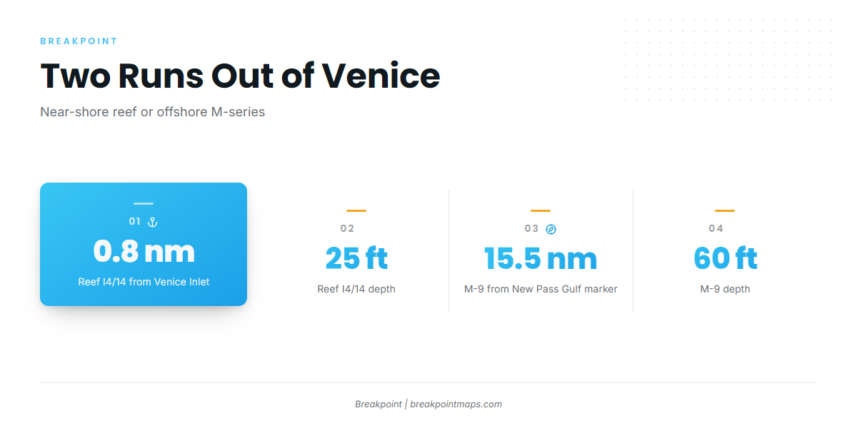
The distances use two different reference points. The near-shore reef is measured from Venice Inlet. The M-series reefs are measured from the New Pass Gulf marker, so plot your own course from Venice Inlet.
Near-shore sites
- Reef I4/14 (Venice Bridge and Pier): 25 ft, 0.8 nm at 230° from Venice Inlet.
- Venice Reef Sites 1 and 2: old bridge materials and concrete rubble.
- Venice Reef V-1 to V-5: limestone boulders.
Offshore M-series
M-9 (tanks) sits in 60 ft, 15.5 nm at 205° from the New Pass Gulf marker. M-10, M-11, M-13 and M-15a/b make up the rest of the offshore set. These runs take you well offshore, so fuel and sea conditions matter.
Grounds and structure near Venice
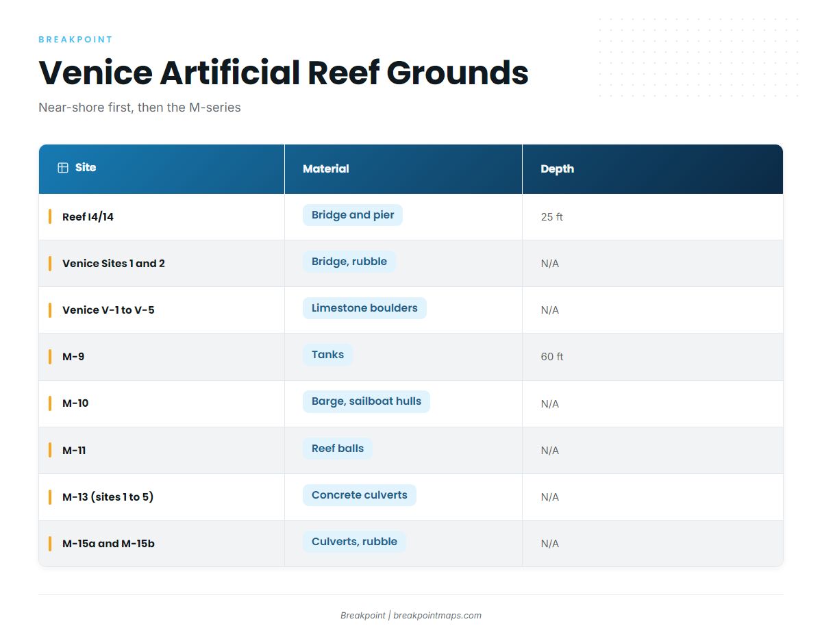
Every ground below is an artificial reef, listed near-shore first, then the M-series in numeric order.
| Site | Material | Depth | Distance/bearing | Reference point |
|---|---|---|---|---|
| Reef I4/14 (Venice Bridge and Pier) | Venice Bridge and Pier | 25 ft | 0.8 nm at 230° | Venice Inlet |
| Venice Reef Sites 1 and 2 | old bridge materials, concrete rubble | |||
| Venice Reef V-1 to V-5 | limestone boulders | |||
| M-9 | tanks | 60 ft | 15.5 nm at 205° | New Pass Gulf marker |
| M-10 | upside-down barge, sailboat hulls | |||
| M-11 | reef balls | |||
| M-13 (sites 1 to 5) | concrete culverts | |||
| M-15a and M-15b | culverts, rubble |
Swipe the table sideways to see every column.
You can view these reefs against the Chart Contours layer in Breakpoint. Chart layers are not for navigation, so use official charts and official NOAA Coast Pilot guidance for the inlet and approaches.
How gray triggerfish are fished here
Local triggerfish fishing happens over artificial hard structure: rubble, boulders, tanks, culverts and reef balls. Tackle, rigs and baits are the same ones used across the Gulf, and the gray triggerfish guide covers them.
Who fishes for gray triggerfish out of Venice
These Venice operators list gray triggerfish:
- TNT Fishing Charters: Capt. Tom Bailas and 1st mate Trisha.
- Playin’ Hookey Fishing Charters: Capt. Peter Koenig, 20 ft Sea Hunt Open Fisherman.
- The Miss Venice Deep Sea Fishing: Captain Joe.
FAQ
How far is the nearest reef from Venice Inlet?
Reef I4/14 (Venice Bridge and Pier) sits 0.8 nm at 230° from Venice Inlet, in 25 ft.
How far out is the M-9 reef?
M-9 (tanks) sits in 60 ft, 15.5 nm at 205° from the New Pass Gulf marker, not from Venice Inlet.
Which buoy covers Venice?
NOAA C-MAN station VENF1, Venice, FL, at 27.072 N, 82.453 W. It reports wind and sea numbers. Pair it with the NWS Tampa Bay marine forecast.
Which Venice charters list gray triggerfish?
TNT Fishing Charters (Capt. Tom Bailas), Playin’ Hookey Fishing Charters (Capt. Peter Koenig) and The Miss Venice (Captain Joe).
Where are the rules for gray triggerfish out of Venice?
FWC sets the state rules and federal rules apply offshore. Check both before fishing. The gray triggerfish guide has the species picture.