Swordfish fishing out of Point Pleasant Beach
Swordfish fishing out of Point Pleasant Beach means an overnight trip. Boats leave through Manasquan Inlet, run offshore to canyon water, and put the gear out at sunset. This guide covers where the boats run, which named structure lies between the inlet and the offshore grounds, and how the local fleet sets up for the night. It doesn’t promise fish, but it should help you decide where to look.
Point Pleasant Beach sits on the south side of the inlet. The swordfish effort here happens in offshore canyon water, and the nearshore reefs aren’t part of it.
Who this is for
If you already run offshore and want to add swordfish, this guide shows how the local trip is built. If you know the inshore reefs and the Mud Hole and are weighing the overnight step, it shows where that structure sits relative to the canyon run. If you would rather watch the method on a charter before trying it on your own boat, it names the local operator that lists swordfish.
When swordfish are around
Timing here follows the trip, not the calendar. The fishing happens after dark on the overnight canyon trip, once the gear is set at sunset. For timing, behavior and tackle in general, see our swordfish guide.
The local trip runs in this order:
- Depart through Manasquan Inlet.
- Run offshore to canyon water.
- Set the gear at sunset.
- Fish through the night.
- Return the next day.
How far and where boats run
Local boats run offshore on an overnight canyon trip. For general offshore context, see the Northeast swordfish picture (see also the Atlantic Northeast region guide).
The overnight canyon trip
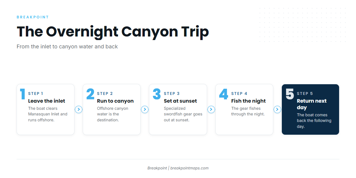
The boat leaves the inlet, runs offshore to canyon water, fishes through the night, and returns the next day. The sunset deployment anchors the trip and is covered in the methods section below.
Reading conditions before the run
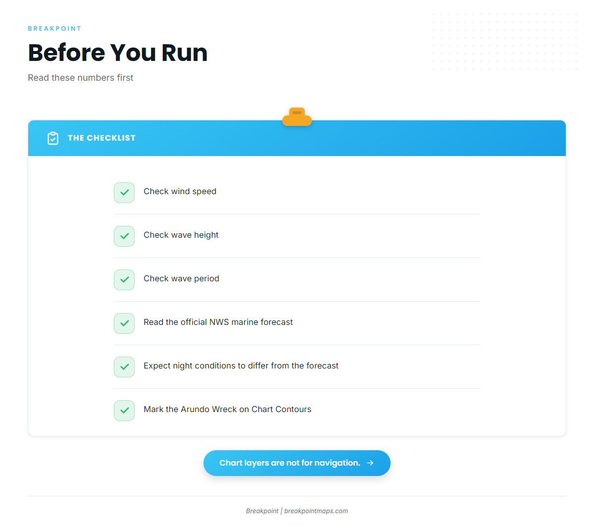
Check three numbers before you commit to the run:
- Wind speed
- Wave height
- Wave period
Pull them from the official NWS marine forecast. Conditions offshore at night can differ from what was posted. Chart layers are not for navigation.
Grounds and structure near the port
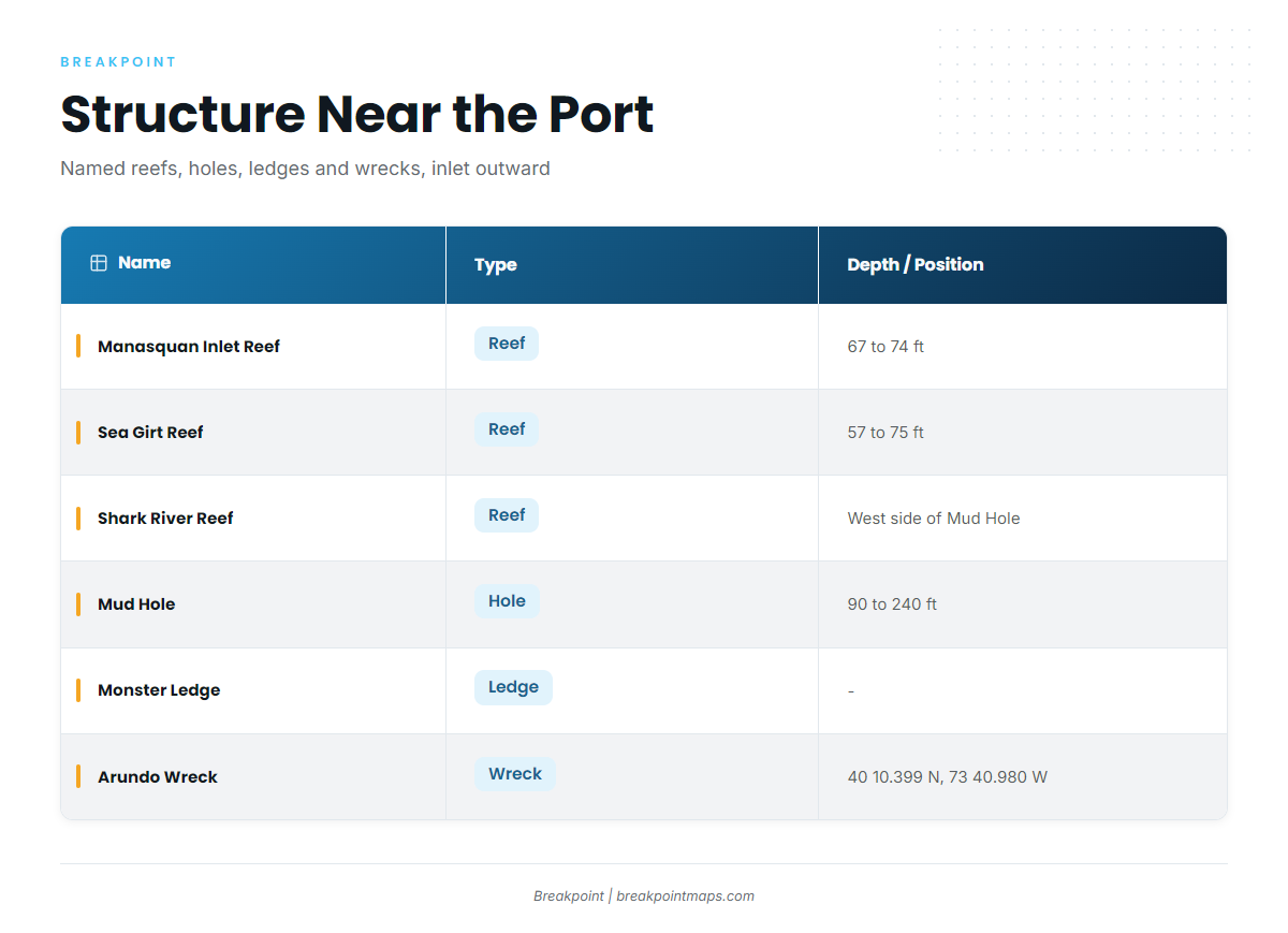
The table lists named reefs, holes, ledges and wrecks on the chart around the port. You either pass these on the way out or already know them. The swordfish effort happens on the overnight canyon trip, and none of these spots is claimed as a swordfish spot.
| Name | Type | Depth / Position |
|---|---|---|
| Manasquan Inlet Reef | Reef | 67 to 74 ft |
| Sea Girt Reef | Reef | 57 to 75 ft |
| Shark River Reef | Reef | West side of the Mud Hole |
| Axel Carlson Reef | Reef | – |
| Mud Hole | Hole | 90 to 240 ft, flats to deepest point |
| Monster Ledge | Ledge | – |
| Arundo Wreck | Wreck | 40 10.399 N, 73 40.980 W |
| Oil Wreck | Wreck | – |
Inshore reefs
- Manasquan Inlet Reef sits in 67 to 74 ft.
- Sea Girt Reef runs 57 to 75 ft.
- Shark River Reef lies on the west side of the Mud Hole.
- Axel Carlson Reef is a named reef off the port.
The Mud Hole and Monster Ledge
The Mud Hole runs from 90 ft on the flats to 240 ft at its deepest point, with Shark River Reef on its west side. Monster Ledge is named structure on the chart.
Wrecks
The Arundo Wreck sits at 40 10.399 N, 73 40.980 W. The Oil Wreck is the other named wreck on the chart.
Mark the Arundo Wreck coordinates and the Mud Hole edges on Chart Contours before you leave the slip. Chart layers are not for navigation.
How swordfish are fished from this port
Swordfish are one of several species in the billfish family. For the others, see other billfish guides.
The sunset deployment
On the overnight trip, specialized swordfish gear goes out at sunset, and that set shapes the night’s fishing. For gear detail, go back to the species guide.
Who fishes for them here
SeaOwl Fishing Charters lists swordfish and deploys specialized swordfish gear at sunset on SeaOwl Fishing Charters’ overnight trip. If you want to see the sunset deployment done before running it on your own boat, this is a place to start.
FAQ about swordfish fishing out of Point Pleasant Beach
Do boats catch swordfish on the inshore reefs?
Local boats fish for swordfish on an offshore overnight canyon trip. The reefs are named structure near the port.
How deep is the Mud Hole?
It runs from 90 ft on the flats to 240 ft at the deepest point. Shark River Reef sits on its west side.
Where is the Arundo Wreck?
It sits at 40 10.399 N, 73 40.980 W. Mark it on Chart Contours before you leave, and remember that chart layers are not for navigation.
Which charters out of Point Pleasant Beach list swordfish?
SeaOwl Fishing Charters, on its overnight trip.
When is the swordfish gear set?
At sunset on the overnight trip.