When striped bass are around Martha’s Vineyard
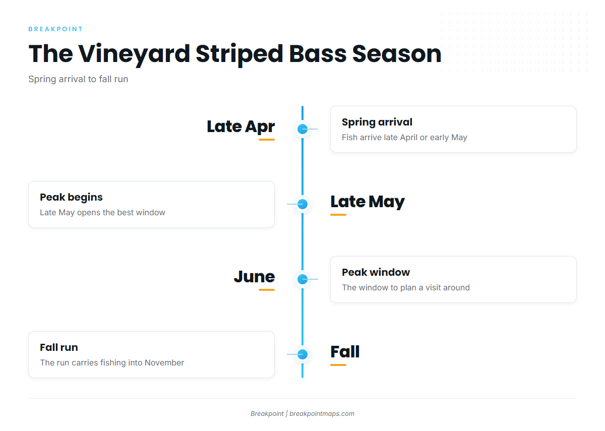
Striped bass fishing out of Martha’s Vineyard starts with an arrival in late April or early May, peaks from late May through June, and has a fall run that carries into November. That window comes from Fishsticks Charters seasons and species, a local operator that lists striped bass. For the species itself, see our striped bass guide; for the coastwide run, see our Northeast striped bass guide (see also the wider Atlantic Northeast guide).
This page covers Martha’s Vineyard only: where boats run, the structure that holds fish, how each ground is fished, and who fishes it. We can’t promise fish, but we can help you decide where to look.
| Window | What the local record shows |
|---|---|
| Arrival | Late April or early May |
| Best fishing | Late May through June |
| Fall run | Into November |
Spring arrival
Fish show up around the island in late April or early May. The early weeks mark the start of the season rather than the peak.
Late May through June peak
Late May through June is the best window, so it’s the stretch to pick if you’re building a visit around one period.
Fall run into November
The fall run keeps striped bass fishing going into November and is the second window worth planning around.
Where boats run and the structure that holds fish
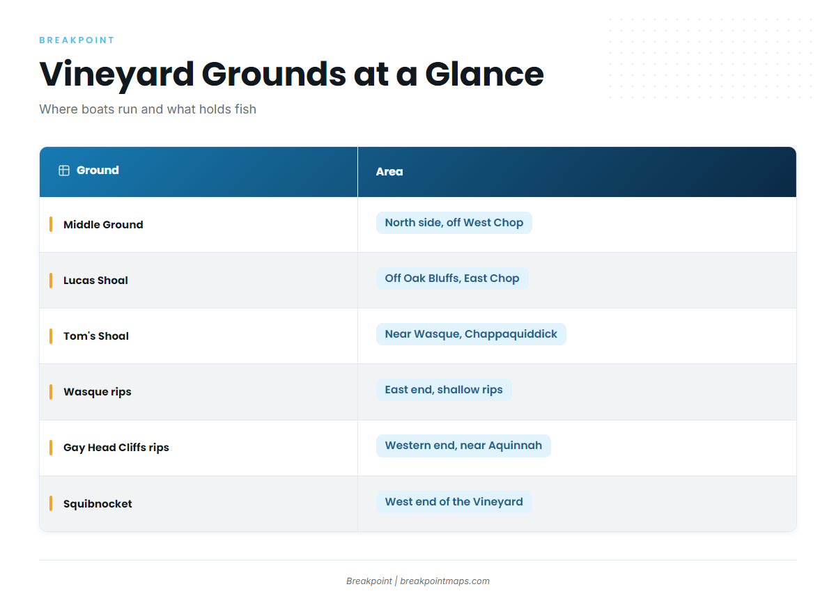
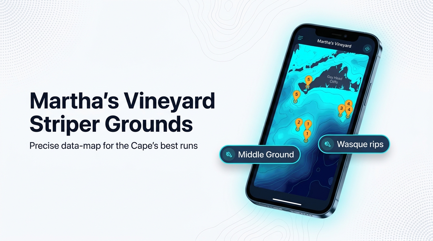
Boats run to three areas of the island: the north side in Vineyard Sound, the east end off Chappaquiddick, and the west end near Aquinnah. No Man’s Land is a run off the island. Current moving over shoals and through rips is what makes this structure hold fish.
| Ground | Area | Detail | Local method |
|---|---|---|---|
| Middle Ground | North side, shallow end off West Chop | 3 ft, about 2.5 NM long east to west | Rips: eels and bait |
| Bow Bell | Western end of Middle Ground | ||
| Lucas Shoal | Vineyard Sound, off Oak Bluffs and East Chop | ||
| Tom’s Shoal | Near Wasque, Chappaquiddick | Jig and troll, wire or lead core | |
| Mutton Shoal | Wasque area | ||
| Wasque rips | East end, shallow rips | Casting soft plastics and topwater | |
| Squibnocket | West end of the Vineyard | Named by Done Deal Charters | |
| Devil’s Bridge | Vineyard | Named by Done Deal Charters | |
| Rips off Gay Head Cliffs | Western Vineyard near Aquinnah | Eels and bait in the rips | |
| No Man’s Land | Off the island | Named by Done Deal Charters |
North side: Middle Ground, Bow Bell and Lucas Shoal
Middle Ground lies on the north side of the Vineyard, with its shallow end off West Chop. It is 3 ft deep and about 2.5 NM long east to west. Bow Bell is its western end. Lucas Shoal sits in Vineyard Sound off Oak Bluffs and East Chop.
Wasque rips: Tom’s Shoal, Mutton Shoal and the shallow rips
The Wasque rips lie off Chappaquiddick at the east end. Tom’s Shoal sits near Wasque, and Mutton Shoal is in the same area. The shallow rips are where the casting happens, covered in the methods section below.
West end: Squibnocket, Devil’s Bridge and the Gay Head rips
Squibnocket sits at the west end of the Vineyard, and the rips off Gay Head Cliffs are near Aquinnah. Done Deal Charters names Squibnocket and Devil’s Bridge among its striped bass runs.
No Man’s Land
No Man’s Land is a run off the island that Done Deal Charters names. It makes its own trip, separate from the grounds along the Vineyard shore.
Mark these shoals on a chart before the run. Chart Contours in Breakpoint shows the depth lines around them. Chart layers are not for navigation.
Reading conditions: NDBC 44020
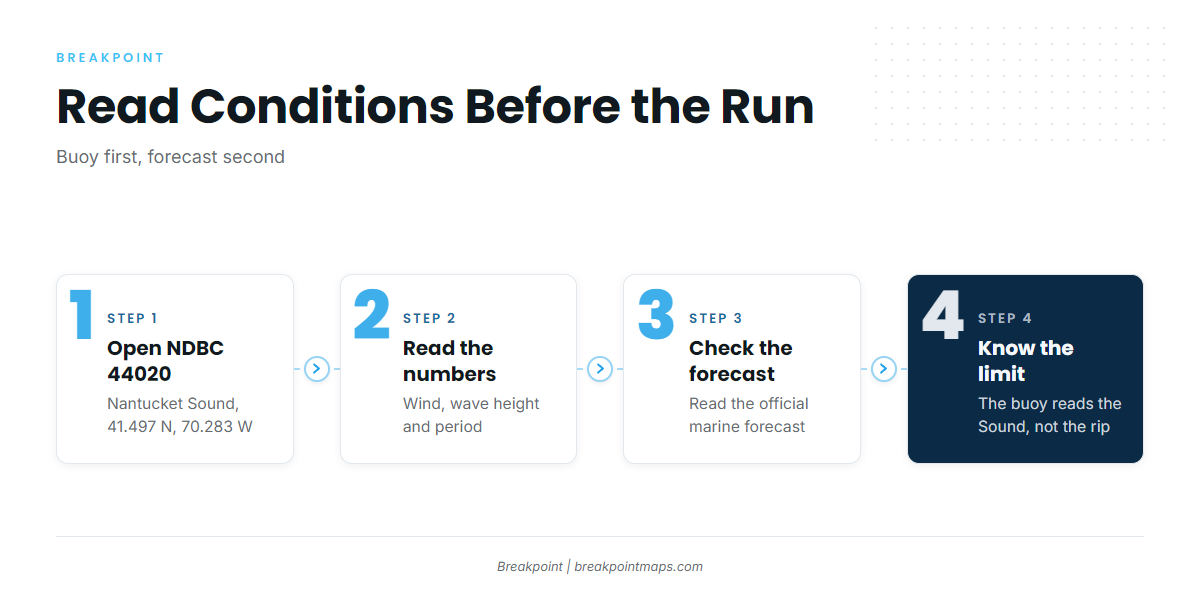
The nearest buoy is NOAA NDBC station 44020 in Nantucket Sound, at 41.497 N, 70.283 W. Check wind, wave height and period there, then read the official Nantucket Sound marine forecast. The buoy describes Nantucket Sound, not the rip you are running to.
How striped bass are fished here
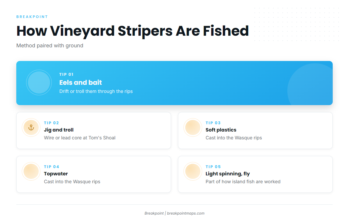
Local methods follow the structure, and each one below is tied to the ground where it is used.
Eels and bait in the rips
Boats drift or troll eels and bait through the rips, including the Wasque rips and the rips off Gay Head Cliffs.
Jig and troll on Tom’s Shoal
At Tom’s Shoal, the local method is jig and troll on wire or lead core.
Casting soft plastics and topwater into the Wasque rips
In the Wasque rips, anglers cast soft plastics and topwater into the shallow rips.
Light spinning and fly
Light spinning and fly tackle are also used to work the island’s fish.
Who fishes for striped bass out of this port
These Martha’s Vineyard striper charters list striped bass and show how local boats work these grounds:
- North Shore Charters, Captain Scott McDowell
- Tomahawk Charters with Capt. Vanderhoop, Capt. Buddy Vanderhoop, 35 ft Carolina Classic (Tomahawk 3)
- Captain Clarke Charters fishing trips, Femme Fatale
- Done Deal Charters out of Martha’s Vineyard, vessel Done Deal, Captain Canha. Its named runs include Squibnocket, Devil’s Bridge and No Man’s Land.
- Local Tide Charters boats: a 32 ft Regulator 2005 Jo B and a 17 ft Yellowfin Skiff
- Fishsticks Charters seasons and species
FAQ about striped bass fishing out of Martha’s Vineyard
When do striped bass arrive at Martha’s Vineyard?
Fish arrive in late April or early May. The best fishing runs late May through June, and a fall run carries into November. That window comes from Fishsticks Charters.
What is Middle Ground?
Middle Ground is a 3 ft shoal on the north side of the Vineyard, about 2.5 NM long east to west. Its shallow end is off West Chop, and Bow Bell is its western end.
How is Tom’s Shoal fished?
Local boats jig and troll with wire or lead core. Tom’s Shoal lies near Wasque, off Chappaquiddick, at the east end of the island.
Which buoy should I check before a run?
Use NOAA NDBC 44020 in Nantucket Sound, at 41.497 N, 70.283 W. Check wind, wave height and period, then the official marine forecast. The buoy reads Nantucket Sound, not the rip itself.
Where are the striped bass rules?
Massachusetts sets them. The regulations section above points to the state page. Check it before you fish, because seasons and limits change.
Where can I read about other inshore gamefish?
See our coastal and offshore gamefish guides for the other species fished from Northeast ports.