
About Indian River Inlet
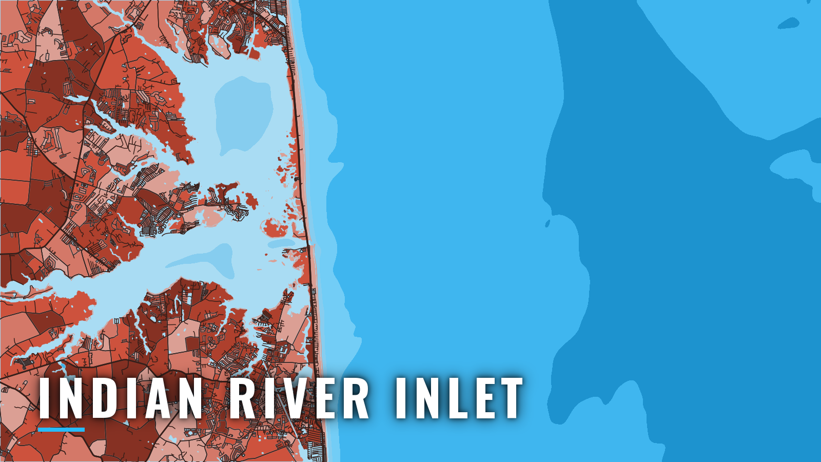
Indian River Inlet is the first opening in the barrier beach south of Delaware Bay, 12 miles south of Cape Henlopen, and it joins the Atlantic to Indian River Bay and Rehoboth Bay. Delaware State Parks runs Indian River Marina on the north side, in Delaware Seashore State Park. The port fishes all year, from inshore reefs to the canyons. Targets include tautog, black sea bass, summer flounder, striped bass, bluefish, tilefish, yellowfin, bluefin and bigeye tuna, mahi, wahoo, and white and blue marlin, in step with the Atlantic Northeast offshore season. Rules for Delaware offshore fishing are on the state page.
Access and navigation
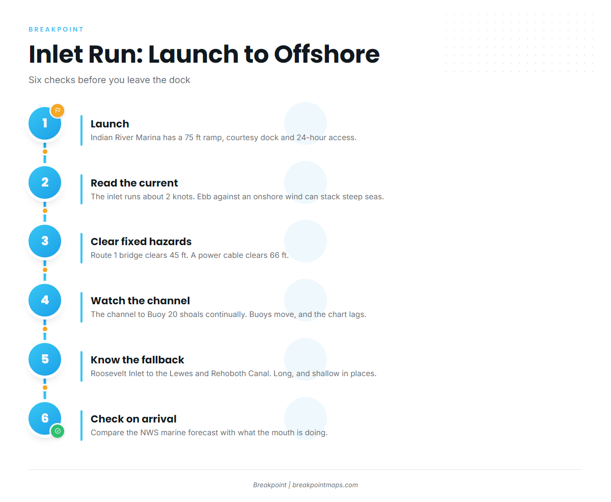
The inlet is a demanding entrance. Current runs about 2 knots, the channel inside shoals continually, and an ebb against an onshore wind can stand up steep, short seas at the mouth.
Public ramps and marinas:
- Indian River Marina ramp – Delaware State Parks, 75 ft ramp, courtesy dock, 24-hour access, seasonal satellite trailer parking with shuttle
- Indian River Marina – 294 slips with water and power, fuel, boat supply store
- Massey’s Landing – DNREC Division of Fish and Wildlife access area on the bay
- Holts Landing – two-lane concrete ramp on Indian River Bay, boats up to 25 ft
Boats not registered in Delaware need the current Ramp Certificate from the Division of Fish and Wildlife.
Current and wind
Current in the inlet runs about 2 knots, and the buoys sometimes tow under. Wind against tide can stack up short, steep seas at the mouth. The combination to watch is an ebb against an easterly or onshore wind. Experienced local boaters tend to avoid a west wind against an incoming current, and the reverse.
Fixed hazards
The Route 1 Indian River Inlet Bridge is a fixed bridge with 45 ft of clearance. An overhead power cable with 66 ft of clearance crosses about 100 yards west of the bridge. If you run a tower or outriggers, know your air draft before you commit.
Moving hazards
The channel from the entrance to Buoy 20 in Indian River Bay shoals continually. It is marked by uncharted buoys that get moved to follow the best water, so the chart can lag the actual conditions. Easterly winds tend to raise the water inside and westerlies lower it, by as much as 3 ft in strong, long-lasting wind. A westerly blow can leave less water than the chart shows.
The NOAA U.S. Coast Pilot 3 describes these inlets as subject to frequent change and in need of local knowledge. Boaters new to the area tend to run aground, so follow local traffic through the channel.
Alternative approach
The Delaware Bay route runs in at Roosevelt Inlet, then through the Lewes and Rehoboth Canal into Rehoboth Bay. It is long and shallow in places, so check local notices and the chart before relying on it.
Check on arrival
Look at the water at the mouth and read the NWS offshore marine forecast when you arrive. The nearby offshore buoy reports add wind and wave numbers. Compare the forecast with what the inlet is doing, and if it looks bigger than you want, switch approaches.
Fishing conditions
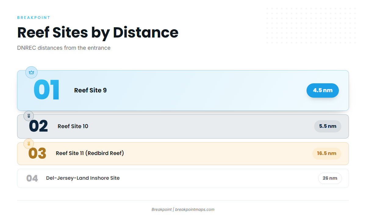
Grounds run from artificial reef sites a few miles off the entrance out to Baltimore Canyon. The DNREC Delaware Reef Guide carries site charts and positions. From nearest to farthest:
- Reef Site 9 – 4.5 nm from the entrance
- Reef Site 10 – 5.5 nm
- Reef Site 11 (Redbird Reef) – 16.5 nm
- Del-Jersey-Land Inshore Site – 26 nm
- Old Grounds
- Hot Dog
- Massey’s Canyon
- Washington Canyon
- Baltimore Canyon
Inside a permitted Delaware reef site, finfish may be taken only by hook and line or spear.
DNREC fishing regulations apply in state waters, out to 3 nm. Tunas, billfish, swordfish and sharks need a NOAA HMS Angling Permit. Check both before fishing, along with the Delaware rules for state and federal waters.
Check OBS SST and Chlorophyll to see where the edge sits before you commit fuel to the canyons. Chart layers are not for navigation.
Winter
Tautog, striped bass and black sea bass work the structure inshore, though fishing windows are often limited by weather. Offshore, bluefin, yellowfin and bigeye tuna are possible when conditions allow. For the offshore side, see bluefin tuna off the Atlantic Northeast. Shortfin mako cannot be possessed in Delaware.
Spring
Black sea bass, tautog, summer flounder, striped bass and black drum fish inshore. Offshore, the first tuna arrive alongside mahi, tilefish and blue marlin. Before the first run, read up on yellowfin in the Atlantic Northeast and bluefin tuna technique.
Summer
Summer is the densest season. Offshore, the full pelagic spread works toward the canyon edges: yellowfin tuna, bigeye along the canyon edges, bluefin, mahi, wahoo, tilefish, and white and blue marlin. Inshore and on the reefs, summer flounder, Atlantic croaker, bluefish, triggerfish, black sea bass, tautog and striped bass all show.
Autumn
Offshore, white marlin, mahi, tilefish, yellowfin and bigeye tuna, and wahoo fish the canyon side. Inshore, summer flounder, black sea bass, bluefish, tautog, triggerfish and striped bass round out the list. The bigeye in the Atlantic Northeast pattern carries into the fall canyon runs.