
About Mexico Beach
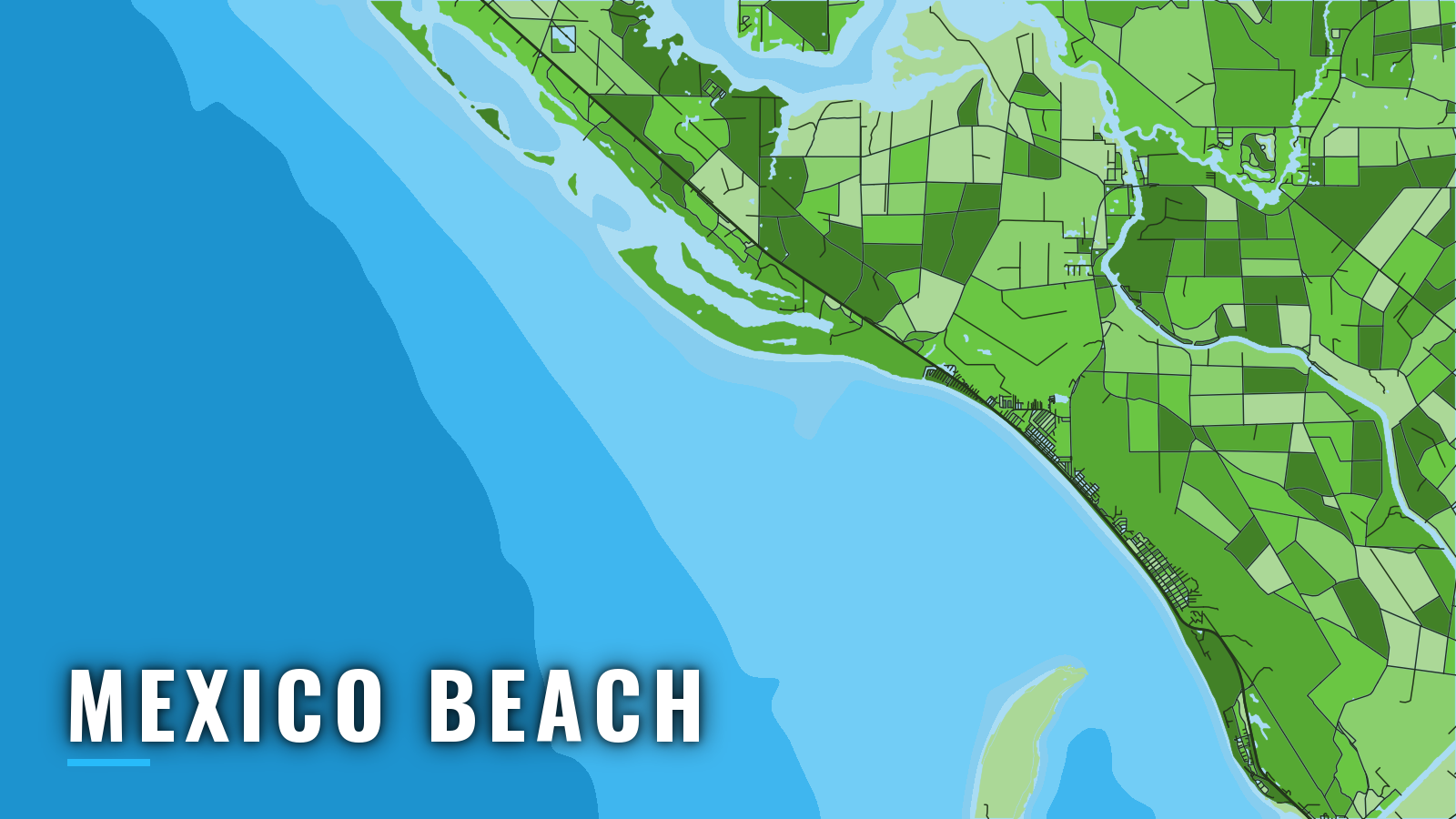
Mexico Beach reaches the northern Gulf through a narrow man-made canal on the Florida Panhandle, between Panama City and Cape San Blas. The city dredges the canal, and a city ramp and a fuel-selling marina sit on it. A volunteer reef association has placed artificial reefs since 1997 on otherwise sandy bottom.
The port fishes year-round. Offshore fishing is concentrated in spring through autumn, and winter depends on the timing of cold fronts. Anglers target cobia, king and Spanish mackerel, red snapper, grouper, amberjack, mahi and wahoo, as listed on Mexico Beach’s official fishing page. The spring cobia run along the beach opens the offshore season.
Seasons for red snapper, gag and amberjack are set by quota and change, so check the Florida regulations page and the Florida Fish and Wildlife Conservation Commission before you fish. Reef fish rules also include a state reef fish angler designation and descending-device requirements.
Access and navigation
Mexico Beach has one public ramp and two canal moorage options, all on the canal a short idle from the Gulf.
- City of Mexico Beach Boat Ramp – city launch on the canal
- Mexico Beach Marina – fuel listed
- City of Mexico Beach Canal Boat Slips – city slips under 5 minutes from the Gulf
The canal is idle speed only. The city runs its own dredge to keep the narrow inlet clear of sand shoals. Facilities and channel conditions change between dredgings and storms, so check City of Mexico Beach notices before you trailer down. Mexico Beach is on Central time, so match tide tables and forecast issue times to it.
Entrance behavior
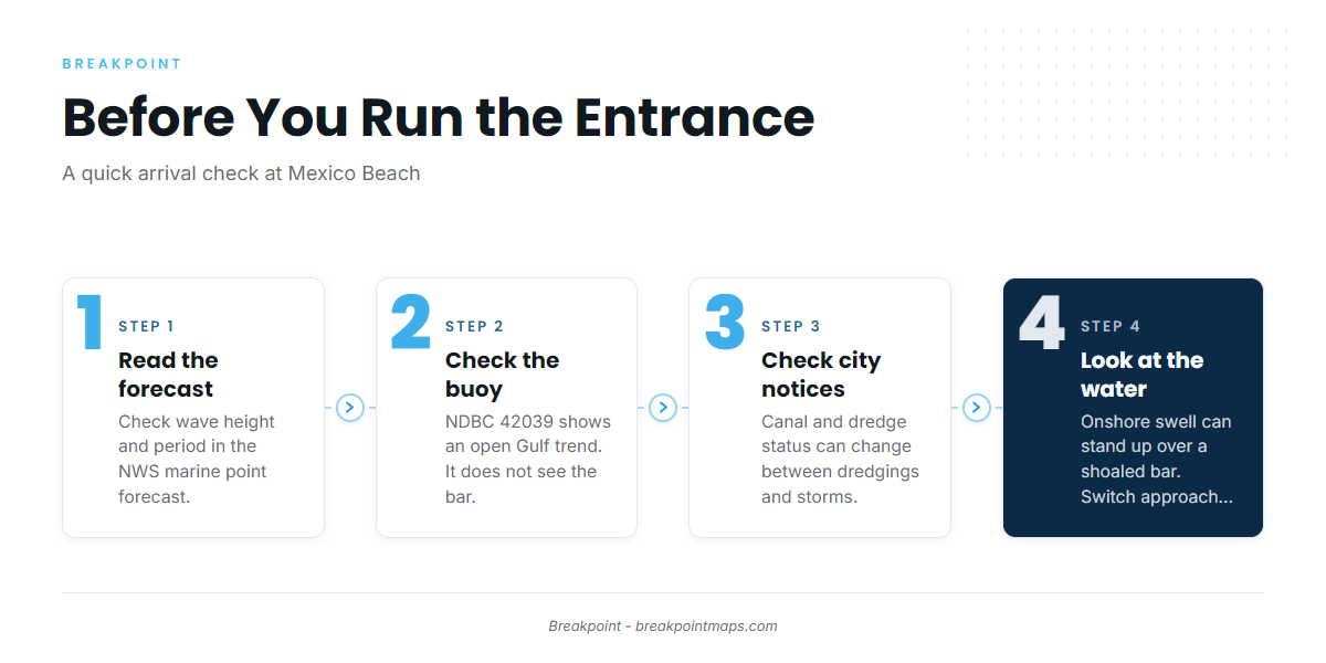
NOAA’s Coast Pilot 5, Chapter 6 describes the privately marked entrance as subject to shoaling, with a reported 5 feet inside. The entrance faces the open Gulf, so onshore swell is the main variable. Swell can stand up over a shoaled bar, and sand tends to shift between dredgings, so the depth you find may differ from any chart.
Alternative approach
The canal is the only exit at Mexico Beach. If the entrance looks rougher than you want to take on, the St. Joseph Bay entrance, about 4.5 miles south of town off St. Joseph Point, offers a deeper bay approach.
Where to read conditions
Start with the NWS Tallahassee coastal waters forecast, then pull the NWS marine point forecast for the water off town. Read wave height together with period: a 3 foot wave at 4 seconds and a 3 foot wave at 8 seconds meet a shoaled entrance very differently.
NDBC buoy 42039 sits offshore, 115 NM SSE of Pensacola. It can’t see the bar, so treat it as a trend for the open Gulf rather than a reading of the entrance. When you arrive, look at the water as well as the official forecast, and switch approaches if the entrance looks bigger than you want.
Fishing conditions
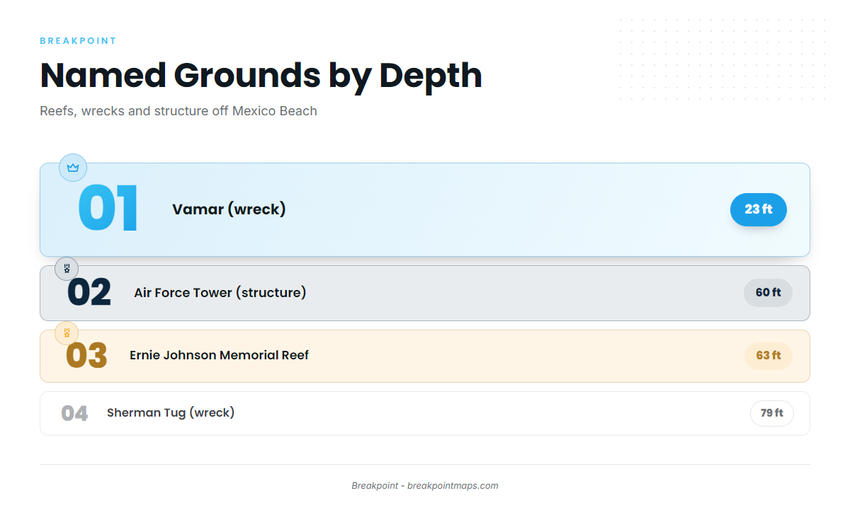
Reefs have been placed here since 1997 on otherwise sandy bottom, so much of the structure close to port is artificial. The named grounds, from the nearest to the deepest:
- John Thompson Memorial Reef (off Bell Shoals) – reef, 3.4 nm from the entrance
- Vamar – wreck, 23 ft
- Air Force Tower – structure, 60 ft
- Ernie Johnson Memorial Reef – reef, 63 ft
- Sherman Tug – wreck, 79 ft
Get coordinates and survey data from MBARA reef sites and coordinates. Plot them and view them over Chart Contours in the app. Chart layers are not for navigation.
Wahoo turn up among the offshore targets. Our wahoo guide and sailfish guide cover bluewater trolling technique.
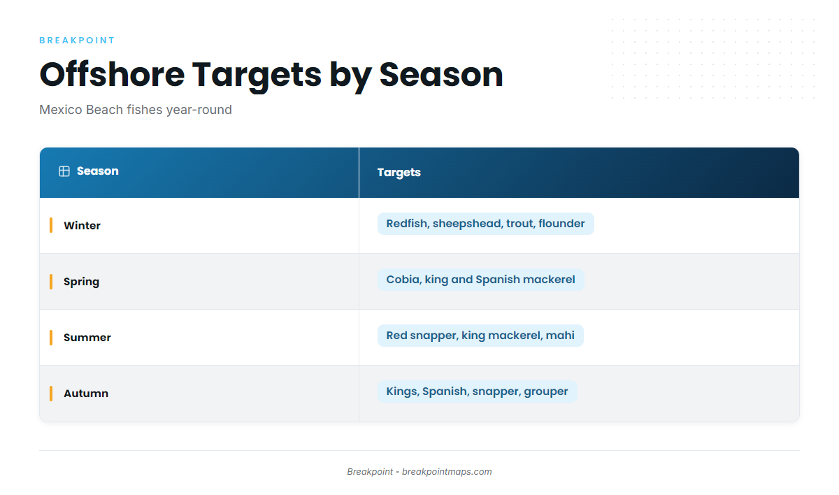
| Season | Main targets near Mexico Beach |
|---|---|
| Winter | Redfish, sheepshead, trout, flounder |
| Spring | Cobia, Spanish and king mackerel, mahi |
| Summer | Red snapper, king mackerel, tarpon |
| Autumn | Spanish and king mackerel, mahi, cobia, snapper, grouper |
Winter
Winter fishing runs between cold fronts, which bring strong north winds along this coast. The Coast Pilot reports waves of 8 feet or more over open water 5 to 11 percent of the time, most often in January and February. Redfish, sheepshead, trout and flounder near port suit the windows between fronts.
Spring
Spring brings the cobia run along the beach, followed by trolling for king mackerel and Spanish mackerel. Mahi start to show as the water warms. The Coast Pilot notes that fog tends to peak in March, which matters on early-season runs.
Summer
Summer centers on red snapper on the reefs and wrecks, with king mackerel on the troll. Season dates are set by quota, so check the rules above. Tarpon can show along the beach. Long-range boats can push out for mahi in bluewater.
Autumn
Autumn brings Spanish and king mackerel back along the reefs, with snapper and grouper on the bottom. Our guide to fall king mackerel covers the troll. Mahi can still turn up, and the guide to cobia in the Gulf covers the fall fish.